Report on Asosan (Japan) — 9 September-15 September 2015
Smithsonian Institution / US Geological Survey
Weekly Volcanic Activity Report, 9 September-15 September 2015
Managing Editor: Sally Sennert.
Please cite this report as:
Global Volcanism Program, 2015. Report on Asosan (Japan) (Sennert, S, ed.). Weekly Volcanic Activity Report, 9 September-15 September 2015. Smithsonian Institution and US Geological Survey.
Asosan
Japan
32.8849°N, 131.085°E; summit elev. 1592 m
All times are local (unless otherwise noted)
JMA reported that during 10-11 September a small-scale eruption from Asosan’s Nakadake Crater generated a plume that rose 500 m above the crater and drifted S and SW. During fieldwork on 11 September, volcanologists observed .a grayish-white plume rising from the vent and sediment deposits around the vent. On 14 September an explosion produced an ash plume that rose 2 km, prompting JMA to raise the Alert Level to 3 (on a scale of 1-5). During an overflight later that day scientists observed ashfall in the crater area, on the N flank as far as 1 km, and on the SE flank as far as 1.3 km. Ashfall was reported over a wide area including Tamana, Kumamoto City, and Yamaga (W flank). According to a news article about 30 tourists in the area were evacuated, and some flights were either canceled or re-routed. Areas within 4 km of the craters were closed. An off-white plume rose 300 m above the crater on 15 September.
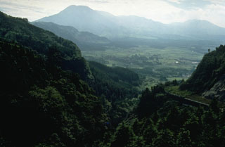
Geological Summary. The 24-km-wide Asosan caldera was formed during four major explosive eruptions from 300,000 to 90,000 years ago. These produced voluminous pyroclastic flows that covered much of Kyushu. The last of these, the Aso-4 eruption, produced more than 600 km3 of airfall tephra and pyroclastic-flow deposits. A group of 17 central cones was constructed in the middle of the caldera, one of which, Nakadake, is one of Japan's most active volcanoes. It was the location of Japan's first documented historical eruption in 553 CE. The Nakadake complex has remained active throughout the Holocene. Several other cones have been active during the Holocene, including the Kometsuka scoria cone as recently as about 210 CE. Historical eruptions have largely consisted of basaltic to basaltic-andesite ash emission with periodic strombolian and phreatomagmatic activity. The summit crater of Nakadake is accessible by toll road and cable car, and is one of Kyushu's most popular tourist destinations.