Report on Rotorua (New Zealand) — 23 November-29 November 2016
Smithsonian Institution / US Geological Survey
Weekly Volcanic Activity Report, 23 November-29 November 2016
Managing Editor: Sally Sennert.
Please cite this report as:
Global Volcanism Program, 2016. Report on Rotorua (New Zealand) (Sennert, S, ed.). Weekly Volcanic Activity Report, 23 November-29 November 2016. Smithsonian Institution and US Geological Survey.
Rotorua
New Zealand
38.08°S, 176.27°E; summit elev. 757 m
All times are local (unless otherwise noted)
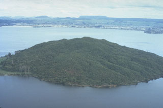
GeoNet reported a small hydrothermal eruption in Lake Rotorua on 28 November, and noted that the occurrence was not unusual. In a news article residents described a geyser that rose 20-30 m above the lake surface. A GNS scientists noted that the last significant steam eruptions in Rotorua occurred about 15 years ago.
Geological Summary. The 22-km-wide Rotorua caldera is the NW-most caldera of the Taupo volcanic zone. It is the only single-event caldera in the Taupo Volcanic Zone and was formed about 220,000 years ago following eruption of the more than 340 km3 rhyolitic Mamaku Ignimbrite. Although caldera collapse occurred in a single event, the process was complex and involved multiple collapse blocks. The major city of Rotorua lies at the south end of the lake that fills much of the caldera. Post-collapse eruptive activity, which ceased during the Pleistocene, was restricted to lava dome extrusion without major explosive activity. The youngest activity consisted of the eruption of three lava domes less than 25,000 years ago. The major thermal areas of Takeke, Tikitere, Lake Rotokawa, and Rotorua-Whakarewarewa are located within the caldera or outside its rim, and the city of Rotorua lies within and adjacent to active geothermal fields.