Mexico Volcanoes
-
Michoacan-Guanajuato
-
Popocatepetl
-
Barcena
-
Popocatepetl
-
Popocatepetl
-
Cofre de Perote
-
La Malinche
-

Chichinautzin
-
Barcena
-
Michoacan-Guanajuato
-
Colima
-

Ceboruco
-
Chichinautzin
-
Michoacan-Guanajuato
-
Cerro Prieto
-
Pico de Orizaba
-
Colima
-
Colima
-
Los Atlixcos
-
Colima
Mexico has 37 Holocene volcanoes. Note that as a scientific organization we provide these listings for informational purposes only, with no international legal or policy implications. Volcanoes will be included on this list if they are within the boundaries of a country, on a shared boundary or area, in a remote territory, or within a maritime Exclusive Economic Zone. Bolded volcanoes have erupted within the past 20 years. Suggestions and data updates are always welcome ().
| Volcano Name | Location | Last Eruption | Primary Volcano Type |
|---|---|---|---|
| Los Atlixcos | State of Veracruz | Unknown - Evidence Credible | Shield |
| Barcena | Revillagigedo Islands (México) | 1953 CE | Pyroclastic cone(s) |
| Ceboruco | Mexico | 1875 CE | Stratovolcano |
| Chichinautzin | Mexico | 399 CE | Volcanic field |
| El Chichon | Mexico | 1982 CE | Lava dome(s) |
| Cofre de Perote | State of Veracruz | 1150 CE | Compound |
| Colima | Mexico | 2019 CE | Stratovolcano(es) |
| Comondu-La Purisima | Baja California (México) | Unknown - Evidence Uncertain | Volcanic field |
| Coronado | Baja California (México) | Unknown - Unrest / Holocene | Stratovolcano |
| Las Cumbres | State of Veracruz | 3920 BCE | Stratovolcano |
| Durango Volcanic Field | Mexico | Unknown - Evidence Credible | Volcanic field |
| La Gloria | State of Veracruz | Unknown - Evidence Credible | Volcanic field |
| Los Humeros | State of Veracruz | 4470 BCE | Caldera(s) |
| Isla Isabel | Mexico | Unknown - Evidence Uncertain | Tuff cone(s) |
| Iztaccihuatl | Mexico | Unknown - Evidence Credible | Stratovolcano |
| Jaraguay Volcanic Field | Baja California (México) | Unknown - Evidence Credible | Volcanic field |
| Jocotitlan | Mexico | 1270 CE | Stratovolcano |
| La Malinche | Mexico | 1170 BCE | Stratovolcano |
| Mascota Volcanic Field | Mexico | Unknown - Evidence Credible | Volcanic field |
| Michoacan-Guanajuato | Mexico | 1952 CE | Volcanic field |
| Naolinco Volcanic Field | State of Veracruz | 1200 BCE | Volcanic field |
| Northern EPR at 16°N | East Pacific Rise | 50 BCE | Fissure vent(s) |
| Northern EPR at 17°N | East Pacific Rise | 50 BCE | Fissure vent(s) |
| Pico de Orizaba | Mexico | 1846 CE | Stratovolcano |
| Pinacate | Northwestern México | Unknown - Evidence Credible | Volcanic field |
| Popocatepetl | Mexico | 2024 CE | Stratovolcano(es) |
| Cerro Prieto | Northwestern México | Unknown - Evidence Uncertain | Lava dome |
| San Borja Volcanic Field | Baja California (México) | Unknown - Evidence Credible | Volcanic field |
| Isla San Luis | Baja California (México) | Unknown - Evidence Credible | Tuff cone |
| San Martin | State of Veracruz | 1796 CE | Volcanic field |
| Sanganguey | Mexico | Unknown - Evidence Credible | Stratovolcano |
| Serdan-Oriental | Mexico | Unknown - Evidence Credible | Volcanic field |
| Socorro | Revillagigedo Islands (México) | 1994 CE | Shield |
| Tacana | México-Guatemala border | 1986 CE | Stratovolcano |
| Nevado de Toluca | Mexico | 1350 BCE | Stratovolcano |
| Isla Tortuga | Baja California (México) | Unknown - Evidence Credible | Shield |
| Zitacuaro-Valle de Bravo | Mexico | 3050 BCE | Volcanic field |
Chronological listing of known Holocene eruptions (confirmed or uncertain) from volcanoes in Mexico. Bolded eruptions indicate continuing activity.
| Volcano Name | Start Date | Stop Date | Certainty | VEI | Evidence |
|---|---|---|---|---|---|
| Colima | 2019 May 11 | 2019 Jul 12 | Confirmed | 1 | Observations: Reported |
| Colima | 2013 Jan 6 | 2017 Mar 7 | Confirmed | 3 | Observations: Reported |
| Popocatepetl | 2005 Jan 9 | 2024 Mar 1 (continuing) | Confirmed | 2 | Observations: Reported |
| Popocatepetl | 2004 May 26 | 2004 May 26 | Confirmed | 2 | Observations: Reported |
| Colima | 1997 Nov 22 | 2011 Jun 21 | Confirmed | 3 | Observations: Reported |
| Popocatepetl | 1996 Mar 5 | 2003 Nov 22 (?) | Confirmed | 3 | Observations: Reported |
| Popocatepetl | 1994 Dec 21 | 1995 Oct 5 | Confirmed | 2 | Observations: Reported |
| Colima | 1994 Jul 21 | 1994 Jul 21 | Confirmed | 1 | Observations: Reported |
| Socorro | 1993 Jan 29 | 1994 Feb 24 ± 4 days | Confirmed | 0 | Observations: Reported |
| Colima | 1991 Mar 1 | 1991 Oct 16 ± 15 days | Confirmed | 2 | Observations: Reported |
| Colima | [1988 Jun 15 ± 180 days] | [Unknown] | Uncertain | ||
| Colima | 1987 Jul 2 | 1987 Jul 2 | Confirmed | 1 | Observations: Reported |
| Tacana | 1986 Feb 16 ± 15 days | 1986 Jun 16 ± 15 days | Confirmed | 1 | Observations: Reported |
| Colima | 1985 Jul 2 ± 182 days | 1986 Jan 5 ± 4 days | Confirmed | 1 | Observations: Reported |
| Colima | [1983 Feb 11] | [1983 Feb 15] | Uncertain | ||
| El Chichon | 1982 Mar 28 | 1982 Sep 11 | Confirmed | 5 | Observations: Reported |
| Colima | 1977 Dec 16 ± 15 days | 1982 Jun 16 ± 15 days | Confirmed | 1 | Observations: Reported |
| Colima | 1975 Dec 11 (?) | 1976 Jun 20 | Confirmed | 2 | Observations: Reported |
| Colima | [1973 Jan 30] | [Unknown] | Uncertain | ||
| Colima | 1963 Jul 2 ± 182 days | 1970 Jul 2 ± 182 days | Confirmed | 1 | Observations: Reported |
| Colima | 1961 Jul 2 ± 182 days | 1962 Dec 1 ± 30 days | Confirmed | 1 | Observations: Reported |
| Colima | 1957 May 14 | 1960 Jul 2 ± 182 days | Confirmed | 1 | Observations: Reported |
| Barcena | 1952 Aug 1 | 1953 Feb 24 ± 4 days | Confirmed | 3 | Observations: Reported |
| Socorro | 1951 May 22 | 1951 May 22 | Confirmed | 2 | Observations: Reported |
| Tacana | 1949 Dec 22 | 1950 Jan 16 ± 15 days | Confirmed | 1 | Observations: Reported |
| Popocatepetl | 1947 Jan | 1947 Feb | Confirmed | 1 | Observations: Reported |
| Michoacan-Guanajuato | 1943 Feb 20 | 1952 Feb 25 | Confirmed | 4 | Observations: Reported |
| Popocatepetl | 1942 | 1943 | Confirmed | 1 | Observations: Reported |
| Colima | [1941 Apr 15] | [Unknown] | Uncertain | ||
| Pinacate | [1934 Dec 31] | [1935 Jan 2 (?)] | Uncertain | ||
| Popocatepetl | 1933 Jan 23 | Unknown | Confirmed | 1 | Observations: Reported |
| San Martin | [1932 Dec 31 ± 365 days] | [Unknown] | Uncertain | ||
| Pinacate | [1928 Jun 9] | [Unknown] | Uncertain | ||
| Colima | 1926 ± 4 years | 1931 (?) | Confirmed | 1 | Observations: Reported |
| Popocatepetl | 1925 | 1927 (?) | Confirmed | 2 | Observations: Reported |
| Popocatepetl | 1923 Nov 27 | 1924 Mar 7 | Confirmed | 1 | Observations: Reported |
| Popocatepetl | 1919 Feb 19 (?) | 1922 | Confirmed | 1 | Observations: Reported |
| Colima | 1913 Jan 17 | 1913 Jan 24 | Confirmed | 4 | Observations: Reported |
| Colima | 1908 Dec 18 | 1909 Jul 1 ± 30 days | Confirmed | 3 | Observations: Reported |
| Socorro | [1905 Jan] | [Unknown] | Uncertain | ||
| Colima | 1904 | 1906 | Confirmed | 1 | Observations: Reported |
| Colima | 1903 Feb 15 | 1903 Oct 30 | Confirmed | 3 | Observations: Reported |
| Socorro | [1896] | [Unknown] | Uncertain | ||
| Colima | 1893 Dec 4 | 1902 | Confirmed | 2 | Observations: Reported |
| Colima | 1891 Jul | 1892 Jun | Confirmed | 2 | Observations: Reported |
| Colima | 1890 Nov 18 | Unknown | Confirmed | 2 | Observations: Reported |
| Colima | 1889 Aug 9 | 1890 Feb 16 | Confirmed | 4 | Observations: Reported |
| Colima | 1887 | Unknown | Confirmed | 0 | Observations: Reported |
| Colima | 1885 Dec 26 | 1886 Oct | Confirmed | 3 | Observations: Reported |
| Colima | 1882 | 1884 | Confirmed | 1 | Observations: Reported |
| Colima | 1880 Dec 1 ± 30 days | 1881 Apr 12 | Confirmed | 2 | Observations: Reported |
| Colima | 1879 Dec 23 | 1880 Apr 30 | Confirmed | 1 | Observations: Reported |
| Tacana | 1878 | Unknown | Confirmed | 1 | Observations: Reported |
| Colima | 1875 | 1878 | Confirmed | 1 | Observations: Reported |
| Colima | 1874 Jun 12 | Unknown | Confirmed | 1 | Observations: Reported |
| Colima | 1872 Feb 26 | 1873 Mar 27 | Confirmed | 3 | Observations: Reported |
| Ceboruco | 1870 Feb 21 | 1875 | Confirmed | 3 | Observations: Reported |
| Colima | 1870 | 1871 | Confirmed | 0 | Observations: Reported |
| Colima | 1869 Jun 12 | 1869 Aug 24 (in or after) | Confirmed | 3 | Observations: Reported |
| Tres Virgenes | [1857] | [Unknown] | Uncertain | ||
| Tacana | [1855 Jan 12] | [Unknown] | Uncertain | ||
| Popocatepetl | [1852] | [Unknown] | Uncertain | ||
| El Chichon | 1850 (?) | Unknown | Confirmed | Correlation: Anthropology | |
| Socorro | [1848] | [Unknown] | Uncertain | ||
| Pico de Orizaba | 1846 | Unknown | Confirmed | 2 | Observations: Reported |
| San Martin | [1838] | [Unknown] | Uncertain | ||
| Popocatepetl | [1834] | [Unknown] | Uncertain | ||
| Popocatepetl | [1827] | [Unknown] | Uncertain | ||
| Colima | 1819 | Unknown | Confirmed | 1 | Observations: Reported |
| Colima | 1818 Feb 15 | 1818 Feb 16 (?) | Confirmed | 4 | Observations: Reported |
| Colima | 1806 | 1809 | Confirmed | 2 | Observations: Reported |
| Colima | 1804 | Unknown | Confirmed | 2 | Observations: Reported |
| Popocatepetl | 1802 | 1804 | Confirmed | 1 | Observations: Reported |
| San Martin | [1797] | [1805] | Uncertain | ||
| Colima | 1795 Mar | 1795 Sep | Confirmed | 2 | Observations: Reported |
| Colima | 1794 Aug | Unknown | Confirmed | 2 | Observations: Reported |
| San Martin | 1794 May | 1796 | Confirmed | 2 | Observations: Reported |
| San Martin | 1793 Mar 2 | 1793 Dec | Confirmed | 4 | Observations: Reported |
| Colima | 1780 Nov 26 | Unknown | Confirmed | 2 | Observations: Reported |
| Colima | 1771 | Unknown | Confirmed | 3 | Observations: Reported |
| Colima | 1770 Mar 10 | 1770 Mar 12 | Confirmed | 3 | Observations: Reported |
| Colima | 1769 | Unknown | Confirmed | 2 | Observations: Reported |
| Michoacan-Guanajuato | 1759 Sep 29 | 1774 | Confirmed | 4 | Observations: Reported |
| Colima | [1749] | [Unknown] | Uncertain | ||
| Tres Virgenes | [1746 May 25 ± 15 days] | [Unknown] | Uncertain | ||
| Colima | 1744 | Unknown | Confirmed | 2 | Observations: Reported |
| Colima | 1743 Oct 22 | Unknown | Confirmed | 2 | Observations: Reported |
| Sanganguey | [1742] | [Unknown] | Uncertain | ||
| Popocatepetl | 1720 | Unknown | Confirmed | 1 | Observations: Reported |
| Colima | 1711 | Unknown | Confirmed | 3 | Observations: Reported |
| Popocatepetl | 1697 Oct 20 | Unknown | Confirmed | 1 | Observations: Reported |
| Colima | 1690 | Unknown | Confirmed | 3 | Observations: Reported |
| Pico de Orizaba | 1687 | Unknown | Confirmed | 2 | Observations: Reported |
| Popocatepetl | 1666 | 1667 | Confirmed | 2 | Observations: Reported |
| San Martin | 1664 Jan 15 (?) | Unknown | Confirmed | 3 | Observations: Reported |
| Popocatepetl | 1663 Oct 13 | 1665 Oct 19 | Confirmed | 3 | Observations: Reported |
| Popocatepetl | 1642 | Unknown | Confirmed | 2 | Observations: Reported |
| Colima | 1622 Jun 8 | 1622 Jun 9 | Confirmed | 4 | Observations: Reported |
| Pico de Orizaba | 1613 | Unknown | Confirmed | 0 | Observations: Reported |
| Colima | 1611 Apr 15 | 1613 | Confirmed | 3 | Observations: Reported |
| Colima | 1606 Nov 25 | 1606 Dec 13 (in or after) | Confirmed | 4 | Observations: Reported |
| Colima | [1602] | [Unknown] | Uncertain | ||
| Popocatepetl | 1592 | 1594 Oct | Confirmed | 2 | Observations: Reported |
| Colima | 1590 Jan 14 | 1590 Jan 15 | Confirmed | 3 | Observations: Reported |
| Popocatepetl | 1590 | Unknown | Confirmed | 2 | Observations: Reported |
| Colima | 1585 Jan 10 | Unknown | Confirmed | 4 | Observations: Reported |
| Popocatepetl | 1580 | Unknown | Confirmed | 2 | Observations: Reported |
| Colima | 1576 | Unknown | Confirmed | 3 | Observations: Reported |
| Popocatepetl | 1571 | Unknown | Confirmed | 2 | Observations: Reported |
| Pico de Orizaba | 1569 | 1589 | Confirmed | 2 | Observations: Reported |
| Ceboruco | 1567 | Unknown | Confirmed | Observations: Reported | |
| Pico de Orizaba | 1566 | Unknown | Confirmed | 2 | Observations: Reported |
| Colima | 1560 | Unknown | Confirmed | 2 | Observations: Reported |
| Popocatepetl | 1548 | Unknown | Confirmed | 2 | Observations: Reported |
| Pico de Orizaba | 1545 | 1555 (?) ± 10 years | Confirmed | 2 | Observations: Reported |
| Popocatepetl | 1542 | Unknown | Confirmed | 2 | Observations: Reported |
| Ceboruco | 1542 | Unknown | Confirmed | Observations: Reported | |
| Popocatepetl | 1539 | 1540 | Confirmed | 2 | Observations: Reported |
| San Martin | [1534 (?)] | [Unknown] | Uncertain | ||
| Pico de Orizaba | [1533] | [1539] | Uncertain | ||
| Popocatepetl | 1530 | Unknown | Confirmed | 2 | Observations: Reported |
| Popocatepetl | 1528 | Unknown | Confirmed | 2 | Observations: Reported |
| Popocatepetl | 1519 Sep | 1523 (?) | Confirmed | 3 | Observations: Reported |
| Colima | 1519 | 1523 | Confirmed | 3 | Observations: Reported |
| Popocatepetl | 1518 | Unknown | Confirmed | 2 | Observations: Reported |
| Popocatepetl | 1512 | Unknown | Confirmed | 2 | Observations: Reported |
| Popocatepetl | [1509] | [Unknown] | Uncertain | ||
| Popocatepetl | 1504 | Unknown | Confirmed | 2 | Observations: Reported |
| Popocatepetl | 1488 | Unknown | Confirmed | 2 | Observations: Reported |
| Popocatepetl | [1363] | [Unknown] | Uncertain | ||
| El Chichon | 1360 ± 100 years | Unknown | Confirmed | 5 | Isotopic: 14C (calibrated) |
| Popocatepetl | 1354 | Unknown | Confirmed | 2 | Observations: Reported |
| Pico de Orizaba | [1351] | [Unknown] | Uncertain | ||
| Popocatepetl | 1345 | 1347 | Confirmed | 2 | Observations: Reported |
| Jocotitlan | 1270 ± 75 years | Unknown | Confirmed | Isotopic: 14C (uncalibrated) | |
| Pico de Orizaba | 1260 ± 50 years | Unknown | Confirmed | 3 | Isotopic: 14C (uncalibrated) |
| El Chichon | 1190 ± 150 years | Unknown | Confirmed | 4 | Isotopic: 14C (calibrated) |
| Pico de Orizaba | [1187] | [Unknown] | Uncertain | ||
| Pico de Orizaba | 1175 | Unknown | Confirmed | 3 | Correlation: Anthropology |
| Pico de Orizaba | [1157] | [Unknown] | Uncertain | ||
| Cofre de Perote | 1150 ± 100 years | Unknown | Confirmed | 2 | Isotopic: 14C (calibrated) |
| Colima | 1110 ± 200 years | Unknown | Confirmed | Isotopic: 14C (calibrated) | |
| Michoacan-Guanajuato | [1050 ± 50 years] | [Unknown] | Uncertain | ||
| Tacana | 1030 ± 40 years | Unknown | Confirmed | Isotopic: 14C (uncalibrated) | |
| Ceboruco | 0930 ± 200 years | Unknown | Confirmed | 6 | Isotopic: 14C (uncalibrated) |
| San Martin | 0890 ± 40 years | Unknown | Confirmed | Isotopic: 14C (uncalibrated) | |
| Popocatepetl | 0823 Mar 1 ± 90 days | Unknown | Confirmed | 4 | Sidereal: Ice Core |
| El Chichon | 0780 ± 100 years | Unknown | Confirmed | 5 | Isotopic: 14C (calibrated) |
| Colima | 0730 ± 100 years | Unknown | Confirmed | Isotopic: 14C (uncalibrated) | |
| El Chichon | 0590 ± 100 years | Unknown | Confirmed | 3 | Isotopic: 14C (calibrated) |
| Colima | 0540 ± 150 years | Unknown | Confirmed | Isotopic: 14C (calibrated) | |
| San Martin | 0480 ± 50 years | Unknown | Confirmed | Isotopic: 14C (uncalibrated) | |
| El Chichon | 0480 ± 200 years | Unknown | Confirmed | Isotopic: 14C (calibrated) | |
| Chichinautzin | 0399 ± 149 years | Unknown | Confirmed | 3 | Isotopic: 14C (calibrated) |
| San Martin | 0380 ± 75 years | Unknown | Confirmed | Correlation: Tephrochronology | |
| Popocatepetl | 0250 (?) | Unknown | Confirmed | Isotopic: 14C (uncalibrated) | |
| Pico de Orizaba | 0220 ± 75 years | Unknown | Confirmed | 3 | Isotopic: 14C (uncalibrated) |
| Chichinautzin | 0203 ± 131 years | Unknown | Confirmed | 3 | Isotopic: 14C (calibrated) |
| El Chichon | 0190 ± 150 years | Unknown | Confirmed | Isotopic: 14C (calibrated) | |
| Pico de Orizaba | 0140 ± 50 years | Unknown | Confirmed | 3 | Isotopic: 14C (uncalibrated) |
| San Martin | 0120 ± 200 years | Unknown | Confirmed | Isotopic: 14C (uncalibrated) | |
| Pico de Orizaba | 0090 ± 40 years | Unknown | Confirmed | 3 | Isotopic: 14C (uncalibrated) |
| Tacana | 0070 ± 100 years | Unknown | Confirmed | 4 | Isotopic: 14C (calibrated) |
| Pico de Orizaba | 0040 ± 40 years | Unknown | Confirmed | 3 | Isotopic: 14C (uncalibrated) |
| El Chichon | 0020 BCE ± 50 years | Unknown | Confirmed | Isotopic: 14C (calibrated) | |
| Northern EPR at 17°N | 0050 BCE ± 1000 years | Unknown | Confirmed | 0 | Correlation: Magnetism |
| Northern EPR at 16°N | 0050 BCE ± 1000 years | Unknown | Confirmed | 0 | Correlation: Magnetism |
| San Martin | 0150 BCE ± 300 years | Unknown | Confirmed | Correlation: Tephrochronology | |
| Popocatepetl | 0200 BCE ± 300 years | Unknown | Confirmed | 5 | Isotopic: 14C (uncalibrated) |
| Colima | 0650 BCE ± 200 years | Unknown | Confirmed | Isotopic: 14C (calibrated) | |
| El Chichon | 0700 BCE ± 200 years | Unknown | Confirmed | Isotopic: 14C (calibrated) | |
| San Martin | 0750 BCE ± 40 years | Unknown | Confirmed | Isotopic: 14C (uncalibrated) | |
| Pico de Orizaba | 0780 BCE ± 50 years | Unknown | Confirmed | 3 | Isotopic: 14C (uncalibrated) |
| Tacana | 1080 BCE ± 150 years | Unknown | Confirmed | Isotopic: 14C (calibrated) | |
| Colima | 1140 BCE (?) | Unknown | Confirmed | Isotopic: 14C (uncalibrated) | |
| Michoacan-Guanajuato | 1140 BCE ± 865 years | Unknown | Confirmed | Isotopic: 14C (calibrated) | |
| Colima | 1170 BCE ± 200 years | Unknown | Confirmed | Isotopic: 14C (calibrated) | |
| La Malinche | 1170 BCE ± 50 years | Unknown | Confirmed | Isotopic: 14C (uncalibrated) | |
| Naolinco Volcanic Field | 1200 BCE ± 100 years | Unknown | Confirmed | Isotopic: 14C (calibrated) | |
| Colima | 1320 BCE (?) | Unknown | Confirmed | Isotopic: 14C (uncalibrated) | |
| San Martin | 1320 BCE ± 300 years | Unknown | Confirmed | Isotopic: 14C (uncalibrated) | |
| El Chichon | 1340 BCE ± 150 years | Unknown | Confirmed | Isotopic: 14C (calibrated) | |
| Nevado de Toluca | 1350 BCE (?) | Unknown | Confirmed | Isotopic: 14C (uncalibrated) | |
| Colima | 1450 BCE ± 100 years | Unknown | Confirmed | Isotopic: 14C (uncalibrated) | |
| Pico de Orizaba | 1500 BCE ± 75 years | Unknown | Confirmed | 3 | Isotopic: 14C (uncalibrated) |
| Michoacan-Guanajuato | 1880 BCE ± 150 years | Unknown | Confirmed | 3 | Isotopic: 14C (uncalibrated) |
| Popocatepetl | 1890 BCE ± 75 years | Unknown | Confirmed | Isotopic: 14C (uncalibrated) | |
| Colima | 1890 BCE ± 75 years | Unknown | Confirmed | Isotopic: 14C (uncalibrated) | |
| Colima | 1940 BCE ± 300 years | Unknown | Confirmed | Isotopic: 14C (calibrated) | |
| El Chichon | 2030 BCE ± 100 years | Unknown | Confirmed | 5 | Isotopic: 14C (calibrated) |
| Michoacan-Guanajuato | 2050 BCE (?) | Unknown | Confirmed | Correlation: Anthropology | |
| Pico de Orizaba | 2110 BCE ± 100 years | Unknown | Confirmed | 3 | Isotopic: 14C (uncalibrated) |
| San Martin | 2130 BCE ± 50 years | Unknown | Confirmed | Isotopic: 14C (uncalibrated) | |
| Chichinautzin | 2238 BCE ± 1413 years | Unknown | Confirmed | 3 | Isotopic: 14C (calibrated) |
| Pico de Orizaba | 2300 BCE ± 75 years | Unknown | Confirmed | 4 | Isotopic: 14C (uncalibrated) |
| Popocatepetl | 2370 BCE ± 75 years | Unknown | Confirmed | Isotopic: 14C (uncalibrated) | |
| Colima | 2370 BCE ± 150 years | Unknown | Confirmed | 4 | Isotopic: 14C (uncalibrated) |
| Pico de Orizaba | 2500 BCE ± 75 years | Unknown | Confirmed | 3 | Isotopic: 14C (uncalibrated) |
| Michoacan-Guanajuato | 2750 BCE ± 200 years | Unknown | Confirmed | 3 | Isotopic: 14C (uncalibrated) |
| Pico de Orizaba | 2780 BCE ± 75 years | Unknown | Confirmed | 3 | Isotopic: 14C (uncalibrated) |
| Colima | 2800 BCE ± 100 years | Unknown | Confirmed | Isotopic: 14C (calibrated) | |
| Colima | 3030 BCE ± 50 years | Unknown | Confirmed | Isotopic: 14C (uncalibrated) | |
| Zitacuaro-Valle de Bravo | 3050 BCE ± 2000 years | Unknown | Confirmed | 0 | Isotopic: K/Ar |
| Socorro | 3090 BCE ± 500 years | Unknown | Confirmed | Isotopic: 14C (uncalibrated) | |
| Colima | 3180 BCE ± 100 years | Unknown | Confirmed | Isotopic: 14C (calibrated) | |
| Colima | 3270 BCE (?) | Unknown | Confirmed | Correlation: Tephrochronology | |
| Colima | 3350 BCE ± 300 years | Unknown | Confirmed | Isotopic: 14C (calibrated) | |
| San Martin | 3440 BCE ± 50 years | Unknown | Confirmed | Isotopic: 14C (uncalibrated) | |
| Colima | 3510 BCE ± 200 years | Unknown | Confirmed | Isotopic: 14C (calibrated) | |
| Colima | 3600 BCE ± 200 years | Unknown | Confirmed | Isotopic: 14C (calibrated) | |
| Popocatepetl | 3700 BCE ± 300 years | Unknown | Confirmed | 5 | Isotopic: 14C (calibrated) |
| Las Cumbres | 3920 BCE ± 50 years | Unknown | Confirmed | Isotopic: 14C (uncalibrated) | |
| Colima | 4110 BCE ± 100 years | Unknown | Confirmed | Isotopic: 14C (calibrated) | |
| Michoacan-Guanajuato | 4140 BCE ± 300 years | Unknown | Confirmed | Isotopic: 14C (calibrated) | |
| Chichinautzin | 4250 BCE ± 75 years | Unknown | Confirmed | 3 | Isotopic: 14C (uncalibrated) |
| Colima | 4430 BCE ± 300 years | Unknown | Confirmed | Isotopic: 14C (calibrated) | |
| Los Humeros | 4470 BCE (?) | Unknown | Confirmed | Isotopic: 14C (calibrated) | |
| Colima | 4500 BCE ± 200 years | Unknown | Confirmed | Isotopic: 14C (uncalibrated) | |
| Pico de Orizaba | 4690 BCE ± 300 years | Unknown | Confirmed | 3 | Isotopic: 14C (uncalibrated) |
| Tacana | 4740 BCE ± 200 years | Unknown | Confirmed | Isotopic: 14C (calibrated) | |
| Colima | 4960 BCE ± 200 years | Unknown | Confirmed | Isotopic: 14C (uncalibrated) | |
| Popocatepetl | 5150 BCE (?) | Unknown | Confirmed | 4 | Isotopic: 14C (uncalibrated) |
| La Malinche | 5580 BCE ± 300 years | Unknown | Confirmed | Isotopic: 14C (uncalibrated) | |
| Tacana | 5720 BCE ± 200 years | Unknown | Confirmed | Isotopic: 14C (calibrated) | |
| Chichinautzin | 5840 BCE ± 500 years | Unknown | Confirmed | Isotopic: 14C (uncalibrated) | |
| La Malinche | 5870 BCE ± 100 years | Unknown | Confirmed | Isotopic: 14C (uncalibrated) | |
| Colima | 5880 BCE ± 200 years | Unknown | Confirmed | Isotopic: 14C (calibrated) | |
| Tacana | 5940 BCE ± 500 years | Unknown | Confirmed | Isotopic: 14C (uncalibrated) | |
| Michoacan-Guanajuato | 5940 BCE ± 335 years | Unknown | Confirmed | Isotopic: 14C (calibrated) | |
| La Malinche | 6120 BCE ± 100 years | Unknown | Confirmed | Isotopic: 14C (uncalibrated) | |
| Pico de Orizaba | 6220 BCE ± 75 years | Unknown | Confirmed | 3 | Isotopic: 14C (uncalibrated) |
| Popocatepetl | 6250 BCE ± 500 years | Unknown | Confirmed | Correlation: Tephrochronology | |
| La Malinche | 6310 BCE ± 75 years | Unknown | Confirmed | Isotopic: 14C (uncalibrated) | |
| Colima | 6320 BCE ± 200 years | Unknown | Confirmed | Isotopic: 14C (uncalibrated) | |
| Michoacan-Guanajuato | 6480 BCE ± 300 years | Unknown | Confirmed | 3 | Isotopic: 14C (uncalibrated) |
| El Chichon | 6510 BCE ± 75 years | Unknown | Confirmed | Isotopic: 14C (calibrated) | |
| Pico de Orizaba | 6710 BCE ± 150 years | Unknown | Confirmed | 5 | Isotopic: 14C (uncalibrated) |
| La Malinche | 6710 BCE ± 200 years | Unknown | Confirmed | Isotopic: 14C (uncalibrated) | |
| La Malinche | 6890 BCE ± 500 years | Unknown | Confirmed | Isotopic: 14C (uncalibrated) | |
| Pico de Orizaba | 7030 BCE ± 50 years | Unknown | Confirmed | 4 | Isotopic: 14C (uncalibrated) |
| Popocatepetl | 7150 BCE (?) | Unknown | Confirmed | 4 | Isotopic: 14C (uncalibrated) |
| Chichinautzin | 7340 BCE ± 1050 years | Unknown | Confirmed | 0 | Isotopic: 14C (calibrated) |
| Michoacan-Guanajuato | 7350 BCE ± 300 years | Unknown | Confirmed | 3 | Isotopic: 14C (uncalibrated) |
| Chichinautzin | 7370 BCE ± 300 years | Unknown | Confirmed | 4 | Isotopic: 14C (calibrated) |
| Colima | 7420 BCE ± 500 years | Unknown | Confirmed | Isotopic: 14C (uncalibrated) | |
| Pico de Orizaba | 7530 BCE ± 40 years | Unknown | Confirmed | Isotopic: 14C (uncalibrated) | |
| Colima | 7690 BCE ± 500 years | Unknown | Confirmed | Isotopic: 14C (uncalibrated) | |
| Jocotitlan | 7740 BCE ± 75 years | Unknown | Confirmed | Isotopic: 14C (uncalibrated) | |
| Chichinautzin | 7930 BCE ± 500 years | Unknown | Confirmed | 3 | Isotopic: 14C (uncalibrated) |
| Tacana | 9450 BCE ± 150 years | Unknown | Confirmed | Isotopic: 14C (calibrated) |
Mexico has 40 Pleistocene volcanoes. Note that as a scientific organization we provide these listings for informational purposes only, with no international legal or policy implications. Volcanoes will be included on this list if they are within the boundaries of a country, on a shared boundary or area, in a remote territory, or within a maritime Exclusive Economic Zone. Suggestions and data updates are always welcome ().
| Volcano Name | Location | Primary Volcano Type |
|---|---|---|
| Acatlan Volcanic Field | Mexico | Volcanic field |
| Acoculco | Mexico | Caldera |
| El Aguajito | Baja California (México) | Caldera |
| Aldama Volcanic Field | Mexico | Volcanic field |
| Apan-Tezontepec | Mexico | Volcanic field |
| Apas-Navenchauc | Mexico | Caldera(s) |
| Los Azufres | Mexico | Caldera |
| Camargo Volcanic Field | Mexico | Pyroclastic cone(s) |
| Volcan el Cantaro | Mexico | Stratovolcano |
| Los Flores | Mexico | Volcanic field |
| Cerro Grande | Mexico | Volcanic field |
| Huitepec | Mexico | Lava dome |
| Cerro Leon | Baja California (México) | Cone |
| Cerro Mencenares | Mexico | Lava dome(s) |
| Mispia | Mexico | Lava dome(s) |
| Moctezuma Volcanic Field | Mexico | Volcanic field |
| Las Navajas | Mexico | Shield |
| Northern Atenguillo | Mexico | Shield(s) |
| Northern Guadalajara Mesa | Mexico | Lava dome(s) |
| Papayo | Mexico | Lava dome |
| Poza Rica | Mexico | Volcanic field |
| Sierra la Primavera | Mexico | Caldera |
| Punta Pulpito | Mexico | Lava dome |
| La Reforma | Baja California (México) | Caldera |
| San Ignacio Volcanic Field | Baja California (México) | Volcanic field |
| San Juan | Mexico | Stratovolcano(es) |
| San Martin Pajapan | Mexico | Stratovolcano(es) |
| San Pedro | Mexico | Caldera |
| San Quintin Volcanic Field | Baja California (México) | Pyroclastic cone(s) |
| San Sebastian Volcanic Field | Mexico | Pyroclastic cone(s) |
| Santa Maria del Oro | Mexico | Maar |
| Santo Domingo Volcanic Field | Mexico | Maar(s) |
| Southern Guadalajara | Mexico | Volcanic field |
| Telapon | Mexico | Stratovolcano |
| Tepetiltic | Mexico | Stratovolcano |
| Tequila | Mexico | Stratovolcano |
| Tlaloc | Mexico | Stratovolcano |
| Tres Virgenes | Baja California (México) | Stratovolcano(es) |
| Ventura Volcanic Field | Mexico | Maar(s) |
| Los Volcanes | Mexico | Volcanic field |
There are 519 photos available for volcanoes in Mexico.
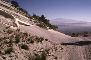
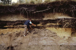 Products of three recent Plinian eruptions of Popocatépetl are seen in this stratigraphic section located near Paso de Cortés at the saddle between Popo and Iztaccíhuatl volcanoes. The thick basal unit was emplaced about 5,000 years ago. It is known as the Upper Pre-Ceramic eruptive sequence and includes pyroclastic flows and secondary lahars that traveled to the south. Volcanologist Claus Siebe is pointing to the overlying 2,500-year-old Lower Ceramic unit, and the 1,100-year-old Upper Ceramic Plinian unit lies at the top.
Photo by José Macías, 1995 (Universidad Nacional Autónoma de México).
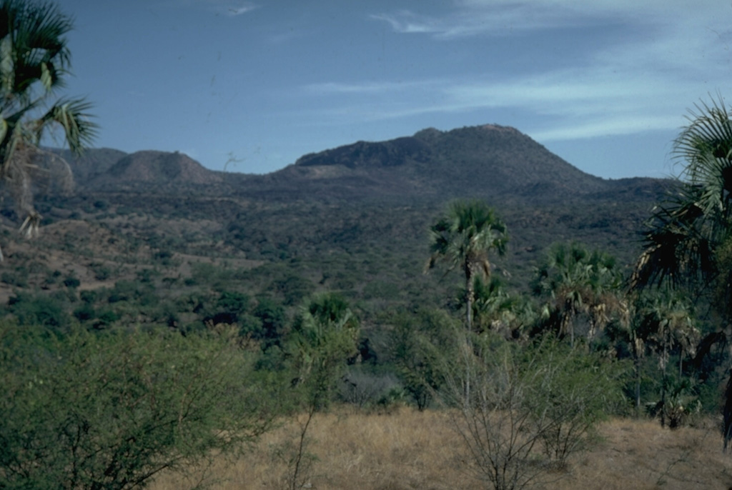
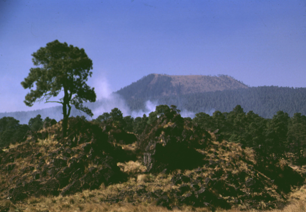
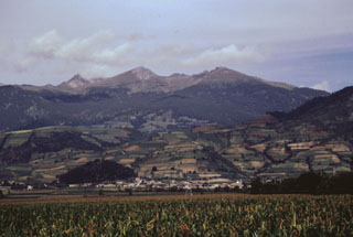
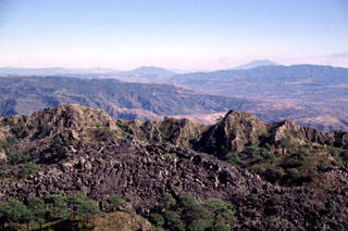
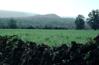
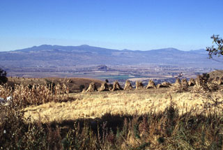 The SE part of the Chichinautzin volcanic field, seen here from the east on the flanks of the Sierra Nevada, forms a major topographic barrier at the southern end of the Valley of Mexico. Several small shield volcanoes, including Volcán Tláloc, appear on the horizon. The shield volcanoes have smaller cones on their flanks, some of which were also constructed on the floor of the Valley of Mexico.
Photo by Lee Siebert, 1997 (Smithsonian Institution).
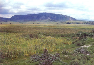
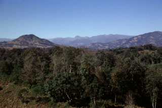 The broad ridge on the horizon is Las Cumbres volcanic complex, a Quaternary center NNE of Pico de Orizaba that contains a 3.5-4.5 km wide summit caldera. The Las Cumbres complex lies in the southern half of the Pico de Orizaba-Cofre de Perote volcanic chain and is topographically much less prominent than the two major volcanoes at the ends of the chain.
Photo by Lee Siebert, 1998 (Smithsonian Institution).
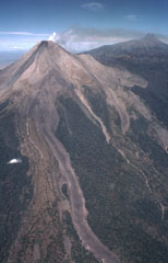 This 3.5-km-long lava flow was emplaced in 1975-76 at Colima. The flow split into two lobes on the upper flank; a shorter lobe drops diagonally to the right just below the light-colored barranca wall (center). Another flow during this eruption traveled down the NE flank and diverged around El Volcancito, the lava dome forming the ridge on the NE (right-hand) flank. A plume drifts to the NE toward the summit of Nevado de Colima.
Photo by Bill Rose, 1989 (Michigan Technological University).
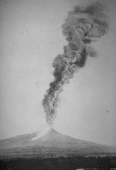
 An ash plume rises from Parícutin in October 1944. The photo was taken from the north at the outskirts of the town of San Juan Parangaricutiro. Lava flows in the foreground had already buried the town; the church tower seen in many other photos of the Parícutin eruption is hidden behind the small tree to the right.
Photo by Carl Fries, 1945 (U.S. Geological Survey, published in Luhr and Simkin, 1993).
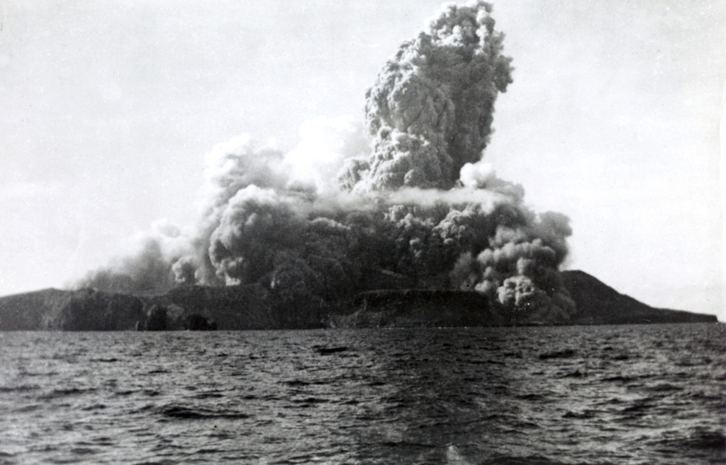
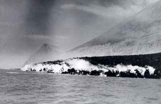
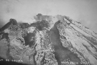
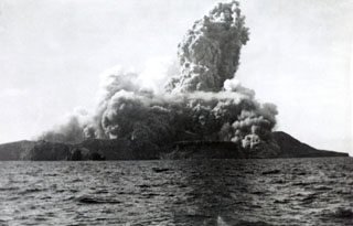 A new cone, Volcán Bárcena, was rapidly constructed during an eruption that began on 1 August 1952 at the southern end of Isla San Benedicto. This photo, taken from off the west coast of the island only four minutes after the start of the eruption, also shows the onset of pyroclastic surges. Lava extrusion occurred in September, November, and December. On 8 December activity shifted to a vent on the SE flank, producing a lava delta that extended about 700 m to sea. Activity ended in late February 1953.
Photo by Robert Petrie, 1952 (U.S. Navy; courtesy of Sherman Neuschel, U.S. Geological Survey).
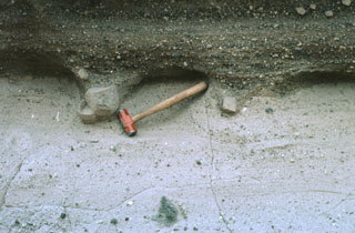 Large lithic blocks in tuff breccias of the Joya de Los Contreras maar form bomb sags that are exposed in three dimensions by differential erosion. The blocks impacted into the previously deposited lighter-colored tuffs, and the pits were subsequently filled by darker-colored crudely laminated surge deposits. The Joya de Los Contreras maar, 750 m by 1000 m wide, is the largest of the Santo Domingo volcanic field.
Photo by Jim Luhr, 1991 (Smithsonian Institution).
 Monogenetic cones of the Chichinautzin volcanic field are seen here below the western flanks of Iztaccíhuatl. These cones, including Cerro Tenayo to the lower left, lie at the easternmost extension of the 90-km-wide Chichinautzin volcanic field, south of the Valley of Mexico. The compound Iztaccíhuatl volcano is mostly Pleistocene in age.
Photo by Hugo Delgado, 1994 (Universidad Nacional Autónoma de México).
 The horseshoe-shaped summit crater of Toluca beyond the east-flank town of San Antonio Balderas opens towards the east. Block-and-ash flows from late-Pleistocene eruptions about 40,000 and 28,000 years ago cover this and other flanks of the volcano over an area of 630 km2.
Photo by José Macías, 1996 (Universidad Nacional Autónoma de México).
 Volcanologist Maurice Krafft measures the temperature of a pyroclastic-flow deposit from El Chichón volcano in April 1982. Pyroclastic flows and surges devastated an area of about 150 km2 around the volcano in a series of powerful eruptions March 28 to April 4.
Copyrighted photo by Katia and Maurice Krafft, 1983.
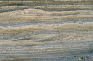 Pyroclastic surge deposits from La Breña maar in México's Durango volcanic field show both laminar and dune bedding. The thin beds (pen in the center for scale) were created by successive explosive eruptions that produced high-velocity pyroclastic surges that swept radially away from the volcano. The direction of movement of the surge clouds was from right to left, as seen from the truncated dune beds on the near-vent side.
Photo by Jim Luhr, 1988 (Smithsonian Institution).
 The thick viscous lava flow in the center was emplaced in 1961 during a period of dome growth. The flow traveled over the rim of the summit crater, eventually reaching the caldera floor by the end of 1962. The flow is seen here in 1978 from the caldera rim NW of the Colima summit. El Volcancito, the lava dome forming the NE-flank peak to the left, formed during the 1869 eruption. The forested lava flow to the lower right was probably erupted in 1872.
Photo by Jim Luhr, 1978 (Smithsonian Institution).
 The steep-walled 200-m-wide crater in the foreground at El Volcancillo on the NE flank of Cofre de Perote was the source of the voluminous Río Naolinco lava flow about 900 years ago. The pahoehoe lava flow traveled initially to the north and then to the east for a distance of 50 km, partly within lava tubes. El Volcancillo consists of two overlapping craters constructed on a ridge crest. The Río Naolinco lava flow originated from the NW crater; the SE crater fed the Toxtlacuaya ‘a’a lava flow down a valley on the opposite side of the ridge.
Photo by Lee Siebert, 1998 (Smithsonian Institution).
 The Atexcac maar is one of several lake-filled maars of the Serdán-Oriental volcanic field. The walls expose pyroclastic surge beds produced during formation of the maar. Cretaceous limestone beds and remnants of a basaltic scoria cone partially destroyed during formation of the maar are also exposed in the western crater walls. Abundant juvenile obsidian clasts are found in the surge deposits.
Photo by Hugo Delgado-Granados, 1997 (Universidad Nacional Autónoma de México).
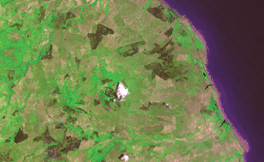
 The lower of the two small peninsulas at the lower right is Punta Púlpito, a Pleistocene obsidian dome dated at about 0.5 million years. The dome juts into the Gulf of California (right) in this NASA Landsat image with north to the top and lies east of the southern end of Bahía Concepción (upper left). The Saquicismunde geothermal area lies near the dome, and the larger Los Volcanes geothermal area, which lies along the coast about 5 km south of Punta el Púlpito, contains 18 fumaroles.
NASA Landsat 7 image (worldwind.arc.nasa.gov)
 The eroded, Pleistocene San Ignacio Volcanic field in Baja Mexico contains dozens of scoria cones and lava flows. The area is shown in this December 2019 Planet Labs satellite image monthly mosaic (N is at the top), which is approximately 52 km across.
Satellite image courtesy of Planet Labs Inc., 2019 (https://www.planet.com/).
 The lava flow descended the SW flank of Pico de Orizaba is about 110 m thick and up to 1.3 km wide at its terminus 5.5 km from the summit, and. has at least eight individual flow lobes. A portion of the flow that was diverted by topography to the west can be seen half-way up the flank. The smaller peak on the lower SW flank to the left of the lava flow is Cerro Colorado, a less than 90,000-year-old lava dome.
Photo by Gerardo Carrasco-Núñez, 2002 (Universidad Nacional Autónoma de México).
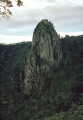 The dramatic spine in the summit crater of Tequila volcano rises 300 m above the crater floor. The dacitic spine, similar to the one at Sangangüey volcano, has been dated at 210,000 years and occupies a summit depression that is breached to the NE. The spine appears to represent the latest activity from the central vent of Tequila.
Photo by Paul Wallace, 1990 (University of California Berkeley).
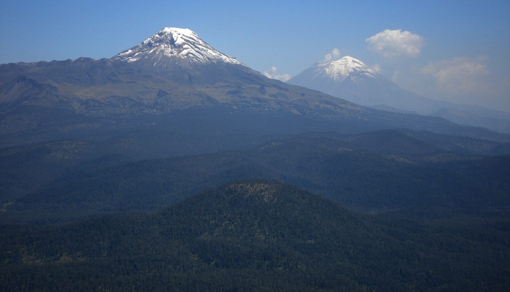
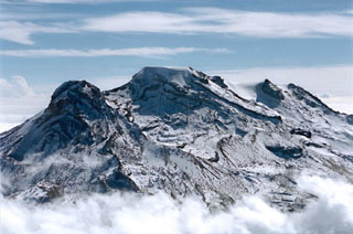
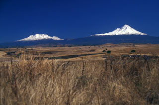 Iztaccíhuatl (left) and Popocatepetl (right), two of the highest volcanoes in Mexico, are seen from the SW on a rare smog-free day. The morphology of Iztaccíhuatl is due to multiple vents across the summit region . Fresh snowfall at Popocatepetl covers periodic ashfall deposits.
 Photo by Lee Siebert, 2004 (Smithsonian Institution).
 Five small scoria cones are aligned NE-SW near the town of Amecameca at the far eastern end of the Chichinautzin volcanic field. The large cone to the lower left is Cerro Chinconquiat, the larger of the two cones at the mid-right is Cerro Tapeixte, and the smaller one at the far right is Cerro la Joya. The cone with radian erosion gullies to the left immediately above Cerro Chinconquiat is Cerro Tenayo.
Photo by José Macías, 1996 (Universidad Nacional Autónoma de México).
 An ash plume towers above Colima on 7 March 1903 in this view from the south. A large explosive eruption on 15 February produced abundant ashfall and pyroclastic flows. The light-colored area down the flank to the left may be pyroclastic flow deposits. More than 20 large explosions, including this one, took place between 15 February and 14 March.
Photo courtesy Julian Flores (University of Guadalajara), 1903.
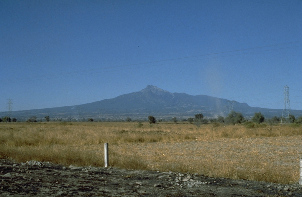
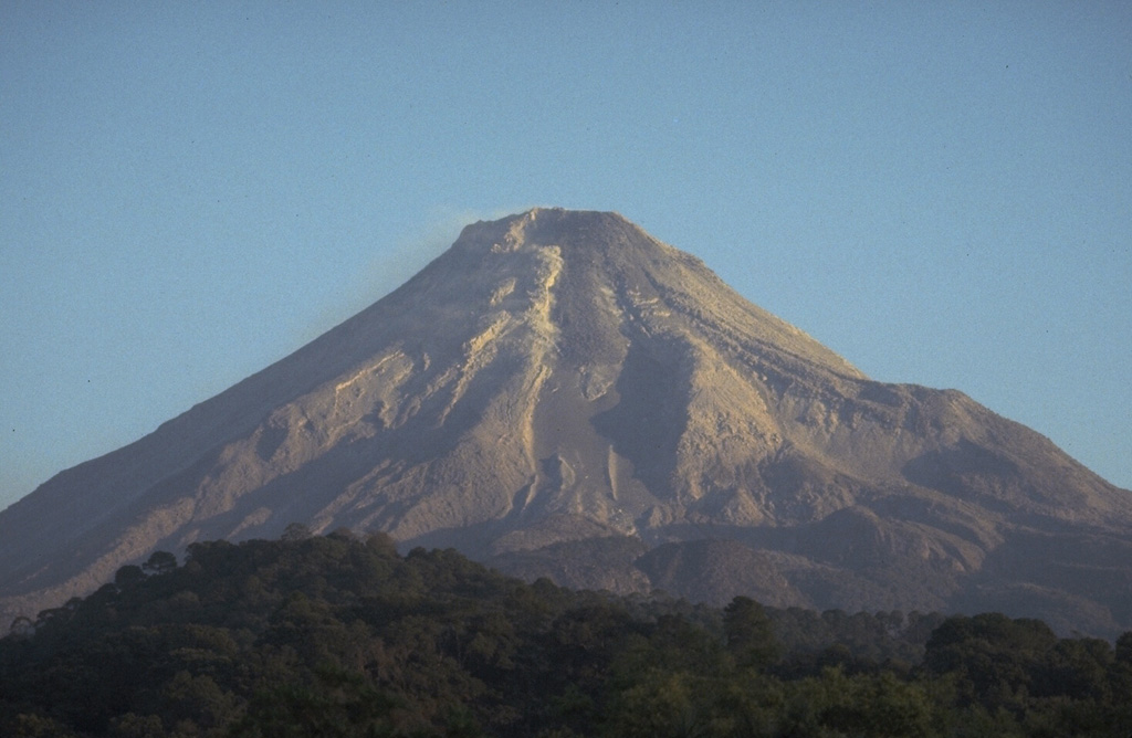
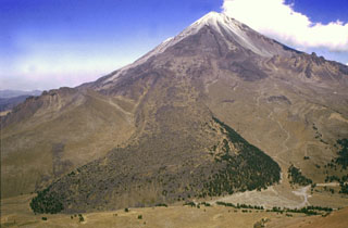
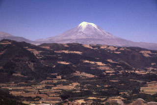 Pico de Orizaba volcano rises above the escarpment at the eastern margin of the Mexican Altiplano. It is seen here from the SE, along the road between Puebla and Orizaba. Like other volcanoes of the Pico de Orizaba-Cofre de Perote chain, deposits of Orizaba are asymmetrically distributed around the summit vent, and extend farther to the east towards the coastal plain.
 Photo by Lee Siebert, 1998 (Smithsonian Institution).
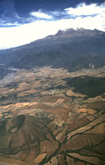
 Iztaccíhuatl rises above the clouds in this aerial view from the NW. The summit ridge is formed by a series of overlapping edifices. La Cabeza is to the left, glacier-covered El Pecho in the center, and Las Rodillas to the far right.
 Photo by Hugo Delgado, 1996 (Universidad Nacional Autónoma de México).
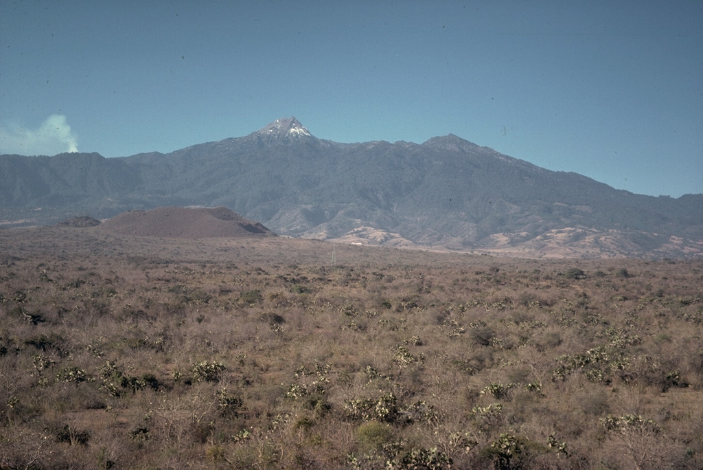
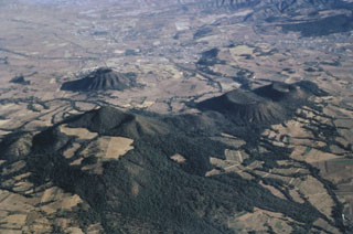
 The large forested (dark) area near the center of the photo is Cerro Tecolote, an eroded stratovolcano located roughly 50 km NE of Parícutin within the Michoacan-Guanajuato volcanic field. Cerro las Cabras (upper left) is a scoria cone that produced the lava flow extending across the upper part of the photo. Mexican Highway 15 travels across the flow, which is of Pleistocene age. Cerro Pajarito is one of the scoria cones south of Cerro Tecolote, and another cone is seen here on the SW flank.
Aerial photo by Comisión de Estudios del Territorio Nacional (CETENAL).
 Parícutin cinder cone, born in a Mexican cornfield in 1943, is perhaps the world's best-known example of a pyroclastic cone. Pyroclastic cones (from the Greek words for "fire" and "broken") are created by the accumulation of explosively ejected fragmental material around a volcanic vent. Depending on the dominant type of ejecta, they are called cinder cones, scoria cones, pumice cones, ash cones, or tuff cones. Pyroclastic cones are typically tens of meters to several hundred meters high and often issue lava flows from vents at their base.
Copyrighted photo by Katia and Maurice Krafft, 1981.
 The summit region of Cofre de Perote consists of at least two glacially eroded edifices. Glacial cirques and moraines are found in the summit area. The steep-walled east-facing scarp cutting across the center of the photo that exposes westward-dipping lavas was formed in part by edifice collapse.
Photo by Lee Siebert, 1999 (Smithsonian Institution).
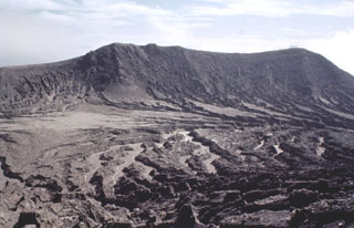
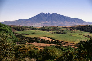
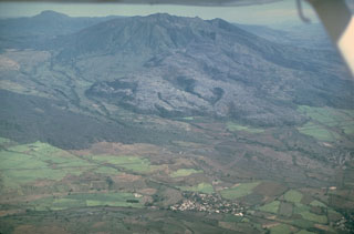 Volcán Ceboruco is a small, but complex stratovolcano with two concentric summit calderas. The thick lava flow (center) on the western flank was emplaced during an eruption in 1870-75. Eruption of the rhyodacite Jala Pumice formed the initial 4-km-wide caldera about 1,000 years ago. The second caldera was associated with partial collapse of the large Dos Equis dacite lava dome, which partly filled the earlier caldera. About 15 scoria cones and lava flows are across the flanks.
Photo by Jim Luhr, 1980 (Smithsonian Institution).
 The tree-covered hills in the foreground and center of this view from the summit of Jocotitlán volcano were formed during a massive debris avalanche produced by collapse of the volcano about 9,700 years ago. The debris avalanche deposit includes several conical hummocks (such as those to the lower left) and large transverse ridges up to 2.7 km long. The avalanche traveled a maximum distance of 12 km to the NE and covered an area of 80 km2.
Photo by Hugo Delgado-Granados, (Universidad Nacional Autónoma de México).
 A composite aerial photo with north to the top shows the lighter-gray summit of San Juan volcano just left of the center of the photo. Cerro Alto, the highest peak of the San Juan complex, forms the dark area at the lower left. A dark shadow highlights a 5-km-long NE-trending ridge that marks an eruptive fissure of the cone-building stage of San Juan. Prominent leveed lava flows that reach the northern flank mark the latest eruptive products of San Juan. The cities of Tepic and Jalisco lie at the upper and lower right, respectively.
Photo courtesy of Jim Luhr (Smithsonian Institution).
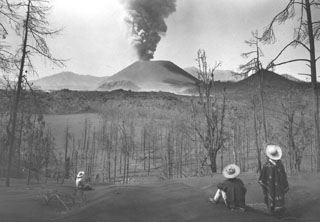 Local Tarascan residents observe Parícutin volcano from Cerro de Equijuata, 2.5 km to the NNE, in March 1944. In this photo taken a little more than a year after the eruption began the Sapichu cone appears at the NE (left-hand) base of Parícutin. The rugged lava flows of June 1943 are visible in the middle of the photo. Heavy ashfall has defoliated trees and a thick ash deposit mantles the landscape.
Photo by Arno Brehme, 1944 (U.S. National Archives, published in Foshag and Gonzáles-Reyna, 1956).
 The Tres Vírgenes volcanic complex consists of three stratovolcanoes constructed along a NE-SW line, seen here from the SE. La Vírgen (the youngest and highest when this 1995 photo was taken) is seen to the he left, with the El Azufre peak to the right and the older El Viejo forming the lower peak to the far right. The sparsely vegetated dark lava flow in the foreground is one of the youngest from La Virgen. A major Plinian eruption from a SW-flank vent was followed the by extrusion of a thick lava flow.
Photo by José Macías, 1995 (Universidad Nacional Autónoma de México).
 The San Quintín Volcanic Field on the NW coast of Baja California contains lava flows and young scoria cones. This view looks south from Volcán Basu to Picacho Vizcaino (surrounded by young lava flows), and Volcán Sudoeste (upper left). These are among the youngest features of the San Quintín field.
 Photo by Jim Luhr, 1990 (Smithsonian Institution).
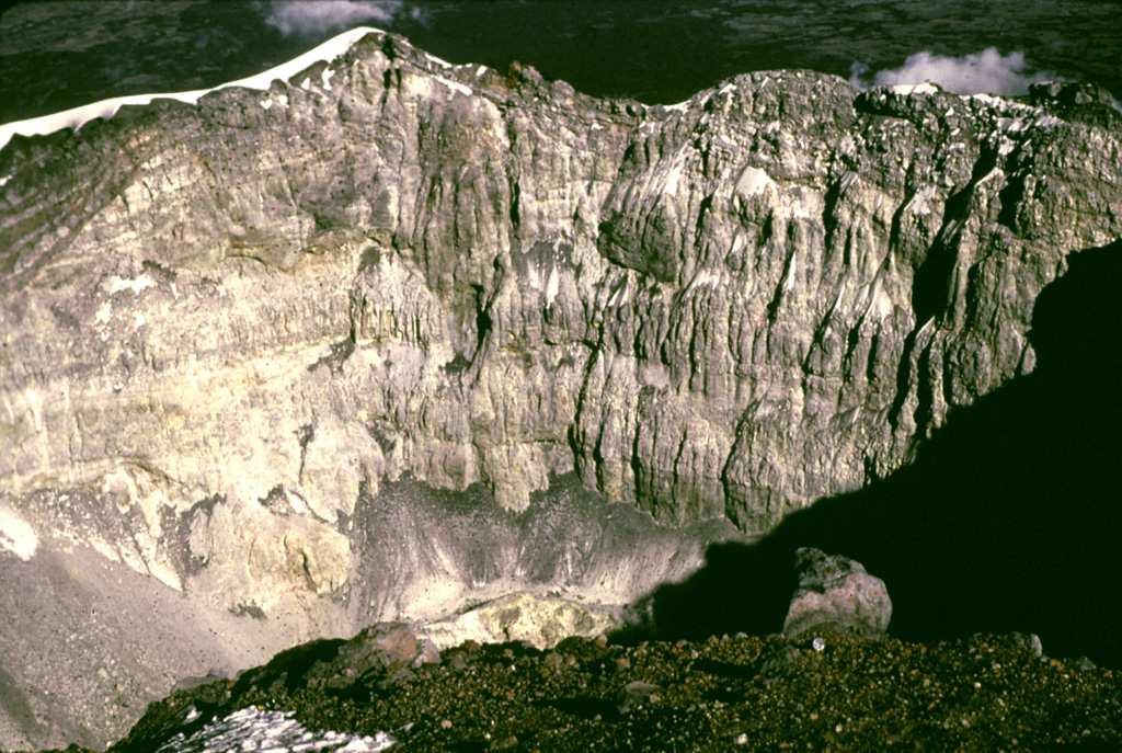
 The eastern rim of the 1982 crater at El Chichón is seen here from the rim of the larger, older crater. Erosional gullies formed within pyroclastic flow and surge deposits that traveled radially away from the 1982 crater. The rim rises about 50 m above the moat between the two craters. Prior to the 1982 eruption a lava dome reached several hundred meters above the crater floor.
Photo by Bill Rose, 1983 (Michigan Technological University).
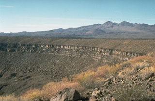
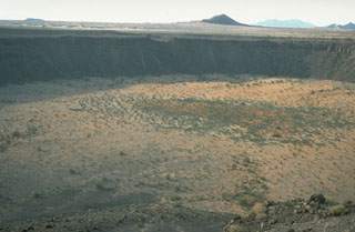 McDougal crater on the NW side of the Pinacate Volcanic Field in NW México is the largest maar at Pinacate. This view from the SE looks across the 1,520 x 1,740 m wide crater, which contains playa deposits 130 m below the rim. The maar erupted through flat-lying alluvial terrain of the Gran Desierto.
Photo by Richard Waitt, 1988 (U.S. Geological Survey).
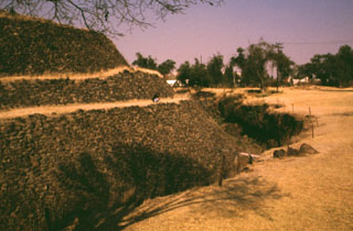 The Cuicuilco pyramid in the southern part of Mexico City was surrounded by lava flows from Xitle volcano about 1,600 years ago. The basaltic flows underlie the area to the right and are exposed in the trench walls around the pyramid. The Preclassic Cuicuilco site is one of the oldest archaeological areas in central México. The earliest occupations date back to 2,100-1,800 BCE, and the pyramid was constructed about 80-600 BCE, when Cuicuilco had become an important Pre-Hispanic city.
Photo by Lee Siebert, 1998 (Smithsonian Institution).
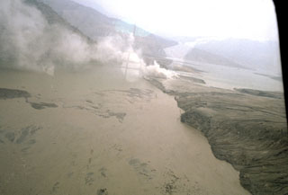
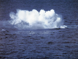 During a submarine eruption that was first observed on 29 January 1993, small explosions were produced when floating hot rocks fractured and their hot interiors came in contact with sea water. Large blocks of dark-gray, highly-vesiculated basalt up to 5 m in diameter rose to the surface. During individual pulses at irregular intervals, tens of blocks accompanied by bubbles could be observed rising through the water column. The blocks emitted loud hissing and crackling noises from thermal expansion prior to breaking up into smaller pieces and sinking.
Photo by Hugo Delgado-Granados, 1993 (Universidad Nacional Autónoma de México).
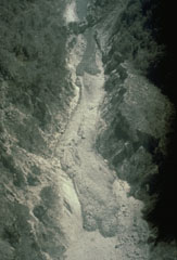 This 24 April 1991 aerial photo shows deposits from the 1991 eruption of Colima in the lower part of the Barranca El Cordobán on the south flank. The deposits at the bottom of the photo with rounded flow fronts and well-defined levees originated from block-and-ash flows. The darker, more recent deposits near the top of the photo contain a higher amount of juvenile (fresh magmatic) material.
Photo by Jean-Christophe Komorowski, 1991(Arizona State University).
 Cerro Quemado cone of the Camargo volcanic field is seen here on the horizon from the north with the quarry in the adjacent Cerro el Salto (La Olivina) cone in the center of the photo. La Olivina is a source of abundant spinel-lherzolite xenoliths that were once mined for peridot.
Photo by Jorge Aranda-Gómez, 1995 (Universidad Nacional Autónoma de México).
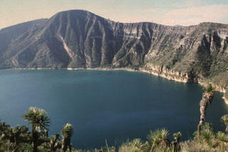
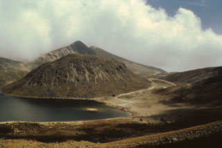 The rounded El Ombligo dome is one of the youngest features in the summit crater of Nevado de Toluca. The dome separates the crater floor into two lakes, the largest of which on the SW side of the crater (left) is called Lake of the Sun. The other lake, known as the Lake of the Moon, lies beyond the right side of the dome in this view, which shows the road leading into the summit crater to the right.
 Photo by José Macías, 1995 (Universidad Nacional Autónoma de México).
 The Woodford group (Ieft) and Media Luna (right), seen here from the SSE, comprise the northern group of cones of the San Quintín Volcanic Field. It consists of a cluster of scoria cones and associated lava flows. The large cone of Media Luna opens towards the east, and it produced a lava flow in that direction.
Photo by Jim Luhr, 1990 (Smithsonian Institution).
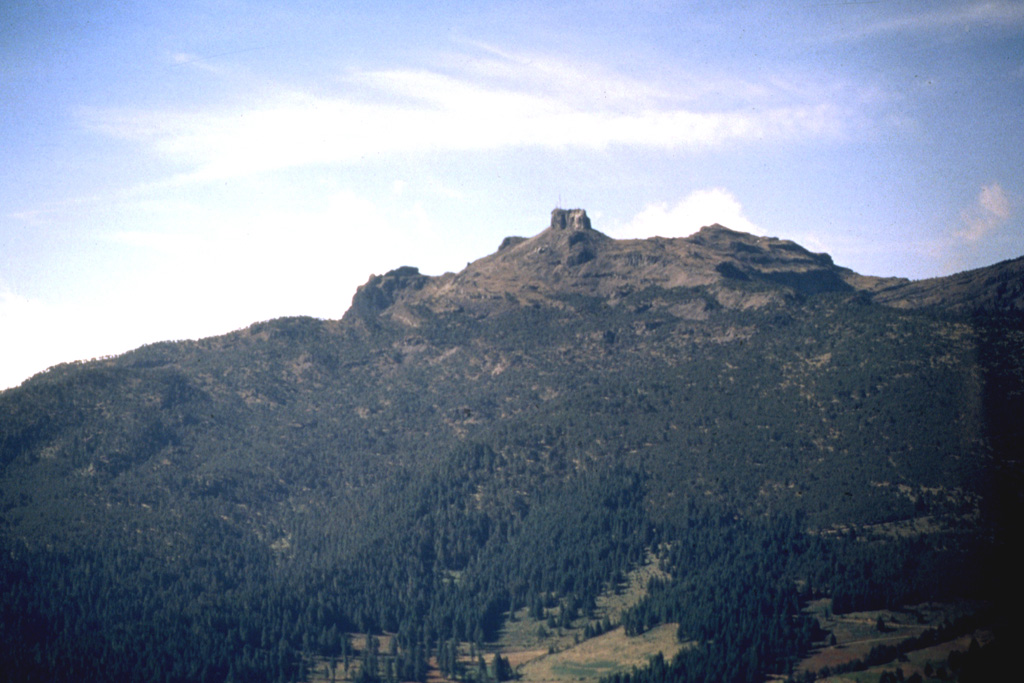
 The peak to the left is San Antonio, the youngest of the Tacaná volcanic complex. A major eruption from the upper SW flank about 1,950 years ago produced a block-and-ash flow that traveled about 14 km to the south with associated lahars. The eruption concluded with the extrusion of lava flows and a lava dome. Construction at the pre-Hispanic center of Izapa was halted because of temporary abandonment of the city due to the lahars.
Photo by Norm Banks, 1987 (U.S. Geological Survey).
 A roadcut through the eastern rim of the Cerro Xalapasco tuff cone exposes pyroclastic-surge deposits. The road provides access to a quarry where perlite (hydrated obsidian) is mined. Cofre de Perote volcano rises on the distant horizon across the Serdán-Oriental basin.
Photo by Lee Siebert, 1998 (Smithsonian Institution).
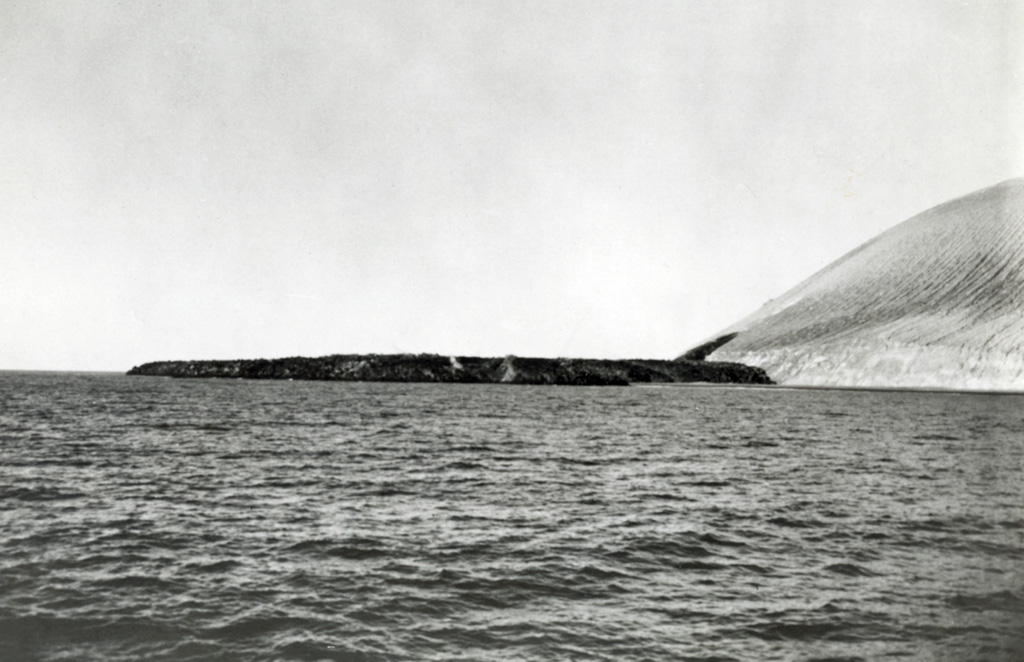
 Entry of the Delta Lávico lava flow into the sea produces steam along the flow margins. The flow originated from a vent low on the Volcán Bárcena 1952-53 tuff cone. Punta Sur, the southernmost tip of the island, is in the left background and is a Montículo Cinerítico tuff cone that formed prior to the 1952 eruption and was formerly the highest point on the island.
Photo by U.S. Navy, 1952 (courtesy of Sherman Neuschel, U.S. Geological Survey).
 The Pinacate volcanic field covers approximately 55 x 60 km and contains numerous maars and scoria cones. The field is prominent in this arid region of NW México near the head of the Gulf of California. The crater rim across the center of the photo is the 1.6-km-wide Cráter Elegante maar. Pinacate Peak in the distance is at the summit of Santa Clara shield volcano, which contains many scoria cones and lava flow fields.
Photo by Richard Waitt, 1988 (U.S. Geological Survey).
 Ceboruco, seen here from the west, contains two summit calderas. The rim of the older caldera, which collapsed about 1,000 years ago following eruption of the Jala Pumice, forms the peaks to the left and right of the summit. The thick, light-gray-colored lava flow at the mid left and center part of the photo was produced during the 1870-75 eruption.
Photo by Jim Luhr, 1974 (Smithsonian Institution).
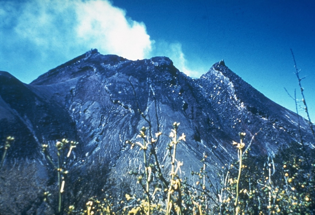
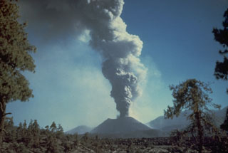
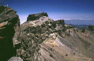
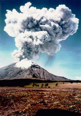 An ash plume towers above Popocatépetl as viewed from Paso de Cortés NW of the volcano at 1032 on 11 June 1997. The photo was taken 18 minutes after a 15-minute-long volcanic tremor episode that accompanied the major ash emission, which reached an altitude of 4 km above the summit. Intermittent ash emission had begun on 5 March 1996, some of which produced ashfall that reached the Gulf of Mexico. This activity was accompanied by periodic growth and destruction of lava domes in the summit crater.
Photo courtesy CENAPRED, Mexico City, 1997.
 The inner caldera rim of Ceboruco forms the ridge extending across the photo in this view looking toward the SE from near the summit. The inner caldera wall consists of massive dome lavas that were emplaced within the outer caldera. The unvegetated lava flow in the foreground was erupted from a vent within a scoria cone complex at the western side of the inner caldera, probably in 1870. Flat-topped Volcán Tequila forms the peak in distance to the upper right.
Photo by Lee Siebert, 1997 (Smithsonian Institution).
 The small Cerro El Colli is one of the youngest post-caldera domes of the Sierra La Primavera volcanic complex, immediately west of the city of Guadalajara. The dome, seen here from the south, has been dated to about 30,000 years and is the easternmost of several emplaced near the southern caldera rim. An 11-km-wide caldera formed as a result of the eruption of the 20 km3 Tala Tuff about 95,000 years ago. Fumaroles and hot springs are active throughout the volcanic complex.
Photo by Hugo Delgado-Granados, (Universidad Nacional Autónoma de México).
 By the time that this 7 June 1960 photo was taken at Colima, the lava dome had risen to the height of the crater rim. The dome had begun growing again in May 1957 after about 25 years of quiescence, from a depth about 50 m below the notch in the northern crater rim (center) known as La Gran Vena. In 1961 this dome growth resulted in lava flowing out of the crater through this notch and down the northern flank.
Photo by Guillermo Saucedo, 1958 (courtesy Julian Flores, University of Guadalajara).
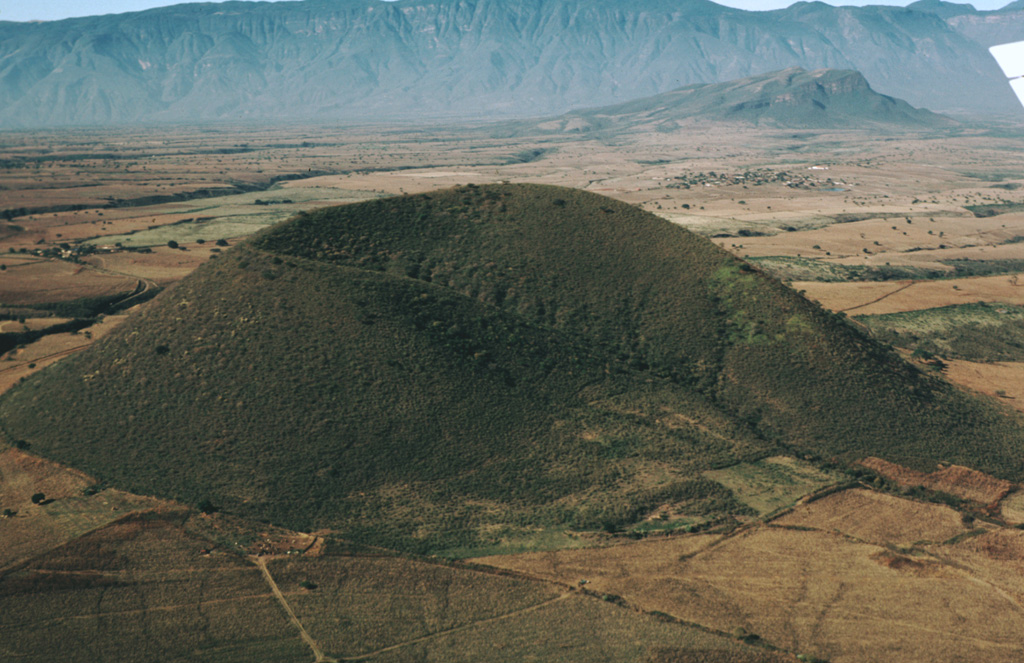
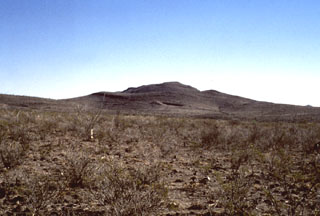
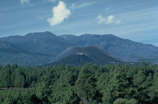 Parícutin, the volcano that erupted in cornfield in 1943, is the best-known feature of the Michoacán-Guanajuato volcanic field. The huge field contains over 1,400 vents covering a wide area of Michoacán and Guanajuato states. Scoria cones are the predominant volcanic form, and lava domes, maars, tuff rings, and lava flows are also present. Parícutin is seen here from the NE with Cerro de Tancítaro in the background.
Photo by James Allan, 1985 (Smithsonian Institution).
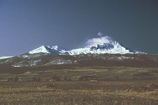 Nevado de Toluca is seen here from the NW just after a winter snowfall. The Pico del Fraile summit is to the right. Late-Pleistocene block-and-ash flows and Plinian eruptions have affected all sides of the volcano.
Photo by Paul Wallace, 1992 (University of California Berkeley).
 The ridge in the background is a thick basaltic andesite lava flow of probable Holocene in age that is part of the San Borja Volcanic Field. The flow is seen here from State Highway 1 in central Baja California. The sparsely vegetated flow is one of many younger lava flows of the field.
 Photo by Andy Saunders, 1984 (University of Leichester).
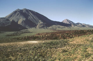
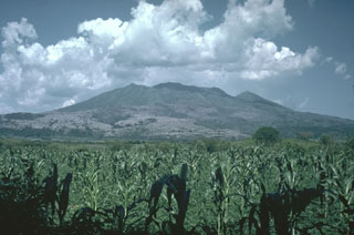
 Sangangüey is an eroded stratovolcano that is seen here from the SW across farmlands of the Tepic basin, with a spine visible in the summit crater. The NW and SE flanks contain 45 scoria cones that erupted during the past 300,000 years; some of these NW-flank cones are visible below the left horizon.
 Photo by Lee Siebert, 1997 (Smithsonian Institution).
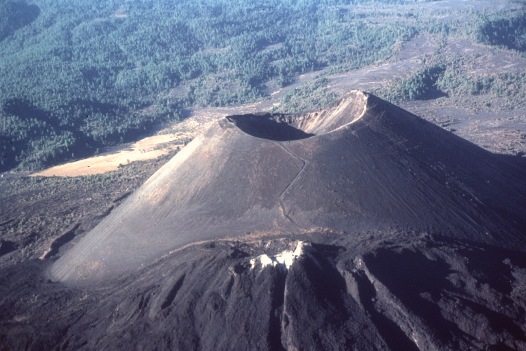
 By the end of the 9-year-long eruption of Parícutin, the new scoria cone had risen 424 m above the surface of the original cornfield. The 900-m-wide oval-shaped cone is elongated in a NW-SE direction and is truncated by a circular 280-m-wide crater. The western peak (right) is the highest point on the crater rim. The NE-flank peak of Nuevo Juatita is in the foreground with its top covered by white minerals from fumaroles, and was the main source of lava flows during the last five years of the eruption.
Photo by Jim Luhr, 1997 (Smithsonian Institution).
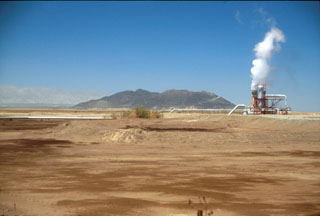 The Cerro Prieto compound rhyodacite lava dome is the only volcanic feature of the Cerro Prieto geothermal field. A 200-m-wide crater is located at the summit of the NE-most dome. The dome probably formed during at least five eruptive stages between about 100,000 and 10,000 years ago, with both magmatic and phreatic activity. Explorers in the mid-1500s reported steam and sulfuric gases.
Photo by Brian Hausback, 1995 (California State University, Sacramento).
 Cerro el Mocajete, seen here from the NW with a wall formed of lava blocks in the foreground, is one of the many pyroclastic cones of the Tertiary-to-Quaternary Los Flores volcanic field. It lies in one of many NNW-SSE-trending fault-bounded valleys of the limestone Sierra Madre Oriental, to the west of a lengthy lava flow originating from Cerro Partido. These volcanoes are located in the rugged Sierra Madre Oriental at the conjunction of the states of Tamaulipas, Nuevo León, and San Luis Potosí.
 Photo by Jim Luhr, 2000 (Smithsonian Institution).
 A pyroclastic flow lobe about 4 km NE of the crater, south of Nicapa, is seen within a day or two of its deposition on 4 April 1982. The Nicapa valley was the site of the most extensive pyroclastic flows of the 1982 El Chichón eruption. Up to three units are present, each 2-15 m thick and containing abundant pumice blocks 15-40 cm in diameter. Volcanic ash (fragmented rock, crystals, and glass) from the 4 April pyroclastic surges cover a broad radial area around the crater to distances 1.5 km beyond the extent of the pyroclastic flows in the Nicapa valley.
Photo by Servando De la Cruz-Reyna, 1982 (Universidad Nacional Autónoma de México).
 Major pyroclastic flow deposits of the 3-4 April 1982 eruptions at El Chichón formed natural dams blocking the Rio Magdalena. This tephra dam was located about 4.5 km WSW of the crater and produced a lake that eventually reached 4 km in length and had a volume of 26 million cubic meters. It failed catastrophically about seven weeks after the end of the eruption (26 May), causing a massive lahar with temperatures reaching 82°C that destroyed a bridge and damaged a hydroelectric site, killing one worker and badly scalding three others.
Photo by Servando De la Cruz-Reyna, 1982 (Universidad Nacional Autónoma de México).
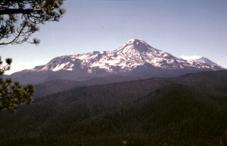 The profile of Iztaccíhuatl seen from the summit of Papayo volcano to the north. The northern base of the volcano is the Llano Grande edifice (the oldest edifice of Iztaccíhuatl) and the NW-flank La Trampa lava flows. The low-angle ridge extending to the NE (left) consists of the Teyotl dacite lava flows that erupted from a vent on the upper northern flank about 80,000 years ago. A gas plume can be seen at the summit of Popocatépetl to the far right.
Photo by Lee Siebert, 1997 (Smithsonian Institution).
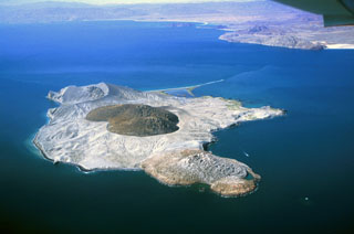 Isla San Luis lies across a narrow channel from the NE coast of Baja California (in the background). A rhyolite obsidian dome is in the center of the small island. An older dome forms the northern part of the island (foreground) and is partially mantled by ash and pumice from the central dome. An eroded tuff ring, Plaza de Toros, occupies the SE end of the island.
Photo by Keith Sutter, 2000.
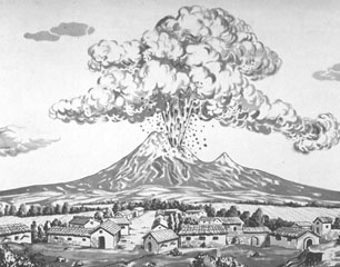 This sketch shows an eruption of Colima on 16 April 1872, as seen from the SE with Nevado de Colima peak on the right skyline. The sketch correctly depicts the eruption as originating from El Volcancito, a NE-flank vent. This event began at 10 in the morning and lasted for 30 minutes. The 1872 eruption began on 26 February and lasted until 14 March of the next year, when ashfall occurred in Colima City 35 km to the south.
Sketch by Emiliano Meza (courtesy of Julian Flores, University of Guadalajara).
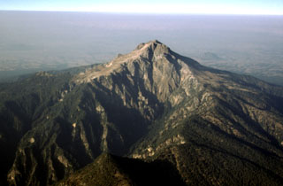 Malinche is located between the Popocatépetl-Iztaccíhuatl and Orizaba-Cofre de Perote volcanic ranges. The edifice is largely Pleistocene in age and is seen here in an aerial view from the SE. The canyons on the flanks are a result of glacial erosion. Holocene lahars from La Malinche associated with an eruption about 3,100 years ago reached the Puebla basin and affected precolumbian settlements.
Photo by Gerardo Carrasco-Núñez, 1997 (Universidad Nacional Autónoma de México).
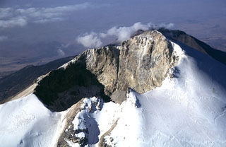 The Pico de Orizaba summit crater is 400 x 500 m with a crater floor 300 m below the summit on the NW side of the rim. Climbers' tracks can be seen on the Jamapa Glacier to the lower right.
 Photo by Gerardo Carrasco-Núñez, 1997 (Universidad Nacional Autónoma de México).
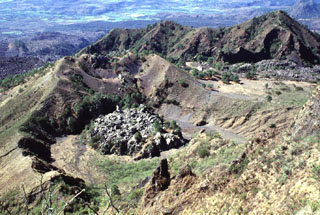 The small lava dome on the floor of the crater in the foreground was emplaced late in the 1870-75 eruption of Ceboruco. Levees of a lava flow that traveled 6.5 km down the west flank are higher than this crater, indicating that the main 1870 vent that fed the flows was probably located above the dome. The ridge to the upper right is the NW rim of the outer caldera.
Photo by Lee Siebert, 1997 (Smithsonian Institution).
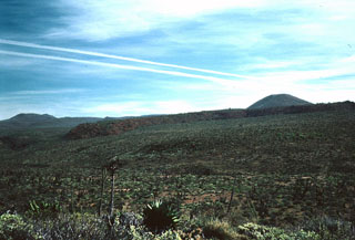 One of the many scoria cones of the Jaraguay Volcanic Field is seen here from the SW across the Arroyo San José. Two lava flows of probable Holocene age originated from a nearby scoria cone. This is the largest young volcanic field of Baja California, located in northern Baja between Jaraguay and Arroyo San José, it contains numerous scoria cones and lava flows.
Photo by Andy Saunders, 1984 (University of Leichester).
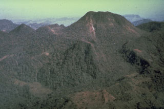 Prior to the major 1982 eruption, El Chichón contained a large summit lava dome (upper right) and a lower flank dome (center) inside two overlapping craters, seen here from the SW in 1981. A small steam plume rises from a fumarole along a fault down the left side of the larger dome. The last major eruption of El Chichón prior to 1982 occurred about 500 years ago, but residents reported an eruption about 130 years ago that was witnessed by their grandparents but was not strong enough to prompt an evacuation.
Photo by René Canul, 1981 (Comisión Federal de Electricidad).
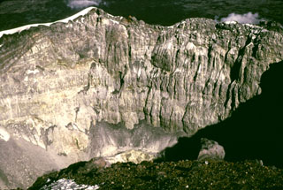 The steep crater wall of Popocatépetl is seen here from the western crater rim 1979 showing the stratigraphy of the upper cone. The low point on the eastern crater rim is about 170 m below the summit.
Photo by Bob Luhr, 1979.
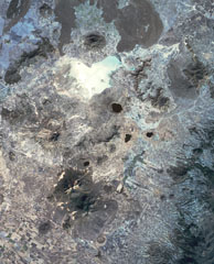 This view of the Serdán-Oriental basin covers about 38 km in a N-S (vertical) direction. The circular peak at the upper center, partially surrounded by young lava flows from Los Humeros caldera, is Cerro Pizarro lava dome. The lake-filled maar to the SSE across the light-colored dry lake basin is Alchichica maar. The erosionally ribbed flanks of Cerro Xalapaxco tuff cone and Cerro Pinto lava dome lie to the SW, and the large forested peaks at the bottom are the the twin Las Derrumbadas lava domes.
NASA Landsat satellite image, 1999 (courtesy of Loren Siebert, University of Akron).
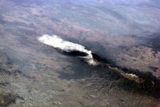 An ash plume from Popocatépetl reaching over 9 km above sea level and dispersing to the south on 23 January 2001. Larger explosions the day before had produced plumes that rose 8 km above the summit and pyroclastic flows that traveled 4-6 km down the north flank. The large dark-colored area below and to the left of the volcano is a lava field. The elongate Iztaccíhuatl volcano is visible to the lower right.
Image courtesy of Earth Sciences and Image Analysis Laboratory, NASA Johnson Space Center, 2002 (http://eol.jsc.nasa.gov).
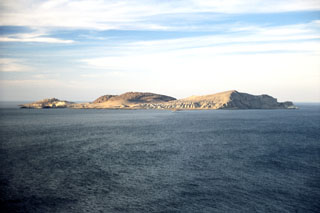 Isla San Luis, seen here from the SW with a large rhyolitic lava dome near the center, is the largest of the seven Encantada islands in the northern part of the Gulf of California. The roughly 180-m-high island lies 3 km off the eastern shore of Baja California. An older lava dome forms the NE tip of the island, and an eroded tuff ring lies at the SE tip. The lava dome seen here in the center of the island was constructed within a tuff ring and is the youngest volcanic feature.
Photo by Brian Hausback, 1997 (California State University, Sacramento).
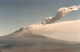 Two plumes are visible at Popocatépetl on 11 March 1996, six days after the renewal of explosive activity. A continuous diffuse plume disperses to the south at about 5,500 m elevation (roughly the height of the summit), while a second plume produced by a small explosion rises to about 8,000 m altitude. Beginning in 1996 multiple lava domes were extruded in the summit crater and periodically partially removed by explosions.
Photo by Hugo Delgado-Granados, 1996 (Universidad Nacional Autónoma de México).
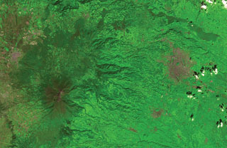 The flanks of the massive Cofre de Perote shield volcano extend across most of the left two-thirds of this satellite image. The summit of the volcano (lower left) has been truncated by edifice failure to the east. The large brown area at the middle right is Jalapa, the capital city of the state of Veracruz; to its SW is the city of Coatepeque. The voluminous dark-colored Río Naolinco lava flow north of Jalapa originated from a vent on the lower NE flank of Cofre de Perote about 900 years ago and traveled an additional 15 km beyond the margin of this image.
ASTER satellite image, 2001 (National Aeronautical and Space Administration, processed by Doug Edmonds).
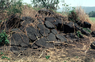 A pressure ridge on the surface of a lava flow from El Molcajete pyroclastic cone rises above agricultural lands on the valley floor about 2 km SW of Molcajete. The flow is one of the youngest from the Los Flores volcanic field in the Sierra Madre Oriental.
Photo by Jim Luhr, 2000 (Smithsonian Institution).
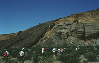 Participants in a geological field excursion examine the stratigraphy within the Cerro Colorado maar. The outcrop exposes a variety of deposits produced by several episodes of phreatomagmatic activity. The south crater walls here reveal layered tuff deposits and material from the collapse of the inner crater wall into the vent. Steeply dipping dark-colored tuff beds (left) can be traced from the crater floor up and over the walls, and then down the outer flanks of the cone.
Photo by Bill Rose, 1978 (Michigan Technological University).
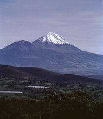 Pico de Orizaba, also known as Citlaltépetl ("Mountain of the Star") is seen here from the south. The snow-free peak to the left is Sierra Negra, a Pleistocene volcano that was active simultaneously with Orizaba. These volcanoes mark the southernmost extent of the Cofre de Perote-Pico de Orizaba volcanic chain.
Photo by José Macías, 1996 (Universidad Nacional Autónoma de México).
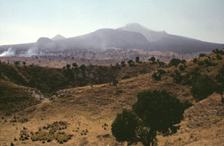 The NE flank of Volcán la Malinche contains deep glacially carved canyons and the craters in the foreground are part of the Xalapaxco tuff cone complex. Xalapaxco means "vessel or container made of sand" in the Aztec Nahuatl language. The tuff cone contains ten overlapping craters influenced by changes in water and magma supply rates during the course of an eruption. The tuff cone was erupted through alluvial fan deposits consisting of reworked fluvial and glacial deposits on the lower flank of Malinche.
Photo by Lee Siebert, 1998 (Smithsonian Institution).
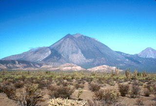 The Tres Vírgenes volcanic complex in central Baja California consists of a NE-SW-trending chain of three volcanoes, seen here from the SE. Volcanism has migrated over time to the SW. El Azufre is the intermediate-age cone to the right and La Vírgen is to the left. The latest major eruption produced a Plinian pumice fall deposit and thick lava flows from a vent near the ridge seen halfway up the SW flank (left).
Photo by Brian Hausback, 1990 (California State University, Sacramento).
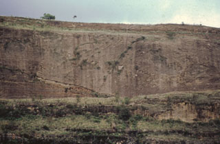 An exposure on the south flank of the Nevado de Toluca shows two debris flow deposits transformed from original flank failures of the volcano during the late Pleistocene. Debris avalanche and lahar deposits cover a broad area of about 500 km2 to the south.
Photo by José Macías, (Universidad Nacional Autónoma de México).
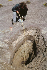 A trench dug on the flank of the Popocatépetl above the tree line at 4 km exposes deposits of a major explosive eruption. Volcanologist Claus Siebe from the National University of Mexico is measuring the thickness of an alternating sequence of ashfall and pyroclastic surge deposits produced during a Plinian eruption of the volcano about 1,100 years ago. Following this major eruption, lahars from accumulated ashfall deposits on the slopes of Popocatépetl and Iztaccíhuatl flooded the Puebla basin.
Photo by José Macías, 1998 (Universidad Nacional Autónoma de México).
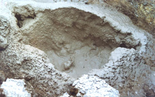 Mudpots are found at hydrothermal areas near the summit of Cerro Evermann. Fumaroles are active at the base of a relatively young lava dome, which is one of the youngest features of the summit area. The most active area is on the SE side of a northern dome and includes areas of emissions, boiling water or mud, clay alteration, and sulfur deposits.
Photo by Martha Marin, 1998 (Mexican Navy).
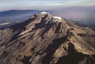 Iztaccíhuatl is a massive 450 km3 stratovolcano SE of Mexico City, seen here from the SW. The summit is composed of several overlapping edifices, including the northernmost peak, La Cabeza (left), the snow-capped high point El Pecho, and Las Rodillas (below the lower Ayoloco glacier near the center). Most activity ceased during the Pleistocene, and the volcano has been extensively glaciated, as seen by the sharp-crested glacial moraines below the Ayoloco glacier.
Photo by José Macías, 1995 (Universidad Nacional Autónoma de México).
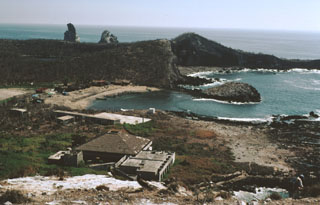 A biological research station and fishermen's shacks line the shores of Playa Chica on the SE side of Isla Isabel in this 1999 photo. The two spires to the upper left are the Islotes Las Monas, eroded remnants of an offshore cone. The lake-filled Laguna Fragatas maar can be seen at the left in front of the spires of the Islotes Las Monas. The small 1.5-km-wide uninhabited Isla Isabel is a wildlife sanctuary.
Photo by Jim Luhr, 1999 (Smithsonian Institution).
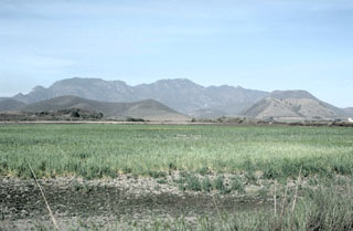 Volcán el Puerto (left) and Volcán Embarcadero (right) are seen from the east across fields of the Mascota graben. Both cones have craters that open towards the east. They are in the NW side of the Mascota Volcanic Field and erupted near the western base of the graben walls, which in this view consists of metamorphic rocks and elsewhere of Cretaceous tuffs. The Mascota graben here is about 5 km wide.
Photo by Jim Luhr, 1985 (Smithsonian Institution).
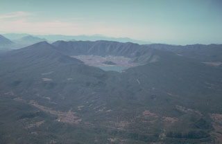 Volcán Tepetiltic is an andesitic and dacitic stratovolcano truncated by an elliptical, 5 x 2.5 km caldera that contains a lake at its NE corner. The compound caldera, seen here from the NE, was formed during major rhyodacitic eruptions that were closely followed by emplacement of lava domes on the eastern flank. A permanent caldera lake (center) occupies the lower NE caldera floor. The small forested lava dome beyond the caldera lake was emplaced near the intersection of the two calderas.
 Photo by Jim Luhr, 1978 (Smithsonian Institution).
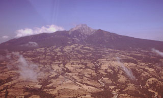 Broad alluvial fans composed of fluvial, glacial, and volcaniclastic sediments surround La Malinche volcano. The circular volcano is dissected by radial drainages on all sides. During attempts to reconstruct the Quaternary glacial history of Mexican volcanoes a yellowish-red pumice layer that extends around Malinche volcano was dated to between about 12,100 and 7,650 years old.
Photo by Gerardo Carrasco-Núñez, 1997 (Universidad Nacional Autónoma de México).
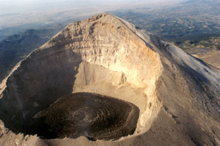 This photo shows the Popocatépetl summit crater with fresh lava visible on 9 December 1997 after rapid lava extrusion during 5-6 December had almost covered the entire crater floor. The high point on the WSW crater rim rises 450 m above the floor of the 700-m-wide crater. The stratigraphy of the upper cone is visible in the far crater wall.
 Photo by Hugo Delgado-Granados, 1997 (Universidad Nacional Autónoma de México).
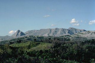 El Chichón is seen in profile from the SSW in January 1983. The upper flanks of the volcano were completely deforested by the devastating eruptions of March and April 1982. The sharp peak at the left is the SW lava dome. The broad ridge at the center is the rim of the 220,000-year-old somma of El Chichón; the 1-km-wide 1982 crater was formed inside the older crater. Removal of the summit lava dome by the 1982 explosions lowered the height of the summit of El Chichón by about 200 m.
Copyrighted photo by Katia and Maurice Krafft, 1983.
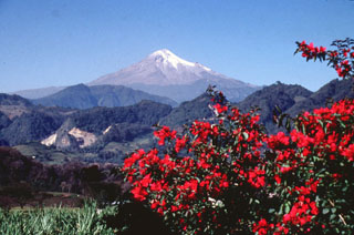 Pico de Orizaba volcano towers above ridges of Cretaceous limestone on its ENE flank. The glaciated volcano was constructed during three stages and has undergone edifice collapse on several occasions. Collapse of the initial Torrecillas edifice during the Pleistocene produced the massive Jamapa debris avalanche. It traveled down the Jamapa river and overtopped gaps in limestone foothills to reach the current area of the city of Huatusco, beyond where this photo was taken.
Photo by Lee Siebert, 1998 (Smithsonian Institution).
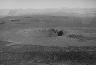 Cráter Elegante is one of the largest maars of the Pinacate volcanic field, seen here from the WSW. The uneven area on the southern crater rim (to the right) is a scoria cone that was dissected during formation of the maar. Another darker scoria cone to the right is surrounded by lighter-colored pyroclastic surge deposits from the maar-forming eruptions. A third scoria cone (lower left) opens toward the rim of Cráter Elegante and is partially surrounded by the younger dark-colored lava flow in the foreground.
Photo by David Roddy, 1965 (U.S. Geological Survey).
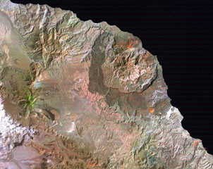 Three major Quaternary volcanic complexes are visible in this Landsat satellite image of Baja California. The N-S-trending Las Vírgenes volcanic complex to the left consists of three stratovolcanoes that are progressively younger towards the south. The 10-km-wide La Reforma caldera along the Gulf of California coast to the right displays darker andesite flanks and a resurgent dome in the center. The extensively eroded El Aguajito caldera has indistinct margins but the large resurgent dome forms the roughly circular eroded hills west of La Reforma.
NASA Landsat image (processed by Brian Hausback, UC Sacramento).
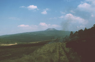 A symmetrical cone is located on Volcán Pelado, a small shield volcano about 10 km south of Xitle volcano. Pyroclastic flows accompanied the formation of the cone. Pelado and the Xitle cone, which erupted about 1,670 years ago, are among the many Holocene vents of the Chichinautzin volcanic field. Both eruptions affected nearby settlements.
Photo by Paul Wallace, 1991 (University of California Berkeley).
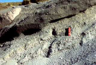 The products of the last major eruption of La Malinche that occurred about 3,100 years ago are exposed around the summit area and consist of a weakly stratified pumiceous ash and fine lapilli layer, along with associated pyroclastic flow and lahar deposits. Lahars originating from La Malinche reached the Puebla basin and contain pottery fragments, indicating that nearby communities were affected by the eruption. The pocket knife provides scale.
Photo by Renato Castro, 2000 (courtesy of José Macías, Universidad Nacional Autónoma de México).
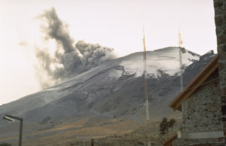 An ash plume rising from the summit crater of Popocatépetl in January 1995 as seen from the mountaineering lodge at Tlamacas, 4.5 km NNE of the summit. Phreatic eruptions that began on 21 December 1994 were the first from the volcano in almost a half century. Intermittent ash eruptions continued until May 1995 and then resumed in March 1996.
 Photo by Dan Dzurisin, 1995 (U.S. Geological Survey).
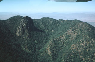 The summit depression of Tequila volcano is breached narrowly to the NE and originated from erosional excavation. A prominent 300-m-high dacitic spine, left after erosional removal of softer rocks surrounding the vent, forms the dramatic steep-sided peak at the left. The spine was dated at about 210,000 years and probably represents the latest activity from the central vent.
 Photo by Jim Luhr, 1979 (Smithsonian Institution).
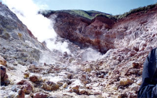 Hydrothermal alteration is extensive within the valley walls of a thermal area near the summit of Cerro Evermann. Gases rise from fumaroles in this 1998 view. The largest fumarolic vent is located at the head of a large barranca NE of the summit. During a 1957 visit by Mooser and Bryan, temperatures of 65-97°C were measured. Similar temperatures ranging from 61-101°C were measured in 1993.
Photo by Martha Marin, 1998 (Mexican Navy).
 Ash deposits cleared from the streets of Ciudad Guzmán are piled up after the major explosive eruption of 20 January 1913. The eruption plume was calculated to have reached a height of 21 km, and the resulting ashfall caused significant disruption to the major city of Ciudad Guzmán, 25 km to the NE. Pyroclastic flows from this eruption reached as far as 17 km from the volcano.
Anonymous, 1913.
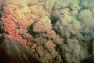 A convecting ash column rises above a small pyroclastic flow on the SW flank of Colima volcano in México on 16 April 1991. The pyroclastic flow, colored by the late-afternoon sun, was produced by the collapse of portions of the summit lava dome.
 Photo by Alfredo Ramirez (pilot Ernesto Gómez Hofman), 1991 (courtesy Melchor Urzua, Protección Civil de Colima).
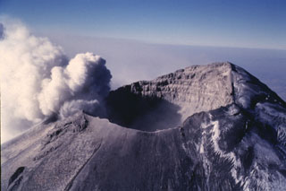 An ash plume erupts from the small vents along the eastern edge of the crater in this 11 March 1996 photo. The plume rises up to the crater rim then is dispersed by the predominant winds to the east, becoming detached from the summit crater after the explosion ends. The glacier on the NW (right) side of the crater is partly covered with dark gray ash from previous eruptions.
Photo by José Macías, 1996 (Universidad Nacional Autónoma de México).
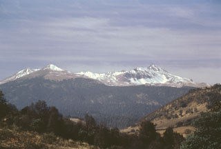 Nevado de Toluca is a broad edifice with a 1.5-km-wide summit crater that opens to the east. The northern flank rises here above the Zacango valley with a thin covering of summit snow. Two explosive eruptions during the late Pleistocene produced widespread ashfall and pyroclastic flow deposits. More recent work has revealed evidence for at least one Holocene eruption, about 3,300 years ago.
Photo by José Macías, 1997 (Universidad Nacional Autónoma de México).
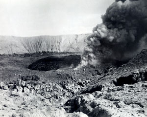 A small eruption on 10 December 1952 took place from the moat between the inner (dark-colored) and outer lava domes in the Bárcena summit crater. A lava dome was first observed on 20 September, when it was about 8 m high and 55 m wide. On 15 November the dome was observed to fill about half of the 700-m-wide crater. At the time of this photo, an older outer dome littered with breadcrust bombs and ejecta surrounded the new inner dome.
 Photo by L.W. Walker, 1952 (courtesy of Sherman Neuschel, U.S. Geological Survey).
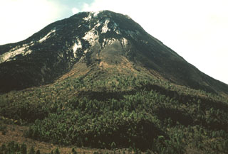 The exact age of the forested lava flow with the lobate margins in the foreground below El Volcancito on the NE flank of Colima is not known, but it may have been erupted in 1872. The 0.06 km3 lava flow traveled over the NW rim of the summit crater. Large explosive eruptions took place in 1872, and ash covered a >30 km radius. An explosion on 10 January 1873 caused ashfall 200 km away in Zamora.
Photo by Jim Luhr, 1978 (Smithsonian Institution).
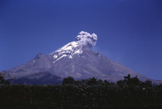 An ash plume rising above Popocatépetl is seen here from the western flank on 8 March 1995. The plume rose about 500 m above the crater and was dispersed by the wind toward the south. A phreatic eruption on 21 December 1994 resulted in light ashfall on the city of Puebla, 45 km east. Intermittent ash eruptions, such as the one pictured here, continued until May 1995 and then resumed in March 1996.
Photo by José Macías, 1995 (Universidad Nacional Autónoma de México).
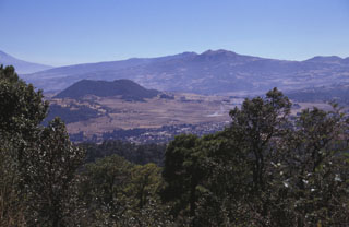 The Chichinautzin volcanic field covers an area of more than 1,000 km2 in a 90-km-wide, E-W-trending area south of the Valley of Mexico. This view looks SE from the 1,600-year-old Xitle scoria cone to Volcán Yololica (the forested scoria cone to left of the center), with Volcán Cuauhtzin on the horizon (right-center) and Volcán Tlaloc to its left. The name Chichinautzin means Burning Lord in the Nahuatl language, and several eruptions have impacted Pre-Hispanic cultures in the Valley of Mexico.
Photo by Lee Siebert, 1998 (Smithsonian Institution).
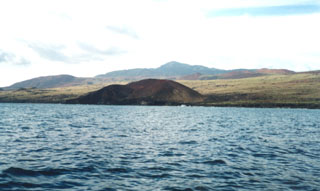 This cone lies along the SSE coast of Socorro Island, east of Cabo Rule (also known as Cabo Regla). The peak on the center horizon is Cerro Evermann, the high point of the island. Basaltic cones and lava flows of the Lomas Coloradas formation blanket the southern tip of the island. Although 80% of the surface of the island is covered by silicic post-caldera lava domes and flows and few pre-caldera rocks are exposed, the bulk of the Socorro shield volcano is considered to be composed of basaltic deposits.
Photo by Martha Marin, 1998 (Mexican Navy).
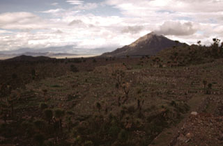 During the late-Pleistocene or Holocene, voluminous andesite and basaltic-andesite lava flows erupted from scoria cones on the southern caldera rim and flowed long distances down the flank. The age of the flows is not known precisely, but the roughly 6,000-year-old Cantona archaeological site in this photo was constructed on top of the flows. A meteorological cloud on the horizon drifts from the summit of Cerro Pizarro, the northernmost lava dome of the Serdán-Oriental volcanic field.
Photo by Gerardo Carrasco-Núñez, 1995 (Universidad Nacional Autónoma de México).
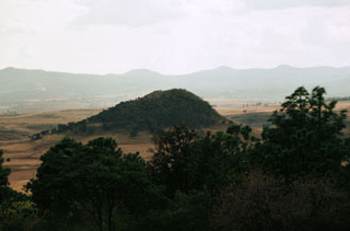 A mostly Pliocene volcanic field is located near the town of Los Volcanes, at the southern end of the Atenguillo graben in the Jalisco tectonic block of western México. This photo shows an eroded andesitic center near the town of Los Volcanes. The 285 km2 volcanic field consists of lava cones and flat-topped lava flows overlying Cretaceous ignimbrites. The extensional tectonic setting of Los Volcanes, which is situated in a graben of the Jalisco block, has resulted in the eruption of a wide variety of lava types.
Photo by Paul Wallace, 1998 (University of California Berkeley).
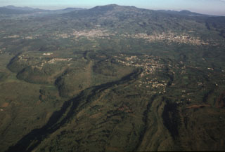 The large, steep-sided Xicomulco lava flow descends from the flanks of the Sierra Chichinautzin into the Valley of Mexico. The viscous lava flow averages 75 m in thickness, displays prominent flow levees, and traveled 4.5 km north. The flow was extruded with very little explosive activity and the vent was subsequently filled in and is now overlain by the town of San Bartolo Xicomulco (right-center). In the background is the town of San Pablo Oztotepec. Volcán Tlaloc is the broad volcano in the center of the horizon.
Photo by Gerardo Carrasco-Núñez, 1997 (Universidad Nacional Autónoma de México).
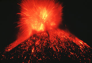 A nighttime Strombolian eruption at Parícutin ejects incandescent blocks and bombs onto the flanks of the scoria cone. Ejecta like this accumulated around the vent to build the cone during February 1943 to February 1952.
Photo by Carl Fries, 1945 (U.S. Geological Survey, published in Luhr and Simkin, 1993).
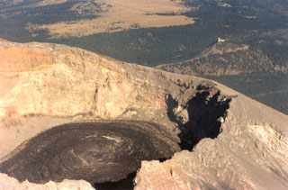 Black lava fills the crater floor of Popocatépetl on 9 December 1997 after rapid lava extrusion on December 5-6 had almost covered the entire crater floor. Circular flow ridges that formed during lava extrusion from the central vent are visible. TV transmission towers at Cerro Tlamacas on the northern flank are seen in the background to the upper right, and at the top of the photo are the light-colored grasslands of Llano Grande at Paso de Cortés, the saddle between Popocatépetl and Iztaccíhuatl volcanoes.
Photo by Hugo Delgado-Granados, 1997 (Universidad Nacional Autónoma de México).
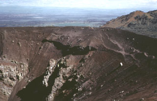 Volcán Tecolote is one of the youngest scoria cones of the Pinacate volcanic field and is located NE of Cráter Elegante. This complex cone contains faults and small craters, opens towards the NW, and was constructed on top of the Mayo cone. Large volcanic bombs, some with cores of older volcanic and non-volcanic rocks, are scattered across the southern and east crater rims and southern flanks. Six basaltic ‘a’a lava flows extend from the base of the cone.
Photo by Bill Rose, 1974 (Michigan Technological University).
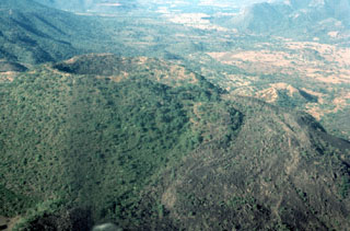 Jorullo scoria cone of the Michoacán-Guanajuato volcanic field is seen here from the ENE. The eruption began with phreatic and phreatomagmatic activity on 29 September 1759 with wet ashfall and lahars that caused damage to neighboring haciendas. By 13 November the cone had reached 250 m in height, and the eruption episode continued until 1774. The sparsely vegetated lava flow to the right was the produced near the end of the eruption.
Photo by Jim Luhr, 1997 (Smithsonian Institution).
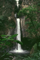 A series of waterfalls near the town of Xico on the eastern flank of Cofre de Perote formed over a massive lava flow. Cofre de Perote was constructed along the margin of the Mexican Altiplano, and thick viscous Pleistocene lava flows extend tens of kilometers down the eastern flanks towards the coastal plain.
Photo by Lee Siebert, 1998 (Smithsonian Institution).
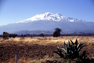 Iztaccíhuatl rises SW of the Puebla basin in central México. A series of overlapping cones constructed along a NNW-SSE trend forms the summit ridge, which is 6 km long just above the snowline. Glaciation has extensively eroded the summit and flanks of the dominantly Pleistocene edifice. The Toltec climbed Iztaccíhuatl and left terracotta, carved stone, jade, and obsidian artifacts just below the summit, forming the highest archeological site in North America.
Photo by Lee Siebert, 1997 (Smithsonian Institution).
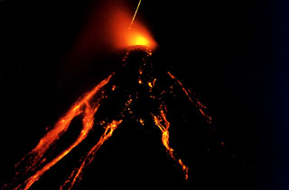 Time-lapse photograph (30 minutes) of Colima taken from a point near Suchitlán (18 km SSW) around 2300 on 26 November 1998. Incandescence appears above the summit lava dome, and lava flows and hot blocks detaching from the flows are visible down the flanks. Rapid lava extrusion had begun at 20 November 1998 following a year of small intermittent ash emissions. Long-term intermittent lava extrusion, dome growth, pyroclastic flows, and occasional strong explosions continued for several years.
Photo courtesy of Claus Siebe, 1998 (Universidad Nacional Autónoma de México).
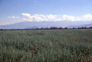 The flat-topped summit of Las Cumbres volcanic complex, a Quaternary volcano NNE of Pico de Orizaba, is seen here from the NW across the Serdán-Oriental basin. A 3.5-4.5 km wide summit caldera is partially filled by the Cerro Gordo lava dome. At least one of a group of monogenetic cones, craters, and lava domes on the flanks of the volcano is of Holocene age.
Photo by Lee Siebert, 1997 (Smithsonian Institution).
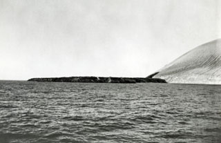 This lava delta formed during the 1952-53 eruption, seen here from the NE. The Delta Lávico flow extended 700 m out to sea on the SE side of Isla San Benedicto and formed a peninsula about 1.2 km wide. The lava can be seen extruding from the vent on the lower SE flank. The eruption began on 8 December and by the following morning the lava flow had reached the coast. Lava effusion continued into February 1953.
Photo by U.S. Navy, 1952 (courtesy of Sherman Neuschel, U.S. Geological Survey).
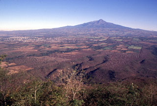 The history of the Colima volcanic complex has been characterized by repetitive collapse of the cones, producing rapid debris avalanches that can travel far from their source. The entire broad apron south of Colima in this view, including the area underlying Colima City to the left, is formed of deposits produced by volcanic landslides and associated lahars. The youngest avalanche, about 2,600 years ago, traveled 35 km as far as the city of Colima.
 Photo by Lee Siebert, 1997 (Smithsonian Institution).
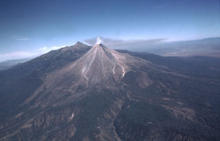 A diffuse gas plume emits from the summit of Colima with a rate of 320 ± 50 tons/day in February 1982. Volcanism at the Colima volcanic complex has migrated southward from the 300-500 km3 Nevado de Colima in the background. The ancestral Colima volcano was constructed on the southern flank of Nevado de Colima and then collapsed to form the scarp, which now holds the modern Colima edifice (foreground) that grew over the past 2,600 years.
Photo by Bill Rose, 1982 (Michigan Technological University).
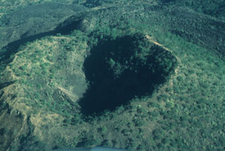 Since the end of the 1759-1774 eruption the Jorullo crater has been collapsing inward along steep, arcuate faults, increasing its dimensions to 400 x 500 m; its depth was 150 m by 1997.
 Photo by Jim Luhr, 1997 (Smithsonian Institution).
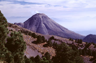 A weak gas plume rises from Volcán de Colima, seen here from the north near the antenna station on Nevado de Colima. The prominent lava flow descending the center of the north flank was erupted in 1961 at the time of the initial overflow of the 1913 crater. The ridge on the left-hand slope is El Volcancito, a NE-flank lava dome that began growing in 1869.
Photo by Lee Siebert, 2000 (Smithsonian Institution).
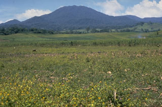 Volcán San Martín Tuxtla is a large edifice in the NE part of the basaltic Los Tuxtlas Volcanic Field on the coast of the Gulf of México. The summit and flanks contain more than 250 cones and maars. Two large eruptions took place in 1664 and 1793. The 1793 eruption occurred from two scoria cones in the 1-km-wide summit crater and produced widespread ashfall and lava flows that extended 3.5 km down the NE flank.
Photo by Steve Nelson, 1986 (Tulane University).
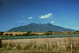 Volcán Tequila is an eroded andesitic-dacitic volcano of Pleistocene age that rises about 1800 m above the surrounding plains. Tequila is the SE-most of a chain of calc-alkaline stratovolcanoes NW of Guadalajara. A prominent 300-m-high summit spine, similar to that at Sangangüey volcano, can be seen here in the center of the summit crater, which was been breached to the NE, in the direction of the photo. The volcano is surrounded by a series of older flank rhyolitic lava domes, obsidian flows, and basaltic cinder cones.
Photo by Paul Wallace, 1989 (University of California Berkeley).
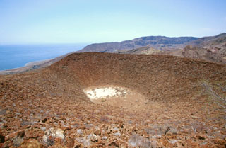 The summit crater of La Vírgen parasitic cinder cone on the east flank of La Reforma caldera is seen from its north rim. The SE rim of 10-km-wide La Reforma caldera forms the ridge on the horizon with the Gulf of California on the left.
 Photo by Keith Sutter, 2000.
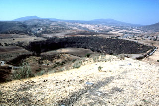 Several maars of the Michoacan-Guanajuato volcanic field are visible in this photo. The 600-m-wide Hoya Solis maar is seen from the SW rim of Hoya Blanca maar, immediately SW of the city of Valle de Santiago. The rim of Hoya de Cintora maar lies beyond Hoya Solis below the far-left horizon.
Photo by Jim Luhr, 2002 (Smithsonian Institution).
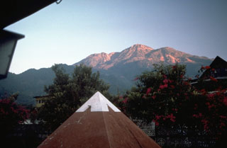 Tacaná is located along the México/Guatemala border, seen here from the SSE from the Mexican town of Unión Juárez, where it rises above the Pacific coastal plain. The elongate summit region is composed of a series of lava domes. Historical activity has included mild phreatic eruptions, but stronger explosive activity, and production of pyroclastic flows, occurred earlier.
Photo by Norm Banks, 1987 (U.S. Geological Survey).
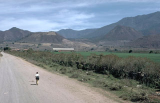 The summit ridge of flat-topped Volcán Molcajete (left) is at the level of the horizon in this view from the SW. Molcajete, referring to stone bowls used for grinding grains, is a common name applied to scoria cones with well-preserved craters. Volcán El Tecomate is the steep-sided scoria cone to the right. These two cones are located NE of the town of Mascota and are part of a Pleistocene-to-Holocene volcanic field in the Jalisco block, which is being underthrust by the eastward-subducting Rivera tectonic plate.
Photo by Jim Luhr, 1985 (Smithsonian Institution).
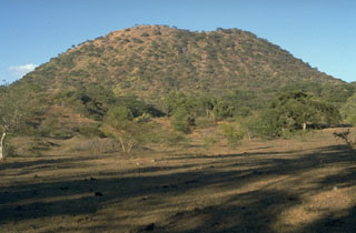 The principal vent of Jorullo formed the scoria cone seen here from the SSE that grew to 250 m in height during the first month and a half of the 1759 eruption. Lava flows were erupted at some unknown later time from four flank vents located along a NE-SW fissure cutting through the main cone.
 Photo by Jim Luhr, 1996 (Smithsonian Institution).
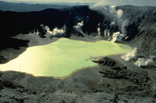 In late April 1982, following a series of powerful explosive eruptions from March 28 to April 4 that created a new 1-km-wide crater at El Chichón volcano, a lake began forming on the crater floor. By November the lake was up to 600 m wide and about 120 m deep. Vigorous steam plumes rise from fumaroles below the west crater wall in this March 28, 1983 photo. In January 1983 the lake was hot (52-58 degrees Centigrade) and acidic (pH of 0.5).
Copyrighted photo by Katia and Maurice Krafft, 1983.
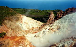 Fumarolic areas at Socorro are concentrated near the summit of Cerro Evermann. They occur on all sides of North Dome, a young lava dome just to the north. The most extensive hydrothermal alteration is located in areas on the E, W, and SW sides of North Dome.
Photo by Martha Marin, 1998 (Mexican Navy).
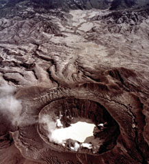 This view from the west on 4 November 1982 shows the impact of the El Chichón eruption about seven months later. Fumaroles are present around the new lake partially filling the crater, and the surrounding area was devastated by pyroclastic flows and surges. The 1982 crater is located within an older 1.5 x 1.9 km crater.
NASA Space Shuttle image, 1982 (http://eol.jsc.nasa.gov/).
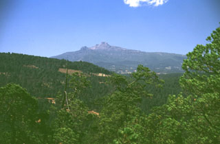 One of the Aztec names for Cofre de Perote was Naucampatepetl, or "Mountain of Four Sides." The flat-topped glacially modified summit is seen here from the NE on the road between the cities of Perote and Jalapa (Xalapa), the capital city of the state of Veracruz. The highway follows the low-angle surface of valley floors filled by young lava flows that erupted from vents on the NE flank.
Photo by Lee Siebert, 1999 (Smithsonian Institution).
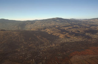 Several volcanoes of the Chichinautzin volcanic field can be seen in this aerial photo from the NE. To the lower left is Volcán Teuhtli with a small cone on its summit to the far left. The lava flow with steep flow boundaries in the center of the photo descending diagonally to the right is the massive Xicomulco lava flow. Volcán Cuauhtzin, in the background to the right, emplaced widespread lava flows.
 Photo by Gerardo Carrasco-Núñez, 1997 (Universidad Nacional Autónoma de México).
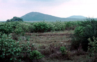 The easternmost of two pyroclastic cones named Cerros Las Hermanas (The Sisters) appears at the left, with an unnamed cone to the NE on the right horizon. These cones on the low coastal plain along the Gulf of Mexico barely reach 250 m elevation. The cones are located at the NW end of the Aldama volcanic field, an area of Quaternary phonolitic and basaltic pyroclastic cones and lava flows SE of the Sierra de Tamaulipas. Trachytic and phonolitic explosive eruptions were followed by the emission of young basaltic lava flows.
 Photo by Jim Luhr, 2000 (Smithsonian Institution).
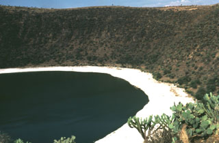 The Valle de Santiago in the NE part of the Michoacán-Guanajuato volcanic field NW of Lake Yuriria contains a group of maars formed by phreatomagmatic eruptions. The maars, four of which are lake-filled, range from 0.8 to 1.8 km in diameter, are 80 to 180 m deep, and are probably Holocene in age. This photo shows the Hoya Rincón de Parangüeo maar at the northern end of the group.
Photo by Jim Luhr, 1982 (Smithsonian Institution).
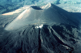 The renowned Parícutin scoria cone, which grew from a Mexican cornfield beginning in 1943, is one of the roughly 1,000 cones that form the massive Michoacán-Guanajuato volcanic field in central Mexico. White mineral deposits formed across the top of Nuevo Juatita in the foreground, a NE-flank vent that was the main source of lava flows during the last five years of the 1943-1952 eruption.
Photo by Jim Luhr, 1997 (Smithsonian Institution).
 These two photos show the summit of Volcán de Colima from Nevado de Colima in 1909 (top) and 1913 (bottom). They illustrate the effects of a major explosive eruption on 20 January 1913, which removed nearly 100 m of the upper part of the cone and created a 450-m-wide crater that was at least 350 m deep. The eruption produced heavy ashfall and pyroclastic flows that traveled down all flanks. This continued the typical Colima cycle of century-long dome growth and minor explosions culminating in a very powerful explosive eruption.
Photo from Waitz 1915 (Zeitschrift Vulkanologie).
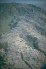 An eruption of Ceboruco volcano began in 1870 and produced the lava flow shown here from the west. Explosive eruptions began from a vent near the western caldera rim in February 1870 and continued with emission of the 1.1 km3 lava flow, which traveled 6 km down the lower flank. The eruption continued sporadically for 5 years, causing extensive damage to livestock and crops. Hundreds of people were forced to abandon their homes.
Photo by Jim Luhr, 1980 (Smithsonian Institution).
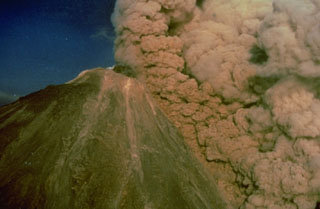 An ash plume rises above a pyroclastic flow traveling down the SW flank of Colima on 16 April 1991, colored orange by the late-afternoon sun. The pyroclastic flow was produced by collapse of unstable parts of the summit lava dome. The black mass at the summit is a lava dome that began growing on 1 March. Later in the eruption, which ended in October, a lava flow traveled down the SW flank to 2,600 m elevation from the roughly 3,850-m-high summit.
Photo by Alfredo Ramirez (pilot Ernesto Gómez Hofman), 1991 (courtesy Melchor Urzua, Protección Civil de Colima).
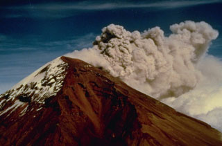 Strong winds disperse an ash plume to the NE from the Popocatépetl summit crater in December 1994. Phreatic explosions that began on 21 December were the first at the volcano in nearly a half century, resulting in ashfall in the city of Puebla, 45 km E. Intermittent ash eruptions lasted until May 1995 and then resumed in March 1996. The explosions ejected a small lake from the crater floor, and three small new craters appeared at the base of the east crater wall.
Photo courtesy CENAPRED, Mexico City, 1994.
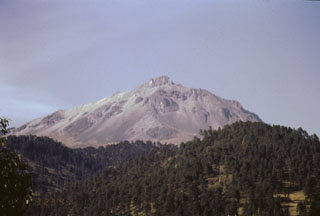 The upper flanks of the dominantly Pleistocene Nevado de Toluca volcano consist primarily of lava flows that are well exposed above the tree line. This view shows the western flanks of Pico del Fraile, the high point on the SW rim of the horseshoe-shaped summit crater. The summit crater and flanks have been extensively modified by glacial erosion.
Photo by José Macías, 1995 (Universidad Nacional Autónoma de México).
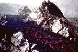 An incandescent lava flow travels down a channel within solidified lava near the SW-flank vents of Parícutin in 1945. Lava flows at this time traveled NW over the site of the village of Parícutin. The Taquí lava flows erupted during 1944-45 and covered about 18 km2. The most striking feature of the Taquí flows was the development of hornitos (rootless vents) when molten lava was ejected through overlying solidified crust.
Photo by Ken Segerstrom, 1945 (U.S. Geological Survey, published in Luhr and Simkin, 1993).
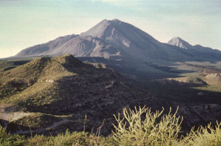 This view from the SE shows the Tres Vírgenes volcanic group, which is aligned in a SW-NE direction. Volcanism has migrated to the SW from the oldest peak El Viejo (far right) through El Volcán Azufre to La Vírgen (center), the highest peak. The ridges on the left flank of La Vírgen are rhyodacite lava flows from a major eruption; the smooth hills in the foreground are Quaternary ignimbrite sheets probably related to the Pleistocene La Reforma caldera to the east.
 Photo by José Macías, 1995 (Universidad Nacional Autónoma de México).
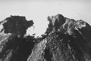 This 1958 photo shows a degassing lava dome in the 450-m-wide summit crater of Colima. Renewed dome growth had begun on 14 May 1957 after a period of quiescence since the early 1930's, and the dome rose 70 m by the end of the year. Dome growth continued for several years, and by 1961 lava began overflowing the crater rim.
Photo by Guillermo Saucedo, 1958 (courtesy Julian Flores, University of Guadalajara).
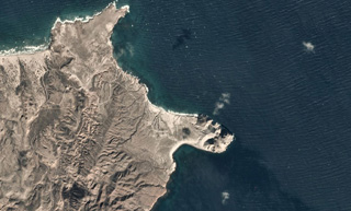 Punta Púlpito is an obsidian lava dome on the peninsula near the center of this 1 December 2019 Planet Scope satellite image (N is at the top). The dome is about 0.5 million years old and geothermal activity continues in the area. This image is approximately 6 km across.
Satellite image courtesy of Planet Labs Inc., 2019 (https://www.planet.com/).
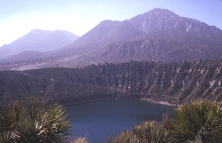 The Las Derrumbadas lava domes rise above the rim of the San Luis Atexcac maar. The two rhyolite lava domes rise about 1 km above their bases. The NW dome (right) consists of a microcrystalline rhyolite that has been extensively altered by fumarolic activity. The SE dome (left) is of similar lithology. The carapace of both domes has been removed by a series of slope failures. The San Luis Atexcac maar in the foreground erupted through Cretaceous limestones and Tertiary monzonites and hornfels.
Photo by Lee Siebert, 1998 (Smithsonian Institution).
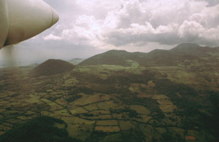 An aerial view from the SE shows cones on the flank of the massive San Martín Tuxtla volcano. More than 250 cones and maars are found on the flanks, mostly along a 40-km-long NW-trending zone parallel to the elongation of the edifice. Many clusters of cones are aligned in this same direction.
Photo by Hugo Delgado-Granados, 1997 (Universidad Nacional Autónoma de México).
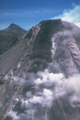 A lava flow advances down the steep upper SW flank of Colima in 1991. Aerial observations revealed lateral levees, pressure ridges near the flow front, and a lava channel within which most of the flow was advancing. The flow was about 100 m wide, 30 m thick, and 300 m long at the time of this 20 April 1991 photograph. Renewed lava extrusion took place following the partial collapse of the summit dome on 16 April. Nevado de Colima is in the background.
Photo by Juan Manuel Espíndola, 1991 (Universidad Nacional Autónoma de México).
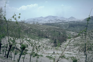 Ash deposited across the countryside around El Chichón volcano, seen in the background of this 19 April 1982 photo taken about two weeks after a series of major eruptions. Ash covered an area of more than 45,000 km2 towards the ENE. At this location, 12 km NE of El Chichón, the ashfall deposit was 30 cm thick. Fine ash and sulfuric acid aerosols from the eruptions circled the globe and were responsible for brilliant sunsets in the northern hemisphere for the next few years.
Photo by Jim Luhr, 1982 (Smithsonian Institution).
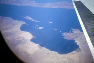 An aerial view from the SW overlooks the Bay of Los Angeles in the foreground in the east-central part of Baja California. Isla Coronado is the largest of the islands in this view with Volcán Coronado at the northern end of the island. Angel de la Guarda Island extends across the top of the photo.
Photo by Brian Hausback, 1996 (California State University, Sacramento).
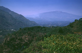 The broad Cofre de Perote massif to the upper right is at the northern end of a N-S-trending volcanic chain at the far eastern side of the Mexican Volcanic Belt. The broad profile was produced by the extrusion of thick sequences of lava flows.
Photo by Lee Siebert, 1999 (Smithsonian Institution).
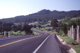 The hill on the horizon is El Volcanicillo, a scoria cone that produced two lava flows down opposite sides of a ridge on the NE flank of Cofre de Perote volcano. The forested area extending across the photo below the cone is the Río Naolinco lava flow, a massive 900-year-old pahoehoe flow that reached as far as 50 km from El Volcanillo; the ‘a’a Toxtlacuaya flow traveled down the opposite side of the ridge. Highway 140 is in the foreground.
Photo by Lee Siebert, 2000 (Smithsonian Institution).
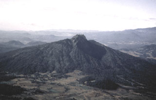 Paracho volcano is one of the many cones of the Michoacán-Guanajuato volcanic field. It is seen here from the west with its summit crater filled by a flat-topped lava dome that is the site of a radio antenna station. The dome fills the upper end of a large erosional valley that extends down the flank from the summit. Edifice collapse has occurred on the eastern side of the volcano, producing a major debris avalanche deposit covering an area of about 175 km2.
Photo by Hugo Delgado, 1991 (Universidad Nacional Autónoma de México).
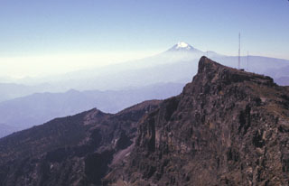 The eastern side of the summit of Cofre de Perote contains a steep escarpment. The volcano lies at the NNE end of a N-S-trending range that extends 50 km S to glaciated, historically active Pico de Orizaba (Citlaltépetl) in the distance. Like other N-S volcanic chains in México perpendicular to the Mexican Volcanic Belt, volcanism in the Cofre-Orizaba chain has migrated to the south.
Photo by Lee Siebert, 1998 (Smithsonian Institution).
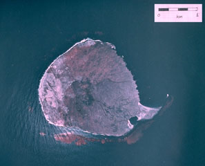 A vertical aerial photograph shows the small, roughly 1-km-wide Isla San Martín, the westernmost of the small volcanoes of the San Quintín volcanic field. Isla San Martín lies 6 km off the Pacific Ocean coast from the rest of the volcanic field and consists of a small basaltic shield volcano capped by a less than 40-m-high cinder cone. The peninsula at the SE (lower right) side of the island is formed by a lava flow.
Aerial photo by Comisión de Estudios del Territorio Nacional (CETENAL), 1:25,000, 1999.
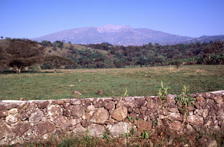 The eastern side of Cofre de Perote volcano contains scarps from a series of edifice collapse events during the late Pleistocene. The youngest escarpment forms the unvegetated area below the summit in this view from just south of the town of Xico, which overlies the youngest avalanche deposit. The summit of Cofre lies 17 km to the west and 3,000 m above this location.
Photo by Lee Siebert, 2000 (Smithsonian Institution).
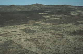 The pyroclastic cone at the upper left is the Pliocene Las Mojoneras volcano of the Camargo volcanic field. The scarp of Las Borregas Fault is visible at the upper right and lies behind the cones. Faulting and eruptive activity were closely linked throughout the evolution of the Camargo volcanic field.
Photo by Charles Conner, 1997 (Southwest Research Institute).
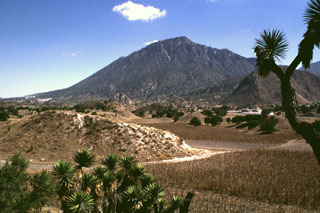 The NW-most of the two Las Derrumbadas lava domes is surrounded by hummocky debris avalanche deposits such as those in the foreground, that were produced by repeated collapse of the domes. The hummocks contain mixtures of rock types, including pyroclastic surge deposits, Cretaceous limestones, lacustrine sediments, and banded obsidians. These are thought to have originated from a former tuff ring that surrounded the lava domes.
Photo by Lee Siebert, 1997 (Smithsonian Institution).
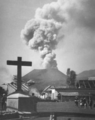 Villagers observe an ash plume rising above Parícutin in 1944 beyond the streets of San Juan Parangaricutiro, soon to be overrun by lava flows. In June and July 1944 lava advanced slowly through the town, which was incrementally evacuated as the flow progressed. Many residents, showing their deep attachment to the land, stayed until the lava overran the last segments of their property.
Photo by William Foshag, 1944 (Smithsonian Institution, published in Luhr and Simkin, 1993).
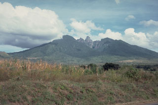 Sangangüey contains a prominent lava spine at its eroded summit, seen here from the west. Sangangüey was constructed on the southern flank of Las Navajas volcano. The NW and SE flanks contain 45 scoria cones that erupted during the past 300,000 years. Activity at the main edifice ceased during the Pleistocene and some cones may only be about 1,000 years old.
Photo by Jim Luhr, 1978 (Smithsonian Institution).
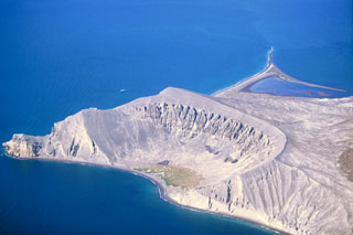 The Plaza de Toros tuff ring on the SE side of Isla San Luis is seen here from the east in 2000. Remnants of dacite lava flows are visible in the upper walls of the crater. Only a third of the tuff ring is still standing; the rest has subsided along normal faults or was eroded by wave action. Longshore currents have redistributed volcanic deposits to produce the tombolo to the upper right that forms the SW tip of the island and is 2 km long at low tide.
Photo by Keith Sutter, 2000.
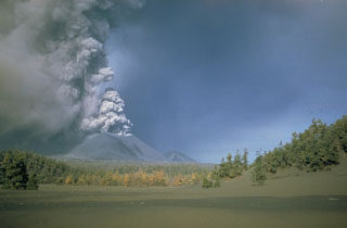 An ash plume rises from the summit crater of Parícutin sometime during 1946-48. A thick ash deposit covers the foreground. An estimated 4,500 cattle and 550 horses died during the heavy ashfall in the early months of the eruption, devastating the local people who depended on the animals for food, plowing, and transportation. Ashfall was deeper than 15 cm over a 300 km2 area around the volcano and continued with varying intensity throughout the 9-year-long eruption.
Photo by Ray Wilcox (U.S. Geological Survey).
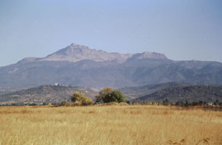 The southern flanks of Nevado de Toluca are seen here from near the town of Coatepec, with the summit peak of El Fraile to the left. The photo clearly shows the tree line on Toluca at about 4,000 m. Massive block-and-ash flows about 37,000 and 28,000 years ago extended down the southern flanks and beyond Coatepec. The hills in the foreground represent semi-vertical faces of faults forming a complex set of horst and graben structures.
Photo by José Macías, 1997 (Universidad Nacional Autónoma de México).
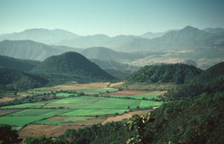 Volcán Tecomate (left of center) and flat-topped Volcán Molcajete (to the right), seen here from the NW, are two of the scoria cones and domes of the Mascota Volcanic Field. These are part of a group cinder cones and lava flows located within the Talpa and Mascota grabens near the town of Mascota, east of Puerto Vallarta.
 Photo by Paul Wallace, 1987 (University of California Berkeley).
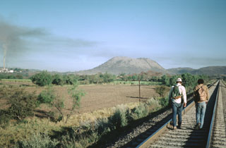 The flat-topped Cerro el Chino lava dome, seen here from the SSE, is a silicic lava dome of the Acatlán volcanic field. This volcanic field, located SW of La Primavera caldera, consists of a group of andesitic cones, rhyolitic lava domes, and lava flows associated with an indistinct caldera. Following eruption of the compositionally zoned Acatlán ignimbrite, a series of rhyolitic and dacitic lava domes, andesitic cones and lava flows, and Quaternary cinder cones were erupted throughout the Acatlán volcanic field.
 Photo by Jim Luhr, 1981 (Smithsonian Institution).
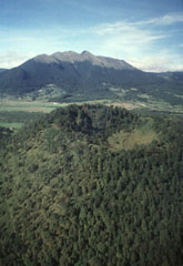 Xitle scoria cone, seen here in an aerial view from the NE with Ajusco volcano in the background, is one of the youngest cones of the Chichinautzin volcanic field. It is about 100 m high, with a crater that is 350 m wide and 115 m deep, and it formed around 2,000 years ago. Xitle (also known as Xicti) means “belly button” in the Nahuatl language, a reference to the shape of the cone and its crater. Volcán Ajusco is a Pliocene-Pleistocene lava dome complex surrounded by block-and-ash flow deposits.
Photo by Hugo Delgado, 1995 (Universidad Nacional Autónoma de México).
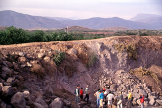 Collapse of México's Colima volcanic complex during the late Pleistocene produced a major debris avalanche and debris flow that traveled 120 km to the Pacific Ocean. The quarried hummock in the foreground and the two brown hills in the middle distance are composed of material transported more than 100 km from Colima volcano (seen in the far distance above the left-hand hummock) and incorporated from valley floors during transport.
Photo by Lee Siebert, 1997 (Smithsonian Institution).
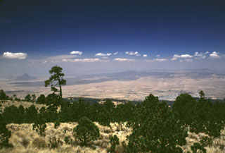 The light-colored area just below the right horizon is the floor of the 15 x 21 km Los Humeros caldera. It is seen here from the SE across the Serdán-Oriental basin from the flanks of Cofre de Perote volcano. Caldera formation during the mid-Pleistocene was followed by extrusion of voluminous lava flows during the late-Pleistocene or Holocene. These flows form the dark-colored area extending across the basin. The peak in the distance to the left is Cerro Pizarro.
Photo by Lee Siebert, 1999 (Smithsonian Institution).
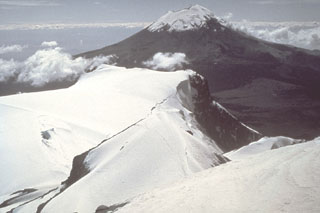 Popocatépetl volcano is seen here to the south from the Iztaccíhuatl summit ridge. Unlike the eroded Iztaccíhuatl volcano, which has been infrequently active during the Holocene, Popocatépetl has been vigorously active.
Photo by Jim Luhr, 1981 (Smithsonian Institution).
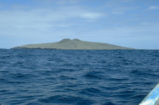 Isla San Martín, 6 km off the west coast of Baja California, is the westernmost volcano of the San Quintín volcanic field and the only one that is located offshore. The 2-km-wide island is a shield volcano capped by scoria cones that reach 230 m above sea level. Wave erosion has truncated part of the volcano, forming the sea cliffs seen at the left on the S side of the island.
Photo by Jim Luhr, 1990 (Smithsonian Institution).
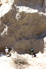 The voluminous La Soledad deposit was erupted in the Zitácuaro-Valle de Bravo volcanic field area about 500,000 years ago and is composed of a complex sequence of block-and-ash and pumice deposits. Geologists in the photo investigate a thick (up to 10 m) pumice deposit that lies on top of a pyroclastic surge layer.
Photo by Lucia Capra, 1993 (courtesy of José Macías, Universidad Nacional Autónoma de México).
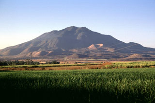 The eroded Sangangüey edifice was constructed during the Pleistocene and its flanks contain 45 scoria cones, some of which have erupted during the Holocene. The cone forming the peak on the lower right horizon and the cone highlighted by the sun below and to the right of the summit in this view from the south are among the youngest.
Photo by Lee Siebert, 1997 (Smithsonian Institution).
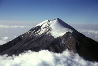 Pico de Orizaba (Volcán Citlaltépetl) rises 4,500 m above the Gulf of Mexico coastal plain. Its summit contained a 500-m-wide crater that was 300 m deep at the time of this 1997 photo. It is seen here from the NNE with the Jamapa glacier to the right above the NW-flank peak of Sarcofago (right center). The present summit cone was constructed during the Holocene, overtopping previously collapsed edifices.
 Photo by Gerardo Carrasco-Núñez, 1997 (Universidad Autónoma Nacional de México).
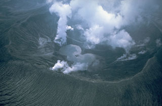 Gas-and-steam plumes emanate from the new El Chichón crater in June 1982, about two months after a major explosive eruption formed it. The first sighting into the crater revealed three small lakes on the crater floor. These later merged into a single lake that reached a maximum depth of about 120 m. This aerial view from the east also shows gully erosion within pyroclastic flow and surge deposits on the flanks.
 Photo by Wendell Duffield, 1982 (U.S. Geological Survey).
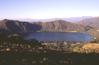 The scenic lake-filled Santa María del Oro maar, erupted through older Miocene rhyolitic tuffs, is one of the many dramatic volcanic features of the Tepic-Chapala graben. The southern rim of the maar (foreground) is reached by a road from the town of Santa María del Oro. The peaks of Cerro Los Lobos form the northern rim on the far side of the maar and rise about 400 m above the Laguna Santa María crater lake. Pyroclastic-surge deposits occur in valleys to the north and in some cases along the walls of the crater.
 Photo by Lee Siebert, 1997 (Smithsonian Institution).
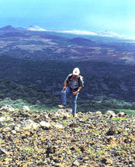 The Lomas Coloradas cones along the SW coast of Socorro appear in the background behind a geologist near the summit of Cerro Evermann. A brief phreatic eruption apparently occurred from a scoria cone west of the Lomas Coloradas on 22 May 1951, witnessed from a yacht offshore at Caleta Binner. During a 5-10 minute period, a plume sequentially incandescent, black, and then white rose a short distance above the cone, and clasts fell around the cone. The plume eventually reached a height of about 1,200 m.
Photo by Hugo Delgado-Granados, (Universidad Nacional Autónoma de México).
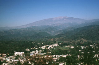 Cofre de Perote volcano towers above the city of Coatepec on its eastern flank. The flanks of contain smaller cones, including the one in the center of the city from which this photo was taken. The volcano was constructed at the eastern margin of the Altiplano and consequently has an asymmetrical profile, extending farther towards the east in the direction of the lower-altitude coastal plain.
Photo by Lee Siebert, 1999 (Smithsonian Institution).
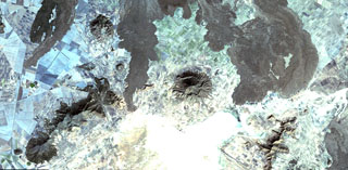 The fresh-looking lava flows at the top of the image were erupted from Los Humeros caldera (just out of view to the north). The basaltic and andesitic lava flows extend up to about 15 km from the caldera rim. The flows have not been dated precisely, but are younger than 20,000 years and could in part be of Holocene age. The Tepeyahualco (left) and Limón (right) lava flows bracket circular 3100-m-high Cerro Pizarro lava dome (right center), the northernmost feature of the Serdán-Oriental volcanic field.
 NASA Landsat satellite image, 1999 (courtesy of Loren Siebert, University of Akron).
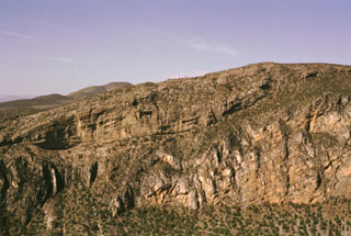 Thick deposits of folded and faulted Cretaceous limestones (lower right) are exposed in the steep 300-m-high walls of the Joya Honda maar. The northern wall of the maar (upper left) displays up to 120 m of initially dry and then wet pyroclastic-surge deposits with dips up to 30 degrees. The 850 x 1000 m wide maar was erupted about 1.1 million years ago.
Photo by Jorge Aranda-Gómez, 1994 (Universidad Autónoma de México).
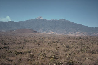 A group of nearly a dozen scoria cones and lava flows were erupted during the late Pleistocene on the floor of the southern Colima graben immediately NE and NW of the Colima volcanic complex. Cerro Apaxtepec (left center), one of these young cones, is seen here with the peak of Nevado de Colima in the center-background. A small plume rises from the active Fuego de Colima volcano to the left.
 Photo by Jim Luhr, 1978 (Smithsonian Institution).
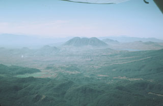 The indistinct elliptical 7 x 10 km wide San Pedro caldera is seen here in an aerial view from the NE, with Laguna San Pedro on the right. The rim of the caldera is exposed only on the east side (left), where it truncates early Pleistocene andesitic-to-dacitic lava domes. The caldera partially cuts the 1.1 million-year-old Cerro Grande shield volcano, whose low-angle slopes can be seen beyond the left side of the three coalescing post-caldera Cerro San Pedro lava domes (center).
Photo by Jim Luhr, 1979 (Smithsonian Institution).
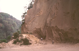 A quarry along the road between Teocelo and Cosautlán de Carvajal exposes thick deposits of the 230 km3 Xáltipan Ignimbrite from Los Humeros volcano. This outcrop lies about 50 km SE of Los Humeros, beyond the Pico de Orizaba-Cofre de Perote range, much of which post-dates the 460,000-year-old ignimbrite. Eruption of the Xáltipan Ignimbrite, which covered an area of about 3,500 km2, resulted in the formation of a 15 x 21 km wide caldera.
Photo by Lee Siebert, 2000 (Smithsonian Institution).
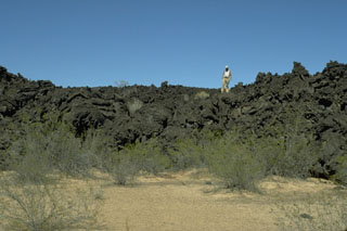 A geologist stands on the irregular surface of a lava flow north of Volcán la Morusa, near Cerro Colorado. The flow is one of many young sparsely vegetated basaltic lava flows of the Pinacate volcanic field. Flow morphologies remain pristine for long periods of time in this arid region.
Photo by Jim Luhr, 1996 (Smithsonian Institution).
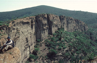 A thick sequence of bedded pyroclastic-surge deposits is exposed in the vertical western wall of La Joya Prieta maar in the Santo Domingo volcanic field in the southern Basin and Range province in the state of San Luis Potosí. The Santo Domingo field contains a group of four maars, the largest of which is the 750 x 1000 m wide La Joya de los Contreras maar, along with several alkalic cinder cones and associated lava flows. The Santo Domingo maars are the source of mantle-derived spinel-lherzolite xenoliths and deep-crustal granulite xenoliths.
Photo by Jim Luhr, 1987 (Smithsonian Institution).
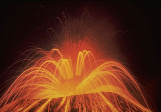 A roughly 15-second time-exposure during the night shows the incandescent trajectories of ejecta from Parícutin on 1 August 1943, near the start of the 1943-52 eruption. Periodic large explosions of bursting lava bubbles in the vent rapidly ejected incandescent lava spatter.
Photo by Carl Fries, 1943 (U.S. Geological Survey).
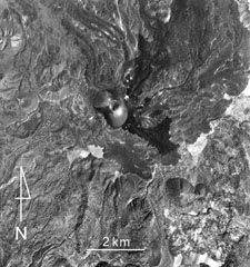 Lava flows from Parícutin (upper center) within the Michoacan-Guanajuato volcanic field cover much of the northern half of this photo. The small white dot immediately NE of the cone is the flank vent of Nuevo Juatita. The latest lava flows that formed during 1952 originated from this vent and form the darker-colored flows that extend to the SE. Cerro Tzirapan is the larger scoria cone near the center, and older cones are to the upper left.
Aerial photo by Comisión de Estudios del Territorio Nacional (CETENAL), 1970.
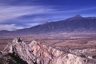 Volcán de Colima (center) and Nevado de Colima (right) are seen here from a quarry at Cerro la Escalera, 23 km NE. Up to 25 m of volcanic deposits (not visible in this photo) from both Cántaro and Colima volcanoes are exposed at Cerro la Escalera. The rocky outcrop in the foreground is a quarry wall cut in Cretaceous limestones for cement. The town of Huescalapa is visible to the lower right within the Colima graben.
Photo by Lee Siebert, 2000 (Smithsonian Institution).
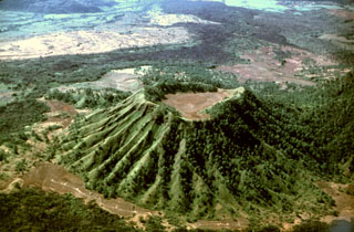 Erosional gullies have formed down the Molcajete Grande flanks, a cone on the lower NW flank of Ceboruco. This aerial view from the NE shows the forested andesite Coapan lava flow beyond the cone. The lighter-colored area just beyond the flow (upper left) is the Destiladero rhyodacitic lava flow.
Photo by Jim Luhr, 1980 (Smithsonian Institution).
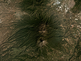 The Colima volcanic complex has two main edifices, the northern Nevado de Colima and the active Volcán de Colima to the south, both in the center of this December 2019 Planet Labs satellite image monthly mosaic (N is at the top; this image is approximately 44 km across). The active cone formed within a 5-km-wide flank collapse scarp, that produced a debris avalanche to the south, one of at least nine collapse events during the past 45,000 years.
Satellite image courtesy of Planet Labs Inc., 2019 (https://www.planet.com/).
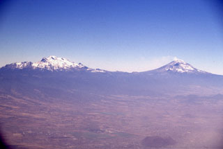 Iztaccíhuatl (left) and Popocatépetl (right) seen east of the Valley of Mexico. The differing profiles of the two volcanoes are due to varying styles and durations of volcanism. Iztaccíhuatl's elongate form reflects migration of volcanism over long periods of time along a NNW-SSE trend; it is largely Pleistocene in age, and has been extensively eroded. The more symmetrical Popocatépetl is much younger and has more-localized vents.
 Photo by Lee Siebert, 1997 (Smithsonian Institution).
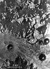 Ashfall from Hoyo el Huanillo scoria cone (lower left) was radiocarbon dated to have formed about 9,300 years ago within the Michoacan-Guanajuato volcanic field. A small ash-covered lava flow extends a short distance to the NW of the cone, which is located 35 km NE of Parícutin. The Cerro Cucundicata scoria cone is to the lower right, and the Cerro Borrego and Cerro Tarucun cones are to the N, NE of the town of Cherán. The eroded Cerro Pacaracua edifice forms much of the upper part of the photo.
Aerial photo by Comisión de Estudios del Territorio Nacional (CETENAL).
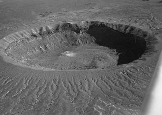 Cráter Elegante, seen here in an aerial oblique view from the NW, is a 1.6-km-wide maar in the Pinacate volcanic field. Within the crater walls are exposed basaltic lava flows, sills, and dikes pre-dating formation of the maar, which are overlain by pyroclastic surge deposits that cover the rim and outer flanks. Lake beds within the maar have been radiocarbon dated at between about 13,000 and 17,000 years, indicating a late-Pleistocene age for the maar-forming eruptions.
Photo by David Roddy, 1965 (U.S. Geological Survey).
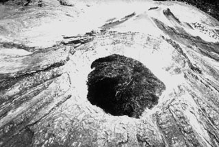 A 1941 aerial photo from the SW shows a dark lava dome that was extruded into the 450-m-wide crater created by the powerful explosive eruption of January 1913. In 1922 the crater floor had a depth of about 300 m and was covered by debris from the crater walls. By May 1930 the crater bottom lay about 150 below the crater rim, and when the crater was visited in January 1931 black lava was up to 50 m below the notch on the northern crater rim. Renewed dome growth in 1957 soon filled the crater and by 1961 lava began flowing over the crater rim.
Photo courtesy Julian Flores (University of Guadalajara), 1941.
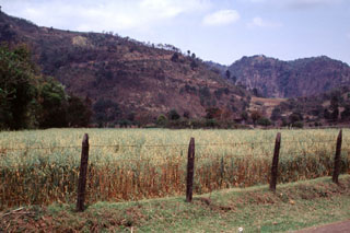 The Rincón de Chapultepec scoria cone is seen here with a switchback road on the southern flank and is one of the younger vents within the Naolinco volcanic field. The crater rim is barely visible against the tip of a ridge of the Sierra de Chiconquiaco range on which the cone was constructed. The valley floor is underlain by tephra deposits from Rincón de Chapultepec that overlie a lava flow that issued from the base of the cone. Rincón de Chapultepec formed about 3,000 years ago.
 Photo by Lee Siebert, 2000 (Smithsonian Institution).
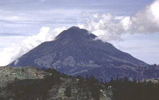 Tacaná is located on the México/Guatemala border at the far NW end of the Central American volcanic belt. It is seen here from the Guatemalan side of the border to the ENE, where it rises steeply above a 9-km-wide caldera surrounded by deeply eroded plutonic rocks. Historical activity has included mild phreatic eruptions, but stronger explosive activity and production of pyroclastic flows occurred earlier.
Photo by Bill Rose, 1986 (Michigan Technological University).
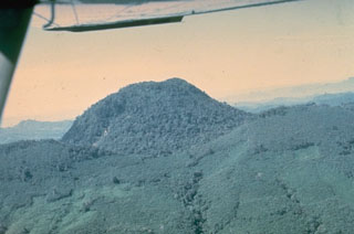 A forested lava dome, seen here from the east in 1974, filled the crater of México's El Chichón volcano and formed its highest point prior to a major eruption in 1982. The low ridge cutting across the middle of the photo is the rim of the pre-1982 crater. Powerful explosive eruptions in March and April 1982 removed the lava dome and produced a 1-km-wide crater.
Photo by Paul Damon, 1974 (University of Arizona).
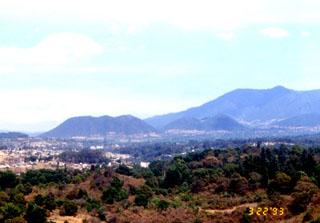 The central area of Las Tres Chicas caldera contains resurgent lava domes (right), pyroclastic deposits, and small lava domes, as high as 300 m. The caldera and domes are part of the Zitácuaro-Valle de Bravo volcanic field.
Photo by Lucia Capra, 1993 (courtesy of José Macías, Universidad Nacional Autónoma de México).
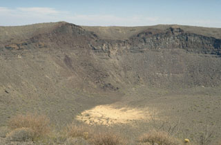 The SE wall of Cráter Elegante reveals a cross-section of a scoria cone that existed prior to explosive formation of the maar. The light-gray remnants of the sill intrusions are visible at the low point of the cone and below its right flank. The vent was located where the SE part of Cráter Elegante is now. The surface of the cone is mantled by pyroclastic surge deposits from the maar-forming eruption.
Photo by Jim Luhr, 1996 (Smithsonian Institution).
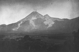 This 11 March 1901 photo from the east shows a small plume from the summit of Colima during a period of intermittent mild explosive eruptions that began in 1893. This eruption included the emission of small lava flows from the summit during 1895-1902. The unvegetated lava flows descending from El Volcancito, the dome on the NE (right) flank, were produced during its formation in 1869.
Photo by José Ma. Arreola, 1901 (courtesy of Julian Flores, University of Guadalajara).
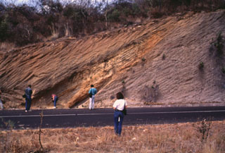 Geologists investigate an exposure in the Popocatépetl southern flank of along the road connecting the towns of Hueyapan and Amayuca in the state of Morelos. The outcrop shows two debris avalanche deposits separated by a yellowish reworked horizon. The deposit to the left corresponds to the youngest avalanche produced by the southern flank failure of the ancient Popocatépetl around 23,000 years ago. Major flanks collapse events have occurred at least three times during the Pleistocene.
Photo by José Macías, 1995 (Universidad Nacional Autónoma de México).
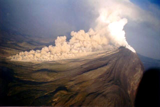 A pyroclastic flow descends the western flank of Colima at 0830 on 22 November 1998. The new growing lava dome had almost entirely filled the 1994 crater by the morning of the previous day, after which lava started flowing out of the summit crater area and producing block-and-ash flows at 3-5-minute intervals that mostly traveled south within the eastern branch of Barranca El Cordobán to distances of more than 4 km.
Photo courtesy of Abel Cortés, 1998 (Colima Volcano Observatory, Universidad de Colima).
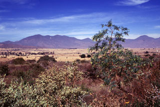 The eastern side of the Volcán el Cántaro complex, seen here from Volcán Apaxtepec, a cinder cone NE of Nevado de Colima volcano, rises above the floor of the Colima rift zone. Cántaro is the oldest and northernmost volcano of the Cántaro-Colima volcanic complex, which extends south through Nevado de Colima to the historically active Volcán de Colima. Cántaro is erosionally modified, but has many well-preserved andesitic-dacitic lava domes on its northern and eastern flanks, including Cerro el Capulín on the far right horizon.
 Photo by Lee Siebert, 2000 (Smithsonian Institution).
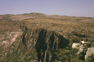 The largest and best-known maar of the Ventura volcanic field is Joya Honda. The eastern wall of the 850 x 1100 m wide, 300-m-deep maar is seen here from the south rim. The maar was erupted through Cretaceous limestones, the cliff-forming units in the crater wall, about 1.1 million years ago. The Ventura volcanic field consists of a group of maars and pyroclastic cones located immediately NE of the city of San Luis Potosí in the southern Basin and Range province of central México.
 Photo by Jorge Aranda-Gómez, 1994 (Universidad Autónoma de México).
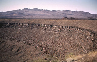 Santa Clara shield volcano, seen on the SW horizon beyond the rim of Cráter Elegante maar, is of late-Pliocene to Pleistocene age. The broad edifice is largely mantled by pyroclastic ejecta and lava flows of the basaltic Pinacate monogenetic volcanic series, which began erupting about 1.2 million years ago. More than 500 scoria cones and associated lava flows have formed across the Pinacate field and extend into the surrounding desert.
Photo by Bill Rose, 1969 (Michigan Technological University).
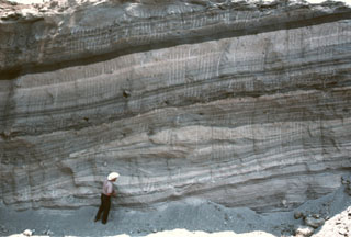 Geologist Todd Housh observes pyroclastic surge deposits in the wall of an abandoned quarry on the north flank of Hoya Estrada maar, directly west of the town of Valle de Santiago. The exposure shows laminar and dune form-bedded surge deposits at the bottom with laminar ashfall layers at the top. The direction that the pyroclastic surges traveled was from right to left.
Photo by Jim Luhr, 2002 (Smithsonian Institution).
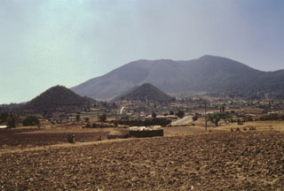 Jocotitlán rises above the Toluca basin and is seen here from the NW. This side of the edifice has a horseshoe-shaped escarpment that formed as a result of gravitational failure of the summit during the early Holocene. The conical hills of Cerro San Miguel (left) and Cerro la Cruz (center) are part of the resulting debris avalanche deposit that covers an 80 km2 area to the NE.
 Photo by José Macías, 1997 (Universidad Nacional Autónoma de México).
 A villager inspects the roof of a house in the village of Parícutin that was destroyed by heavy ashfall in the first year of the eruption. The village that the volcano was named after was located only 3 km NW of the new cone. Ashfall was particularly intense during the eruption's second to fifth months, and the town's 733 residents were forced to evacuate four months after the eruption began. The Mexican government provided new lands in Caltzontzín, 27 km to the SE.
Photo by Frederick Pough, 1943 (American Museum of Natural History).
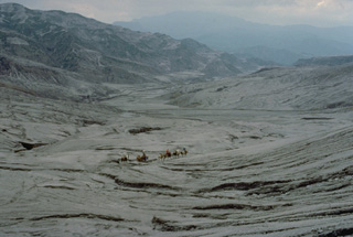 A geological field party on horseback rides through the area devastated by pyroclastic surges during the 1982 eruption of El Chichón. Pyroclastic flows and surges swept a roughly circular area of about 150 km2 radially from the summit to distances up to 8.5 km from the vent. Nine villages were within the devastated zone and thousands of people were killed.
Copyrighted photo by Katia and Maurice Krafft, 1983.
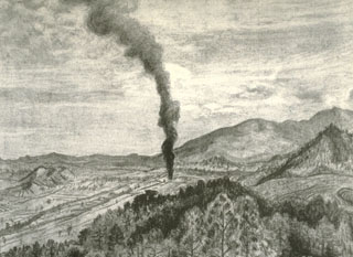 This sketch by Mexican artist Dr. Atl depicts the early moments of the Parícutin eruption in a cornfield near the village from which the volcano was named. A Tarascan farmer, Dionisio Pulido, observed the formation of the eruptive vent in his field about 1630 on 20 February 1943 as he was burning branches.
Sketch by Dr. Atl, 1943 (published in Luhr and Simkin, 1993).
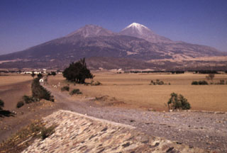 Pico de Orizaba volcano is seen here from the south, with snow-free Sierra Negra volcano to its left. Sierra Negra is the southernmost major vent of the roughly NNE-SSW-trending Pico de Orizaba-Cofre de Perote volcanic chain. The construction of Sierra Negra was contemporaneous with the mid-Pleistocene early stages in the formation of Orizaba volcano. Sierra Negra is composed largely of lava flows and produced numerous pyroclastic flows mainly to the SW and W.
Photo by Lee Siebert, 1998 (Smithsonian Institution).
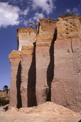 A quarry wall on the lower NW flank of Cofre de Perote volcano exposes a cross-section through part of the Xáltipan Ignimbrite, which erupted about 460,000 years ago and resulted in the formation of Los Humeros caldera. This massive 230 km3 ignimbrite covers a 3,500 km2 area and extends at least 50 km to the coastal plain. The mostly non-welded rhyolitic ignimbrite is overlain by co-ignimbrite airfall tuffs and eight airfall lapilli tuffs.
Photo by Lee Siebert, 1997 (Smithsonian Institution).
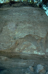 The bedded deposits at the base of this outcrop on the SW flank of Colima near the village of San Antonio are pyroclastic flow and pyroclastic surge deposits from an eruption that was radiocarbon dated to about 4,300 years ago. The thick deposit forming the majority of the outcrop is a debris avalanche deposit produced by collapse of the volcano. Erosion at the base of this deposit has exposed its mottled internal texture, reflecting various lithologic units that were transported without being mixed together.
Photo by Jim Luhr, 1983 (Smithsonian Institution).
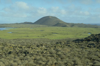 The Volcán Sudoeste scoria cone, and smaller cones at its base, are part of the San Quintín volcanic field in México's Baja Peninsula. They are seen here from the north on the slopes of Picacho Vizcaino. Volcán Sudoeste is one of the youngest scoria cones of the field.
 Photo by Jim Luhr, 1990 (Smithsonian Institution).
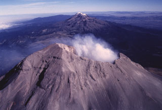 The Sierra Nevada east of the Valley of Mexico is a N-S-trending volcanic chain that runs perpendicular to the E-W trend of the Mexican Volcanic Belt. As with other transverse volcanic chains such as Cántaro-Colima and Cofre de Perote-Orizaba, the volcanic features in the Sierra Nevada range are younger towards the south. The broad forested volcanoes of Tláloc and Telapon in the distance are Pliocene in age, Iztaccíhuatl in the center is largely Pleistocene, and Popocatépetl in the foreground has been historically active.
Photo by José Macías, 1996 (Universidad Nacional Autónoma de México).
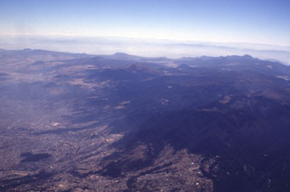 Mexico City encroaches onto the Chichinautzin volcanic field, which covers a broad 1,000 km2 area immediately south of the city. Many of the more than 150 small cones in the volcanic field are of Holocene age. Among the larger features of the field seen in this aerial view from the NW are Volcán Ajusco (the brown-colored peak in the center below the skyline) along with Cerro Pelado, Cerro Chichinautzin, and Cerro Tláloc to the left. In addition to the Xitle eruption less than 2,000 years ago, an eruption of Cerro Chichinautzin was witnessed by local inhabitants.
Photo by Lee Siebert, 1997 (Smithsonian Institution).
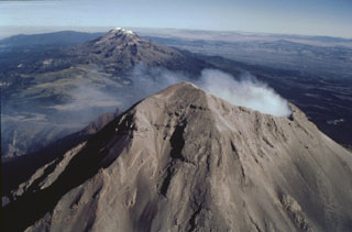 Iztaccíhuatl and Popocatépetl are part of the N-S-trending Sierra Nevada range SE of Mexico City. Iztaccíhuatl, in the center of the range, is to the upper left, and Popocatépetl is in the foreground at the southern extremity of the range. The Sierra Nevada separates the Valley of Mexico from the Puebla basin, which can be seen to the east. Ashfall from recent eruptions covers the summit snow cover this 1996 photo.
Photo by José Macías, 1996 (Universidad Nacional Autónoma de México).
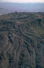 The El Norte lava flows cover most of the N flank of Ceboruco volcano in western México. The south wall of the inner caldera forms the far summit ridge. The andesitic El Norte flows cover a broad area 3.5 km in length and forms a 3.5-km-wide lava flow field at the base of the volcano. Their youthful morphology and unvegetated surfaces suggest a young age, possibly during one of the two 16th century eruptions.
Photo by Jim Luhr, 1980 (Smithsonian Institution).
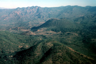 The Jorullo cone (right-center) is seen here from the SSW with Cerro la Pilita cone in the foreground. The small, less-vegetated cones immediately to the left are the SW-flank vents that produced lava flows during the middle part of the 1759-1774 eruption. Cerro la Pilita is an older cone that produced pre-historical lava flows along a narrow channel to the SW.
Photo by Jim Luhr, 1997 (Smithsonian Institution).
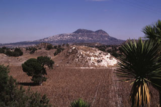 Cerro Pinto on the NE horizon is a lava dome that formed within a tuff cone. Cerro Pinto is one of several large lava domes within the enclosed Serdán-Oriental basin. The hills in the foreground are hummocks of a debris avalanche deposit produced by collapse of Las Derrumbadas lava domes.
Photo by Lee Siebert, 1997 (Smithsonian Institution).
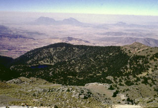 Glacial erosion has modified the summit of Cofre de Perote volcano. Summit lava flows show glacial striations, and a glacial tarn (left) is SW of the summit. Cofre de Perote overlooks the intermontaine Serdán-Oriental basin, which contains lava domes, tuff rings, lava flows, and scoria cones. The two Las Derrumbadas lava domes are in the distance and Cerro Pinto dome to their right are about 40 km SW.
Photo by Lee Siebert, 1999 (Smithsonian Institution).
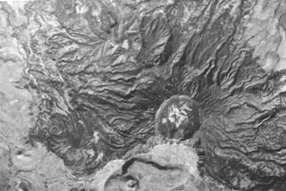 The 1-km-wide central crater of Las Navajas volcano is prominent in an aerial photograph with north to the top. Las Navajas, located immediately north of Sangangüey volcano, is a low-profile shield volcano with a largely buried 4-km-wide caldera. A south-facing arcuate cliff forming the northern wall of a second caldera can be seen to cut the central crater, and an andesitic cinder cone and thick lava flow of post-Las Navajas age are seen to the south of the cliff.
Aerial photo by Comisión de Estudios del Territorio Nacional (CETENAL), courtesy of Steve Nelson.
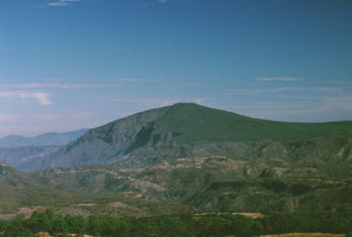 Cerro La Cienega is a broad andesitic shield volcano that lies east of the Atenguillo river near the center of the Northern Atenguillo volcanic field. It is one of three Pliocene andesitic centers in the volcanic field, which also includes the La Laja shield volcano and the El Rosario lava plateau of Pleistocene age.
Photo by Paul Wallace, 1998 (University of California Berkeley).
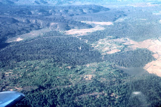 The small light-colored spire in the center of the photo is the renowned steeple of the church of San Juan Parangaricutiro, which was surrounded by lava flows from Parícutin volcano in 1944 in this view from the NE. The steep-sided, viscous lava flows in the background were erupted later, during 1944-46. This is one of numerous lava flows within the Michoacan-Guanajuato volcanic field.
Photo by Jim Luhr, 1997 (Smithsonian Institution).
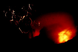 An incandescent pyroclastic flow (lower right) travels down the flanks of El Chichón with lightning produced in the ash plume (left) on 3 April 1982. Minutes later this plume reached an altitude of about 24 km. The eruption of large amounts of tephra and pyroclastic flows and surges caused extensive damage and fatalities. Explosive removal of the summit lava dome created a new 1-km-wide, 300-m-deep crater.
Photo by Servando De la Cruz-Reyna, 1982 (Universidad Nacional Autónoma de México).
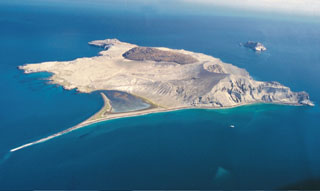 Isla San Luis is seen here from the south with a 2-km-long spit (at low tide) to the lower left. The main features of the island are a rhyolite lava dome forming the NW tip of the island, the darker rhyolitic obsidian dome and coulee in the center, and an eroded tuff ring at the SE tip of the island (to the right). Another tuff ring, Isla Poma, lies 1 km NE of Isla San Luis and is visible to the right.
Photo by Brian Hausback, 2000 (California State University, Sacramento).
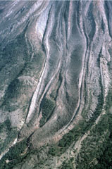 Two parallel lava lobes with lateral levees were emplaced in the Cordoban drainage on the SW flank of Colima, seen here on 8 February 1999. The flows are partly confined within levees of older lava flows. Lava extrusion had begun from the summit lava dome on 20 November 1998 and quickly produced a flow that split into three lobes as it diverged around topographic highs on the upper flanks.
Photo by Jim Luhr, 1999 (Smithsonian Institution).
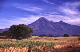 The Colima volcanic complex towers above the floor of the Colima graben. Volcán de Colima is seen here from the SE, with Nevado de Colima, the highest peak in western México, to the right. The flat ridge between the peaks is El Volcancito, a lava dome that began growing in 1869 on the NE flank. The Colima complex, including Volcán Cántaro to the north, forms the westernmost of three major N-S-trending volcanic chains perpendicular to the E-W trending Mexican Volcanic Belt.
Photo by Lee Siebert, 2000 (Smithsonian Institution).
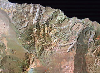 El Aguajito caldera is located along the Gulf of California immediately NE of Tres Vírgenes volcano (lower left) and NW of La Reforma caldera (partially visible at the right). The approximately 10-km-wide caldera covers the broad dissected area from Tres Vírgenes to the sea. The rim of the mid-Pleistocene caldera is not exposed, but an arcuate line of andesitic-to-rhyolitic lava domes lies along its northern margin. Hot springs are located along the southern caldera margin in the linear NW-trending valley between the caldera and Tres Vírgenes.
NASA Landsat image (processed by Brian Hausback, UC Sacramento).
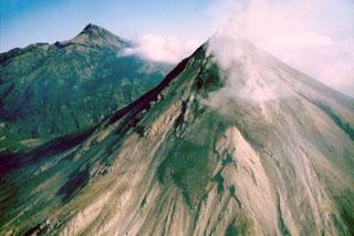 An overflight on the morning of 3 December 1998 shows lava flows advancing down the SW flank of Colima. The flow in the center is diverted by a topographic high into two lobes. By the previous day the three lava flows on the SSW flanks had reached estimated lengths of 1 km (westerly flow), 1.2 km (central flow), and 0.9 km (SE flow). Nevado de Colima is to the left.
Photo by Juan Carlos Gavilanes, 1998 (Colima Volcano Observatory, Universidad de Colima).
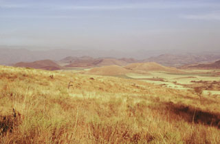 The hills in the center of the photo form part of the SE-flank cone alignment on Sangangüey volcano. This view looks to the SE from the side of cone C4. The cones extend beyond the flanks into the Tepic basin towards the Pleistocene Santa María del Oro maar that erupted through Miocene tuffs beyond the cones, which is not visible in this photo.
Photo by Jim Luhr, 1999 (Smithsonian Institution).
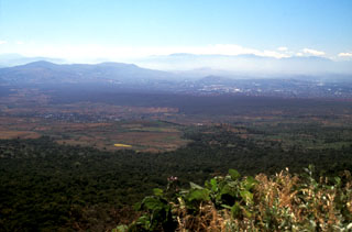 The darker forested area in the center of this photo, extending from the middle right almost across the broad valley floor, is the Texcal lava flow. This lava flow traveled 24 km S onto the Cuernavaca plain after being erupted about 4,200 years ago from the Guespalapa scoria cone. Unlike the Pelado or Chichinautzin eruptions, the Guespalapa eruption did not produce a small shield, but rather one of the longest lava flows of the Sierra Chichinautzin.
Photo by Lee Siebert, 2004 (Smithsonian Institution).
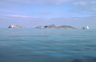 Isla Isabel, a complex of cones and associated lava flows, forms a small 1.5-km-long island located in the Pacific Ocean 30 km off the coast of Nayarit state, Mexico. The island is seen here from the SE with Cerro el Faro cone to the left and the spires of the Islotes Las Monas to the right. Isla Isabel is a wildlife sanctuary whose rocks and vegetation are mantled with white guano. Exposures of the interior of the cones forming the island can be seen in the main island sea cliffs and offshore islets.
Photo by Jim Luhr, 1999 (Smithsonian Institution).
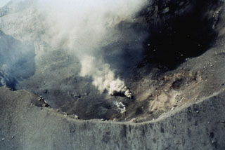 The Popocatépetl summit crater is seen here from the NW on 16 June 1997. The irregular crater floor has several vents and some active fumaroles. The photo was taken five days after an ash eruption on 11 June that produced a 4-km-high plume and was accompanied by lahars that reached several towns to the east. Another strong explosion on 30 June was followed by lava extrusion on the crater floor.
Photo by Roberto Quass, 1997 (Universidad Nacional Autónoma de México).
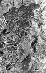 Volcán la Mina is the scoria cone near the center-left margin of the photo with the lava flow emplaced through the collapsed NE crater rim. It formed about 17,170 years ago within the Michoacan-Guanajuato volcanic field, around 90 km ENE of Parícutin. The SW cone containing a crater that also opens to the NE is Volcán el Melón (lower left), which was the source of a lava flow that traveled east to the present-day outskirts of the village of Capula.
Aerial photo by Comisión de Estudios del Territorio Nacional (CETENAL).
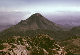 Colima volcano is seen here from the summit of neighboring Nevado de Colima. The forested ridge extending across the center of the photo is the rim of a large scarp formed by the collapse of the ancestral Colima edifice on the southern flank of Nevado. The modern Colima edifice grew within this scarp during the past few thousand years. The ridge on the NE (left) flank of Colima is El Volcancito, a lava dome that formed in 1869.
Photo by Lee Siebert, 1998 (Smithsonian Institution).
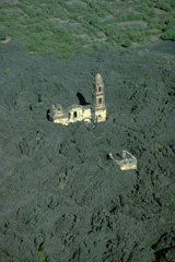 The renowned church of San Juan Parangaricutiro was surrounded by lava flows from Parícutin in July 1944. Only one of the two church steeples had been completed prior to the eruption. The interior of the church was dismantled only days before it was overrun by the lava flow. The west margin of the 1944 lava flow appears at the top, with faintly visible abandoned streets of the town beyond.
 Copyrighted photo by Katia and Maurice Krafft, 1981 (published in Luhr and Simkin, 1993).
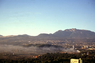 The Xitle scoria cone, the large flat-topped cone on the center horizon, is one of the youngest features of the Chichinautzin volcanic field. Xitle erupted about 1,670 years ago. Initial ash emission was followed by extrusion of a lava flow that traveled 13 km N and covered the prehistoric Cuicuilco urban centers and nearby agricultural lands. Portions of Mexico City, including the National University (UNAM), were built on this lava flow. The Ajusco lava-dome complex appears to the upper right.
Photo by Gerardo Carrasco-Núñez, 1997 (Universidad Nacional Autónoma de México).
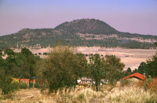 Xitle scoria cone, seen here from the SE, is one of the youngest features of the Chichinautzin volcanic field. The west-flank Xicontle cone, with a 150-m-wide crater, forms the flat ridge to the left. The eruption began about 1,600 years ago producing ashfall that underlies early lava flows. Five flank vents, at Xicontle and on other sides of the Xitle cone, produced voluminous lava flows that surrounded the scoria cone and traveled up to 13 km N, covering 80 km2.
Photo by Lee Siebert, 1998 (Smithsonian Institution).
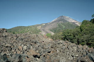 The lava flow in the foreground, which was emplaced during the 1975-76 eruption of Mexico's Colima volcano, can be seen descending through the vegetation at the center. The flow originated from the summit and traveled 3.5 km down the SE flank. The flow bifurcated on the upper slopes to form another lobe that traveled E, forming the darker area that descends into the vegetation at the upper right.
Photo by Jim Luhr, 1983 (Smithsonian Institution).
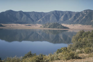 The oval-shaped, 5 x 2.5 km Tepetiltic caldera, seen here from the shore of a lake that occupies the older NE side of the caldera, was formed during two eruptive episodes that produced voluminous rhyodacitic airfall tephra and ashflows. Formation of the compound caldera was closely followed by emplacement of two rhyodacitic lava domes on the eastern flank. The low forested hill at the far side of the lake is a lava dome extruded near the intersection of the two calderas. A second dome was emplaced to the left on the floor of the higher SW caldera.
Photo by Jim Luhr, 1978 (Smithsonian Institution).
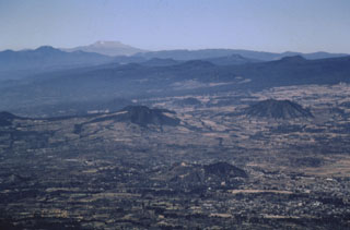 Cones of the Chichinautzin volcanic field in the foreground and middle distance are seen here looking to the west from Popocatépetl volcano. The large flat-topped volcano on the far horizon is Nevado de Toluca. The broad Chichinautzin volcanic field covers a 90-km-wide area south of the Valley of Mexico between the base of the Sierra Nevada (containing Popocatépetl and Iztaccíhuatl) and the eastern flank of Nevado de Toluca.
Photo by José Macías, 1998 (Universidad Nacional Autónoma de México).
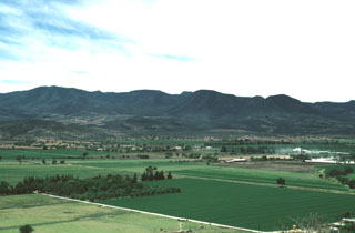 Volcán el Cántaro, viewed here looking SW from the Cerro Usmajac cinder cone, is the oldest and northernmost of the Cántaro-Colima chain of volcanoes that rises above the floor of the Colima rift zone. The Cántaro massif is erosionally modified, but has many well-preserved andesitic-dacitic lava domes on its northern and eastern flanks. As with the southward-migrating volcanism of the Cántaro-Colima chain as a whole, volcanic vents at Cántaro itself are progressively younger to the south.
Photo by Jim Luhr, 1987 (Smithsonian Institution).
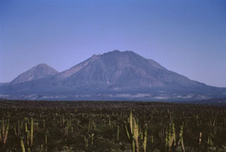 The two most prominent peaks of the Tres Vírgenes volcanic complex in central Baja California are seen here from the SSW. The peak to the left is El Azufre, a dacite lava dome complex. La Vírgen (right), consisting of andesite lava domes and flank scoria cones, formed more recently and has a more complicated history. It has erupted from both summit and flank vents and has produced both Plinian explosive eruptions and dacitic and andesitic lava flows.
Photo by José Macías, 1995 (Universidad Nacional Autónoma de México).
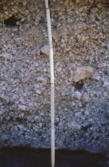 The middle unit of the La Vírgen Plinian fall deposit displays a massive structure (lacking internal structure) with large pink pumice fragments. This deposit, more than 1 km3, is the product of a major explosive eruption that occurred from Tres Vírgenes volcano. The dispersal axis of this airfall deposit was to the SW. The eruption also included the emplacement of pyroclastic flows and voluminous lava flows.
Photo by José Macías, 1995 (Universidad Nacional Autónoma de México).
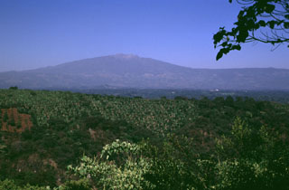 Cofre de Perote, a massive Quaternary volcano at the NNE end of a volcanic chain extending southward to Pico de Orizaba volcano, rises above banana crops below its SE flank. A large compound escarpment formed in part by edifice collapse is visible on the eastern flank. The upper part of this scarp forms the barren area below the summit. Numerous scoria cones, some of Holocene age, formed across the flanks of the largely Pleistocene edifice.
Photo by Lee Siebert, 1999 (Smithsonian Institution).
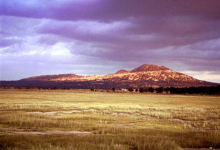 The Cerro Pinto rhyolite lava dome (right) rises 700 m above the Serdán-Oriental basin floor in this view looking ENE. The flat ridge to its left is the rim of the 2-km-wide Cerro Xalapasco, which contains multiple craters.
Photo by Gerardo Carrasco-Núñez, 2002 (Universidad Nacional Autónoma de México).
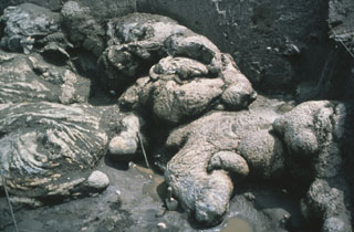 Pillow lavas from Xitle are exposed near the Cuicuilco Ceremonial Center, Mexico City. It is thought that the basaltic lava flows entered into a pond, causing the formation of pillow structures. The possibility that these flow textures indirectly represent "man-made" pillows (entering an artificial pond) has been considered.
Photo by Hugo Delgado, 1997 (Universidad Nacional Autónoma de México).
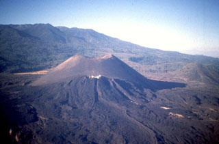 Parícutin, the volcano that grew in a cornfield in 1943, is a well-known feature of the Michoacán-Guanajuato volcanic field. The huge field contains over 1,400 vents covering a wide area across the Michoacán and Guanajuato states. Scoria cones are the predominant volcanic landform, and lava domes, maars, tuff rings, and lava flows are also present. Parícutin is seen here from the NE with the Nueva Juatita flank vent in the foreground, the main source of lava during the last five years of the eruption.
Photo by Jim Luhr, 1997 (Smithsonian Institution).
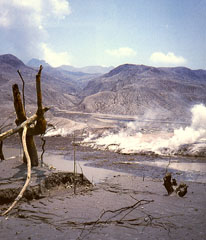 Pyroclastic surges completely devastated vegetation on the flanks of El Chichón out to distances up to 8 km from the crater. Hot pyroclastic flow and surge deposits are seen in this early April 1982 photo at Francisco León, 5 km SSW of the crater. Three major pyroclastic flows occurred on 3 and 4 April, devasting an area of 153 km2; all three surges reached Francisco León. Pyroclastic surges traveled over ridges as high as 300 m.
Photo by Servando De la Cruz-Reyna, 1982 (Universidad Nacional Autónoma de México).
 A view from a helicopter heading east towards Popocatépetl (right) and Iztaccíhuatl (left) in March 2000 during a monitoring flight. Opposing winds above 6 km give the gas plume from Popocatépetl an "S" shape. The Centro Nacional de Prevención de Desastres (CENAPRED) is engaged in an active monitoring program on Popocatépetl using instrumentation to evaluate seismic, geodetic, and geochemical parameters of the ongoing eruption.
Photo by Servando De la Cruz-Reyna, 2000 (Universidad Nacional Autónoma de México).
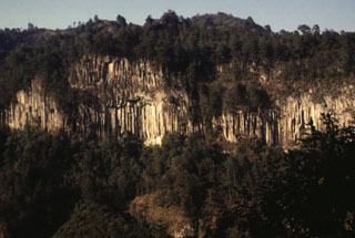 A massive columnar jointed lava flow is exposed in a valley NE of Orizaba volcano. The roughly 530,000-year-old Calcahualco lava flow was erupted during the Torrecillas stage, from the first of three major volcanic edifices forming the volcano. The source vent of this flow is now buried.
Photo by Lee Siebert, 1998 (Smithsonian Institution).
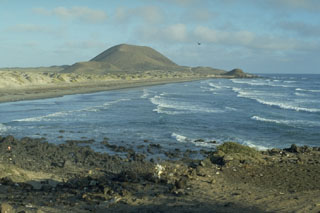 Volcán Sudoeste, one of a group of young cones of the San Quintín Volcanic Field, is located at the end of a narrow peninsula extending into the Pacific Ocean. The sand bars along the coast connect Volcán Sudoeste to Monte Mazo, at the southern end of a 10-km-long sand spit.
Photo by Jim Luhr, 1990 (Smithsonian Institution).
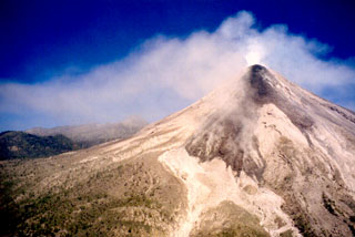 Lava flowing is seen here on 11 December 1998 flowing down the Cordobán drainage (barrancas) on Colima's upper SW flank. From left to right these headwaters comprise the Western, Central, and Eastern Cordobán. The light-colored areas below the lava flow lobes are pyroclastic flow deposits formed by collapse of the lava flow fronts.
 Photo by Juan Carlos Gavilanes, 1998 (Colima Volcano Observatory, Universidad de Colima).
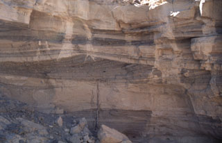 Pyroclastic surge deposits exposed in gullies on the flanks of Cráter Elegante in the Pinacate volcanic field of NW México. This photo shows cross bedding produced by particles transported by saltation or dilute suspension in a high-velocity pyroclastic surge. The direction of movement of the surge cloud, seen by the truncation of dune beds on the near-vent side, was from right to left. This type of bedding is common in areas near the rim of the maar.
Photo by Bill Rose, 1997 (Michigan Technological University).
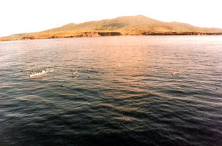 Trails of steam in the foreground rise from floating scoriaceous clasts during a submarine eruption off the west coast of Socorro Island in 1993. The eruption, from vents about 3 km NW of Punta Tosca, was first observed 29 January 1993 following ten days of SOFAR (SOund Fixing And Ranging) signals recorded in Hawaii. Large scoriaceous clasts up to 5 m in size floated to the surface without associated explosive activity. Floating masses of hot scoria were erupted until at least the end of February 1994.
Photo by Hugo Delgado-Granados, 1993 (Universidad Nacional Autónoma de México).
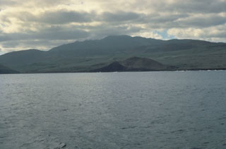 Socorro Island is the summit of a predominantly submarine shield volcano that has a largely buried 4.5-km-wide summit caldera. Cerro Evermann (center) forms the summit and is seen here from the south. Rhyolite lava domes have formed along flank rifts and silicic lava flows have reached the coast. Historical eruptions have been restricted to flank vents, including a submarine vent west of Socorro during 1993-94.
Photo by Steve Nelson, 1989 (Tulane University).
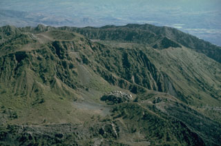 This aerial view of the western part of the summit of Ceboruco shows the rims of the two nested calderas to the upper right. The vent of the 1870-75 eruption contains a small lava dome below center of this photo. A massive lava flow erupted during the 1870 eruption and descended to the lower right.
 Photo by Jim Luhr, 1980 (Smithsonian Institution).
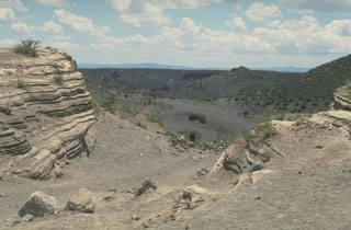 The La Breña-El Jagüey maar complex is one of the youngest features of the Durango volcanic field. This view looks SW from the NE rim of El Jagüey toward La Breña maar and shows the laminated pyroclastic surge beds emplaced during the maar-forming eruptions. El Jagüey and La Breña are two intersecting maars, 700 and 1,400 m wide, respectively.
 Photo by Jim Luhr, 1988 (Smithsonian Institution).
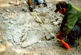 Scientists measure a shattered block ejected during Colima's 10 February 1999 explosion. Several impact craters were measured about 3 km NE of the summit, including from this block, which landed on the road to the caldera. This was the biggest explosion reported for the volcano in the previous 80 years. A substantial number of incandescent blocks started fires on the upper flanks.
Photo courtesy of F. Núñez-Cornú, G. Reyes-Davila, and C. Suárez-Plascencia, 1999 (University of Guadelajara).
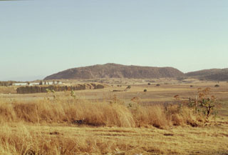 The small Cerro El Colli lava dome is the easternmost of several emplaced along the Sierra La Primavera volcanic complex eastern caldera rim. Eruption of the Southern Arc lavas began about 60,000 years ago and were accompanied by eruptions of airfall pumice and pyroclastic flows. Southern Arc lavas are generally younger to the east.
Photo by Jim Luhr, 1999 (Smithsonian Institution).
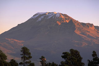 The northern end of the Iztaccíhuatl summit ridge is seen here from east of the Paso de Cortés to the south. A postglacial vent is located on the lower south flank of the volcano, north of the saddle between Iztaccíhuatl and Popocatépetl.
Copyrighted photo by Stephen O'Meara, 1993.
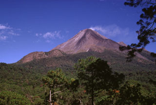 The two rounded peaks to the lower left are the Los Hijos del Volcán lava domes on Colima. These domes formed immediately south of the partially buried remnant of the SE caldera wall. The two domes and associated lava flows post-date caldera formation and mark the southernmost volcanic center of the Cantaro-Colima volcanic chain. Another flank lava dome, El Volcancito, forms the small ridge on the lower right flank, NE of the degassing summit.
Photo by Lee Siebert, 1993 (Smithsonian Institution).
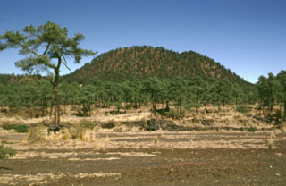 The vegetated lava flows in the middle of the photo traveled short distances to the south from Xitle flank vents, the scoria cone in the background. Most lava flows followed the topographic gradient to the north. Scoria-fall deposits from the 150-m-high pyroclastic cone mantle the foreground and overlie parts of the lava flows.
Photo by Lee Siebert, 1998 (Smithsonian Institution).
 The pre-1982 summit of El Chichón is seen in this aerial view from the east. A large lava dome fills a 1.6 x 2 km wide crater that formed about 220,000 years ago. This dome was destroyed by the 1982 eruptions, which created a new 1-km-wide crater where the former dome was. Two older lava domes are visible to the SW (upper left) and NW (upper right).
Photo by René Canul, 1981 (Comisión Federal de Electricidad).
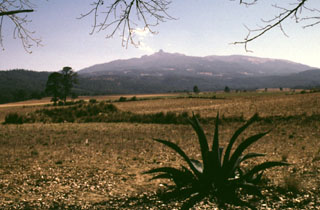 Cofre de Perote, sometimes referred to as the Treasure Chest of Perote, is seen here from the NW above fields near the town of Perote. The lower northern flanks of the largely Pleistocene volcano are overlain by ignimbrite deposits that erupted from the Los Húmeros caldera.
Photo by Lee Siebert, 1998 (Smithsonian Institution).
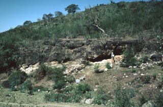 The Acatlán Ignimbrite covers 150 km2. It is compositionally zoned, grading from a white-or-pink colored basal rhyolitic tuff to a black upper andesitic tuff. The upper andesitic tuff is welded in the western part of the deposit, with the degree of welding increasing towards the top.
Photo by Jim Luhr, 1983 (Smithsonian Institution).
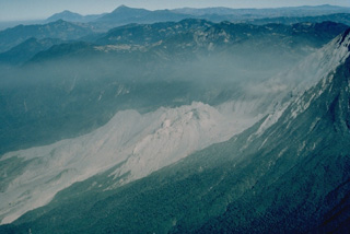 The Santiaguito lava-dome complex (center) has been in continual activity since 1922. It is seen here in March 1983 from the SE, with Siete Orejas volcano forming the broad forested ridge above it and Tacaná (left) and Tajumulco (right) volcanoes appearing on the left skyline. Santiaguito was constructed within the large 1902 explosion crater, which cuts the SW flank of Santa María volcano at the right.
Copyrighted photo by Katia and Maurice Krafft, 1983.
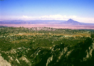 The summit of the Cerro Pinto lava dome on the western side of the Serdán-Oriental basin provides an overview of the crater floor of Cerro Xalapasco tuff cone in the foreground. Pyroclastic surge deposits associated with Cerro Xalapasco were emplaced in a relatively dry eruptive environment. The peak to the far right is Cerro Pizarro, a lava dome at the northern end of the Serdán-Oriental. The flat ridge stretching across the horizon to the north is Los Humeros caldera.
Photo by Gerardo Carrasco-Núñez, 2002 (Universidad Nacional Autónoma de México).
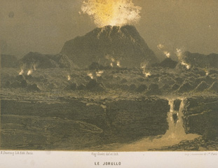 Jorullo, a predecessor to Parícutin, was the first cinder cone of the Michoacán-Guanajuato volcanic field to be formed in historical time. The eruption began on September 29, 1759. Pyroclastic flows and mudflows in the first days caused much damage to neighboring haciendas. The first incandescent bombs were observed on October 8, and after October 14 the eruption was dominantly magmatic. By November 13 the cone had reached 250 m height. Major eruptions continued until 1764, and lesser eruptions were reported until 1774.
From the collection of Maurice and Katia Krafft.
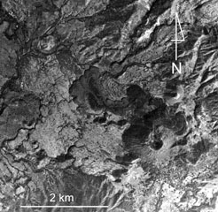 Jorullo volcano and associated lava flows in the Michoacan-Guanajuato volcanic field are visible in the bottom of this photo. Four NE-SW-trending vents flank the main cone, which erupted during 1759-1774. The 1759-74 lava flows appear in varying shades of gray, with the initial (and largest) flows being lighter in color (due to partial ash cover), and the most recent ash-free lava being darker and extending to the NW and NE. Jorullo lies about 80 km SE of Parícutin.
 Aerial photo by Comisión de Estudios del Territorio Nacional (CETENAL).
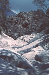 The slowly advancing front of the westernmost of three lava flows in the Cordobán drainage buries light-colored block-and-ash flow deposits formed during earlier collapse of the moving flow front. This photo was taken on 7 February 1999, about two and half months after lava extrusion began in November 1998. The flow front is about 30 m high.
Photo by Jim Luhr, 1999 (Smithsonian Institution).
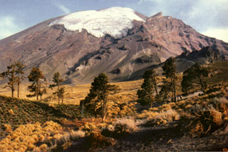 The El Glaciar Norte is located on the northern side of Popocatépetl. Faint climbers' trails can be seen on the lower northern flank heading towards Ventorillo, the peak below the horizon to the right. The popular Las Cruces summit route ascends diagonally below the glacier to the left. The 5,000-m-high El Ventorrillo is the summit of the eroded Nexpayantla edifice, a predecessor to Popocatépetl. Its steep cliffs expose the stratified interior.
Photo by Hugo Delgado-Granados (Universidad Nacional Autónoma de México).
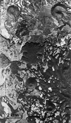 This aerial photo shows part of the Michoacan-Guanajuato volcanic field. Cerro el Pueblito (upper left), radiocarbon dated to about 29,000 years ago, produced the lava flow that extends eastward across the photo that flowed around the older Cerro las Cabras cone to the right. South of this lava flow is the La Vibor lava flow. Cerro Arena is the cone near the center of the photo.
 Aerial photo by Comisión de Estudios del Territorio Nacional (CETENAL).
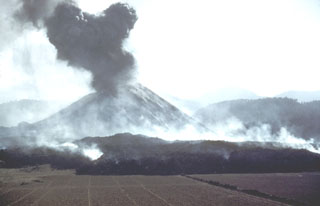 The first lava flow from Parícutin, the Quitzocho flow, moves northward over cornfields prepared for planting. An ash plume rises from the new cone, which by the time of this photo on 25 February, the 5th day of the eruption, was already more than 150 m high. Gas plumes rise from the advancing lava flow.
 Photo by Instituto de Geología, 1943 (published in Luhr and Simkin, 1993).
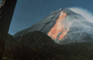 A night-time long exposure photo shows incandescent blocks rolling down the south flank of Colima after being dislodged from the 1982 lava flow. Lava movement down the south flank had begun on 9 December 1981 and was preceded by intermittent small explosions accompanying growth of the summit lava dome.
Photo courtesy Julian Flores, 1982 (University of Guadalajara).
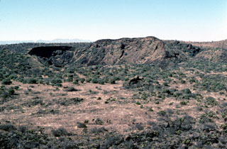 La Breña maar is seen here from the NE at the saddle between it and El Jagüey maar. The hill and crater at the center part of the photo are part of a cluster of nested cones formed on the floor of La Breña shortly after its formation. These post-maar eruptions produced Strombolian scoria and ash deposits due to less water being involved following the phreatomagmatic eruptions that created the maars.
Photo by Jim Luhr, 1979 (Smithsonian Institution).
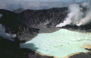 The new 1-km-wide El Chichón crater is seen here in January 1983, less than a year after the major explosive eruption . By this time it was partially filled by a hot, acidic lake. The isolated, low-profile, volcano is a small lava dome complex that was heavily vegetated prior to 1982. More than a half-dozen large explosive eruptions have occurred since the mid-Holocene.
Photo by Bill Rose, 1983 (Michigan Technological University).
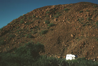 The steep margin of a thick basaltic andesite lava flow is seen from near State Highway 1 in central Baja California with a vehicle for scale. The sparsely vegetated flow is of probable Holocene age and is one of many recent lava flows of the San Borja Volcanic Field.
Photo by Andy Saunders, 1984 (University of Leichester).
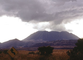 The three coalescing Cerro San Pedro lava domes (center), seen here from the NE, were constructed within the 7 x 10 km wide San Pedro caldera. The ridge at the left is the eastern rim of the caldera, which cuts andesitic-to-dacitic lava domes of early Pleistocene age. The dacitic San Pedro lava domes were dated at 0.75-0.80 million years and were constructed along a WNW-trending line. Two of the domes have partially collapsed, forming large debris-avalanche deposits that reach up to 10 km from the source.
Photo by Jim Luhr, 1978 (Smithsonian Institution).
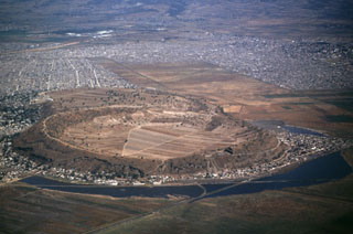 Xico is a low circular tuff ring within Mexico City that is part of the Chichinautzin volcanic field, seen here from the S. This volcano was formed by phreatomagmatic eruptions through the middle of Lake Chalco, the remains of which can be seen surrounding the tuff ring. Chalco and Lakes Texcoco and Xochimilco were formed when lava flows blocked river drainages to the S.
 Photo by Hugo Delgado, 1994 (Universidad Nacional Autónoma de México).
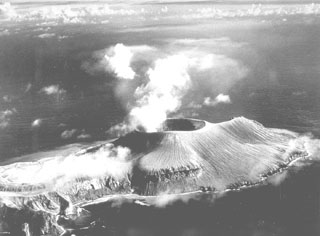 This aerial view from the west shows the new Volcán Bárcena summit crater producing a plume. The 700-m-wide crater had grown to a height of about 380 m in the first two weeks of the eruption. At the time of this 20 September 1952 photo, taken about seven weeks after the start of the eruption, the first of two lava domes had emerged in the summit crater. Extrusion of a lava flow that formed a delta on the far SE side of the island had not yet begun.
Photo by U.S. Navy, 1952 (courtesy of Sherman Neuschel, U.S. Geological Survey).
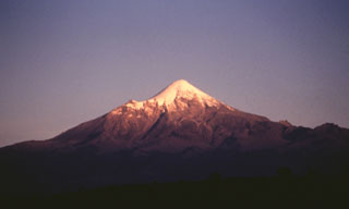 The evening sun illuminates the Pico de Orizaba western flank. The smaller peak to the left is the NW-flank peak of Sarcofago. The NW-dipping lavas of Sarcofago, which is part of the Espolón de Oro edifice, were exposed by edifice collapse. The collapse event forming a horseshoe-shaped crater, inside which the modern cone was constructed.
Photo by José Macías, 1995 (Universidad Nacional Autónoma de México).
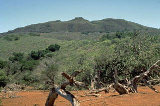 Cerro Evermann is a large cone and lava dome complex that forms the summit of Socorro. It, along with other cones and lava domes, largely fill a 3.8 x 4.5 km caldera at the summit of a shield volcano. Historical eruptions have been restricted to flank vents.
Photo by Steve Nelson, 1989 (Tulane University).
 Los Azufres geothermal field began producing electricity in 1982, the year this photo was taken. The power plant at well AZ-6 shown here is located in the southern (Tejamaniles) section of the field. Surface exposures here consist of the roughly 1-million-year-old Agua Fria rhyolite rocks. Exploratory drilling began at Los Azufres in 1976, and 67 wells had been drilled by 1998 in an area of 60 km2, of which 33 were producing electricity.
Photo by Pat Dobson, 1982 (Lawrence Berkeley National Laboratory).
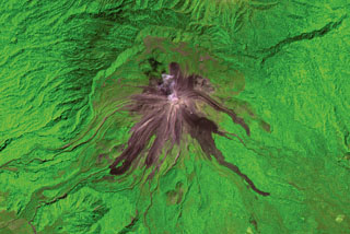 Recent lava flows from Volcán de Colima radiate from the summit in this 2001 ASTER satellite image (N is at the top; this image is approximately 13 km wide). The flows on the E and SE flanks were produced in 1975-76 and reached up to 3.5 km from the summit. The longest flows down the SW flank formed in 1998-99; the three major lobes seen here covered a SW-flank flow from 1991. The headwall of the horseshoe-shaped scarp to the N was produced by collapse of an older edifice.
ASTER satellite image, 2001 (National Aeronautical and Space Administration, processed by Doug Edmonds).
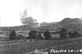 One of the first photographs taken of the Parícutin eruption shows an ash plume rising from the new volcano at 1800 on 20 February 1943, 1.5 hours after the start of the eruption. The photo was taken near Ticuiro, 5 km NNW of the volcano, with the fields of San Juan Parangaricutiro, later overrun by lava flows, in the foreground. Cerro de Canicjuata is the forested older cone to the right.
Photo by Luis Mora-Garcia, 1943 (published in Foshag and González-Reyna, 1956).
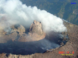 On 3 November 2001 this lava dome was observed on the north side of Colima's summit crater with a spine forming at the top. The spine was about 40 m tall, 40 m wide at its base, and smooth with vertical walls. Extrusion of this new dome had begun in early October and continued with a high extrusion rate, reaching a maximum on 14 October. This was part of a long eruption that began in November 1997 and was accompanied by small explosions.
 Photo courtesy of Centro de Sismologia y Volcanología de Occidente, Centro Universitario de la Costa, 2001.
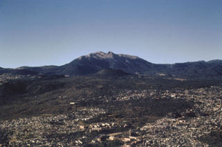 The small Xitle scoria cone in the center of the photo is directly below Volcán Ajusco, the large lava-dome complex on the horizon, and was the source of a voluminous lava flow about 1,670 years ago. The 3.2 km3 flow traveled 13 km north and underlies much of the forested area in the middle of the photo as well as the southern part of Mexico City in the foreground. The flow covered the Preclassic city of Cuicuilco, one of the oldest archaeological sites in central México, and underlies the campus of the National University of México (UNAM).
Photo by José Macías, 1996 (Universidad Nacional Autónoma de México).
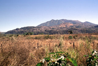 The sparsely vegetated ridge across the center of the photo is the distal margin of the Ceboruco 1870 lava flow. The 1.1 km3 lava flow originated from a vent at the western side of the nested summit calderas and traveled 6.5 km down the Arroyo de los Cuates valley to about 900 m elevation. The notch on the right-hand side of the summit ridge is the moat between the nested calderas.
Photo by Lee Siebert, 1997 (Smithsonian Institution).
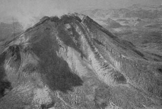 Renewed growth of the lava dome in the summit crater began in 1957. By the time of this aerial photo from the NE in 1961, lava had spilled over a notch in the northern crater rim and produced the lava flow seen here descending the northern flank to the lower right. By the end of 1962 the flow had traveled 1 km from the summit, reaching the caldera floor.
Photo from Mooser and Maldonando-Koerdell 1961 (XIIIth General Assembly IUGG).
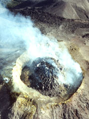 A degassing lava dome partially fills the crater at the summit of Colima on 11 January 2002. Renewed lava dome growth began in May 2001, and by the end of January 2002 the total volume of the dome was estimated to be 1,450,000 m3.
Photo by Mauricio Bretón, 2002 (Colima Volcano Observatory, University of Colima).
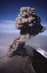 An ash plume rises above the crater of Popocatépetl on 21 February 1995. A phreatic eruption on 21 December 1994 ended a quiescent period that lasted roughly half a century. The eruption produced light ashfall in the city of Puebla, 45 km E. Intermittent ash eruptions, such as the one shown here, continued until May 1995 and then resumed in March 1996.
 Photo by Hugo Delgado-Granados, 1995 (Universidad Nacional Autónoma de México).
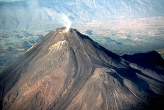 The NE-most of two lava flows produced during the 1975-76 eruption descended the flank of the summit cone until it encountered the 1869 El Volcancito lava dome (lower right). The flow then bifurcated into two lobes to the north and south. The Colima graben floor to the upper left is blanketed by debris avalanche deposits that formed during collapse of previous edifices.
Photo by Warren Huff, 1997 (University of Cincinnati).
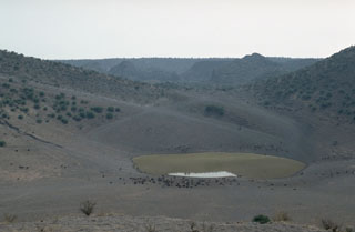 The bottom of El Jagüey maar is occupied by a small lake which marks the level of the groundwater table that lies about 60 m below the top of the surrounding lava plain and serves as a critical regional water hole for cattle (foreground). Explosions occurred when rising magma encountered this aquifer and produced the intersecting La Breña-El Jagüey maars. The NW rim of the 1,400-m-wide La Breña maar forms the horizon beyond the saddle between La Breña and the 700-m-wide El Jagüey maar.
Photo by Jim Luhr, 1988 (Smithsonian Institution).
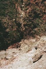 Steam rises from fumaroles (foreground) of the La Primavera geothermal field along La Azufrera fault, which can be seen in the vertical rock-filled gully in the background. Note the person observing the fault for scale. The geothermal field at La Primavera has been explored by the Mexican Comisión Federal de Electricidad (CFE) and exploratory drilling began in 1980.
Photo by Pat Dobson, 1982 (Lawrence Berkeley National Laboratory).
 An ash plume rises above Popocatépetl, whose Aztec name means "Smoking Mountain." This aerial view is of the NE side of the massive volcano, which towers more than 3,200 m above the Valley of Mexico to the right in this December 1994 photograph. Frequent eruptions have been recorded since the pre-Columbian era. El Ventorrillo, the small peak on the right, is a remnant of the eroded Nexpayantla volcano, a predecessor to the modern cone of Popocatépetl.
Photo courtesy of CENAPRED, Mexico City, 1994.
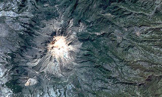 Pico de Orizaba (Volcán Citlaltépetl) formed on the margin of the Altiplano and has substantially higher relief on its eastern (right) side. Debris avalanches and lahars produced by edifice collapse have swept down the eastern flanks onto the coastal plain. A lava flow with lateral levees is visible on the lower SW flank below the summit. The eroded peak to the lower left beyond the lava flow terminus is Sierra Negra, the southernmost peak of the Cofre de Perote-Orizaba volcanic chain.
NASA Landsat satellite image, 1999 (courtesy of Loren Siebert, University of Akron).
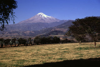 Like other volcanoes in the Cofre de Perote-Pico de Orizaba chain, Orizaba was constructed on the edge of the Altiplano and consequently has higher relief on the eastern side facing the Atlantic coastal plain. Glaciated Orizaba towers 4,200 m above fields near the town of Coscomatepec on its eastern flank. The valley to the left was impacted by the voluminous clay-rich Tetelzingo debris avalanche and lahar during the late Pleistocene.
Photo by Lee Siebert, 1998 (Smithsonian Institution).
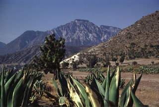 The NW-most dome of the two Las Derrumbadas lava domes, seen here from the NE along the highway to Perote, has undergone extensive hydrothermal alteration. Fumaroles on the domes remain active. The eroded hillside near the center is the outer flank of the San Luis Atexcac tuff ring, which contains a crater lake.
Photo by Lee Siebert, 1999 (Smithsonian Institution).
 Volcán Riveroll, seen here from the NE, is the northernmost of the southern group of cones within the San Quintín Volcanic Field. A broad crater is at the summit and opens widely to the NW. A smaller nested crater was constructed within the original crater and is the youngest feature of the volcano.
Photo by Jim Luhr, 1990 (Smithsonian Institution).
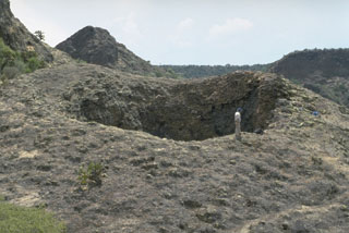 The La Boca crater is a product of the final eruptions of the La Breña-El Jagüey maar complex. La Boca and a nearby small crater, La Boquita, were formed by the accumulation of spatter that welded together during Strombolian activity. The two small craters originated from vents at the SE end of one of the post-maar cones constructed within La Breña maar after the magma-water interaction phase.
Photo by Jim Luhr, 1988 (Smithsonian Institution).
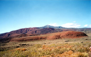 The southern flank of Socorro is underlain by rocks of three distinct origins. On the lower flanks are basaltic rocks of the Lomas Coloradas unit that mostly erupted between about 150,000 and 70,000 years ago. The middle flanks contain trachyte and rhyolite pyroclastic flow deposits that were emplaced between about 540,000 and 370,000 years ago. The summit region, including Cerro Evermann (center horizon), consists of silicic rocks that were erupted between about 180,000 to at least 15,000 years ago.
Photo by Martha Marin, 1998 (Mexican Navy).
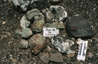 This pile of xenoliths was collected during field work at the Joya de los Contreras maar. The Santo Domingo maars are the source of mantle-derived spinel-lherzolite xenoliths and deep-crustal granulite xenoliths. The light-colored areas on the rims of the xenoliths are a coating of caliche. The scale at the lower right marks 10 cm on the left side.
Photo by Jim Luhr, 1991 (Smithsonian Institution).
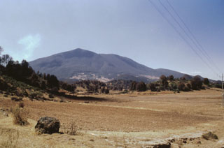 The tree-covered hills in the foreground of this view of Jocotitlán from the NE are the steep lobate front of a massive debris avalanche deposit produced by partial collapse of the volcano. This catastrophic collapse was radiocarbon dated to about 9,690 years ago. The avalanche traveled a maximum distance of 12 km and covered an area of 80 km2. The 2.8 km3 avalanche deposit is overlain by pyroclastic surge and airfall pumice deposits that were erupted immediately following the collapse.
Photo by José Macías, 1997 (Universidad Nacional Autónoma de México).
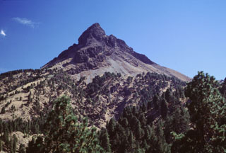 The summit of Nevado de Colima is the highest peak in western México and has been extensively eroded by glaciers, exposing steeply dipping lava flows. This cone is seen here from the northern rim of the outer collapse scarp, which contains a younger scarp on its NW side. This smaller 5-km-wide scarp formed during the late Pleistocene as a result of the collapse of the Nevado II edifice.
Photo by Lee Siebert, 2000 (Smithsonian Institution).
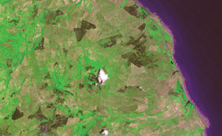 Pyroclastic cones capping the Los Atlixcos shield volcano lie left of the white atmospheric cloud at the center of the image. Lava flows from the shield volcano traveled north and east to reach the coast of the Gulf of Mexico along a broad front covering most of the coast in this view, which covers approximately 10 km in a N-S direction. The west-flowing Río El Tecuán at the bottom of the image defines the southern margin of the lava shield, while the NE-trending Río Santa Ana at the upper left marks the NE margin.
ASTER satellite image, 2002 (National Aeronautical and Space Administration, processed by Doug Edmonds).
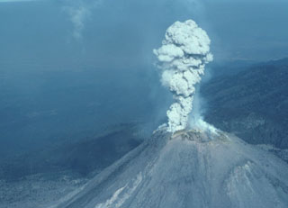 A small explosion 8 February 1999 produced a plume of gas and minor ash that is seen here from the SE about 5 seconds after the explosion began. Rapid lava extrusion began on 20 November 1998 and produced a lava dome in the 1994 crater that soon flowed over the crater rim, producing lava flows that descended the SW flank in several lobes. Block-and-ash flows from collapse of the flow fronts traveled down SW flank drainages. Periodic larger explosions occurred later during this eruption.
Photo by Jim Luhr, 1999 (Smithsonian Institution).
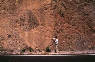 Popocatépetl volcano has been partially destroyed on at least three occasions by massive flank collapse events that have produced voluminous debris avalanche deposits that extend long distances primarily to the south. This roadcut exposes an outcrop of the youngest debris avalanche deposit, which was emplaced about 23,000 years ago. The person for scale points to the edge of a large block of material from the volcano that was carried within finer-grained material.
Photo by José Macías, 1995 (Universidad Nacional Autónoma de México).
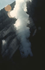 Minor phreatic eruptions took place at Tacaná in February, May, and June 1986. Following a seismic swarm that began the previous day, a moderate phreatic explosion around noon on 8 May created a new 10-m-wide vent and ejected a small amount of fine ash. Vegetation was damaged over an area of 200 x 100 m. Vigorous steam emission was continuing at the time of this 25 June photo. The new vent formed at about 3,600 m elevation on the NE flank.
 Photo by Bill Rose, 1986 (Michigan Technological University).
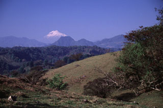 Glaciated Pico de Orizaba (Citlaltépetl) rises 50 km to the SW above rolling terrain south of the town of Xico, on the lower flanks of Cofre de Perote.
 Photo by Lee Siebert, 2000 (Smithsonian Institution).
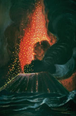 Parícutin ejects a shower of incandescent lava blocks and bombs and an ash plume in this painting by Dr. Atl, the renowned Mexican artist.
 Painting by Dr. Atl (published in Luhr and Simkin, 1993).
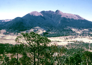 Volcán Ajusco, the highest peak of the Chichinautzin volcanic field, is seen here from the summit of the Xitle scoria cone to the NE. The Pliocene-Pleistocene Ajusco consists of lava domes surrounded by block-and-ash flows. During the Pleistocene the NE flank collapsed, producing a debris avalanche that traveled 16 km. Late-stage eruptions produced more mafic lava flows from flank vents, marking a transition to the monogenetic volcanism of the Chichinautzin volcanic field.
Photo by Lee Siebert, 1998 (Smithsonian Institution).
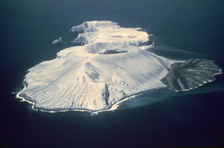 Bárcena volcano forms the elongate island of San Benedicto, seen here from the SW in March 1955. The circular summit crater at the center and the lava delta to the right of the tuff cone formed during an eruption in 1952-53. Pleistocene lava domes are located at the far NE tip of the island. Dark-colored lava from the 1952-53 eruption can be seen in the summit crater.
Photo by Adrian Richards, 1955 (U.S. Navy Hydrographic Office).
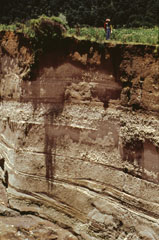 Stream erosion exposes an outcrop of the Upper Toluca Pumice, which originated during the last large Plinian eruption of Nevado de Toluca volcano some 10,500 years ago. This eruption produced a sequence of pyroclastic flow, pyroclastic surge, and ashfall deposits. Note the person at the top of the outcrop for scale. The Upper Toluca Pumice was distributed primarily to the NE and is found over much of the Valley of México.
Photo by José Macías, 1995 (Universidad Nacional Autónoma de México).
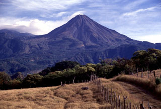 Volcán de Colima was constructed within a large horseshoe-shaped scarp formed by repetitive collapse of a previous edifice. The northern scarp rim forms the arcuate ridge to the far-left of this view from the SW. The modern cone was built over the past 2,600 years and had grown to a height of 400 m above the caldera rim at the time of this 1997 photo. Lava flows form much of the flanks.
Photo by Lee Siebert, 1997 (Smithsonian Institution).
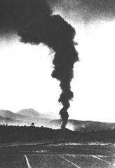 An ash plume rises above the new Parícutin cone on 21 February 1943, the second day of the eruption. The new cone is about 30 m high and is just rising above the treetops in this view from the NE. During this early stage the cone had slope angles of 32 degrees toward the west and lower angles to the east. At this point lava had begun flowing to the east.
Photo by Salvador Ceja, 1943 (U.S. National Archives, published in Luhr and Simkin, 1993).
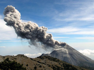 A Vulcanian explosion typical of activity at Colima is seen here from the north on 10 March 2007. Intermittent explosive eruptions with occasional lava dome growth and associated pyroclastic flows had been continuing for nearly a decade at this time.
 Photo courtesy of Colima Volcano Observatory, 2007.
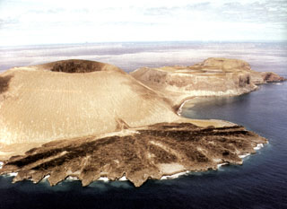 The Delta Lávico flow forms a peninsula on the SE flank of Volcán Bárcena at the southern end of San Benedicto Island. The tuff cone and lava flow formed during the 1952-53 eruption. The flat-topped cone to the right is Cráter Herrera, a lava dome with crater. Another lava dome, Roca Challenger, forms the northern tip of the island beyond Cráter Herrera.
Photo by Hugo Delgado-Granados, 1993 (Universidad Nacional Autónoma de México).
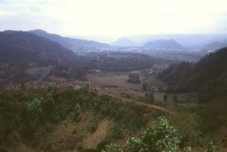 The Coacoatzintla lava flow that fills this valley floor originated from a vent at the base of Rincón de Chapultepec crater in the foreground. It was dated to about 3,000 years ago and underlies the present-day town of Coacoatzintla, seen in front of the dark-colored hill below the right horizon. The flow, which traveled 6 km to the south, diverted around the hill (formed of limestone bedrock) into the valley of the Río Naolinco, which extends from right to left in the distance. This eruption is the youngest known from the Naolinco Volcanic Field.
Photo by Lee Siebert, 2000 (Smithsonian Institution).
 The Colima volcanic complex consists of the massive overlapping edifices Nevado de Colima (the highest point of the complex to the right) and Volcán de Colima (left). Volcán de Colima was constructed within a 5-km-wide caldera that opens to the south and has been the source of large debris avalanches. Frequent historical eruptions have included dome growth, explosive activity, pyroclastic flows, and lava flows.
Photo by James Allan, 1981 (Smithsonian Institution).
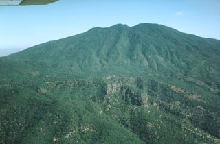 The south flank of the erosionally modified Tequila volcano is seen in an aerial view. The oldest lava flows from the Pleistocene stratovolcano overlie a south-flank rhyolitic lava dome dated at about 460,000 years. Summit crater activity ceased about 210,000 years ago, but flank eruptions producing andesitic lava flows and basaltic cinder cones continued until the late Pleistocene.
Photo by Jim Luhr, 1979 (Smithsonian Institution).
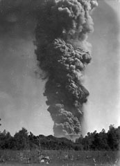 An ash plume towers 6 km above Parícutin on 24 March 1943, a little more than a month after the start of the eruption. The photo was taken from 3 km N in Tititzu and shows the advancing front of the Mesa del Corral lava flow in the middle ground, with the rim of the scoria cone behind it.
Photo by William Foshag, 1943 (Smithsonian Institution, published in Foshag and Gonzáles-Reyna, 1956).
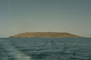 Isla Tortuga is 4-km-wide volcanic island located in the Gulf of California, 40 km off the coast of Baja California. The summit contains a 1-km-wide caldera and recent lava flows cover much of the flanks. This 1989 view is from the west.
Photo by Marjorie Summers, 1989 (Smithsonian Institution).
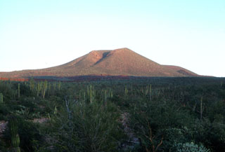 A young scoria cone rises above cactus-covered terrain NE of the town of La Purísima. The Comondú-La Purísima volcanic field, located in southern Baja California, west of the Sierra de la Giganta, has been active from the Miocene to the Quaternary. The youngest lava flows are mostly located in the area between the Comondú and La Purísima rivers.
Photo by Brian Hausback, 1983 (California State University, Sacramento).
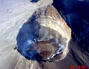 An aerial photograph from the NE on 23 December 2000 looks down into the Popocatépetl crater. Gas rises from the margins of lava emplaced in the summit crater since earlier that month. During December 2000 to January 2001 dome growth was at record-setting rates and amassed the largest active dome ever recorded at the volcano at the time. The previous dome-growth episode had taken place in February 2000.
 Photo courtesy CENAPRED, Mexico City, 2000.
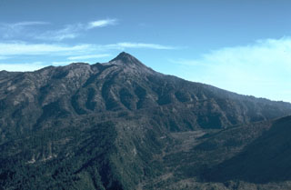 The lower area in the foreground of this view of Nevado de Colima is the moat of a large horseshoe-shaped caldera. The steep rim forms the forested arcuate ridge in the center. The caldera formed during collapse of the ancestral Colima, south of the current cone. The flanks of modern-day Colima, which have filled much of the caldera and overtopped in on three sides, appear to the lower right.
Photo by Jim Luhr, 1981 (Smithsonian Institution).
 Los Azufres is one of several silicic volcanic complexes with active geothermal near the center of the Trans-Mexican Volcanic Belt. Located about 200 km NW of Mexico City, Los Azufres consists of an 18 x 20 km early Pleistocene caldera that was later partially filled by resurgent dacite to rhyolite lava domes. This view shows the Agua Fria fault and thermal features looking NE from Cerro Pizcuaro.
Photo by Pat Dobson, 1982 (Lawrence Berkeley National Laboratory).
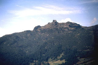 The smooth profile of the Cofre de Perote volcano is modified on the NE side by steep escarpments. The morphology of the summit reflects both edifice collapse and glacial erosion. Dacite lava flows can be seen on the right-hand horizon.
Photo by Hugo Delgado, 1997 (Universidad Nacional Autónoma de México).
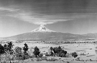 Gas emissions from the summit crater of Popocatépetl volcano on 18 January 1947 are dispersed towards Tonantzintla 40 km away. Brief explosions in January and February 1947 ejected ash and steam. Ash affected the Schmidt camera mechanism at the Tonantzintla Astrophysical Observatory. During interviews in 1989, tribal elders recalled the explosions and seismicity in 1947. This was last known activity at Popocatépetl before an eruption in 1994.
Photo by Juan Presno, 1947 (courtesy of E. Chavira, INAOE).
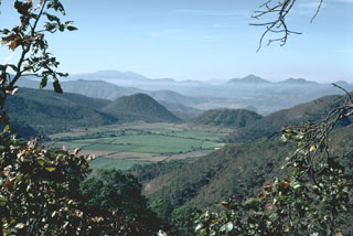 A group of scoria cones and lava domes are located near the town of Mascota, east of Puerto Vallarta. Steep-sided Tecomate lava dome (near the center) and Molcajete scoria cone (right center) are seen here from the NW. A recent eruption produced a lava flow from Volcán Malpais, north of Mascota.
Photo by Jim Luhr, 1985 (Smithsonian Institution).
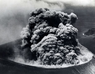 A Vulcanian ash plume rises from the Bárcena crater on 9 September 1952, more than a month after the start of the eruption. The roughly 300-m-wide crater is seen here from the east. Explosions producing eruption columns that rose to about 600 m above sea level were observed at 20-minute intervals, along with occasional small pyroclastic surges that swept down the flanks of the cone and sometimes reached the coast. The roar of the eruption was heard above the noise of the plane's engine.
Photo by U.S. Navy, 1952 (courtesy of Sherman Neuschel, U.S. Geological Survey).
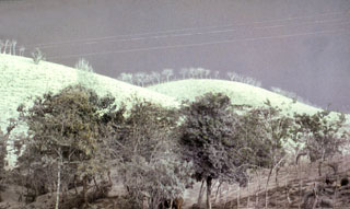 Ashfall deposits whitened the landscape around El Chichón like snow and stripped many trees of their leaves, such as seen here near Villahermosa to the north. Ashfall deposits trending to the ENE blanketed an area of 45,000 km2 within the 1 mm isopach. Ash plumes reached 17 km or higher on 28-29 March and 3-4 April 1982. The exceptionally high sulfur content of the magma produced an eruptive plume rich in sulfuric acid aerosols, which circled the globe in three weeks and led to warming of the stratosphere and cooling of the troposphere.
 Photo by Servando De la Cruz-Reyna, 1982 (Universidad Nacional Autónoma de México).
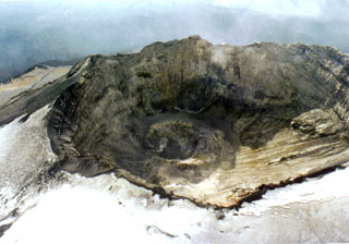 This aerial view shows the Popocatépetl summit crater in 1996, following the 1994-95 eruptive period. Subsequent activity has been both effusive and explosive, with periodic extrusion and explosive removal of lava domes emplaced on the crater floor. This aerial view is roughly from the north, with the summit out of view to the right.
Photo by Hugo Delgado-Granados, 1996 (Universidad Nacional Autónoma de México).
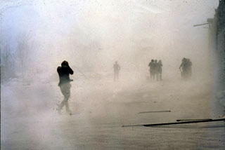 Soldiers search the town of El Naranjo, 7.5 km south of the crater, a few days after the end of the eruption amidst remobilized ash. Approximately 2,000 people were killed, among them were one geologist and 32 soldiers sent to the village of Francisco León, ~ 6 km SW of the summit, after the 28-29 March explosion. The pyroclastic flow that traveled through Francisco León left only a thin deposit, but the only remaining structure in the village was remnants of the church.
Photo by Servando De la Cruz-Reyna, 1982 (Universidad Nacional Autónoma de México).
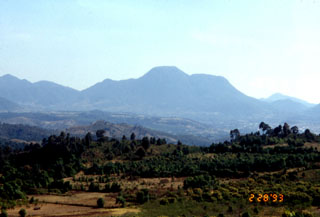 This view from the north shows the Cerro el Cacique lava dome, part of the extensive Zitácuaro-Valle de Bravo volcanic field in the central Mexican Volcanic Belt. The dome rises over the city of Heroica de Zitácuaro, which is built on top of a deposit originating from collapse of the Cerro Pelón lava dome (visible to the left of the Cacique dome). Andesite lava flows to the south in the Valle de Bravo area are as young as about 5,000 years.
Photo by Lucia Capra, 1993 (courtesy of José Macías, Universidad Nacional Autónoma de México).
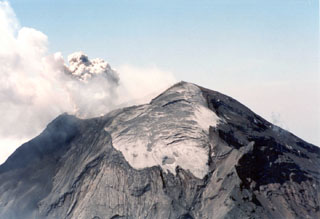 The north side of Popocatépetl with the Ventorrillo glacier near the summit is shown here during an explosion on 26 April 1996. To the lower right is the El Ventorrillo peak at around 5,000 m elevation.
Photo by Hugo Delgado-Granados, 1996 (Universidad Nacional Autónoma de México).
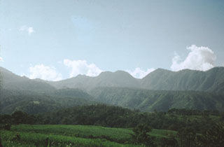 Volcán San Juan, the NW-most major volcano of the Mexican Volcanic Belt, displays an irregular profile west of the city of Tepic. The northern wall of a 1 x 4 km wide, oval-shaped caldera that was created about 15,000 years ago forms the right-hand horizon. The rounded notched peak on the center horizon is an intracaldera lava dome that was constructed shortly thereafter. The flanks of Cerro Alto stratovolcano, the 2240 m high point of the San Juan volcanic complex, can be seen at the extreme left.
Photo by Jim Luhr, 1976 (Smithsonian Institution).
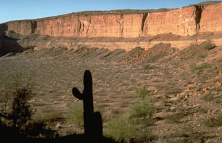 The Cerro Colorado maar, in the Pinacate volcanic field 24 km NE of Pinacate Peak, contains a 1-km-wide crater formed by explosions on a nearly flat surface. Distribution of ejecta by prevailing winds produced a hill on the side of the crater opposite this steep, 110-m-high crater wall. The ejecta include fragments of underlying granitic and metamorphic rocks.
Photo by Richard Waitt, 1988 (U.S. Geological Survey).
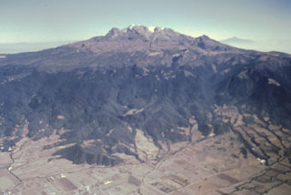 Iztaccíhuatl rises more than 2.5 km from the floor of the Valley of Mexico to form one of Mexico’s highest volcanoes. The profile of a sleeping woman in the legend of Popocatépetl and Iztaccíhuatl can be seen in this view from the west. The massive 450 km3 volcano is a composite of overlapping edifices along a N-S-trending line.
Photo by José Macías, 1995 (Universidad Nacional Autónoma de México).
 A gas plume rises above a growing lava dome below the crater rim of Colima in May 1958. The dome, which had been at a level 50 m below the deep notch in the northern crater rim (right) for several decades, had begun growing in May 1957 and eventually filled the crater. In 1961 lava began overflowing the crater through this notch. The photo was taken from the NE, with the NE-flank El Volcancito lava dome to the far left.
Photo by José Suarez Joramillo, 1958 (courtesy of Julian Flores, University of Guadalajara).
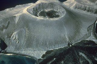 An aerial view from the SE shows the Bárcena tuff cone, constructed during an eruption in the Revillagigedo Islands off the western coast of México during 1952-53. The 700-m-wide crater is partially filled by lava, and the lava delta at the lower right was fed from a vent on the flank. The tuff cone was constructed to a height of about 330 m from near sea level within the first few weeks of an eruption that began on 1 August. Lava was seen in the crater by mid-September and flank lava extrusion began on 8 December.
Photo by Adrian Richards, 1955 (U.S. Navy Electronics Laboratory).
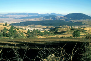 The broad forested ridge in the center of this photo is the Tenango lava flow, which was erupted about 8,500 radiocarbon years ago from an E-W-trending fissure at the western margin of the Chichinautzin volcanic field. It forms a prominent isolated mesa on which the fortified city of Teotenango with its many pyramids and courts was built by the Matlatzinca people about 1000 BCE.
Photo by Lee Siebert, 2004 (Smithsonian Institution).
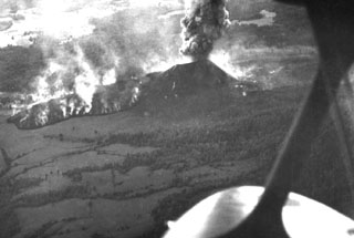 An aerial view from the NNW on 5 March 1943, about two weeks after the start of the Parícutin eruption, shows the Quitzocho lava flow advancing to the NE as an ash plume rises from the scoria cone. The flow was about 6-15 m thick as it advanced.
 Photo by Ezequiel Ordonez, 1943 (U.S. National Archives).
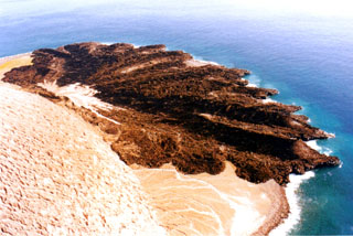 Wave erosion rapidly modified the once smooth coastal margin of the lava delta that erupted in 1952-53. The vent that produced the flow is to the left at the base of the light-colored tuff cone that also formed during the eruption. The Delta Lávico flow extended 700 m out to sea and formed a peninsula about 1.2 km wide.
Photo by Hugo Delgado-Granados, 1993 (Universidad Nacional Autónoma de México).
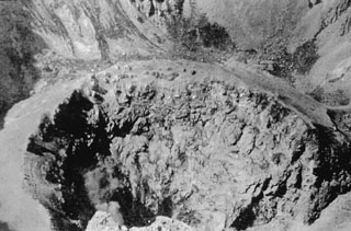 This view shows the Popocatépetl summit crater floor towards the end of its 1919-1928 period of activity. The crater floor is occupied by a smaller crater about 150 m in diameter. After 1925, the activity of the volcano decreased dramatically and ended by 1927.
Photo by Dr. Atl (courtesy of José Macías, Universidad Nacional Autónoma de México).
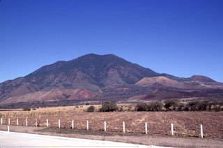 Multiple scoria cones have formed across the flanks of Sangangüey. The light-colored cone below the skyline and to the right is cone C4, and the darker cone on the lower right horizon is D8. These two cones are part of the youngest group of cones and may be only 1,000 years old. A lava flow from the C4 crater traveled down the south flank of Sangangüey between the two older cones of B3 and B4, in the foreground.
Photo by Lee Siebert, 1997 (Smithsonian Institution).
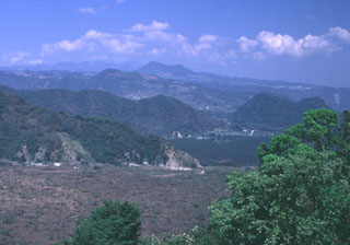 The Naolinco Volcanic Field consists of a broad area of scattered Quaternary cones and associated lava flows north of the city of Jalapa, the capital city of the state of Veracruz. Cerro Acatlán in the distance is the largest cone, and is located NE of the town of Naolinco de Victoria. This and other nearby cones have fed lava flows that traveled to the S and SE. The barren area in the foreground is part of the Río Naolinco lava flow, which erupted from vents on the NE flank of Cofre de Perote volcano.
Photo by Lee Siebert, 1999 (Smithsonian Institution).
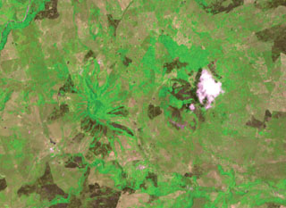 Radial drainages outlining two pyroclastic cones capping the Los Atlixcos shield volcano are visible immediately left (west) of the weather cloud and 2 km farther west at the left center. The two cones, both known as Cerro los Atlixcos, were constructed along an E-W line and rise 200-300 m above a connecting saddle. The 800-m-high western cone is 100 m higher than the eastern cone; both cones are breached to the east. Lava flows from Los Atlixcos reached the Gulf of Mexico along a broad front.
ASTER satellite image, 2002 (National Aeronautical and Space Administration, processed by Doug Edmonds).
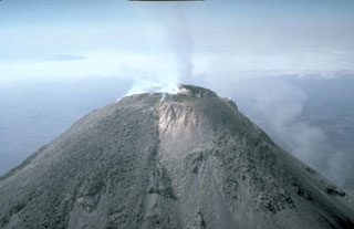 An aerial view from the east shows a weak plume from the 1991 summit dome and the geothermal area directly east of the dome in the 1987 vent. The lighter deposits in center of the photo are hydrothermally altered, forming a highly unstable area similar to those that collapsed to the south on 16 April.
 Photo by Claus Siebe, 1991 (Universidad Nacional Autónoma de México).
 The Jorullo cone eruption began in 1759 in the Michoacán-Guanajuato Volcanic Field. In this view from the NW the unvegetated area visible on the center-horizon is the final lobe that flowed north. Volcán del Norte, one of Jorullo's four flank cones visible on the left horizon, produced a lava flow towards the west during the middle stages of the 1759-74 eruption.
Photo by Jim Luhr, 1996 (Smithsonian Institution).
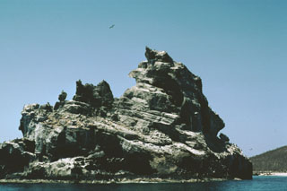 Wave erosion of a tuff cone off the western coast of Isla Isabel has produced the jagged profile of the 100-m-wide southernmost sea stack in the Islotes Las Monas. The three guano-covered cone remnants forming the Islotes Las Monas lie within about 200 m of the eastern coast of Isla Isabel, which can be seen to the right.
Photo by Jim Luhr, 1999 (Smithsonian Institution).
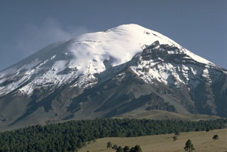 The snow-capped peak of México's Popocatépetl stratovolcano rises above the Tlamacas region to its north. A faint plume rises from a deep summit crater. The sharp peak below the horizon at the right is Ventorrillo, the summit of the eroded Nexpayantla volcano that was a predecessor to Popocatépetl. Its steep cliffs expose the stratified, layered interior of a stratovolcano.
Photo by William Melson, 1968 (Smithsonian Institution)
 A SE-trending chain of scoria cones extends beyond the flank of Sangangüey volcano into the Tepic basin. Cerro el Molcajete, the flat-topped cone to the right, shares the name of Volcán el Molcajete on the NW flank of Sangangüey. This NW-SE-trending alignment of Pleistocene basalt and mugearite scoria cones is seen here from the south across farmlands near the village of El Limón.
Photo by Jim Luhr, 1999 (Smithsonian Institution).
 Devastating pyroclastic flows and surges from the March-April 1982 eruptions of El Chichón turned large areas surrounding the crater into a landscape devoid of vegetation. The pyroclastic flows and surges travelled radially away from the volcano to distances of about 6 km, covering an area of about 153 km2. This January 1983 aerial photo shows the effect of extensive erosion of these deposits during the previous rainy season.
Photo by Bill Rose, 1983 (Michigan Technological University).
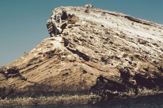 A sea-cliff exposure at the southern end of Islota Pelón, located off the NW coast of Isla Isabel, shows a dramatic angular uncomformity between two generations of dipping tuff beds. The large volcanic bomb perched on the rim at the top lies on dipping layers in the interior of the tuff cone. Wave erosion has left only the arcuate western rim of Islota Pelón, whose vent lies out of view to the right.
Photo by Jim Luhr, 1999 (Smithsonian Institution).
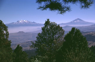 The volcanoes bordering the Valley of Mexico appear in Aztec legend. Popocatépetl (right) is said to hold a funeral torch for Iztaccíhuatl (left), the sleeping "Woman in White." The hills in the foreground (seen from the summit of Xitle scoria cone) are part of the broad Chichinautzin volcanic field south of Mexico City. Chichinautzin means "Burning Lord," a possible reference to eruptive activity.
Photo by Lee Siebert, 1997 (Smithsonian Institution).
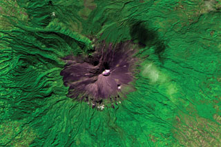 Volcán Popocatépetl is seen in this ASTER satellite image taken in 2001 (N is at the top; this image is approximately 22 km across).. A dilute plume from the summit crater casts a shadow on the upper right flank. The edifice contains the Ventorrillo peak NW of the crater, a remnant of an earlier edifice, and the headwall of the deep Nexpayantla valley down the NW flank. At least three previous major cones were destroyed by gravitational failure during the Pleistocene, producing massive debris avalanche deposits that cover broad areas to the south.
ASTER satellite image, 2001 (National Aeronautical and Space Administration, processed by Doug Edmonds).
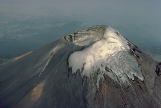 The summit of Popocatépetl volcano, seen here from the north, is cut by a 400 x 600 m wide, steep-walled crater that is elongated in a NE-SW direction. The crater floor is 500 m below the volcano's summit on the NW rim, which is 170 m above the SE rim. Historical eruptions of Popocatépetl have originated from this crater and have periodically formed smaller subcraters, pyroclastic cones, or lava domes on its floor.
Copyrighted photo by Katia and Maurice Krafft, 1978.
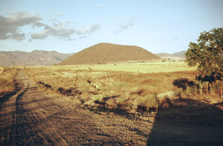 Volcán Telcampana, seen here from the SW, is one of a cluster of late-Pleistocene scoria cones that formed within the southern Colima graben, at the NW base of Nevado de Colima volcano. Pyroclastic surge deposits were emplaced when the cone erupted through a former lake or marsh and are exposed in roadcuts on the west side of the volcano.
Photo by Jim Luhr, 1980 (Smithsonian Institution).
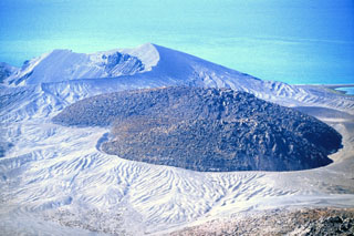 An obsidian lava dome fills the crater in the center of Isla San Luis, off the NE coast of Baja California, seen in this photo that was taken in 2000. As growth of the dome continued, a thick coulee advanced to the south and overflowed the rim to form the broad lobe behind it. The eroded Plaza de Toros tuff ring in the left background forms the SE tip of the island.
Photo by Keith Sutter, 2000.
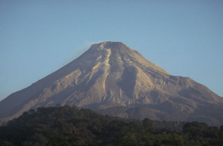 A lava flow travels down the upper flank of Colima in this 20 January 1982 view from the south. The dark-colored flow can be seen descending from the dome down the center. A period of lava dome growth with intermittent small explosions and block-and-ash flows had begun in December 1977. Renewed lava extrusion had begun on 9 December 1980.
Photo by Jim Luhr, 1982 (Smithsonian Institution).
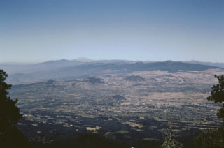 A wide-angle view of the Chichinautzin volcanic field from the flanks of Popocatépetl shows some of the abundant pyroclastic cones and low shield volcanoes that form the mostly monogenetic field. The massive Chichinautzin volcanic field covers more than 1,000 km2 and stretches 90 km in an E-W direction from the eastern base of Nevado de Toluca volcano (the light-colored peak on the far horizon) to the western flanks of Popocatépetl and Iztaccíhuatl.
Photo by José Macías, 1998 (Universidad Nacional Autónoma de México).
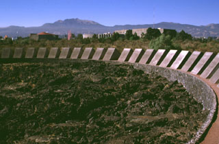 Vegetation has been cleared from the surface of a massive lava flow from Xitle volcano to form a park on the campus of the National University of México (UNAM). Pahoehoe textures of the roughly 1,600-year-old basaltic lava flow are exposed in the park. The tube-fed flow traveled 13 km from Xitle, a small scoria cone whose summit forms the flat area on the horizon to the left of Volcán Ajusco, the large lava dome complex on the horizon.
Photo by Lee Siebert, 1998 (Smithsonian Institution).
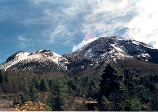 The two rounded peaks to the left, 700 m below and 1 km NE of the summit of Colima, are the El Volcancito lava-dome complex, with dome growth commencing on 12 June 1869 after large explosive eruptions. Deformation had been visible with the naked eye since 19 March. During the eruption 0.21 km3 of lava filled the NE part of the caldera, and lava flows from Volcancito flowed to the ESE and ENE over the caldera rim.
Photo by Guillermo Castellano, 1990 (courtesy of Jim Luhr, Smithsonian Institution).
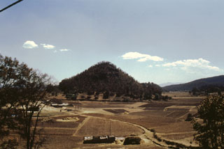 This conical hill is among many hummocks found at the NE base of Jocotitlán volcano and represents part of the edifice that collapsed in a massive volcanic debris avalanche about 9,700 years ago. The hummocks contain abundant large blocks (1-10 m in diameter) and larger mega-blocks (10-20 m in diameter). The largest are up to 200 m high and occur within 3-5 km of the volcano along with large parallel transverse ridges up to 2.7 km long. The size and height decrease towards the margins of the deposit.
Photo by José Macías, 1997 (Universidad Nacional Autónoma de México).
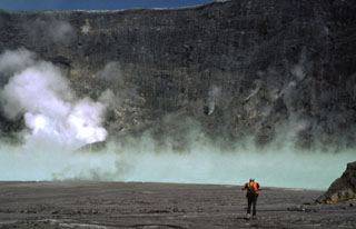 A volcanologist traverses the floor of the El Chichón crater toward the steaming, turquoise crater lake in January 1983, during the first visit to the crater following the major March-April 1982 explosive eruption. The new lake had grown to a depth of about 120 m by November 1982, after which lake level dropped slightly. In January 1983 the lake was hot (52-58°C) and acidic (pH of 0.5). By October 1983 the temperature had dropped to 42°C and the pH was 1.8.
 Photo by Bill Rose, 1983 (Michigan Technological University).
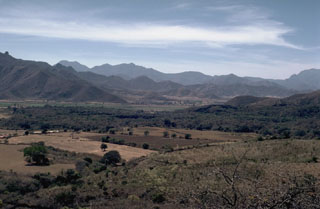 The forested lava flow extending across the valley floor in the center of the photo is from Volcán Malpais in the Mascota Volcanic Field, and may be only a few thousand years old. The flow is seen here looking west across the graben floor from Volcán Molcajete.
 Photo by Jim Luhr, 1985 (Smithsonian Institution).
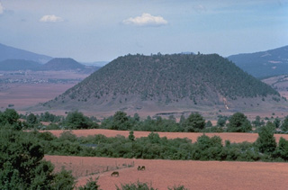 The flat-topped Hoya el Huanillo cinder cone, located about 35 km NE of Parícutin, erupted during the early Holocene about 9300 years ago. It is seen here from the NW with the town of Cherán in the left distance near the Cerro Cucundicata cinder cone. In contrast to many other Michoacán cinder cones, only a small ash-covered lava flow was emitted from Hoya el Huanillo.
Copyrighted photo by Katia and Maurice Krafft, 1981.
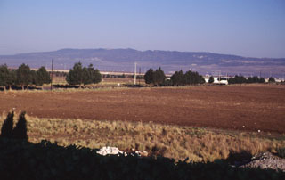 The broad ridge in the distance to the NW is Los Humeros, the easternmost of a series of large silicic volcanic centers with active geothermal systems located north of the axis of the Mexican Volcanic Belt. Eruption of the Xáltipan Ignimbrite about 460,000 years ago resulted in formation of the 15 x 21 km Los Humeros caldera. Recent eruptions at Los Humeros produced extensive basaltic lava flows; hot springs and fumarolic activity continue at Los Humeros, which has a producing geothermal field.
Photo by Lee Siebert, 2000 (Smithsonian Institution).
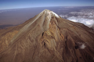 México's highest volcano, Pico de Orizaba, is seen here in an aerial view from the SE. The modern Citlaltépetl cone, marking the upper part of the volcano, was constructed within horseshoe-shaped scarps formed by previous edifice collapse events. The orange-brown ridges at the middle left and center are remnants of the oldest edifice, Torrecillas. The lighter-colored area between these two ridges is a thick, historical, lava flow that was erupted from the modern cone.
Photo by Gerardo Carrasco-Núñez, 1997 (Universidad Nacional Autónoma de México).
 The Laguna Alchichicha maar is filled by the largest lake in the Serdán-Oriental basin. The rim of the basaltic to basaltic-andesitic maar varies in height and is highest on the western side. The western crater wall exposes a scoria cone that was partially destroyed by the maar-forming eruption. White tufa deposits line the shore of the lake.
Photo by Lee Siebert, 1997 (Smithsonian Institution).
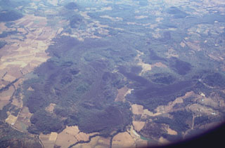 Lava flows in the western part of the Michoacán-Guanajuato volcanic field are seen here from the north. Cerro el Astillero, a scoria cone near the middle right-hand margin of the photo, was the source of the unvegetated lava flow that extends to the east and then south. Cerro el Pedegral, a cone near the lower left, produced lava flows to the west and south toward the upper part of the photo. This lava field is located near the town of Tancítaro and is among the many Holocene flows in the Michoacán-Guanajuato field.
Photo by Lee Siebert, 1997 (Smithsonian Institution).
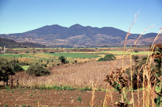 The irregular ridge on the horizon is the SE rim of the compound 5-km-wide Tepetiltic caldera. The NE caldera was offset from the center of the stratovolcano and its rim is lower to the NE (right). The flanks of the andesitic-dacitic stratovolcano are blanketed by deposits of rhyodacitic ash and pumice from the caldera-forming eruptions. Cinder cones on the NW and SE flanks of the volcano erupted alkalic lava flows.
 Photo by Lee Siebert, 1997 (Smithsonian Institution).
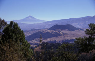 Volcán Popocatépetl rises to the SE beyond the Sierra Chichinautzin, as seen from the summit of Xitle volcano, one of the youngest cones of the Chichinautzin volcanic field. The scoria cone near the center is Volcán Yololica. More than 150 small cones formed across the Chichinautzin range; many of these are of Holocene age.
 Photo by Lee Siebert, 1998 (Smithsonian Institution).
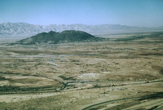 Cerro Prieto is a compound rhyodacite lava dome and is the only volcanic feature of the major Cerro Prieto geothermal field. It is the northernmost volcanic field in México and rises above the arid floor of the Imperial valley at the head of the Gulf of California, 35 km south of the city of Mexicali. The dome was constructed along a NE-trending fracture and a 200-m-wide crater is located at the summit of the NE-most dome.
Photo by Marshall Reed, 1959 (U.S. Department of Energy).
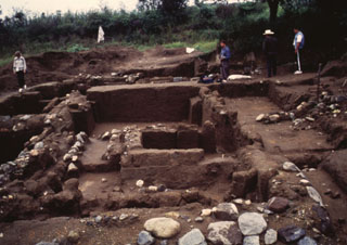 An archaeological excavation on the northern flank of Popocatépetl reveals a village destroyed by a major eruption. The site, known as Tetimpa, was buried by roughly 1 m of tephra around 2,500 years ago. The eruption is known as the Lower Ceramic Plinian Eruption, in reference to the archaeological materials. This small village was constructed on top of an older pyroclastic flow deposit formed during another Plinian eruption about 5,000 years ago.
Photo by José Macías, 1995 (Universidad Nacional Autónoma de México).
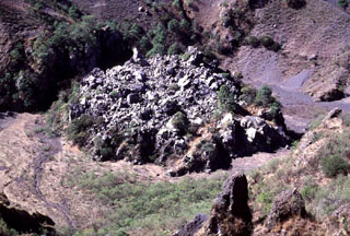 A small lava dome was extruded in the main vent of the 1870-75 eruption of Ceboruco volcano in western México. Fumaroles (not visible in this photo) with temperatures measured at about 100°C were located around the base of the dome when the photo was taken in 1997.
 Photo by Lee Siebert, 1997 (Smithsonian Institution).
 The Cerro Prieto lava dome is seen here beyond an evaporation pond of the Cerro Prieto geothermal field at the head of the Gulf of California, 35 km south of the city of Mexicali. The first geothermal power plants began operation at Cerro Prieto in 1973; nine power plants and about 130 wells were in operation in 1997.
Photo by Pat Dobson, 1998 (Lawrence Berkeley National Laboratory).
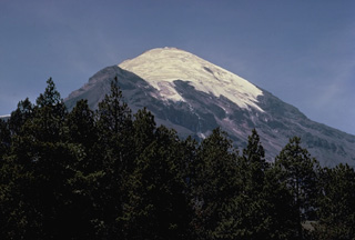 Pico de Orizaba (Volcán Citlaltépetl) rises to 5675 m at the southern end of volcanic chain the extends north to Cofre de Perote volcano. Orizaba is seen here from its NW flank with the snow-free peak of Sarcofago halfway down the left skyline. Periodic major explosions during the Holocene from North America's highest volcano were separated by long quiescent periods. Eruptions during the past 5000 years have primarily produced dacitic lava flows. Historical activity has consisted of minor ash eruptions and the extrusion of viscous lava flows.
Copyrighted photo by Katia and Maurice Krafft, 1978.
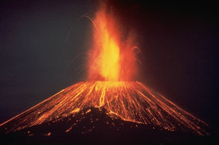 This nighttime time-exposure of México's Parícutin volcano in 1948 shows a Strombolian eruption ejecting incandescent blocks that then rolled down the slopes of the cone. Parícutin is known as the volcano that erupted in a cornfield in 1943. It grew to a height of more than 150 m within the first week of its appearance and remained active until 1952.
Photo by Carl Fries, 1948 (U.S. Geological Survey).
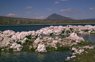 The Laguna Alchichicha maar is the largest of the Serdán-Oriental volcanic field, located just off Highway 140 between Puebla and Jalapa. The low rim of the maar increases in height to the west. The pyroclastic surge deposits contain juvenile fragments of scoriaceous basaltic or basaltic-andesite material. Tufa deposits such as those in the foreground are located along the shore of the lake. Cerro Pizarro in the distance is the northernmost lava dome of the Serdán-Oriental field.
Photo by Lee Siebert, 1997 (Smithsonian Institution).
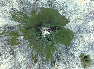 Farmlands surround La Malinche volcano NE of the city of Puebla in this 1999 Landsat satellite image (N is at the top; this image is approximately 30 km across). Deep erosional gullies have formed down the flanks, and the 1.5-km-diameter late-Pleistocene Xalapasco maar complex is on the lower ENE Flank about 11 km from the summit.
 NASA Landsat satellite image, 1999 (courtesy of Loren Siebert, University of Akron).
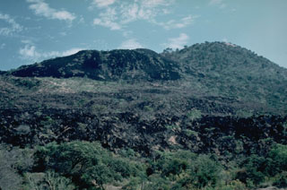 The most recent lava flows of the 1759-74 Jorullo eruption appear in the left and foreground of this view from the north with the sparsely vegetated cone of Jorullo to the upper right. Unlike earlier lava flows that were covered with ashfall from explosive eruptions, this latest does not and remains relatively unvegetated in this 1982 photo. Lava flows were erupted from NE-SW-trending flank vents and covered an area of 9 km2.
Photo by Jim Luhr, 1982 (Smithsonian Institution).
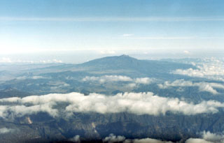 The broad Cofre de Perote massif in the distance is seen in an aerial view from the west. As with other volcanoes of the Orizaba-Cofre chain, it was constructed over the eastern margin of the Mexican altiplano, so that the volcano asymmetrically extends farther toward the lower-elevation coastal plain. It rises 1,700 m above the Serdán-Oriental basin on the west and 3,000 m above the city of Jalapa (Xalapa) to the east.
Photo by Lucio Cardenas, 1996 (CENAPRED, courtesy of Hugo Delgado, Universidad Nacional Autónoma de México).
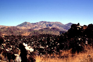 The unvegetated Ceboruco lava flow in the foreground appears to be some of the youngest of the W-flank flows. The peaks on either side of the broad summit in this view from the WSW are the rims of the 4-km-wide outer caldera.
Photo by Lee Siebert, 1997 (Smithsonian Institution).
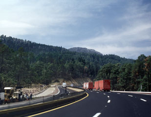 The Mexico City-Puebla highway skirts the northern margin of a voluminous lava flow from Papayo volcano, a lava dome whose rounded summit appears above the horizon to the SW above the trucks to the right. The dome produced massive lava flows that cover an area of 84 km2, with a volume of about 21 km3. The flows display transverse arcuate pressure ridges, and lateral levees.
Photo by Lee Siebert, 1999 (Smithsonian Institution).
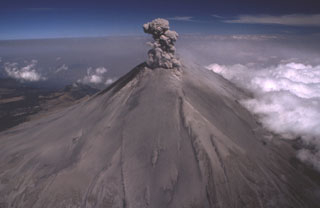 Ash from previous explosions covers the slopes of Popocatépetl on 21 February 1995, as another ash plume rises above the summit crater in this aerial view from the south. Repeated small-to-moderate eruptions had begun on 21 December 1994. The renewal of eruptive activity after a quiescence of about a half century prompted the initial temporary evacuation of 50,000 people living in towns east of the volcano.
Photo by Hugo Delgado-Granados, 1995 (Universidad Nacional Autónoma de México).
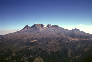 Iztaccíhuatl along with Popocatépetl are the subjects of legends with their morphologies reflecting their characters. The profile of a sleeping woman can be seen here from the west above the Valley of Mexico. A series of overlapping cones constructed along a NNW-SSE trend forms the summit ridge. From left to right they are La Cabeza (the head), El Pecho, Las Rodillas, and Los Pies (the feet). The volcano is mostly Pleistocene in age, but minor Holocene activity has occurred.
Photo by Gerardo Carrasco-Núñez (Universidad Nacional Autónoma de México).
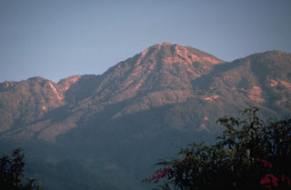 Tacaná lies about 30 km south of the Polochic‐Motagua fault, in the zone which marks the Caribbean and North American plate boundary. The summit, seen here from the SSE, is elongated as a result of the extrusion of a series of lava domes with the youngest center, San Antonio, being at the SW (left). In the center is the Tacaná itself, with Chichuj to the right.
Photo by Norm Banks, 1987 (U.S. Geological Survey).
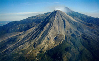 An aerial view of Colima's SW flank on 11 March 1999 shows recently erupted lava flows with lateral levees. Nevado de Colima appears to the right of the Volcán de Colima summit. Intermittent ash eruptions beginning in 1997 were followed by lava effusion, dome growth, pyroclastic flows, and more powerful explosive eruptions a year later.
Photo by Juan Carlos Gavilanes, 1999 (Colima Volcano Observatory, University of Colima).
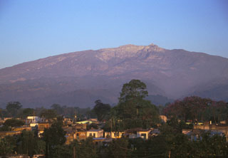 Large compound horseshoe-shaped scarps, formed in part by edifice collapse, are visible near the summit of the eastern side of Cofre de Perote volcano. The massive size of the edifice can be appreciated in this photo taken from the city of Coatepec, which lies 21 km ESE and 3,000 m below the summit.
Photo by Lee Siebert, 1999 (Smithsonian Institution).
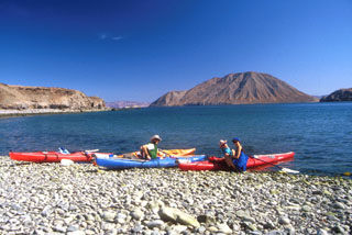 Volcán Coronado (back right) rises behind a group of kayakers across the Canal de los Ballenas in this 1994 photo. The small cone is about 2 km wide with a 300 x 160 m crater at the northern end of Coronado Island, 3 km off the eastern coast of Baja California.
Photo by Brian Hausback, 1994 (California State University, Sacramento).
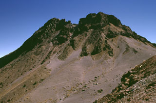 The post-caldera cone of Nevado de Colima forms the high point of the Colima volcanic complex and is the highest peak in western México. The cone, formed of steeply dipping lava flows, was constructed within the youngest of three large scarps that date back to about 500,000 years and has since been extensively glaciated. The scarps open towards the east and formed in part as a result of large flank failures. The youngest is about 5 km in diameter and has a well-preserved western wall, from which this photo was taken.
Photo by Lee Siebert, 1998 (Smithsonian Institution).
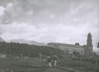 On 7 July 1944 a lava flow (left) approaches the church of San Juan Parangaricutiro. Residents had already evacuated the town when lava first entered the town on 17 June. By the time the flow stopped in early August the church was entirely surrounded by lava.
Photo by William Foshag, 1943 (Smithsonian Institution, published in Luhr and Simkin, 1993).
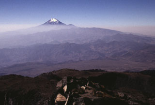 The N-S-trending Cofre de Perote-Pico de Orizaba volcanic chain is perpendicular to the trend of the Mexican Volcanic Belt. This view looking southward from the Cofre de Perote summit towards glacier-capped Pico de Orizaba in the background shows two lesser known volcanic complexes in between. The La Gloria volcanic field, also known as the Desconocido-Tecomales volcanic field, forms the eroded area in the center of the photo, and Las Cumbres volcano is the broad range that extends from in front of Orizaba to the right-center horizon.
Photo by Lee Siebert, 1998 (Smithsonian Institution).
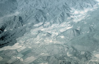 Part of the Mascota Volcanic Field in the Jalisco tectonic block east of Puerto Vallarta appears in this aerial view from the south. The scoria cone in the center is Volcán Molcajete, which along with the smaller Volcán Novillero to its left. The forested lava flow at the left side of the valley originated from Volcán Malpais. It is located at the valley margin above and left of Volcán Novillero.
Photo by Steven Nelson, 1996 (Tulane University).
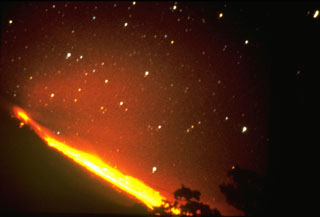 Incandescent blocks dislodging from a slow-moving lava flow create an incandescent path below stars in this 24 April 1961 night-time long exposure of Colima. Following lava dome growth in the summit crater, a lava flow began traveling down the northern flank in 1961 and reached the caldera moat by the end of 1962.
Photo by José Suarez Jaramillo, 1961 (courtesy of Julian Flores, University of Guadalajara).
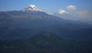 This photo looks south from Telapón volcano and shows the rounded Papayo lava dome in the foreground, with snow-capped Iztaccíhuatl (left) and Popocatépetl (right) in the background. These volcanoes, along with Telapón, and Tláloc stratovolcanoes, form a N-S-trending chain east of Mexico City and transverse to the Mexican Volcanic Belt trend.
Photo by Anita Cadoux, 2007 (Instituto de Geofísica, UNAM, Mexico).
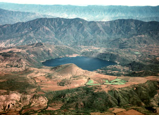 The scenic lake-filled Santa María del Oro maar was erupted through older Miocene rhyolitic tuffs of the Sierra Madre Occidental. The lake is seen here from the NW, with the large ridge behind it forming the axis of a large fold affecting the Miocene ashflow tuff deposits. The southern rim of the maar is reached by a road from the town of Santa María del Oro (right center). The peaks on the northern rim of the roughly 3-km-wide maar rise about 400 m above the Laguna Santa María crater lake.
 Photo by Jim Luhr, 1979 (Smithsonian Institution).
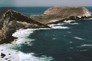 The flat-topped Cerro El Faro cone (upper right) lies across a low isthmus at the southernmost tip of Isla Isabel. It is seen here across the Acantilado Mayor Bay from Cerro del Mirador, the high point of the small 1.5-km-long island. Wave erosion has eroded the flank of Monte Transverso to the left. The two cones are connected by a lava flow.
Photo by Jim Luhr, 1999 (Smithsonian Institution).
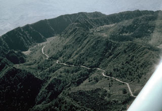 The walls of two nested summit calderas are seen here in an aerial view of Ceboruco from the NE, with the road to the summit. The formation of the 3.7-km-wide outer caldera was associated with eruption of the 5 km3 Jala Pumice and the Marquesado pyroclastic flow about 1,000 years ago. The Jala Pumice covers broad areas to the north and east.
Photo by Jim Luhr, 1980 (Smithsonian Institution).
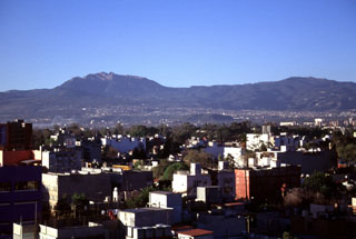 Ajusco volcano rises above Mexico City to the south. The Chichinautzin volcanic field covers a broad, 1,000 km2 area with more than 150 small cones of mostly Holocene age. One of the youngest eruptions occurred from the Xitle cone about 1,670 years ago, producing a massive 3.2 km3 lava flow that covered prehistorical urban centers and agricultural land. It is now overlain by the southern part of Mexico City.
Photo by Lee Siebert, 1997 (Smithsonian Institution).
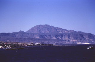 The early Pleistocene La Reforma caldera lies NW of the town of Santa Rosita (left) on the Gulf of California. The roughly 10-km-wide caldera contains a central dome (center horizon) made of resurgent basement rocks. Ignimbrite outflow sheets form flat surfaces and scarps. The age of the caldera was determined by the K-Ar method to be between 1.6 and 1.4 Ma. The eruption of andesitic and dacitic ring-fracture lava domes followed. Andesitic lava flows were erupted on the flanks of the caldera both before and after caldera formation.
Photo by José Macías, 1995 (Universidad Nacional Autónoma de México).
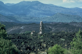 The tower of the unfinished San Juan Parangaricutiro church rises above the lava flows that surrounded it in 1944. The Taquí lava flow began on 8 January 1944 from the SW base of Parícutin. Renewed lava extrusion on 24 April threatened the town of San Juan Parangaricutiro and impacted it 17 June. The church was surrounded by lava in July. By the time the flow ceased in early August it had a length of 10 km.
Photo by James Allan, 1985 (Smithsonian Institution).
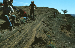 A group of geologists observe bedded pyroclastic surge deposits from the Cerro Colorado maar. Thinly bedded surge units are typical of distal portions of pyroclastic surge deposits, caused by deposition of material from the basal part of the flow.
Photo by Bill Rose, 1978 (Michigan Technological University).
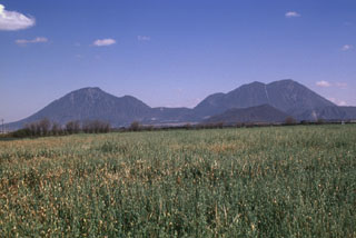 The most prominent features of the Serdán-Oriental volcanic field are the two Las Derrumbadas lava domes. The NW (left) and SE (right) domes are of similar height and lithology and rise about 1 km above their bases. The Serdán-Oriental is a broad closed basin at the eastern end of the Mexican altiplano containing lava domes, tuff rings, lava flows, and scoria cones of late-Pleistocene to Holocene age. Several of the tuff rings, such as Laguna Atexcac and Laguna Alchichica, contain crater lakes.
Photo by Lee Siebert, 1997 (Smithsonian Institution).
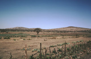 The rim of La Joya Honda maar is viewed here from the south, with the northern maar wall on the left and a cone on the SE flank on the right. The maar, whose name is sometimes spelled La Hoya Honda, is 850 x 1100 m wide and was erupted through Cretaceous limestones about 1.1 million years ago. The maar contrasts with several other Mexican maars in having a thick sequence of wet-surge deposits with primary dips up to 30 degrees.
Photo by Jim Luhr, 1983 (Smithsonian Institution).
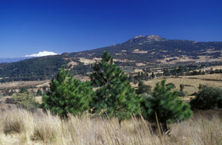 The Cuautzin lava dome (right horizon) north of the crest of the Sierra Chichinautzin, with cnow-capped Iztaccihuatl volcano on the left horizon. It formed between about 7,360 and 8,225 radiocarbon years ago, producing lava flows and block-and-ash flow deposits around the dome. Cuautzin means "Seat of the Eagle" in the Nahuatl language.
 Photo by Lee Siebert, 2004 (Smithsonian Institution).
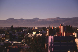 Young scoria cones of the Chichinautzin volcanic field appear on the skyline above Mexico City. Many of the more than 150 small cones within the volcanic field are of Holocene age. At least two of the cones erupted less than 2,000 years ago, producing lava flows that impacted inhabited areas.
Photo by Lee Siebert, 1997 (Smithsonian Institution).
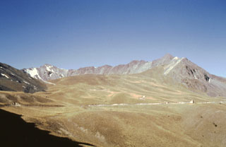 The far western crater rim of Nevado de Toluca volcano is seen here on the horizon from the NE. The road into the crater is across the center of the photo below the low, smoother northern crater rim. The smooth surface of the northern flank consists of a lava flow that was modified by extensive Pleistocene-Holocene glacial erosion.
 Photo by José Macías, 1997 (Universidad Nacional Autónoma de México).
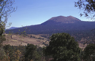 Volcán Pelado is a small shield volcano in the eastern part of the Chichinautzin field with a cone at the summit. Formation of the volcano, between about 10,500 and 9,260 years ago, was accompanied by pyroclastic flows that entrained pottery fragments from nearby settlements. Volcán Pelado lies 10 km south of Xitle, another scoria cone of the Chichinautzin volcanic field that erupted less than 2,000 years ago.
Photo by Lee Siebert, 1998 (Smithsonian Institution).
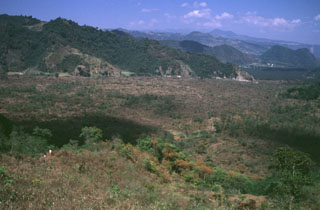 The people in the left foreground are standing on the Toxtlacuaya lava flow, which traveled in a narrow lobe down into the valley filled by the flat-lying Río Naolinco lava flow. Both flows were produced about 900 years ago during a geochemically bimodal eruption which initially produced the alkaline Toxtlacuaya lava flow and then the voluminous calc-alkaline Río Naolinco flow. Although the flows erupted through the lower flanks of Cofre de Perote volcano, they are geochemically distinct from Cofre de Perote lavas.
Photo by Lee Siebert, 1999 (Smithsonian Institution).
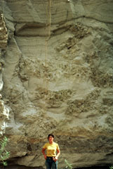 The giant pumice beds at Primavera volcano represent an unusual sedimentation event following formation of La Primavera caldera. Individual pumice blocks from 0.3 to more than 6 m across are enclosed within fine-grained volcanic ash-rich lake sediments. The giant pumice blocks originated by eruption of rhyolitic lava into a caldera lake. The pumice fractured into large blocks that floated to the surface, rafted across the lake, and settled to the bottom after becoming waterlogged. Subsequent deposition of fine-grained lake sediments buried the pumice blocks.
Photo by Jim Luhr, 1979 (Smithsonian Institution).
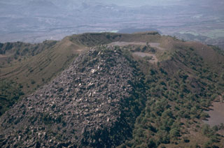 A small lava flow, possibly produced during or before the 1870-75 eruption of Ceboruco, descended eastward from the rim of a crater within the inner caldera. This flow traveled 500 m to the east. The small crater to the right of the flow formed in the NE side of the larger crater. These are part of a complex group of features within the nested summit calderas.
Photo by Jim Luhr, 1980 (Smithsonian Institution).
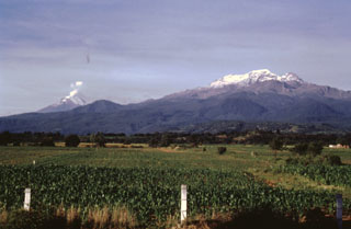 Iztaccíhuatl (right) and Popocatépetl (left) rise above farmlands at the eastern margin of the Puebla basin within Izta-Popocatépetl National Park. Andesite and dacite lava flows erupted from vents along the N-S-trending summit ridge of Iztaccíhuatl extend all the way to the base of the volcano. A small plume rises from the summit of Popocatépetl in this 1996 photo.
Photo by José Macías, 1996 (Universidad Nacional Autónoma de México).
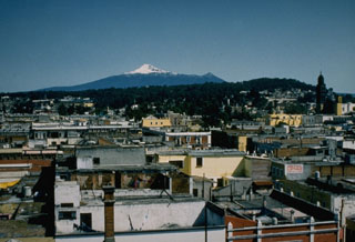 The summit of Malinche volcano rises beyond the historical city of Puebla. Pleistocene glaciers have eroded the flanks of the volcano, but at least one of several tuff cones and explosion craters on the flanks is of Holocene age.
Photo by Ismael Morales, 1993 (Universidad Autónoma de Puebla).
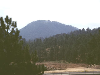 The Cerro Papayo dacite lava dome is located 2.5 km S of the pass in the northern Sierra Nevada between Mexico City and Puebla. The 1-km-wide dome rises 230 m above surrounding lava flows and produced voluminous lava flows that traveled about 10 km ENE toward the Puebla basin and 10 km WSW into the Valley of Mexico.
Photo by Lee Siebert, 1999 (Smithsonian Institution).
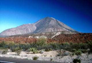 Las Tres Vírgenes is viewed here from the SSE along State Highway 1. The steep-sided Pinto dacite coulée dome is the notable feature on the SW flank (left). Directly in the center, on the S flank, are the Virgen dacite lava domes. The lava flows across the bottom of the photo are part of the Miocene Esperanza Basalt.
Photo by Brian Hausback, 1990 (California State University, Sacramento).
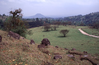 The slope in the foreground is the surface of the Xico debris avalanche deposit, which formed at the end of the Pleistocene during the youngest of several edifice collapse events at Cofre de Perote volcano. The highly mobile avalanche traveled into the Río Pescado drainage and covers an area of at least area ∼73 km2.
Photo by Lee Siebert, 2000 (Smithsonian Institution).
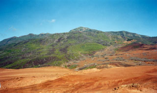 The summit cone and lava dome complex of Cerro Evermann is viewed here from the SE flank. Obsidian lava domes and flows of rhyolite and trachyte composition have filled most of the summit craters. Cerro Evermann formed within the 4.5 x 3.8-km-wide, 370,000 year old Pleistocene caldera. The caldera rim is exposed at about 600 m elevation on the south and east sides of Cerro Evermann, where it forms a 20-50 m high scarp.
Photo by Martha Marin, 1998 (Mexican Navy).
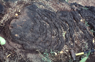 The wrinkled surface of a pahoehoe lava flow of Los Flores volcanic field is exposed near the town of Nuevo Morelos. The basaltic lava flow, seen here about 35 km from its source at Cerro Partido, traveled about 80 km to the SSE down a narrow valley in the Sierra Madre Oriental. The geologic hammer at the lower right provides scale.
Photo by Jim Luhr, 2000 (Smithsonian Institution).
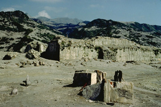 Francisco León was one of 9 villages destroyed by the 1982 eruptions of southern México's El Chichón volcano, seen steaming in the distance in this January 1983 photo. Powerful laterally moving pyroclastic surges knocked down all walls of buildings in the village, leaving only the basal portion of the massive walls of the village church (center), oriented parallel to their flow. The village of Francisco León was located 5.5 km SW of the volcano, just within the circular area swept by pyroclastic flows and surges on April 3, the 4th day of the 1982 eruption.
 Copyrighted photo by Katia and Maurice Krafft, 1983.
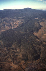 Volcán Tláloc, the broad volcano on the horizon, is one of the larger volcanic centers of the eastern part of the Chichinautzin volcanic field. It erupted about 6,200 years ago and is seen here from the east with a large lava flow in the foreground.
 Photo by Hugo Delgado, 1994 (Universidad Nacional Autónoma de México).
 El Azufre volcano (center) is the central peak of the Tres Vírgenes volcanic complex. Its summit lies about 4 km N of the highest peak of the complex, La Vírgen (left). The small peak immediately to the right of El Azufre is El Viejo, the oldest edifice of the complex. El Viejo was constructed SW of the Pleistocene El Aguajito caldera, partly visible on the far-right horizon. Both El Viejo and El Azufre are composed of lava domes and flows.
Photo by Marjorie Summers, 1987 (Smithsonian Institution).
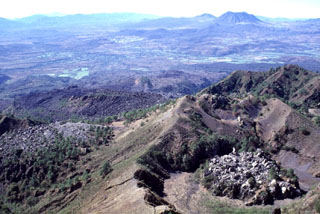 The view of the 1870 vent and the San Pedro-Ceboruco graben is from the Ceboruco summit. The small lava dome to the lower right and the unvegetated lava flow to the lower left were emplaced during the 1870-75 eruption. The Cerro San Pedro lava dome on the horizon directly above the 1870 dome was constructed within the 7 x 10 km San Pedro caldera. The peak immediately left of Cerro San Pedro is Cerro Tetillas.
Photo by Lee Siebert, 1997 (Smithsonian Institution).
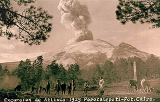 A postcard photograph labeled "Excurcion de Atlixco - 1925" shows an ash plume rising above the summit crater of Popocatépetl as seen by visitors east of Paso de Cortés on the north side of the volcano. The peak on the right horizon is El Ventorrillo, part of a previous edifice.
Courtesy of Enrique Chavira (INAOE; from Elia Rascón Cano family archive).
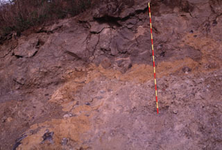 Textures associated with volcanic landslides are preserved in this quarry wall more than 100 km from the source of this major avalanche from México's Colima volcano. Large fractured blocks appear at the top of the exposure, and a color mottling is produced by adjacent segments of the volcano or valley floor material incorporated during transport. A 2-m-high ruler provides scale.
Photo by Lee Siebert, 1997 (Smithsonian Institution).
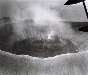 An overflight on 15 November 1952 shows the Bárcena crater half-filled with viscous lava. Sporadic small explosions were observed during the overflight, and continuous weak steam emission took place from the center of the dome. Montículo Cinerítico in the background and to the left is an eroded cone at the southern tip of the island that formed before the 1952 eruption.
Photo by U.S. Navy, 1952 (courtesy of Sherman Neuschel, U.S. Geological Survey).
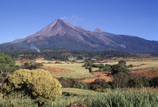 Colima (left), with a diffuse gas plume drifting from its summit, and Nevado de Colima (right) form a pair of edifices comprising the Colima volcanic complex. The modern Colima cone was constructed during the past 2,600 years within a large horseshoe-shaped flank collapse scarp that opens towards the south. The modern edifice has overtopped the eastern caldera rim (roughly corresponding to the vegetation line), and unvegetated lava flows that were emplaced during 1975-76 are visible down the outer flanks.
Photo by Lee Siebert, 1997 (Smithsonian Institution).
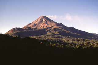 Two lava domes, known as Los Hijos del Volcán, form the two hills on the southern flank just below the left horizon of Colima. They are the southernmost of the Colima volcanic complex vents, which have erupted further towards the south through time. The 1981-1982 lava flow forms the lobe descending diagonally from the summit to the left.
Photo by Lee Siebert, 1997 (Smithsonian Institution).
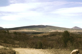 The low-angle La Laja shield volcano lies at the southern end of the Plio-Pleistocene Northern Atenguillo volcanic field in the Jalisco tectonic block of western México. La Laja was dated at about 660,000 years. Initial phreatomagmatic eruptions at La Laja produced pyroclastic-surge and airfall deposits. These were followed by the extrusion of a thick sequence of lava flows that built the symmetrical shield volcano. The flows blocked the Río Atenguillo, forming an ephemeral 20-km-long lake.
Photo by Paul Wallace, 1998 (University of California Berkeley).
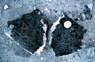 A basaltic clast with a light-colored silicic rim from the Hoya Estrada maar. The coin provides scale.
Photo by Jim Luhr, 2002 (Smithsonian Institution).
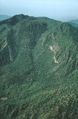 Following the eruption of the Tepic Pumice and the formation of an elongated caldera at the summit of San Juan volcano, a lava dome was constructed within the caldera. The dome forms the rounded forested area in front of the western caldera rim, which marks the horizon. The caldera is 4 km wide in the E-W direction of this photo and 1 km wide in a N-S direction. Andesitic lava flows (left center) erupted from the dome and flowed across the caldera floor to its eastern side.
Photo by Jim Luhr, 1979 (Smithsonian Institution).
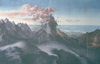 A large eruption of San Martín Tuxtla volcano took place in 1793. This drawing shows Strombolian explosions ejecting ash and incandescent bombs from a cone within the summit crater, with the Gulf of Mexico in the background. The eruption began on 2 March and lasted until December. Periodic strong eruptions occurred from two scoria cones that grew within the 1-km-wide summit crater. Lava flowed through a notch in the rim of the summit crater for 3.5 km down the northern flank.
Drawing from Archivo General de la Nación (México), courtesy of Larry Feldman.
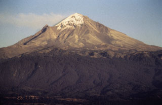 The western flank of Popocatépetl is seen here in November 1994, a little more than a month prior to its eruption on 21 December 1994. A faint gas plume is dispersing to the NE by predominant winds. The peak halfway down the left flank is Ventorrillo, a remnant of an older volcanic center preceding the construction of the modern edifice.
Photo by José Macías, 1994 (Universidad Nacional Autónoma de México).
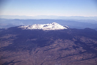 Nevado de Toluca is seen here from the NW. It is a broad, complex stratovolcano with a 1.5-km-wide summit crater that opens to the east. A lava dome in this crater separates two lakes, known as the lakes of the Sun and Moon, which can be reached by the road seen ascending diagonally across the snow-covered slopes.
Photo by Lee Siebert, 1997 (Smithsonian Institution).
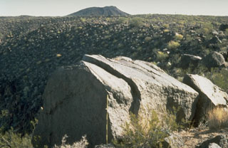 A large ejected block lies on the rim of Trebol maar in the NW part of the Pinacate volcanic field, immediately SE of Macdougal maar. The scale in front of the block has dark- and light-colored bars that mark 10 cm increments. The block fractured into three large segments following impact.
Photo by Richard Waitt, 1988 (U.S. Geological Survey).
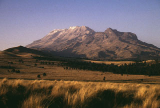 The broad Iztaccíhuatl massif rises north of Paso de Cortes, the saddle between Iztaccíhuatl and Popocatépetl volcanoes. The summit of Iztaccíhuatl is at the left, NNW of the apparent high point Las Rodillas (center). The sharp peak at the right is Los Pies (also known as Amacuilecatl), the southernmost major peak of the volcano.
Photo by Lee Siebert, 1998 (Smithsonian Institution).
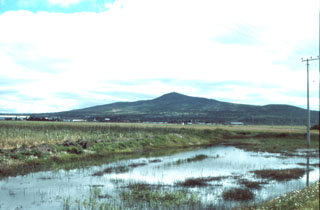 Santa Ana shield volcano of the Apan-Tezontepec volcanic field seen from the NW. The volcano is of Pleistocene age and has an elevation of 3020 m. The city at the volcano's foot is Sahagún. The Apan-Tezontepec volcanic field in the NE part of the Valley of Mexico covers portions of the states of Hildalgo, Tlaxcala, and México and contains about 300 eruptive centers. The vast majority of these are scoria cones, but shield volcanoes, lava flows, and lava domes are also present.
Photo by Armando García, 1998 (courtesy of José Macías, Universidad Nacional Autónoma de México).
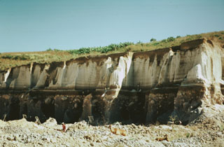 The locally widespread Tepic Pumice is exposed in this quarry on the NW outskirts of the city of Tepic. The zoned rhyodacitic-andesitic pumice, forming the upper half of this exposure, was erupted about 15,000 years ago and resulted in the formation of a 4-km-wide caldera at the summit of San Juan volcano. The 5.6 cu km Tepic Pumice deposit underlies the city of Tepic, the captial city of Narayit state, to thickness of 2-9 m.
 Photo by Jim Luhr, 1976 (Smithsonian Institution).
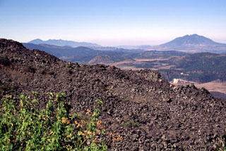 The El Norte lava flows of Ceboruco in the foreground cover much of the northern flank. These young flows erupted from vents within the inner summit caldera and may have been emplaced during one of two 16th-century eruptions. The lava flows traveled 3.5 km down the north flank and formed a broad, 3.5-km-wide front at the base of the volcano. The volcano with the irregular profile in the left distance is Tepetiltic; Sangangüey forms the peak to the far right.
Photo by Lee Siebert, 1997 (Smithsonian Institution).
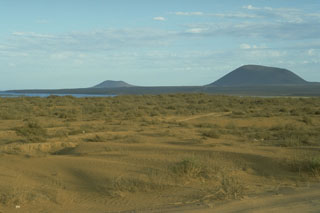 Volcán Ceniza (left) and Cerro Kenton (right), seen here from near Chapala, are two of a group of young scoria cones in the southern part of the San Quintín Volcanic Field in northern Baja California. Along with the Riveroll cone to the NW, they are constructed along a NW-SE trend, one of several fracture patterns in the San Quintín field. The two cones form a peninsula extending into Bahia Falsa, part of which is visible to the left.
Photo by Jim Luhr, 1990 (Smithsonian Institution).
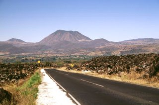 The flat-topped rhyolitic Los Ocotes lava dome (center) was erupted on the southern flank of Tepetiltic volcano about 100,000 years ago and is the youngest product of that complex. Extrusion of the dome blocked drainages to form Laguna San Pedro, out of view to the left. The rim of Tepetiltic caldera forms the right horizon. Los Ocotes is seen here from the SE along Highway 15 where it crosses the blocky andesitic El Ceboruco lava flow in the foreground, which traveled 8 km from Ceboruco volcano.
Photo by Lee Siebert, 1997 (Smithsonian Institution).
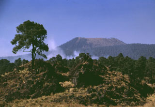 The cone of Volcán Pelado is located SE of Ajusco volcano. The eruption of the cone, seen here from the SE, produced pyroclastic flows that traveled to the north, east, and south. Lava flows that erupted from E-W-trending fissures cover an area of about 63 km2. Pottery shards have been found within the deposits, indicating that the eruption affected neighboring settlements.
Photo by Lee Siebert, 1998 (Smithsonian Institution).
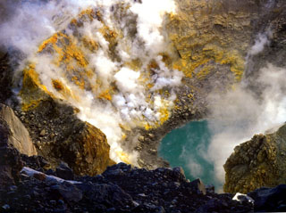 Gas and steam emit from fumaroles on the sulfur-encrusted crater wall of Popocatépetl seen here in 1993, prior to the eruptive activity that began in December 1994. The east floor of the crater contained a smaller circular crater about 200 m in diameter and 50 m deep. A small lake about 40 m in diameter and 10 m deep, which varied in size seasonally, contained warm water (29°C) in 1986. By February 1994 the lake temperature had risen to 65°C.
Photo by Hugo Delgado-Granados, 1993 (Universidad Nacional Autónoma de México).
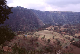 The rounded ridge in the foreground is the tephra-mantled surface of a lava flow erupted from the base of the Rincón de Chapultepec scoria cone about 3,000 years ago. This 50-m-thick lobe was extruded for a distance of 2 km to the south on top of an earlier olivine-basaltic lava flow that filled the valley floor and traveled 6 km from the vent.
Photo by Lee Siebert, 2000 (Smithsonian Institution).
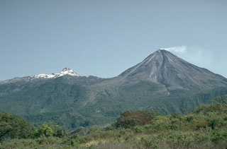 A weak plume from the summit of Mexico's Colima volcano in 1992 with snow-capped Nevado de Colima to the left; view from the WSW. Frequent eruptions have been recorded at Colima since the 16th century. Eruptions have been dominated during the past century by lava effusion associated with lava dome growth, explosive eruptions of varying magnitude, and frequent pyroclastic flows.
Photo by Jim Luhr, 1992 (Smithsonian Institution).
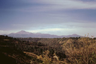 Nevado de Toluca is seen here from the south with its highest peak El Fraile to the left. The volcano is also known by its Nahuatl name, Xinantécatl. The morphology is due in part to explosive eruptions, large slope failures, and glacial erosion. Nevado de Toluca lies 80 km WSW of Mexico City.
Photo by José Macías, 1995 (Universidad Nacional Autónoma de México).
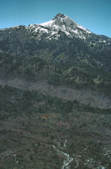 The summit of Nevado de Colima is seen here from the top of El Volcancito, a lava dome on the NE flank. A lava flow from Volcancito descended to the lower right. A light-colored east-dipping lava flow is exposed in the scarp wall, and the rim is seen diagonally across the center of the photo.
 Photo by Jim Luhr, 1978 (Smithsonian Institution).
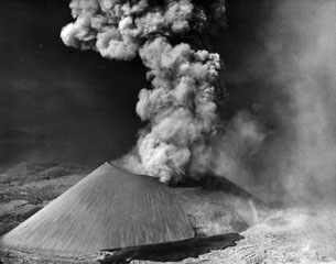 In mid-November 1944 lava broke out of the SSW base of the cone, below the south vent in the crater, seen here from the S. The Ahuán flow advanced over the earlier Taquí flows in the foreground. A small lava intrusion was exposed in the flank of the cone a short distance above the vent. Ahuán flows traveled around the east side of the cone and to the north.
Photo by Frank Zierer, 1944 (published in Foshag and González-Reyna, 1956).
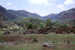 The Puebla Vieja cone along the horizon to the left is one of the westernmost cones of the Naolinco Volcanic Field. The forested hill in the center of the photo is the distal portion of a lava flow that traveled to the SE down the valley floor. In the foreground are exposures of the Coacoatzintla lava flow from the Rincón de Chapultepec cone.
Photo by Lee Siebert, 2000 (Smithsonian Institution).
 The irregular reddish area in the center of this false-color LANDSAT image is the Tenango lava flow. It was erupted about 8500 years ago from an E-W-trending fracture that also passes through Nevado de Toluca volcano, whose flanks appear at the left. The basaltic-andesite Tenango flow forms a prominent isolated mesa on which the fortified city of Teotenango with its many pyramids and courts was built by the Matlatzinca people about 1000 BCE. The Tenango flow lies at the far western end of the Chichinautzin volcanic field of central México.
 NASA Landsat image by Michael Abrams, 1996 (courtesy of José Macías, Universidad Nacional Autónoma de México).
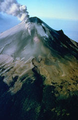 A plume rises above the eastern side of the summit crater of Popocatépetl in December 1994. Ash deposits from previous eruptions darken the glaciers on the upper flank. This aerial view from the NE shows the El Ventorillo peak on the right-hand horizon, the remnant of an older edifice.
Photo courtesy CENAPRED, Mexico City, 1994.
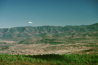 This photo looks east from Las Tortugas volcanic center towards the town of Atenguillo. Low hills just behind and sightly to the left of Atenguillo are eroded trachybasaltic lava flows of Pliocene age. The ridge in the background exposes late Cretaceous ashflow tuffs that make up the Atenguillo graben walls.
Photo by Paul Wallace, 1998 (University of California Berkeley).
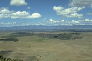 The Durango Volcanic Field covers 2,100 km2 at the eastern edge of the Sierra Madre Occidental (background) of north-central México. The broad lava plain contains about 100 Quaternary scoria cones and several important peridotite and granulite xenolith localities. The La Breña-El Jagüey maar complex, two of the youngest features of the field, are seen here from the ENE at the summit of Cerro Pelón scoria cone.
 Photo by Jim Luhr, 1988 (Smithsonian Institution).
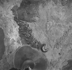 A vertical aerial photo of Parícutin taken on 26 May 1945 shows the cone at the bottom with the partially buried horseshoe-shaped Sapichu vent on its NE flank. Lava flows, forming the lighter-colored areas in the photo, surround the Quitzocho Ridge in the center of the photo and the older Cerro de Jarátiro scoria cone at the top. Ultimately nearly the entire Quitzocho Ridge was buried by lava flows.
 Aerial photo by Comisión de Estudios del Territorio Nacional (CETENAL), 1:25,000, 1945.
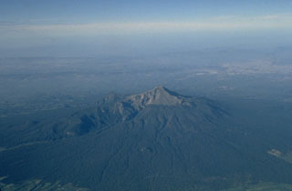 Volcán la Malinche, seen here in an aerial view from the NE, is an eroded edifice with deep canyons from glacial erosion, located NE of the city of Puebla and between the Popocatépetl-Iztaccíhuatl and Orizaba-Cofre de Perote volcanic ranges. Much of the edifice was constructed during the Pleistocene but there are Holocene tephra layers of Holocene age.
Photo by Steve Nelson, 1987 (Tulane University).
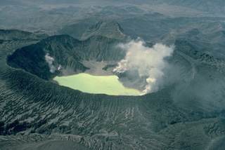 El Chichón is a small, but powerful andesitic stratovolcano that occupies an isolated location in the Chiapas region far from other Holocene volcanoes. Prior to 1982, this relatively unknown volcano was a heavily forested lava dome cluster of no greater height than adjacent non-volcanic peaks. This 1983 photo from the NE shows the effects of powerful eruptions in 1982, the first major eruptions at El Chichón in 500 years. The explosions removed the summit lava dome and created a new 1-km-wide crater now containing an acidic lake.
Copyrighted photo by Katia and Maurice Krafft, 1983.
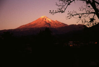 Pico de Orizaba volcano is seen here at sunrise above the town of Calcahualco. The volcano is named for the city of Orizaba below its SE flank, but is also known by the Aztec name of Citlaltépetl (Star Mountain). The volcano has a rich cultural history. Its lower slopes host Aztec villages, pyramids, and temples, and it is depicted in Aztec hieroglyphics.
Photo by Lee Siebert, 1998 (Smithsonian Institution).
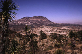 The Cerro Pinto lava dome is seen here from the rim of Laguna San Luis Atexcac maar, just south of Highway 140. The dome grew within a cone with a crater about 2 km wide. The crater overlaps with that of the Cerro Xalapasco cone to the north.
Photo by Lee Siebert, 1998 (Smithsonian Institution).
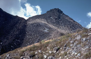 The peak to the upper right is El Volcancito, a lava dome on the NE flank of Colima that began extruding on 12 June 1869 following large explosive eruptions. The dark-colored lava flow with the steep margins to the left erupted from the summit dome during 1975-76. The flow descended the NE flank towards the saddle and then split into two lobes on either side of Volcancito and traveled N and SE.
Photo by Jim Luhr, 1987 (Smithsonian Institution).
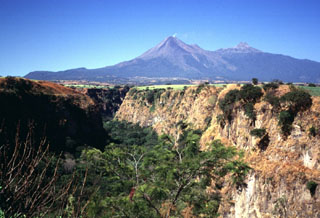 Repeated flank failure events from both Volcán Colima (left) and Nevado de Colima (right) have lefta thick apron of debris avalanche deposits on three sides of the complex. This steep-sided, 120-m-deep canyon wall at La Platanera, SE of Colima, exposes deposits inferred to represent at least seven major debris avalanches. The vegetation line on Colima volcano marks the largely buried rim of a horseshoe-shaped collapse scarp that has been the source of one or more recent avalanches.
Photo by Lee Siebert, 1997 (Smithsonian Institution).
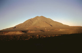 This view shows the SSW flank of Tres Vírgenes in Baja California. Much of the volcano consists of lava domes and viscous lava flows. The hills on the flanks are rhyodacite lava flows associated with a Plinian eruption. The aligned flat-topped terraces on the plain are underlain by basaltic andesitic lava flows of Tertiary age.
 Photo by José Macías, 1995 (Universidad Nacional Autónoma de México).
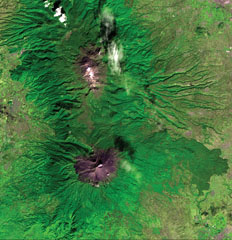 The N-S-trending Popocatépetl-Iztaccíhuatl volcanic chain lies between the Valley of Mexico and the Puebla basin. Snow-capped Iztaccíhuatl volcano lies just above the center of the image. The city of Texmelucan can be seen at the upper right. Across the Paso de Cortés from Iztaccíhuatl is steaming Popocatépetl volcano, located SE of the city of Amecameca (mid-left margin). A voluminous prehistorical lava field from Popocatépetl forms the forested lobe extending about 20 km down the eastern flank at the lower right.
ASTER satellite image, 2001 (National Aeronautical and Space Administration, processed by Doug Edmonds).
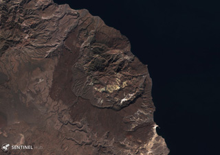 The early Pleistocene La Reforma caldera is in the center of this 16 November 2019 Sentinel-2 satellite image (N is at the top) along the Gulf of California. The caldera is about 9 km wide, with andesitic outer flanks and a resurgent dome in the center.
Satellite image courtesy of Copernicus Sentinel Data, 2019.
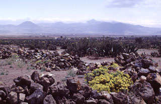 The western side of La Gloria volcanic complex rises above the Serdán Oriental basin. This complex forms a sparsely populated volcanic highland between Cofre de Perote and Las Cumbres volcanoes. Numerous cones are scattered throughout the complex on both sides of two major east-facing escarpments.
Photo by Lee Siebert, 2000 (Smithsonian Institution).
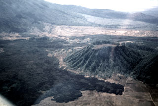 The dark Coapan andesite lava flow surrounds the Molcajete Grande cone (right center) on the NW flank of Ceboruco, whose slopes are visible to the upper left. The light-colored area across the upper part of the photo beyond the forested Coapan flow is the rhyodacite Destiladero lava flow.
 Photo by Jim Luhr, 1979 (Smithsonian Institution).
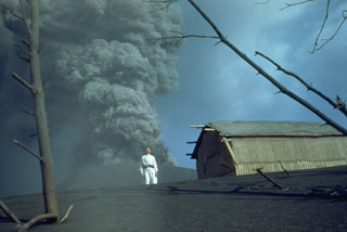 An ash plume at Parícutin in 1944 is photographed from the first observatory cabin 1.5 km north, with local resident Celedonio Gutierrez in the foreground. Gutierrez was born in the nearby town of San Juan Parangaricutiro, which was inundated by lava flows, and became actively involved in collaborations with U.S. scientists throughout the eruption.
Photo by Ken Segerstrom, 1944 (U.S. Geological Survey, published in Luhr and Simkin, 1993).
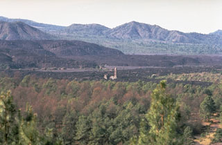 The steeple of the church of San Juan Parangaricutiro rises above surrounding lava fields in the center of the photo, seen here from the NE. The still-unfinished church was inundated by lava in July 1944, a month after flows began advancing into the town. The unvegetated, steeper-sided lava flows in the background were erupted later during 1944-46.
Photo by Jim Luhr, 1982 (Smithsonian Institution).
 An 1834 painting shows the Popocatépetl crater with several areas of fumarolic activity on the crater floor. Reports of eruptive activity during the 1827-1834 period are uncertain. The painting looks to the east across the Puebla basin with the snow-capped Orizaba peak on the right horizon.
Painting by Daniel Thomas Eggerton (Collection of the National Bank of Mexico; courtesy José Macías, UNAM).
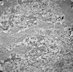 Quaternary lava flows of varying ages cover the entire 4-km-wide field of view in this aerial photo of an area NW of Jalapa. Several lobes of the sparsely vegetated Toxtlacuaya lava flow extend across the center of the photo. The northernmost lobe joins with the darker-colored Río Naolinco lava flow at the upper right. Both of these flows were erupted about 900 years ago from El Volcancillo, a vent on the NE flank of Cofre de Perote. The Toxtlacuaya flow overlies older flows from the Central Cone Complex and still older flows at the bottom from Cerro La Joya.
Aerial photo by Comisión de Estudios del Territorio Nacional (CETENAL), 1:25,000.
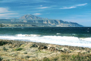 Post-caldera resurgent blocks of the early Pleistocene La Reforma caldera rise to the north above the Gulf of California. The roughly 10-km-wide caldera contains a 1300-m-high central dome (left-center horizon) made of resurgent basement rocks. Ignimbrite outflow sheets form flat surfaces and scarps, and uplifted marine terraces are prominent along the coast.
 Photo by Brian Hausback, 1994 (California State University, Sacramento).
 A cluster of cinder cones of the Camargo volcanic field lies within the arid northern Bolsón de Mapimí graben in north-central México, about 150 km SW of Big Bend National Park in Texas. More than 300 volcanic vents, mostly cinder cones and lava cones, are located in a broad 2500 km2 lava plateau that extends 60 km E-W and 70 km N-S. The Camargo field is mostly Pliocene in age, but activity continued into the Pleistocene.
Photo by Jim Luhr, 1996 (Smithsonian Institution).
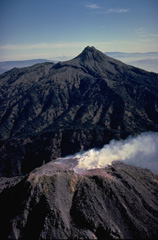 A steam plume pours off the summit of Colima volcano in June 1978, with sharp-peaked Nevado de Colima in the background to the north. During an eruptive period from December 1977 to June 1982, growth of the summit lava dome was accompanied by periodic small exposions and block-and-ash flows. A lava flow was extruded down the south flank beginning in December 1981.
Copyrighted photo by Katia and Maurice Krafft, 1978.
 The 200-m-high Cerro la Pitahaya pyroclastic cone is seen from the SSE near the town of Francisco Madera. It is one of many cinder cones of the Aldama volcanic field along the coastal plain near the Gulf of Mexico.
Photo by Jim Luhr, 2000 (Smithsonian Institution).
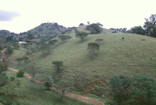 These large hills on the outskirts of the city of Huatusco, 35 km from Orizaba, are hummocks of the Jamapa debris avalanche and debris flow deposit, which covers 350 km2. The avalanche occurred during the late Pleistocene by collapse of the northern side of Torrecillas volcano, a predecessor to Orizaba, and created a 3.5-km-wide horseshoe-shaped scarp. The rapidly moving avalanche was able to ride up and over a ridge into drainages that do not originate from Orizaba.
Photo by Lee Siebert, 1997 (Smithsonian Institution).
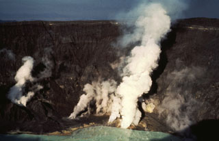 Gas-and-steam plumes emit from fumaroles on the crater floor of El Chichón volcano in January 1983. Gas and steam also rise from the hot, acidic crater lake in the foreground. Fumarole temperatures in the lower crater walls and floor ranged from 98 to 115°C.
Photo by Bill Rose, 1983 (Michigan Technological University).
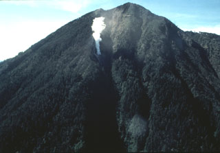 An aerial view of the NE flank of Tacaná volcano on 25 June 1986 shows a steam plume rising above a new vent. Minor phreatic eruptions, the first since 1949, took place in February, May, and June 1986. Following a seismic swarm beginning the previous day, a moderate phreatic explosion around noon on 8 May created a new 10-m-wide vent and ejected a small amount of fine ash. Vegetation was damaged over an area of 200 x 100 m.
Photo by Bill Rose, 1986 (Michigan Technological University).
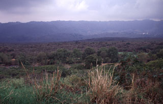 The Río Naolinco lava flow, which fills the entire valley floor in the foreground, is the most voluminous of two chemically distinct lava flows erupted from El Volcancillo on the south flank of Cofre de Perote volcano about 900 years ago. The Río Naolinco flow traveled 50 km and has an estimated volume of about 1.3 km3. This view looks south across the flow near its widest point about 25 km from the vent.
Photo by Lee Siebert, 2000 (Smithsonian Institution).
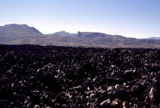 Highway 15 cuts across the lava flow that extends 7 km down the SW flank of Ceboruco. Maps show that this flow, referred to as El Ceboruco, existed prior to the 1870 eruption. Pliocene ignimbrites form the hills in the background.
Photo by Lee Siebert, 1997 (Smithsonian Institution).
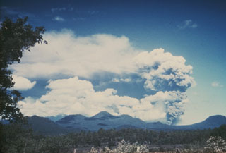 This photo shows an ash plume rising above Parícutin on 9 June 1943, seen here from the Uruapan highway to the east. Prevailing winds distribute the ash plume to the south. Other scoria cones appear on the horizon, some of the 1,000-plus scoria cones within the massive Michoacán-Guanajuato volcanic field.
Photo by William Foshag, 1943 (Smithsonian Institution).
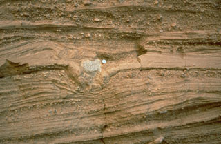 Pyroclastic surge deposits surround the Cerro Colorado maar of the Pinacate volcanic field in NW México. These thin beds (note the coin for scale) were formed by successive explosions that produced pyroclastic surges. The light-colored rock in the center of the photo is a ballistic block that impacted the surface of earlier surge deposits, compressing them and forming a small pit called a bomb sag.
Photo by Richard Waitt, 1988 (U.S. Geological Survey).
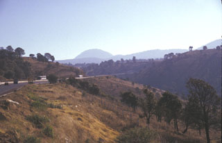 Papayo dome is seen in the center of this photo, a dacite lava dome along the crest of the Sierra Nevada 15 km north of Iztaccíhuatl volcano. The dome, seen here from the west, was the source of a voluminous postglacial lava flow that traveled 9.5 km to the WSW and more than 10 km to ENE. The Mexico City-Puebla highway (left) follows the northern margin of the lava flow, which covers an area of 84 km2.
Photo by Lee Siebert, 1997 (Smithsonian Institution).
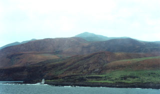 The northern, western, and southern flanks of Socorro are dominated by silicic lava domes and flows, which cover about 80% of the surface of the island. This view shows Cerro Evermann from the SW coast. Trachyte and rhyolite lava flows from summit and flank vents extend into the sea and have produced an irregular shoreline, with the distal portions of lava flows forming numerous small peninsulas.
Photo by Martha Marin, 1998 (Mexican Navy).
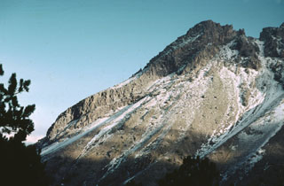 This 1978 photo shows an andesite lava flow several hundred meters long formed the northern summit ridge of Nevado de Colima, which was constructed within the youngest of three overlapping collapse scarps. This post-caldera cone has been extensively glaciated.
Photo by Jim Luhr, 1978 (Smithsonian Institution).
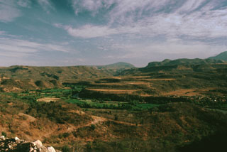 The terraced Río Ameca valley cuts through flat-lying basaltic lava plateaus of the Northern Atenguillo volcanic field of Pliocene-to-early Pleistocene age. The northernmost of these basaltic plateaus, El Rosario, has been dated at about 640,000 years.
 Photo by Paul Wallace, 1998 (University of California Berkeley).
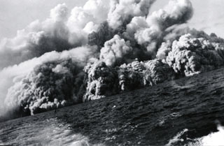 Pyroclastic surges at about 0805 on 1 August 1952 travel across the sea at the western coast of the island, 20 minutes after the start of the eruption. Several inches of ash and lapilli up to 12 mm in diameter fell on the deck of the fishing boat from which this photo was taken as it sailed away from the volcano at full speed.
Photo by Robert Petrie, 1952 (U.S. Navy; courtesy of Sherman Neuschel, U.S. Geological Survey).
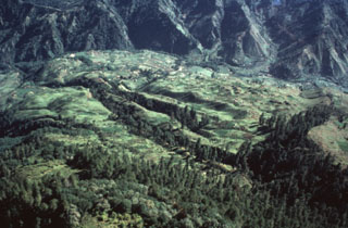 An aerial view of the Río Las Majadas valley in Guatemala on the NNE side of Tacaná volcano shows thick deposits of lahars and debris avalanches filling the valley. These deposits provide a flat surface for agricultural use in deeply eroded terrain. The valley drains from its headwaters in Guatemala through México into the Pacific Ocean, and lahars during future eruptions could affect both countries.
Photo by Bill Rose, 1986 (Michigan Technological University).
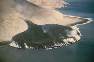 A steaming lava flow issuing from a fissure on the SE flank of Bárcena volcano, in the Revillagigedo Islands west of México, forms a peninsula about 300 m wide that extends about 230 m out to sea. This photo from the SE on 11 December 1952 was taken three days after the beginning of lava extrusion. By the time the eruption ended in February 1953 the lava delta had extended the shoreline by 700 m.
Photo by Adrian Richards, 1952 (U.S. Navy Hydrographic Office).
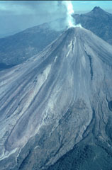 A helicopter view of Colima volcano towards the north on 8 February 1999 shows the degassing lava dome and active lava flows with Nevado de Colima in the background. A single flow originated from the summit dome, but the light-colored topographic high on the upper SW flank caused it to split into separate lobes. The easternmost lobe can be seen here descending diagonally to the lower left. The lava flow from 1991 was completely covered by this new flow.
Photo by Jim Luhr, 1999 (Smithsonian Institution).
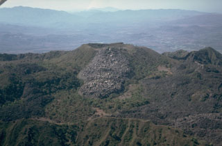 This aerial view looks from the east across the inner summit caldera of Ceboruco. The unvegetated lava flow in the center was emplaced either in 1870-75, or during earlier eruptions in 1542 or 1567. The flow covering the caldera floor to the lower right is the near-vent portion of the voluminous El Norte lava flows. The ridge in the foreground is the eastern rim of the inner caldera.
Photo by Jim Luhr, 1980 (Smithsonian Institution).
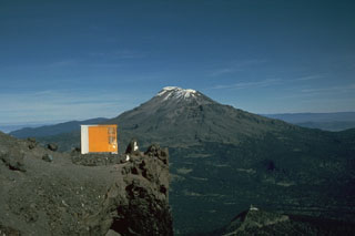 The elongate Iztaccíhuatl has a more conical profile when viewed from the Querentano hut on Popocatépetl to the south. One of the youngest vents of Iztaccíhuatl produced a lava flow north of the Paso de Cortés saddle between the two volcanoes. The flow traveled 5 km to the east.
Photo by Jim Luhr, 1981 (Smithsonian Institution).
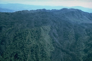 The El Norte lava flows, which cover much of the northern flank of Ceboruco, were erupted along buried ring fractures within nested calderas. The flows split into two lobes, a broad northern lobe that reached the base of the volcano and a narrower NW lobe (lower right). The southern wall of the inner caldera forms the irregular ridge behind the flows (below the distant haze), with the summit cone and lava flows visible at top right.
Photo by Jim Luhr, 1980 (Smithsonian Institution).
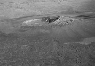 Cerro Colorado tuff cone is one of the most prominent features of the Pinacate volcanic field in Mexico. This aerial oblique view from the NW shows the 1-km-wide crater with the highest point on the S rim. Tuff beds that compose the S rim dip inward up to 20-25 degrees. Cerro Colorado's crater was formed during several episodes of phreatomagmatic eruptions from multiple vents, during which portions of the tuff cone slumped into the crater.
Photo by David Roddy, 1965 (U.S. Geological Survey).
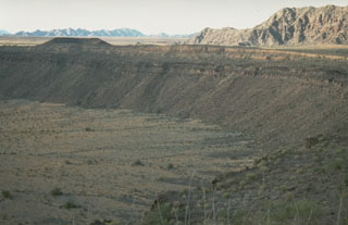 McDougal Crater, one of many Quaternary maars in the Pinacate volcanic field, formed within darker lava flow units near the top of the crater wall. Lighter-colored pyroclastic surge deposits form the crater rim and playa deposits formed on the crater floor. Crystalline rocks of the Sierrita el Temporal range are visible beyond the upper right crater rim to the north.
Photo by Richard Waitt, 1988 (U.S. Geological Survey).
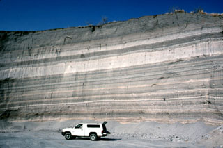 The walls of a quarry on the SW flank of Hoya Estrada maar close to the city of Valle de Santiago show a spectacular sequence of deposits from the maar-forming eruptions. Most of the outcrop consists of gray-colored dominantly planar pyroclastic surge beds. The three prominent light-colored layers are ashfall deposits. The largest ash layer is about 2 m thick just above the middle of the outcrop in this view looking towards the vent.
Photo by Jim Luhr, 2002 (Smithsonian Institution).
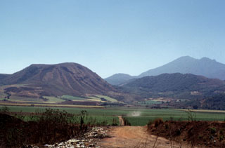 Volcán el Molcajete (left) is the largest scoria cone on the NW flank of Sangangüey volcano (upper right). The crater opens to the NW and was the source of a lava flow that traveled across the floor of the Tepic valley.
Photo by Jim Luhr, 1999 (Smithsonian Institution).
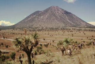 The SE-most of the two Las Derrumbadas lava domes is seen here from the SE. The extensively altered dome is surrounded by debris avalanche deposits. The more recent avalanche deposits consist almost entirely of microcrystalline rhyolite from the core of the dome. They left horseshoe-shaped collapse scarps such as the one visible to the upper right. These scarps reveal areas of intense alteration to kaolinite produced by prolonged fumarolic activity.
Photo by Hugo Delgado-Granados, 1995 (Universidad Nacional Autónoma de México).
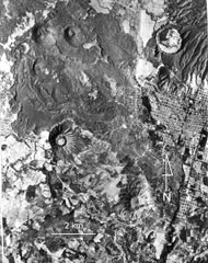 Cerro el Jabalí (upper left) and the adjacent Cerro el Sapien (immediately to the east) of the Michoacan-Guanajuato volcanic field produced the unvegetated lava flow extending across the top of the photo. Ashfall from Cerro el Jabalí scoria cone, located about 15 km SE of Parícutin, erupted about 3,830 years ago. The city of Uruapan is in the right side of the photo, south of the circular Costo (Cerro Cotji) maar.
Aerial photo by Comisión de Estudios del Territorio Nacional (CETENAL).
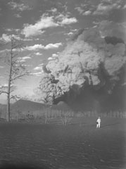 A geologist observes an ash plume rising above the crater of Parícutin on 22 March 1944, as seen from 1 km SW at Mesa de Cocjarao. During March 1944 the eruptive activity ranged from small ash plumes accompanied by deep rumbling to large but almost soundless ash plumes, as was true with the plume shown here.
Photo by William Foshag, 1944 (Smithsonian Institution, published in Foshag and Gonzáles-Reyna, 1956).
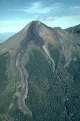 During an eruption from December 1975 to June 1976 lava flows from the Colima summit lava dome descended the E and SE flanks. The SE flow (left) split into two lobes, the longest of which traveled 3.5 km. Another flow traveled initially to the NE before diverting around El Volcancito, the smaller cone on the right horizon, and descended the E flank. All three lobes cross the upper-vegetation line that marks the location of the caldera wall that has been largely buried.
Photo by James Allan, 1981 (Smithsonian Institution).
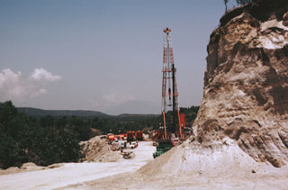 The Sierra La Primavera complex has been the site of extensive geothermal development. The drill rig here is at well PR-5, located near the center of the caldera just south of the Mesa El Nejahuete lava dome. Surface exposures in this location consist of tephra-rich lacustrine sediments.
Photo by Pat Dobson, 1982 (Lawrence Berkeley National Laboratory).
 The campus of the Universidad Nacional Autónoma de México (UNAM), the National University of México, overlies a 1,600-year-old lava flow from the Xitle scoria cone in the Chichinautzin volcanic field. Basaltic lava from Xitle is exposed in the foreground between buildings of the departments of geology and geophysics. Volcanologists and seismologists from the university conduct research on Mexican volcanoes and are involved in monitoring of ongoing activity.
Photo by Lee Siebert, 1998 (Smithsonian Institution).
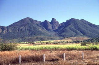 The steep remnant at Sangangüey volcano (center) rises 250 m above the Arroyo Caracol, an erosional valley down the SW flank. It is similar in composition to surrounding layered lava flows, but contains less glass, which suggests slower cooling. The Arroyo Caracol exposes a 700-m-thick section showing the interior stratigraphy of the cone.
Photo by Lee Siebert, 1997 (Smithsonian Institution).
 Volcán la Malinche, seen here from the south, derives its name from a Mayan woman who became the wife, aide, and interpreter of the Spanish explorer Cortés. The Spanish mispronounced the woman's name Malintzin as Malinche.
 Photo by Steve Nelson, 1987 (Tulane University).
 The Cerro Prieto geothermal field on the Colorado River delta in NW México, seen here in 1998, is a large producing geothermal field. This view shows the Unit 1 power plant. Exploration drilling began in 1959 and by the mid-1980s more than 100 wells had been drilled to depths as great as 3.5 km. Despite few surface volcanic features, the hydrothermal system covers an area of more than 100 km2.
Photo by Pat Dobson, 1998 (Lawrence Berkeley National Laboratory).
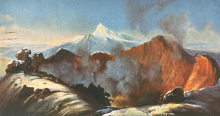 This painting by Rugendas published in 1856 depicts the active crater of Colima as it appeared in 1834 during the first scientific expedition to the summit. The painting shows the broad, deep crater excavated by the major explosive eruption of 15 February 1818. This eruption produced pyroclastic flows and abundant ash emission. Ashfall was reported up to 440 km away in Querétaro, Mexico City, Zacateras, and San Luis Potosí. Nevado de Colima appears in the background.
Painting by Juan Mauricio Rugendas (courtesy of Julian Flores, University of Guadalajara).
 Eleven scoria cones have formed in the southern Colima graben near the flanks of Colima volcano since the late Pleistocene. Cerro la Erita, a 190-m-high cone, is seen here from the NE. Cerro el Petacál (top right) is a fault block of older rocks that rises above the graben floor. Sierra Manantlán forms the 1,700-m-high western graben wall on the SW block of the rift zone.
Photo by Jim Luhr, 1981 (Smithsonian Institution).
 Islota Pelón (upper left), just off the NW coast of Isla Isabel, is the outer rim of a mostly submerged cone whose SE rim (center) is located on the tip of the main island. A narrow lava flow seen diagonally from the lower right to the bay is part of the Planicie lava flow and is the product of the youngest eruption on Isla Isabel.
Photo by Jim Luhr, 1995 (Smithsonian Institution).
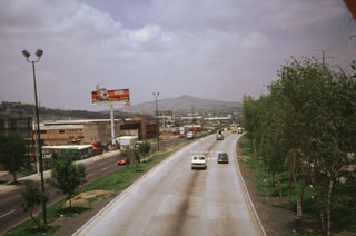 Guadalajara, México's second largest city, partially overlies a chain of nine basaltic-andesite volcanic centers of Plio-Pleistocene age. The volcanoes were constructed along a NW-SE-trending line that cuts through the southern portion of the city. The centers range from small cinder cones, such as Cerro San Bartolo, to larger composite volcanoes. The largest volcanoes are located at the SE end of the chain. This view shows the streets and buildings of Guadalajara partially overlapping one of the westernmost cones.
Photo by Julian Flores, 1999 (University of Guadalajara).
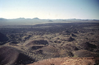 More than 500 basaltic scoria cones and associated lava flows dot the Pinacate volcanic field, visible here near Cerro Colorado. The field also contains maars like Cerro Colorado and the large basaltic-to-trachytic Santa Clara shield volcano.
Photo by Bill Rose, 1997 (Michigan Technological University).
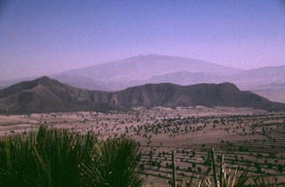 The broad Cofre de Perote massif towers above the eastern margin of the Serdán-Oriental basin. The low-angle volcano consists primarily of thick lava flows. It is the northernmost volcano of a roughly N-S-trending chain at the eastern margin of the Mexican Volcanic Belt that extends southward to Orizaba volcano. The ridge in the center of the photo is an outcrop of Cretaceous limestone that underlies the Cofre-Orizaba volcanic chain and is exposed on either side of the range.
Photo by Lee Siebert, 1998 (Smithsonian Institution).
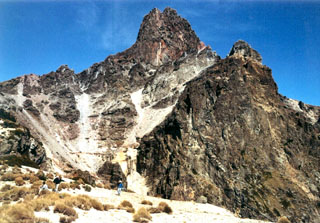 The summit pinnacle of La Malinche is seen here from the south. The summit consists of several lava domes, one of which filled the vent from the last major eruption of the volcano about 3,100 years ago. Note the people in the left foreground for scale.
Photo by Renato Castro, 2000 (courtesy of José Macías, Universidad Nacional Autónoma de México).
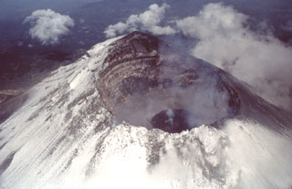 An aerial view of Popocatépetl from the east on 4 July 1997 shows a dark gray lava dome with a strong fumarole emanating from its center. This dome was extruded after an explosive event on 30 June 1997 produced an eruptive column that deposited a thin ash layer on Mexico City. The far crater wall reveals a stratigraphic profile of lava flows and fragmental material forming the upper part of the cone.
Photo by José Macías, 1997 (Universidad Nacional Autónoma de México).
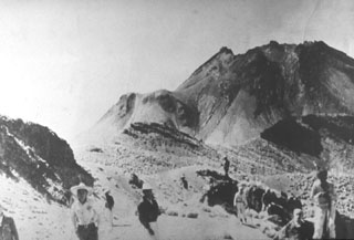 The powerful 1913 explosive eruption at Colima removed about 100 m of the summit and created a large 450-m-wide crater. The jagged 1913 crater rim is seen here in 1936 from Nevado de Colima. Lava had partially filled the 350-m-deep crater, but did not overflow the rim until 1961. El Volcancito, the lava dome created in 1869, is the feature on the left side of the cone.
Photo courtesy Julian Flores (University of Guadalajara), 1936.
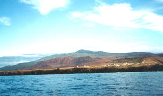 Cerro Evermann, the high point of Socorro Island, rises above a Mexican Naval camp near the southern tip of the island. Socorro lies in the Revillagigedo Islands south of Baja California. Cerro Evermann is a cone and lava dome complex that forms the summit. Rhyolite lava domes have formed along flank rifts, and silicic lava flows that were erupted from summit and flank vents have created an irregular shoreline.
 Photo by Martha Marin, 1998 (Mexican Navy).
 Papayo is the small rounded lava dome on the far-right horizon; the two peaks with snow-dusted summits on the horizon are Tláloc (left) and Telapón (center). This view looks to the NE across the Valley of Mexico from the flanks of the Chichinautzin range.
Photo by Lee Siebert, 2004 (Smithsonian Institution).
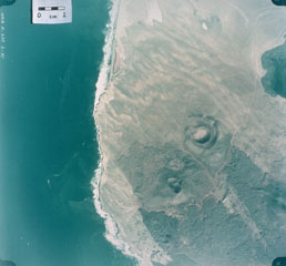 This 1978 aerial photo shows the nested craters of Volcán Riveroll (right-center) and the intersecting craters of Volcán Basu (below and to the left). The Riveroll craters open towards the NW (upper left). The darker basaltic lava flows extend to the SE from both cone complexes. The flow from Riveroll diverts around the Kenton scoria cone (edge of image at the lower right). The lighter areas are windblown sand. the Pacific coast shoreline is to the left, and the body of water to the upper right is part of San Quintín Bay.
Aerial photo by Comisión de Estudios del Territorio Nacional (CETENAL), 1:25,000, 1978.
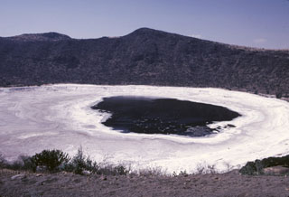 The Hoya Rincón de Parangüeo maar rises directly above the town of the same name located on the lower southern flank. A brackish lake of seasonally variable size partially fills the floor of the 2-km-wide maar, seen here from its southern rim. The high point on the northern rim rises 450 m above the crater floor. Rincón de Parangueo is part of the Valle de Santiago maar field on the NE side of the Michoacán-Guanajuato volcanic field and is about 7 km NW of the town of Valle de Santiago.
Photo by Jim Luhr, 2002 (Smithsonian Institution).
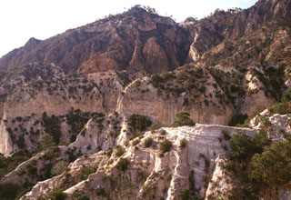 The pyroclastic surge deposits in the foreground are exposed in front of Cerro Pinto lava dome. The dome has a glassy and pumiceous outer layer partly overlain by pyroclastic surge deposits and blocks of local bedrock.
Photo by Gerardo Carrasco-Núñez, 2002 (Universidad Nacional Autónoma de México).
This is a compilation of Mexico volcano information sources, such as official monitoring or other government agencies.
| Civil Protection Agencies | |
|---|---|
| Civil Protection Jalisco | |
| Volcanic Ash Advisory Center | |
|---|---|
| Washington Volcanic Ash Advisory Center (VAAC) | |
| - Washington VAAC Archive | |
| - Washington VAAC Notices | |