Global Volcanism Program | Image GVP-12467
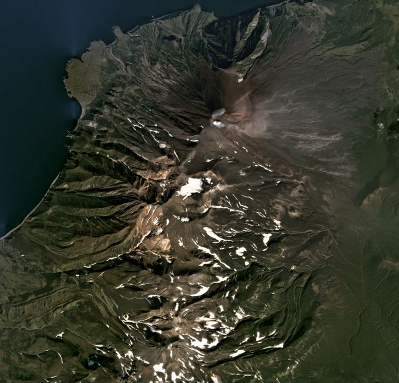
Chikurachki is the northern-most edifice of the Chikurachki-Tatarinov-Lomonosov volcanic chain on the Kurile’s Paramushir Island, shown in this September 2020 Planet Labs satellite image monthly mosaic (N is at the top; this image is approximately 18 km across). The summit has a roughly 450-m-diameter summit crater that is emitting a weak plume dispersing to the E in this image. Tatarinov is the group of craters south of the oxidized Chikurachki cone, and the Lomonsov Group is near the center of the bottom of this image.
Satellite image courtesy of Planet Labs Inc., 2020 (https://www.planet.com/).
Copyrighted image used with permission. All Rights Reserved. Contact photographer for any usage requests.
Keywords: crater | stratovolcano | gas | plume | gas plume | emissions | wind dispersal | remote sensing
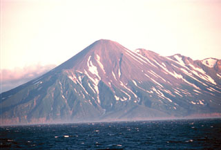
Chikurachki