Report on Atka Volcanic Complex (United States) — November 1993
Bulletin of the Global Volcanism Network, vol. 18, no. 11 (November 1993)
Managing Editor: Richard Wunderman.
Atka Volcanic Complex (United States) "Rumbling" and degassing accompanies M 5.1 earthquake
Please cite this report as:
Global Volcanism Program, 1993. Report on Atka Volcanic Complex (United States) (Wunderman, R., ed.). Bulletin of the Global Volcanism Network, 18:11. Smithsonian Institution. https://doi.org/10.5479/si.GVP.BGVN199311-311160
Atka Volcanic Complex
United States
52.331°N, 174.139°W; summit elev. 1518 m
All times are local (unless otherwise noted)
On 10 December AVO reported the following. "On 4 December, following a M 5.1 earthquake at 1836 beneath the . . . island of Atka, residents of Atka village reported "rumbling" from the cluster of volcanoes that forms the N part of the island. At the same time, residents observed increased steaming from a fumarolic area on the flank of Kliuchef volcano and noted a distinct sulphur smell. A check of satellite imagery did not confirm any change in the surface state of the volcanoes. Late this week, the weather had deteriorated and no visual observations of the volcanoes were possible. . . ."
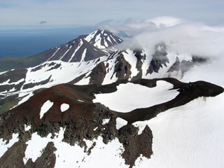
Geological Summary. The Atka Volcanic Complex consists of a central shield and Pleistocene caldera and four notable volcanic cones. A major explosive dacitic eruption accompanied formation of the caldera about 500,000 to 300,000 years ago; approximately half of the caldera rime remains, open towards the NW. The Sarichef cone, ~5 km ESE of the caldera rim, retains a symmetrical profile, unlike most other heavily eroded features outside the caldera to the S and W. The Kliuchef stratovolcano grew within the caldera and exhibits five eruptive vents striking NE, including two at the summit, that have been active in the Holocene. A 700-m-diameter crater 1 km NE of the summit may have been the source vent for a large 1812 CE eruption. Hot springs and fumaroles are located on the flanks of Kliuchef and in a glacial valley to the SW. The most frequently active volcano of the complex is Korovin, at the NE tip of Atka Island about 5 km N of Kliuchef. An 800-m-diameter crater on the SE side of the summit contains a deep circular pit that sometimes contains a crater lake thought to be the source of phreatic ash explosions. The smaller Konia cone, slightly offset to the E, lies between Kliuchef and Korovin. Most of the lava flows in the complex are basaltic, though some dacitic flows are also present.
Information Contacts: AVO.