Report on Kadovar (Papua New Guinea) — July 1977
Natural Science Event Bulletin, vol. 2, no. 7 (July 1977)
Managing Editor: David Squires.
Kadovar (Papua New Guinea) No significant changes in the thermal area
Please cite this report as:
Global Volcanism Program, 1977. Report on Kadovar (Papua New Guinea) (Squires, D., ed.). Natural Science Event Bulletin, 2:7. Smithsonian Institution. https://doi.org/10.5479/si.GVP.NSEB197707-251002
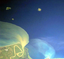
Kadovar
Papua New Guinea
3.608°S, 144.588°E; summit elev. 365 m
All times are local (unless otherwise noted)
"Three detailed investigations have been made since the March report: 25-28 April (Cooke, Norris) 72 hours of seismic recording, gas condensates collected, temperatures measured, and magnetic field re-surveyed; 7-8 June (Dent) 30 hours seismic recording, temperatures measured, and gas and gas condensates collected; and 7-8 July (Wallace, Norris, Emeleus) 30 hours seismic recording, temperatures measured, gas and gas condensates collected, and magnetic field re-surveyed.
"The main thermal area has been little changed during this period. The original fumarole of last September shows the same degree of activity as it did then. Volcano-seismic activity was virtually nil. Maximum temperatures were still 99-100°C but there may have been slight changes in the magnetic field pattern. The only features presently indicating continued development are weak thermal areas that are still being established in new areas on other parts of the island. Some of the population have returned, contrary to a previous report, but they have established a new settlement in a comparatively safe area, having abandoned their old village site."
Geological Summary. The 2-km-wide island of Kadovar is the emergent summit of a Bismarck Sea stratovolcano of Holocene age. It is part of the Schouten Islands, and lies off the coast of New Guinea, about 25 km N of the mouth of the Sepik River. Prior to an eruption that began in 2018, a lava dome formed the high point of the andesitic volcano, filling an arcuate landslide scarp open to the south; submarine debris-avalanche deposits occur in that direction. Thick lava flows with columnar jointing forms low cliffs along the coast. The youthful island lacks fringing or offshore reefs. A period of heightened thermal phenomena took place in 1976. An eruption began in January 2018 that included lava effusion from vents at the summit and at the E coast.
Information Contacts: D. Wallace, RVO.