Report on Ruang (Indonesia) — 1 May-7 May 2024
Smithsonian Institution / US Geological Survey
Weekly Volcanic Activity Report, 1 May-7 May 2024
Managing Editor: Sally Sennert.
Please cite this report as:
Global Volcanism Program, 2024. Report on Ruang (Indonesia) (Sennert, S, ed.). Weekly Volcanic Activity Report, 1 May-7 May 2024. Smithsonian Institution and US Geological Survey.
Ruang
Indonesia
2.3°N, 125.37°E; summit elev. 725 m
All times are local (unless otherwise noted)
PVMBG reported that seismicity at Ruang during 1-2 May was characterized by continuous tremors along with both deep and shallow volcanic earthquakes. The number of seismic events was decreasing based on a seismic station at the Ruang Post, 5 km from the crater; two closer stations, 1.5 and 2.7 km from the crater, had been damaged by eruptions. During 1-4 and 7 May white-and-gray ash plumes that were sometimes dense rose 100-700 m above the summit and drifted in multiple directions. Dense white steam-and-gas plumes rose 100-450 m above the summit and drifted NE, E, and S during 5-7 May.
On 5 May PVMBG reduced the exclusion zone from a 7 km radius around the active crater to 5 km. According to news reports a total of 5,849 residents of Tagulandang Island had been evacuated by 5 May; additional evacuations were halted after the exclusion zone was changed. The Sam Ratulangi International Airport (98 km SW in Manado, North Sulawesi) reopened on 5 May, though several airports remained closed including Djalaludin Airport in Gorongtalo, Siau Airport in the Sitaro Islands, Naha Airport in the Sangihe Islands, Lolakndi Bolaang Mongondow Airport, Miangas Airport, and Melonguane Airport in the Talaud Islands. The Alert Level remained at 4 (the highest level on a scale of 1-4).
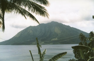
Geological Summary. Ruang volcano is the southernmost volcano in the Sangihe Island arc, north of Sulawesi Island; it is not the better known Raung volcano on Java. The 4 x 5 km island volcano is across a narrow strait SW of the larger Tagulandang Island. The summit contains a crater partially filled by a lava dome initially emplaced in 1904. Explosive eruptions recorded since 1808 have often been accompanied by lava dome formation and pyroclastic flows that have damaged inhabited areas.
Sources: Pusat Vulkanologi dan Mitigasi Bencana Geologi (PVMBG, also known as CVGHM), Antara News, Antara News, Antara News, Antara News