Global Volcanism Program | Image GVP-01664
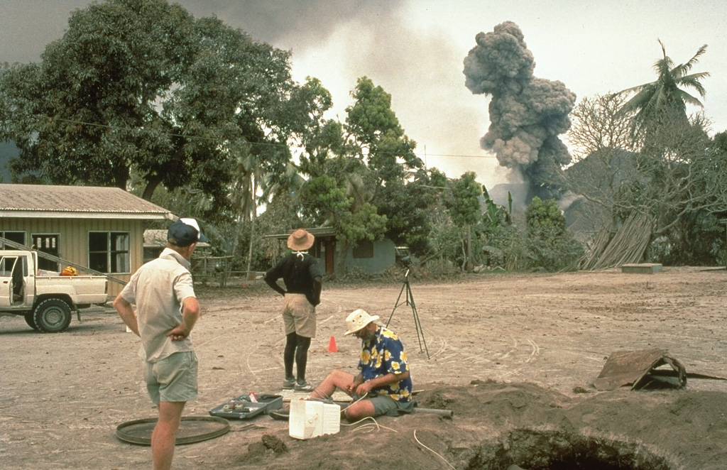
Scientists from the Rabaul Volcano Observatory and the U.S. Geological Survey observe an eruption plume from Tavurvur volcano on 4 October 1994, while conducting deformation measurements on Matupit Island. This location was a tilt site where repeated measurements of uplift or subsidence were made during the course of the eruption. The pit at the lower right was excavated to study ashfall deposits from the eruption.
Photo by Elliot Endo, 1994 (U.S. Geological Survey).
![]() This image is made available as a Public Domain Work, but proper attribution is appreciated.
This image is made available as a Public Domain Work, but proper attribution is appreciated.
Galleries: Fieldwork | Technology | Volcano Monitoring
Keywords: volcanologist | deformation | field work | volcano monitoring | caldera

Rabaul