Global Volcanism Program | Image GVP-10441
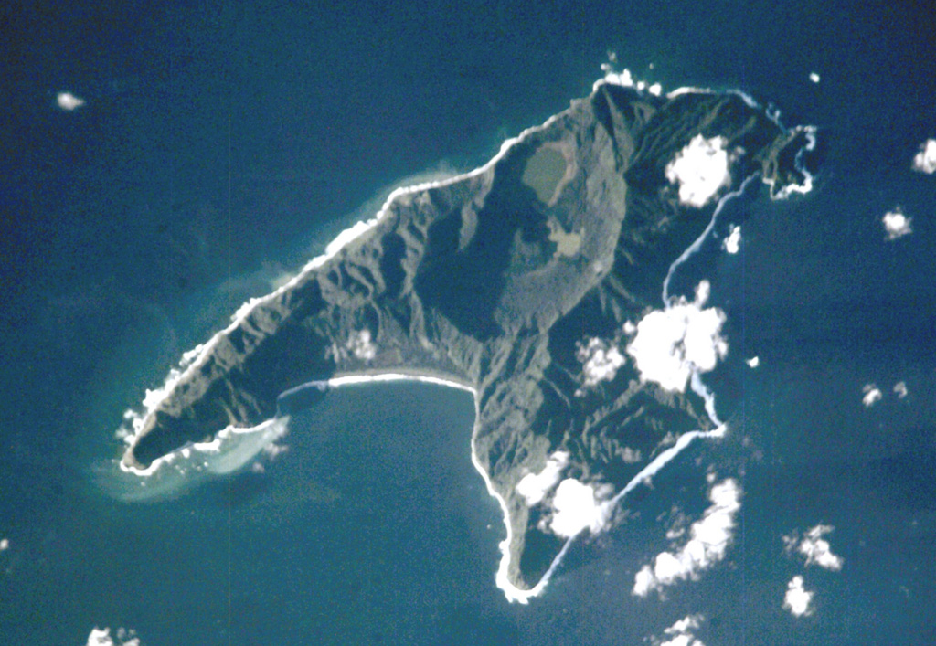
Anvil-shaped Raoul Island is the largest and northernmost of the Kermadec Islands. Two calderas are prominent in this International Space Station view with N to the upper right. The 2.5 x 3.5 km caldera cuts the center of the island, and the E wall of the partially submerged Denham Bay caldera rises above the smooth coastline at the left-center. The 6.5 x 4 km wide Denham Bay caldera formed during a major dacitic explosive eruption about 2,200 years ago, which truncated the W side of the island.
NASA International Space Station image ISS002-E-8883, 2001 (http://eol.jsc.nasa.gov/).
![]() This image is made available as a Public Domain Work, but proper attribution is appreciated.
This image is made available as a Public Domain Work, but proper attribution is appreciated.
Keywords: island volcano | remote sensing

Raoul Island