Global Volcanism Program | Image GVP-11548
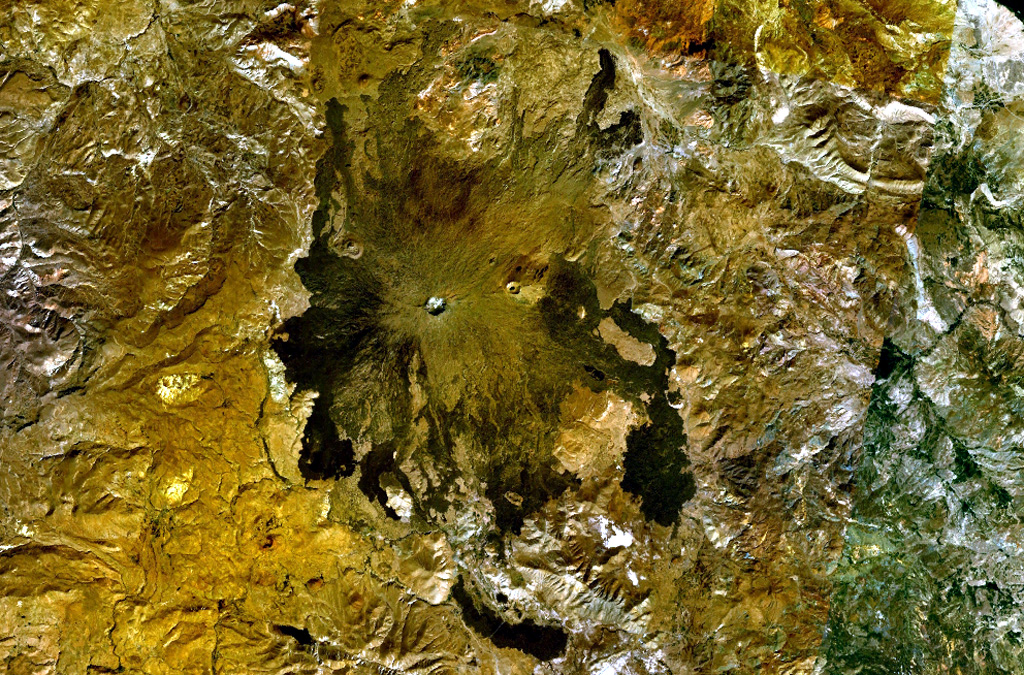
Two circular craters lie along an E-W trend on the summit ridge of Tendürek Dagi shield volcano in this NASA Landsat composite image (with north to the top). The higher western cone is capped by a steep-walled crater, and the flatter eastern crater contains a lake. Late-stage activity formed trachytic lava domes and flows as well as basaltic pahoehoe flows that extend 10-20 km N and S.
NASA Landsat 7 image (worldwind.arc.nasa.gov)
![]() This image is made available as a Public Domain Work, but proper attribution is appreciated.
This image is made available as a Public Domain Work, but proper attribution is appreciated.
Keywords: shield volcano | lava flow | crater
Tendürek Dagi