Global Volcanism Program | Image GVP-11928
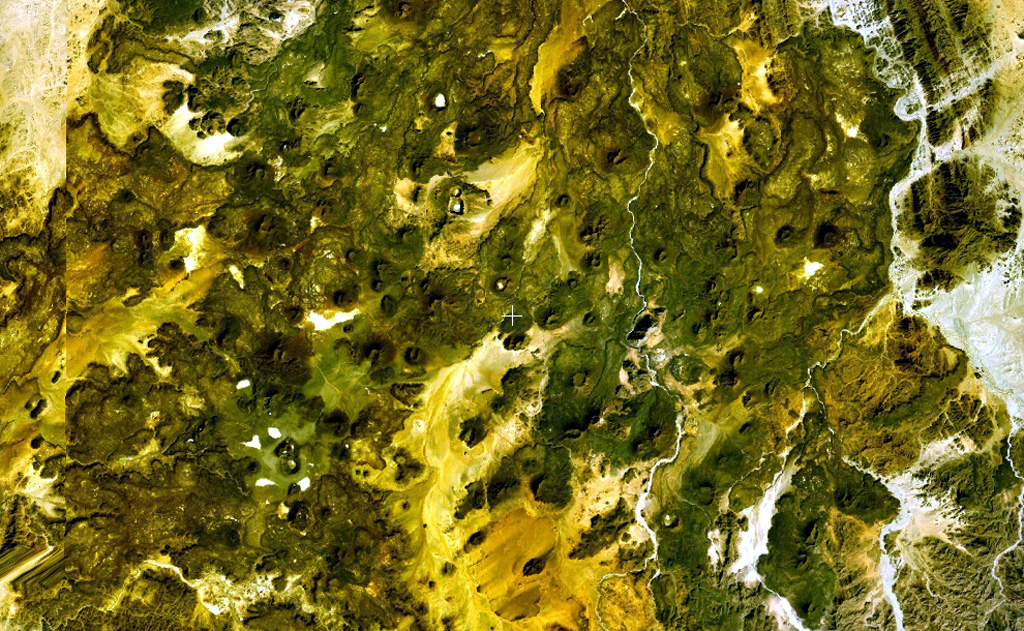
This NASA Landsat false-color image shows small scoria cones and lava flows of the Manzaz volcanic field in the Hoggar (Ahaggar) volcanic district of Algeria. The volcanic field covers an area of 1,500 km2, overlying Precambrian metamorphic and plutonic rocks of the Tuareg shield. The youngest volcanoes rest on Neolithic terraces and are of Holocene age.
NASA Landsat 7 image (worldwind.arc.nasa.gov)
![]() This image is made available as a Public Domain Work, but proper attribution is appreciated.
This image is made available as a Public Domain Work, but proper attribution is appreciated.
Galleries: Volcanic Fields
Keywords: remote sensing | volcanic field | scoria cone

Manzaz Volcanic Field