Global Volcanism Program | Image GVP-12233
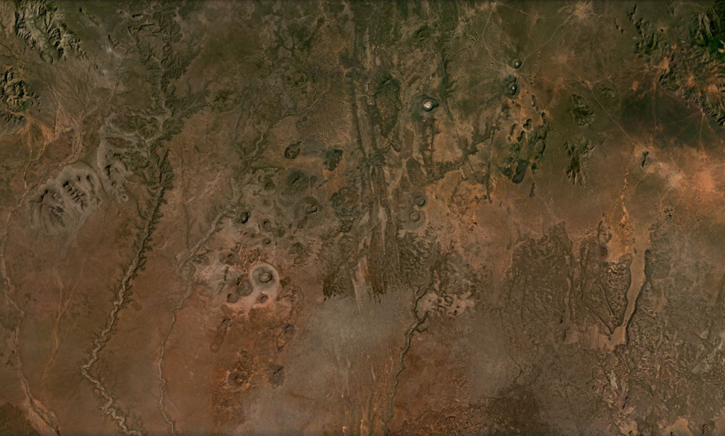
Cones, maars, lava flows, and craters of the Dilo-Dukana Field are visible in this December 2020 Planet Labs satellite image mosaic (N at the top; this image is approximately 104 km across) along the Ethiopia-Kenya border, which crosses roughly NW-SE through the view. The most prominent feature in the southern part of the field is the 1.8-km-wide Gof Dukana maar in Kenya, just SW of the center of the image.
Satellite image courtesy of Planet Labs Inc., 2020 (https://www.planet.com/).
Copyrighted image used with permission. All Rights Reserved. Contact photographer for any usage requests.
Keywords: volcanic field | maar | scoria cone

Dilo-Dukana Volcanic Field