Report on Dieng Volcanic Complex (Indonesia) — June 2003
Bulletin of the Global Volcanism Network, vol. 28, no. 6 (June 2003)
Managing Editor: Edward Venzke.
Dieng Volcanic Complex (Indonesia) Plume emissions and modest seismicity through early July 2002
Please cite this report as:
Global Volcanism Program, 2003. Report on Dieng Volcanic Complex (Indonesia) (Venzke, E., ed.). Bulletin of the Global Volcanism Network, 28:6. Smithsonian Institution. https://doi.org/10.5479/si.GVP.BGVN200306-263200
Dieng Volcanic Complex
Indonesia
7.2°S, 109.879°E; summit elev. 2565 m
All times are local (unless otherwise noted)
Seismicity and plume frequency increased at Dieng beginning in April 2002 (BGVN 27:05). During 27 May-7 July 2002, the Volcanological Survey of Indonesia (VSI) reported higher-than-normal activity. Deep and shallow earthquakes were recorded, along with tectonic events (table 3). During 27 May-9 June, VSI reported a white plume from Sileri crater up to 50 m high. Observations in mid-June revealed a mud ejection from Sikidang crater. Dieng remained at Alert Level 2 (on a scale of 1-4). No further reports were issued through at least May 2003.
Table 3. Earthquakes recorded at Dieng during 27 May-7 July 2002. Courtesy VSI.
| Date | Deep volcanic | Shallow volcanic | Distant tectonic |
| 27 May-02 Jun 2002 | 1 | 25 | 1 |
| 03 Jun-09 Jun 2002 | 1 | 38 | 1 |
| 10 Jun-16 Jun 2002 | 13 | 14 | 1 |
| 17 Jun-23 Jun 2002 | -- | 18 | 3 |
| 24 Jun-30 Jun 2002 | -- | 7 | 2 |
| 01 Jul-07 Jul 2002 | -- | 3 | -- |
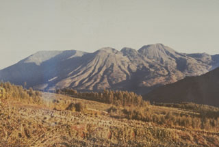
Geological Summary. The Dieng plateau in the highlands of central Java is renowned both for the variety of its volcanic scenery and as a sacred area housing Java's oldest Hindu temples, dating back to the 9th century CE. The Dieng Volcanic Complex consists of multiple stratovolcanoes and more than 20 small Pleistocene-to-Holocene craters and cones over a 6 x 14 km area. Prahu stratovolcano was truncated by a large Pleistocene caldera, which was subsequently filled by a series of cones, lava domes, and craters, many containing lakes. Lava flows cover much of the plateau, but observed activity has been restricted to minor phreatic eruptions. Gas emissions are a hazard at several craters and have caused fatalities. There are abundant thermal features and high heat flow across the area.
Information Contacts: Dali Ahmad, Volcanological Survey of Indonesia (VSI), Jalan Diponegoro No. 57, Bandung 40122, Indonesia (URL: http://www.vsi.esdm.go.id/).