Report on Marchena (Ecuador) — August 1991
Bulletin of the Global Volcanism Network, vol. 16, no. 8 (August 1991)
Managing Editor: Lindsay McClelland.
Marchena (Ecuador) First historical eruption
Please cite this report as:
Global Volcanism Program, 1991. Report on Marchena (Ecuador) (McClelland, L., ed.). Bulletin of the Global Volcanism Network, 16:8. Smithsonian Institution. https://doi.org/10.5479/si.GVP.BGVN199108-353080
Marchena
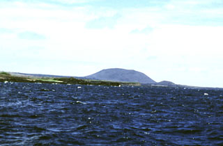
Ecuador
0.33°N, 90.47°W; summit elev. 343 m
All times are local (unless otherwise noted)
Marchena . . . started erupting on 25 September. The TOMS instrument aboard the Nimbus-7 satellite passed at about 1100 and sensed no SO2, but the next pass, at the same time on 26 September, mapped a 300-km plume to the SW with an SO2 content estimated to be close to 100 kt. High SO2 values immediately over the volcano indicated that the eruption was still vigorous at that time. On the following day the plume was nearly twice as long, but had almost vanished by the same time on 28 September. Weather satellite images during this period showed low cloud cover, but no conclusive indication of the volcanic plume. . . .
Geological Summary. The low shield volcano forming Marchena Island contains one of the largest calderas of the Galápagos Islands. The 6 x 7 km caldera and its outer flanks have been largely buried by a cluster of pyroclastic cones and associated lava flows. Its first historical eruption occurred in 1991. Other young lava flows, some of which may be only a few thousand, or even a few hundred years old, filled the caldera and flowed down its outer forested flanks, in some cases to the sea.
Information Contacts: A. Carrasco, Charles Darwin Research Station; S. Doiron, GSFC; SAB.