Report on Westdahl (United States) — December 1991
Bulletin of the Global Volcanism Network, vol. 16, no. 12 (December 1991)
Managing Editor: Lindsay McClelland.
Westdahl (United States) Tephra emission declines
Please cite this report as:
Global Volcanism Program, 1991. Report on Westdahl (United States) (McClelland, L., ed.). Bulletin of the Global Volcanism Network, 16:12. Smithsonian Institution. https://doi.org/10.5479/si.GVP.BGVN199112-311340
Westdahl
United States
54.516°N, 164.65°W; summit elev. 1563 m
All times are local (unless otherwise noted)
The eruption ... continued until 15 January when a significant decrease in activity was noted. Bad weather prevented further observations of the lava flow. Aircraft pilots reported steam and ash plumes to 3.7-7.0 km altitude on 16-20 December, and 4.9 km altitude on 21-23 December. Light ashfall was noted on 16, 25, and 26 December at False Pass, 90 km NE. Residents of False Pass reported hearing rumbling for several nights prior to 30 December. Analyses of ash samples (collected 9 and 25 December) indicated a basaltic andesite composition, with [54.7]% SiO2.
Steam clouds rose to 4.6-4.9 km altitude on 2 and 3 January. Ash clouds were again observed on 8 and 9 January, rising to 2.1-2.4 km altitude. Satellite images during the late afternoon on the 9th showed the plume extending about 150 km SE. A dark spot appeared in satellite images of the volcano for several days prior to 13 January, indicating high temperatures. A black ash cloud was reported to 4 km on 13 January.
The eruption was greatly diminished in intensity on 15 January. Observers noted a small amount of steam at ground level in the vicinity of the eruption site, but there was no sign of a vertical plume. That day, an elongate area of slightly elevated temperature on the volcano's NE flank was visible in a satellite image.
[A 23 January overflight provided the first clear view of the lava flow since 3 December. The flow appeared to have widened to cover 2-3 times its 3 December area, but its front had not advanced significantly.]
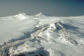
Geological Summary. Westdahl is a broad glacier-covered volcano occupying the SW end of Unimak Island. Two peaks protrude from the summit plateau, and a new crater formed in 1978 cuts the summit icecap. The volcano has a somewhat of a shield-like morphology and forms one of the largest volcanoes of the Aleutian Islands. The sharp-topped, conical Pogromni stratovolcano, 6 km N, rises several hundred meters higher than Westdahl, but is moderately glacially dissected and presumably older. Many satellitic cones of postglacial age are located along a NW-SE line cutting across the summit of Westdahl. Some of the historical eruptions attributed to the eroded Pogromni may have originated instead from Westdahl (Miller et al. 1998). The first historical eruption occurred in 1795. An 8-km-long fissure extending east from the summit produced explosive eruptions and lava flows in 1991.
Information Contacts: AVO.