Report on Kozushima (Japan) — September 1995
Bulletin of the Global Volcanism Network, vol. 20, no. 9 (September 1995)
Managing Editor: Richard Wunderman.
Kozushima (Japan) Strong earthquake swarm in early October
Please cite this report as:
Global Volcanism Program, 1995. Report on Kozushima (Japan) (Wunderman, R., ed.). Bulletin of the Global Volcanism Network, 20:9. Smithsonian Institution. https://doi.org/10.5479/si.GVP.BGVN199509-284030
Kozushima
Japan
34.219°N, 139.153°E; summit elev. 572 m
All times are local (unless otherwise noted)
At 2143 on 6 October, a M 5.6 earthquake occurred near Kozu-shima (figure 2). The earthquake, which had an intensity at Kozu-shima of V on JMA's scale, caused a few landslides there. A M 4.8 earthquake 14 minutes earlier had an intensity of IV. During the next several days, an earthquake swarm continued offshore to the SW of Kozu-shima (figure 2, bottom). The swarm's maximum depth shifted downward with time, reaching 20-25 km. None of this seismicity was thought to have been induced by volcanism.
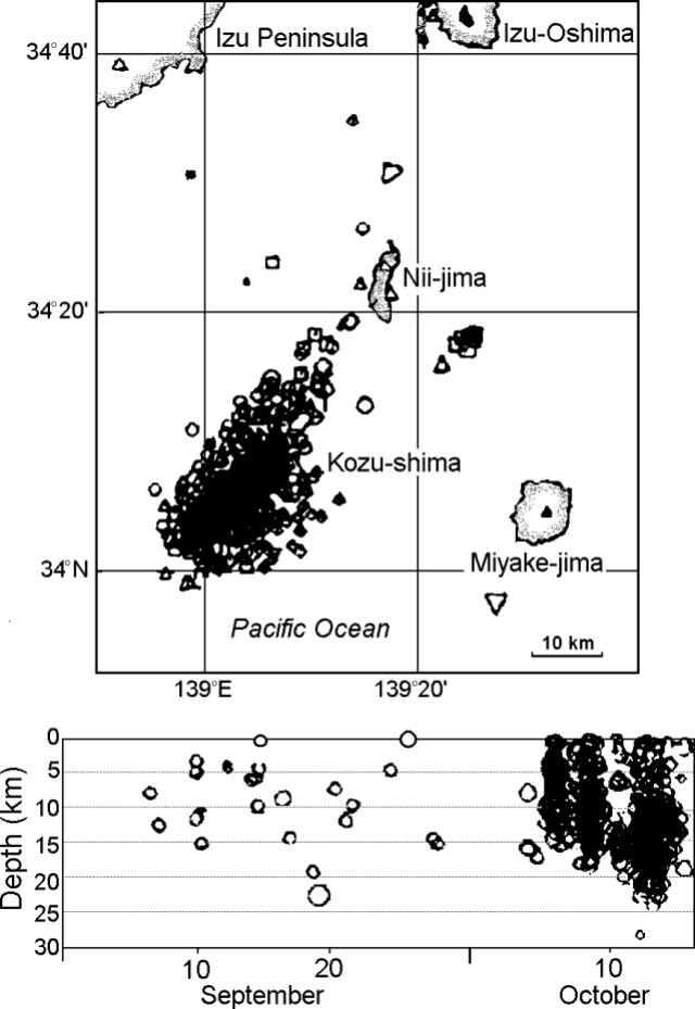 |
Figure 2. Kozu-shima epicenter map (top) and plot of focal depths versus time for September through 16 October 1995 (bottom). Courtesy of JMA. |
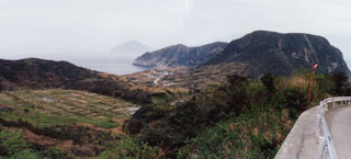
Though obscured by epicenters on figure 2, Kozu-shima island has dimensions of 4 x 6 km and lies 20 km SSW of Nii-jima island and adjacent to the Izu Peninsula. Kozu-shima contains abundant rhyolitic surge deposits and lava domes. Its last eruption was in 838-840 AD. Seismicity near the volcano, and sometimes in vicinity of Nii-jima, has been episodically high in recent years.
Geological Summary. A cluster of rhyolitic lava domes and associated pyroclastic deposits form the 4 x 6 km island of Kozushima in the northern Izu Islands. The island is the exposed summit of a larger submarine edifice more than 20 km long that lies along the Zenisu Ridge, one of several en-echelon ridges oriented NE-SW, transverse to the trend of the northern Izu arc. The youngest and largest of the 18 lava domes, Tenjosan, occupies the central portion of the island. Most of the older domes, some of which are Holocene in age, flank Tenjosan to the north, although late-Pleistocene domes are also found at the southern end of the island. A lava flow may have reached the sea during an eruption in 832 CE. The Tenjosan dome was formed during a major eruption in 838 CE that also produced pyroclastic flows and surges. Earthquake swarms took place during the 20th century.
Information Contacts: Volcanological Division, Seismological and Volcanological Department, Japan Meteorological Agency (JMA), 1-3-4 Ote-machi, Chiyoda-ku, Tokyo 100 Japan.