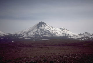
Report on Pavlof (United States) — October 1996
Bulletin of the Global Volcanism Network, vol. 21, no. 10 (October 1996)
Managing Editor: Richard Wunderman.
Pavlof (United States) Eruptions that began on 15 September persist during November
Please cite this report as:
Global Volcanism Program, 1996. Report on Pavlof (United States) (Wunderman, R., ed.). Bulletin of the Global Volcanism Network, 21:10. Smithsonian Institution. https://doi.org/10.5479/si.GVP.BGVN199610-312030
Pavlof
United States
55.417°N, 161.894°W; summit elev. 2493 m
All times are local (unless otherwise noted)
The current episode of eruptive activity, which began on 15 September (BGVN 21:08-21:09), persisted during 15 October-29 November. Seismicity, satellite imagery, and visual observations indicated ongoing lava fountaining from two vents near the summit. Two lava flows advanced down the flanks of the volcano. Intermittent bursts of lava to heights of <300 m above the crater continued. These bursts formed diffuse ash layers that pilots reported to be typically below an altitude of 6,100 m.
From 2200 on 18 October intense seismicity was recorded, but it ceased the next morning (19 October). This increased seismic activity indicated that the eruption strengthened considerably. On 22 October, seismicity showed a short-lived burst at about 1300, and at 1330 pilots reported an ash plume rising to an altitude of 7,600 m. At 1450 satellite observations showed a narrow ash cloud 90 km long drifting NE up the peninsula. During 26 October-1 November, intermittent narrow plumes, extending up to several hundred kilometers downwind, were visible on satellite images. Light ashfall was observed at Nelson Lagoon on the morning of 28 October.
On 4 November, seismicity significantly increased at 0800 and declined several hours later. This seismic increase was followed by an increase in eruptive activity. Satellite imagery showed a plume extending 250 km to the NE. Pilots reported the cloud top at 5,800-m altitude. During 9-15 November, diffuse ash layers occasionally reached altitudes of 7,000-7,300 m. Observers in Sand Point, Nelson Lagoon, and Cold Bay reported a steam-and-ash plume, rising from low on the N flank, to altitudes as high as the plume issuing from the summit vents. Although the source of the plume was not directly observed, the presence of ash suggested the possibility of a new vent low on the N flank. Two half-hour periods of intense seismicity, beginning at 1130 on 22 November and at 0430 on 23 November, resulted in steam-and-ash emissions. The plumes reached altitudes of 9,100 m and extended downwind. A small ash plume from the 23 November event was detected moving several hundred kilometers to the NW. However, no ashfall was reported from local communities.
Geological Summary. The most active volcano of the Aleutian arc, Pavlof is a Holocene stratovolcano that was constructed along a line of vents extending NE from the Emmons Lake caldera. Pavlof and Pavlof Sister to the NE form a dramatic pair of symmetrical, glacier-covered stratovolcanoes that overlook Pavlof and Volcano bays. Little Pavlof is a smaller cone on the SW flank of Pavlof volcano, near the rim of Emmons Lake caldera. Unlike Pavlof Sister, eruptions have frequently been reported from Pavlof, typically Strombolian to Vulcanian explosive eruptions from the summit vents and occasional lava flows. The active vents lie near the summit on the north and east sides. The largest recorded eruption took place in 1911, at the end of a 5-year-long eruptive episode, when a fissure opened on the N flank, ejecting large blocks and issuing lava flows.
Information Contacts: Alaska Volcano Observatory (AVO), a cooperative program of a) U.S. Geological Survey, 4200 University Drive, Anchorage, AK 99508-4667, USA (URL: http://www.avo.alaska.edu/), b) Geophysical Institute, University of Alaska, PO Box 757320, Fairbanks, AK 99775-7320, USA, and c) Alaska Division of Geological & Geophysical Surveys, 794 University Ave., Suite 200, Fairbanks, AK 99709, USA.

