Report on Pavlof (United States) — September 1997
Bulletin of the Global Volcanism Network, vol. 22, no. 9 (September 1997)
Managing Editor: Richard Wunderman.
Pavlof (United States) Steam plume in June; ash covering ice near summit seen in July
Please cite this report as:
Global Volcanism Program, 1997. Report on Pavlof (United States) (Wunderman, R., ed.). Bulletin of the Global Volcanism Network, 22:9. Smithsonian Institution. https://doi.org/10.5479/si.GVP.BGVN199709-312030
Pavlof
United States
55.417°N, 161.894°W; summit elev. 2493 m
All times are local (unless otherwise noted)
The latest eruption began on 15 September 1996 and continued intermittently through 3 January 1997, when a small ash burst rose just above the summit (BGVN 21:08-21:12). On the morning of 24 January a pilot reported steam and possibly minor ash emissions. A ground observer reported on 4 February that the summit vent area, which had been snow-covered the previous week, was bare. Small steam plumes, varying in height up to 900 m above the summit, were reported on 6, 15-16, and 19 February (BGVN 22:01).
Observers in Cold Bay (60 km SW) reported snow-free conditions at the summit during 8-21 March. Satellite images at the time did not show any thermal anomalies. By 4 April seismicity had returned to a near-background level, after fourteen weeks of eruptive quiescence, and the alert status was lowered from Yellow to Green. A slight increase in the level of seismicity began on 1 June and continued through the 6th. On the afternoon of 2 June U.S. National Weather Service observers in Cold Bay saw a steam plume rising and increasing in vigor to 900 m above the summit. This event prompted an increase in the alert status to Code Yellow. Satellite images recorded a moderate thermal anomaly on 3 June. Seismic activity declined during 7-13 June. Although fluctuations continued, the level was near background, so on 13 June the status returned to Code Green. Clouds obscured the volcano during 4-13 June.
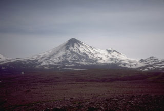
During fieldwork on 8 July, Alaska Volcano Observatory (AVO) scientists had a clear aerial view of the volcano. They circled the volcano in an upward spiral, observing that most of the glacial ice was still intact. At a distance, the Pavlof cone appeared black, which had led to the belief that the glacial ice had been melted by volcanic heat. Closer inspection showed that the dark coloring was due to ash covering the snow; bright blue glacial ice could be seen in crevasses. The adjacent peak of Pavlof Sister showed an ash concentration gradient; higher concentrations made it appear darker towards its base. The only parts where the ice seemed to be missing corresponded to a rust-red region where lava had recently flowed. Approaching the summit of Pavlof, the scientists observed sulfur deposits within and around the perimeter of the jagged crater walls. The crater was filled in with debris and tephra; only remnant steam remained around the crater, and no active degassing could be seen around the buried vent.
Geological Summary. The most active volcano of the Aleutian arc, Pavlof is a Holocene stratovolcano that was constructed along a line of vents extending NE from the Emmons Lake caldera. Pavlof and Pavlof Sister to the NE form a dramatic pair of symmetrical, glacier-covered stratovolcanoes that overlook Pavlof and Volcano bays. Little Pavlof is a smaller cone on the SW flank of Pavlof volcano, near the rim of Emmons Lake caldera. Unlike Pavlof Sister, eruptions have frequently been reported from Pavlof, typically Strombolian to Vulcanian explosive eruptions from the summit vents and occasional lava flows. The active vents lie near the summit on the north and east sides. The largest recorded eruption took place in 1911, at the end of a 5-year-long eruptive episode, when a fissure opened on the N flank, ejecting large blocks and issuing lava flows.
Information Contacts: Alaska Volcano Observatory (AVO), a cooperative program of a) U.S. Geological Survey, 4200 University Drive, Anchorage, AK 99508-4667, USA (URL: http://www.avo.alaska.edu/), b) Geophysical Institute, University of Alaska, PO Box 757320, Fairbanks, AK 99775-7320, USA, and c) Alaska Division of Geological & Geophysical Surveys, 794 University Ave., Suite 200, Fairbanks, AK 99709, USA.

