Report on North Gorda Ridge Segment (United States) — January 1998
Bulletin of the Global Volcanism Network, vol. 23, no. 1 (January 1998)
Managing Editor: Richard Wunderman.
North Gorda Ridge Segment (United States) Seismic swarm on 8 January
Please cite this report as:
Global Volcanism Program, 1998. Report on North Gorda Ridge Segment (United States) (Wunderman, R., ed.). Bulletin of the Global Volcanism Network, 23:1. Smithsonian Institution. https://doi.org/10.5479/si.GVP.BGVN199801-331031
North Gorda Ridge Segment
United States
42.67°N, 126.78°W; summit elev. -3000 m
All times are local (unless otherwise noted)
On 8 January in the NE Pacific, the NOAA/PMEL T-phase Monitoring System recorded high seismicity from the E flank of the Gorda Ridge's N section (figure 7). The exact nature of the activity is unknown. Over 500 small earthquakes were recorded during a 6-day period (figures 8 and 9). The events were located along several en-echelon normal faults on the flank of the Gorda Ridge, E of the neovolcanic zone (figure 9). The moment-tensor solution for a M 3.8 earthquake within the swarm showed the event to be a normal fault earthquake.
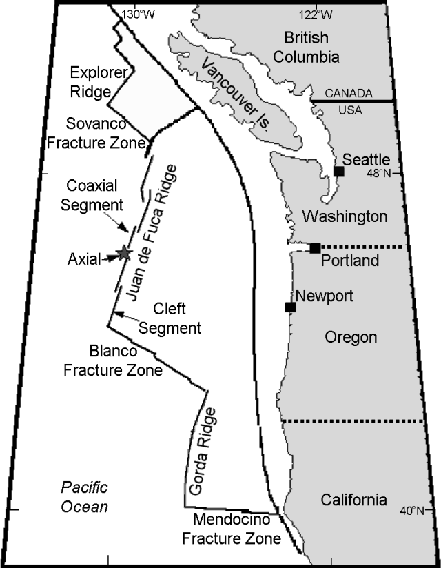 |
Figure 7. Map of plate boundaries and other features associated with the Juan de Fuca Ridge in the NE Pacific. Courtesy of NOAA/PMEL. |
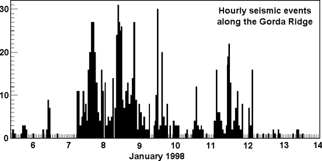 |
Figure 8. Number of seismic events per hour at the N section of the Gorda Ridge during 6-14 January 1998. Courtesy of NOAA/PMEL. |
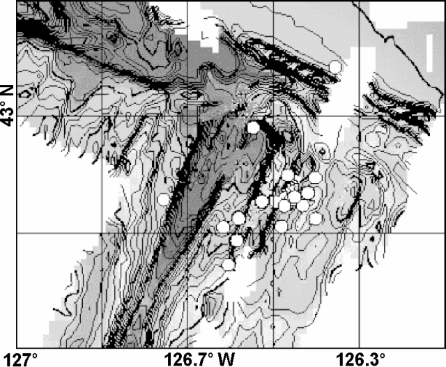 |
Figure 9. Earthquake epicenters along the flank of the N end of Gorda Ridge recorded during 7-14 January 1998. The base map shows bathymetric contours shaded with darker fill patterns at greater depths. Courtesy of NOAA/PMEL. |
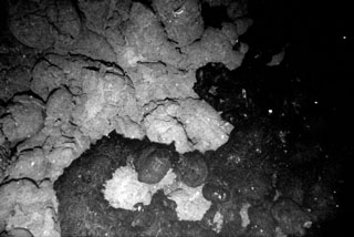
Substantial data sets from the Gorda Ridge were collected during the 1980s, including water column surveys, full SeaBeam coverage, SeamarC I and II surveys, camera surveys, extensive dredges, and submersible dives. A submarine lava flow erupted in 1996 (BGVN 21:02 and 21:06) at the N end of the Gorda Ridge (~200 km W of Oregon's S coast). The eruption was initially detected based on acoustic T-waves (seismic waves transmitted through the ocean) from a seismic swarm and based on large thermal plumes in the colder ambient sea water. Subsequent camera tows revealed new lava flows ~100-200 m wide located along a fissure that was at least 3.5-km long.
Geological Summary. The northernmost of five segments of the Gorda Ridge lies immediately south of the Blanco Transform Fault that offsets the Gorda and Juan de Fuca oceanic spreading ridges. The 65-km-long segment is located about 200 km W of the southern Oregon coast and has deep 5- 10-km-wide valleys at either ends with a shallower narrow axial valley at the center. This morphology, which in plan view resembles an hourglass, is typical of magmatically active spreading segments. A submarine lava flow was erupted in late February and early March 1996, near the center of the segment. The eruption was initially detected through acoustic T-waves from a seismic swarm and the emission of large thermal plumes. In April submarine cameras revealed new lava flows about 100-200 m wide along a fissure that was at least 3.5 km long. A seismic swarm of uncertain origin also occurred at this location in January 1998.
Information Contacts: Chris Fox and Bob Dziak, NOAA Pacific Marine Environmental Laboratory (PMEL), 2115 SE Osu Drive, Newport, OR 97365 USA (URL: https://www.pmel.noaa.gov/).