Report on Miyakejima (Japan) — May 2000
Bulletin of the Global Volcanism Network, vol. 25, no. 5 (May 2000)
Managing Editor: Richard Wunderman.
Miyakejima (Japan) 26-27 June earthquake swarm; seawater stain on SW flank
Please cite this report as:
Global Volcanism Program, 2000. Report on Miyakejima (Japan) (Wunderman, R., ed.). Bulletin of the Global Volcanism Network, 25:5. Smithsonian Institution. https://doi.org/10.5479/si.GVP.BGVN200005-284040
Miyakejima
Japan
34.094°N, 139.526°E; summit elev. 775 m
All times are local (unless otherwise noted)
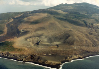
Press sources, including Reuters and the Associated Press, reported that on 26 June seismic activity began on the 55 km2 island of Miyake-jima. About 4,300 earthquakes were detected from late on 26 June through 27 June, although many were too small to be felt. On 27 June a M 4.5 earthquake, the largest registered, was centered in shallow water near the island's W coast. According to a 27 June article, Yoshiaki Ida, a seismologist with the Coordinating Committee for the Prediction of Volcanic Eruptions (CCPVE), said an eruption of steam may have begun undersea. The Defense Agency of Japan reported that an area of shallow water with a blue and yellow tinge near the island's W coast suggested that an eruption may have occurred underwater on the morning of 27 June (figure 3). In addition, a Defense Agency patrol boat reported feeling a strong jolt from below and shortly thereafter another patrol boat observed thick steam rising from the sea's surface in the same area.
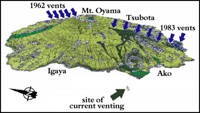 |
Figure 3. Shaded-relief schematic of the 8-km wide, circular island of Miyake-jima, as seen from the W. Sea surface discoloration on 27 June was located ~ 2.2 km off the coast of the port of Ako and was associated with an increase in seismic activity which appeared to be the result of a submarine eruption. Courtesy of the University of Tokyo. |
Authorities were concerned that the eruption could move closer to the shoreline; therefore, on the night of 26 June, 2,500 of the 4,000 Miyake-jima residents were evacuated from the SW and SE sections of the island and relocated to potentially safer areas of the island.
On 29 June, Japan Times reported that fears of a volcanic eruption on Miyake-jima had tapered off. They said that the Japan Meteorological Agency's CCPVE reported that seismic activity had moved off the W coast of the island (figure 4) and that magmatic activities were weakening. On Wednesday, 28 June, more than 400 earthquakes/hr were recorded between 1100 and 1600, but the number dropped to 289 between 1600 and 1700 hours. Some residents began to go home on Thursday as the danger subsided and the evacuation order was partially lifted.
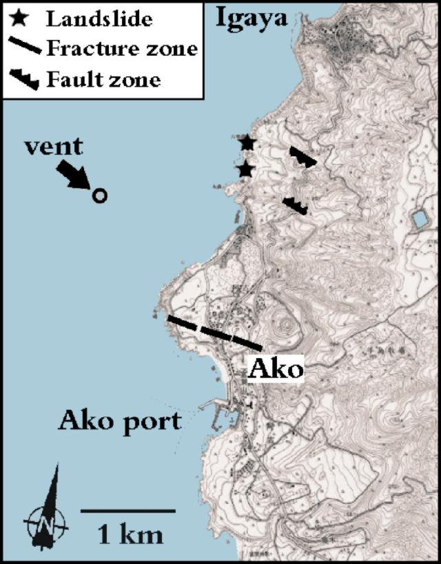 |
Figure 4. A close-up of the SW coast of the Miyake-jima. As of 29 June, seismic activity migrated to the W of the island causing landslides (stars) and eventually moved to the shallow waters to the W of the island where blue and yellow tinges in the water have been attributed to submarine venting. Fractures and faults are also shown. Courtesy of the University of Tokyo. |
Other events occurred in early July as this Bulletin went to press. A future issue will discuss side-scan sonar confirmation of a small submarine pit at the presumed vent site and a sudden caldera-style collapse that formed a substantial summit pit crater.
Geological Summary. The circular, 8-km-wide island of Miyakejima forms a low-angle stratovolcano that rises about 1,100 m from the sea floor in the northern Izu Islands about 200 km SSW of Tokyo. The basaltic volcano is truncated by small summit calderas, one of which, 3.5 km wide, was formed during a major eruption about 2,500 years ago. Numerous craters and vents, including maars near the coast and radially oriented fissure vents, are present on the flanks. Frequent eruptions have been recorded since 1085 CE at vents ranging from the summit to below sea level, causing much damage on this small populated island. After a three-century-long hiatus ending in 1469 CE, activity has been dominated by flank fissure eruptions sometimes accompanied by minor summit eruptions. A 1.6-km-wide summit crater was slowly formed by subsidence during an eruption in 2000.
Information Contacts: Volcano Research Center - Earthquake Research Institute (VRC-ERI), University of Tokyo, Yayoi 1-1-1, Bunkyo-ku, Tokyo, 113-0032 Japan (URL: http://www.eri.u-tokyo.ac.jp/shimano/miyake2000/esurface.html); The Japan Times; Reuters; Associated Press.