Report on Soputan (Indonesia) — June 2000
Bulletin of the Global Volcanism Network, vol. 25, no. 6 (June 2000)
Managing Editor: Richard Wunderman.
Soputan (Indonesia) During May-July 2000, continued dome growth, lava flows, and several explosions
Please cite this report as:
Global Volcanism Program, 2000. Report on Soputan (Indonesia) (Wunderman, R., ed.). Bulletin of the Global Volcanism Network, 25:6. Smithsonian Institution. https://doi.org/10.5479/si.GVP.BGVN200006-266030
Soputan
Indonesia
1.112°N, 124.737°E; summit elev. 1785 m
All times are local (unless otherwise noted)
This report covers the period of 1 May to 3 July 2000. Tiltmeter readings from 1-3 May showed a decrease in both the x-axis (25 µrad) and y-axis (40 µrad on the SW side of the summit, indicating deformation due to magma rising towards the surface. Magma continued to rise, but there was no increase in earthquakes registered at the Soputan Post Observatory (SPO) in Maliku. Nevertheless, seismic data from both satellite-telemetered and SPO's instruments contained an increasing trend in cumulative energy that could have been the result of tectonic earthquakes. A 5 May MR 6.5 earthquake in Banggai, ~325 km SW of Soputan, is thought to have been a precursor to a 13 May eruption.
At 1250 on 13 May, an eruption began with the ejection of incandescent materials and the emission of a thick, black ash cloud that rose 1,000 m above the summit and drifted NE. There were reports of ashfall up to 2 cm thick in the towns of Malompar and Tombatu, ~9 km S of the summit.
In the weeks following this event, seismicity remained elevated, with tectonic earthquakes dominating activity. Sporadic emissions of thin, white ash-and-steam plumes rose up to 100 m, but no explosions were reported. By 22 June, scientists were reporting several small explosions and avalanches, as well as a significant increase in the number of volcanic tremors and avalanche earthquakes.
At 1200 on 1 July, continuous tremor earthquakes reached amplitudes of 20-50 mm. Later that day, at 2232, two loud booms were heard and at 2255, lava was seen flowing up to 200 m to the W of Soputan's summit, covering over 13-14 May lava flows. Lightning was also seen around the crater and the rising plume. At 0200 on 2 July, Strombolian lava fountains were seen spewing lava 10-50 m above the crater. Later in the day, a thick gray ash plume was seen as it reached ~1,000 m altitude and slowly changed color to a dark brown. The volcano continued to produce ash plumes and persistent booming that indicated explosions were taking place although they could not be seen. The number of earthquakes reached over 100 events per day, indicating that lava dome growth continued. Observations made at both SPO and the Lokon Post Observatory, ~30 km N in Tomohon, gave the government reason to have concern for inhabitants' safety and, on 3 July, the alert level was raised from 2 to 3 (on a scale of 4).
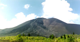
Geological Summary. The Soputan stratovolcano on the southern rim of the Quaternary Tondano caldera on the northern arm of Sulawesi Island is one of Sulawesi's most active volcanoes. The youthful, largely unvegetated volcano is the only active cone in the Sempu-Soputan volcanic complex, which includes the Soputan caldera, Rindengan, and Manimporok (3.5 km ESE). Kawah Masem maar was formed in the W part of the caldera and contains a crater lake; sulfur has been extracted from fumarolic areas in the maar since 1938. Recent eruptions have originated at both the summit crater and Aeseput, a prominent NE-flank vent that formed in 1906 and was the source of intermittent major lava flows until 1924.
Information Contacts: Dali Ahmad, Volcanological Survey of Indonesia (VSI), Jalan Diponegoro No. 57, Bandung 40122, Indonesia (URL: http://www.vsi.esdm.go.id/).

