Report on Nyiragongo (DR Congo) — March 2001
Bulletin of the Global Volcanism Network, vol. 26, no. 3 (March 2001)
Managing Editor: Richard Wunderman.
Nyiragongo (DR Congo) Lava lake status unclear; new fumaroles and elevated ground temperatures
Please cite this report as:
Global Volcanism Program, 2001. Report on Nyiragongo (DR Congo) (Wunderman, R., ed.). Bulletin of the Global Volcanism Network, 26:3. Smithsonian Institution. https://doi.org/10.5479/si.GVP.BGVN200103-223030
Nyiragongo
DR Congo
1.52°S, 29.25°E; summit elev. 3470 m
All times are local (unless otherwise noted)
During the beginning of March 2001, scientists from the Goma Volcanological Observatory visited Nyiragongo in an effort to determine if the volcano was active. At that time the crater was estimated to be 800-1,000 m in diameter. They reported that the surface level of the lava lake in the summit crater remained the same as in 1996 (the last time it was measured), ~300 m below the crater rim, 120 m below what is considered to be the critical level. Thus, as this issue of the Bulletin goes to press, it remains uncertain whether Nyiragongo's lava lake's surface remained active and molten, or whether its surface was covered by a thick solid crust. GVN will try to clarify this in a future report.
The scientists observed several changes since January 2001. Fumaroles were present on the side of the small central crater. The ambient ground temperature in this area is normally 5-9°C, but was measured to be 28°C. There were also fumaroles with gas temperatures of 70°C. Researchers measured temperatures of ~50°C in cracks upstream of Shahero crater ~2 km S of the summit crater. Cracks observed in the main cone suggested dilatation of the crater area.
TOMS observations. Anomalous, volcanogenic SO2 concentrations over the region were detected by space-borne (TOMS) instruments in February. Since these concentrations were presumably associated with the eruption of Nyamuragira, they were discussed within that report. On the other hand, the large sizes of these concentration anomalies and the uncertainty of the relevant eruption chronologies make it unclear whether Nyiragongo contributed appreciable SO2.
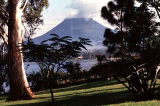
Geological Summary. The Nyiragongo stratovolcano contained a lava lake in its deep summit crater that was active for half a century before draining catastrophically through its outer flanks in 1977. The steep slopes contrast to the low profile of its neighboring shield volcano, Nyamuragira. Benches in the steep-walled, 1.2-km-wide summit crater mark levels of former lava lakes, which have been observed since the late-19th century. Two older stratovolcanoes, Baruta and Shaheru, are partially overlapped by Nyiragongo on the north and south. About 100 cones are located primarily along radial fissures south of Shaheru, east of the summit, and along a NE-SW zone extending as far as Lake Kivu. Many cones are buried by voluminous lava flows that extend long distances down the flanks, which is characterized by the eruption of foiditic rocks. The extremely fluid 1977 lava flows caused many fatalities, as did lava flows that inundated portions of the major city of Goma in January 2002.
Information Contacts: Wafula Mifundu, Observatore Volcanologie de Goma (RDC-E), Goma, Democratic Republic of Congo; Jim Smith, US Agency for International Development / Office of US Foreign Disaster Assistance, 1300 Pennsylvania Ave., NW, Washington, DC 20523-8602 USA (URL: https://www.usaid.gov/who-we-are/organization/bureaus/bureau-democracy-conflict-and-humanitarian-assistance/office-us); Simon Carn, Joint Center for Earth System Technology (NASA/UMBC), University of Maryland Baltimore County, 1000 Hilltop Circle, Baltimore, MD 21250 USA.

