Report on Kanlaon (Philippines) — October 2001
Bulletin of the Global Volcanism Network, vol. 26, no. 10 (October 2001)
Managing Editor: Richard Wunderman.
Kanlaon (Philippines) Earthquakes increase during early 2001 and begin to decrease 28 March
Please cite this report as:
Global Volcanism Program, 2001. Report on Kanlaon (Philippines) (Wunderman, R., ed.). Bulletin of the Global Volcanism Network, 26:10. Smithsonian Institution. https://doi.org/10.5479/si.GVP.BGVN200110-272020
Kanlaon
Philippines
10.4096°N, 123.13°E; summit elev. 2422 m
All times are local (unless otherwise noted)
During January through March 2001, earthquake clusters were recorded by the seismic monitoring network around Canlaon. Similar activity occurred prior to the 10 August 1996 phreatic explosion from the active summit crater of the volcano (BGVN 21:07), leading the Philippine Institute of Volcanology and Seismology (PHIVOLCS) to believe that the earthquakes could signify a reactivation of the volcanic system at depth, a precursor to more vigorous activity such as ash explosions. On 21 March, a PHIVOLCS advisory of possible forthcoming activity recommended the immediate suspension of all treks to the summit crater. In addition, the 4-km-radius Permanent Danger Zone (PDZ) became off-limits at all times.
Beginning 28 March through at least 31 May, earthquakes averaged only about 1-2 events per day, a low level of seismicity. Accordingly, PHIVOLCS relaxed its no-entry advisory but urged visitors to avoid entering the crater because explosions could still occur without warning. For the same reason, the public was reminded that no permanent human activity is permitted within 4 km of the crater. No further reports were issued through at least October.
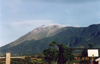
Geological Summary. Kanlaon volcano (also spelled Canlaon) forms the highest point on the Philippine island of Negros. The massive andesitic stratovolcano is covered with fissure-controlled pyroclastic cones and craters, many of which are filled by lakes. The largest debris avalanche known in the Philippines traveled 33 km SW from Kanlaon. The summit contains a 2-km-wide, elongated northern caldera with a crater lake and a smaller but higher active vent, Lugud crater, to the south. Eruptions recorded since 1866 have typically consisted of phreatic explosions of small-to-moderate size that produce minor local ashfall.
Information Contacts: Philippine Institute of Volcanology and Seismology (PHIVOLCS), Department of Science and Technology, 5th & 6th Floors, Hizon building, 29 Quezon Avenue, Quezon City, Philippines; Bureau of Meteorology, Northern Territory Regional Office, P.O. Box 40050, Casuarina, NT 0811, Australia.

