Report on Suwanosejima (Japan) — April 2003
Bulletin of the Global Volcanism Network, vol. 28, no. 4 (April 2003)
Managing Editor: Edward Venzke.
Suwanosejima (Japan) Ash explosions in September and December 2002, and activity in January 2003
Please cite this report as:
Global Volcanism Program, 2003. Report on Suwanosejima (Japan) (Venzke, E., ed.). Bulletin of the Global Volcanism Network, 28:4. Smithsonian Institution. https://doi.org/10.5479/si.GVP.BGVN200304-282030
Suwanosejima
Japan
29.638°N, 129.714°E; summit elev. 796 m
All times are local (unless otherwise noted)
Though the volcano had been relatively quiet since 26 August 2002 (BGVN 27:07), the Japan Meteorological Agency reported that explosive eruptions became frequent on the morning of 12 September 2002. Rumbling was heard intermittently at a location ~4 km SSW of the summit, and light ashfall was observed on 12 September. Explosions occurred at 0816, 1246, 1746, and 1754 on 12 September, and at 0853, 1016, and 1027 on 13 September.
A pilot report contained in the Kagoshima Airport weather observation issued at 1000 on 5 December 2002 noted a plume estimated to be between 900 and 1,200 m altitude. The U.S. Air Force Weather Agency noted that the plume was also seen on DMSP (Defense Meteorological Satellite Program) imagery at 1034 and on NASA Terra MODIS imagery at 1055 on 5 December.
The REAL-Volc Project at the Volcano Research Center, Earthquake Research Institute, University of Tokyo, has detected several thermal anomalies on Suwanose-jima since they started an AVHRR monitoring system in 2001. Anomalies were seen on 11 October 2001, 20 November 2001, 30 December 2001, 20 April 2002, and 12 January 2003.
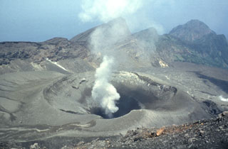
Geological Summary. The 8-km-long island of Suwanosejima in the northern Ryukyu Islands consists of an andesitic stratovolcano with two active summit craters. The summit is truncated by a large breached crater extending to the sea on the E flank that was formed by edifice collapse. One of Japan's most frequently active volcanoes, it was in a state of intermittent Strombolian activity from Otake, the NE summit crater, between 1949 and 1996, after which periods of inactivity lengthened. The largest recorded eruption took place in 1813-14, when thick scoria deposits covered residential areas, and the SW crater produced two lava flows that reached the western coast. At the end of the eruption the summit of Otake collapsed, forming a large debris avalanche and creating an open collapse scarp extending to the eastern coast. The island remained uninhabited for about 70 years after the 1813-1814 eruption. Lava flows reached the eastern coast of the island in 1884. Only about 50 people live on the island.
Information Contacts: Naokuni Uchida, Japan Meteorological Agency (JMA-Fukuoka Center), 1-3-4 Ote-machi, Chiyoda-ku, Tokyo 100, Japan (URL: http://www.jma.go.jp/); Takayuki Kaneko, Volcano Research Center, Earthquake Research Institute, University of Tokyo, Yayoi 1-1-1, Bunkyo-ku, Tokyo 113-0032, Japan (URL: http://www.eri.u-tokyo.ac.jp/VRC/index_E.html); Charles Holliday, U.S. Air Force Weather Agency, 106 Peacekeeper Drive, Ste 2NE, Offut AFB, NE 68113-4039, USA (URL: http://www.557weatherwing.af.mil/).