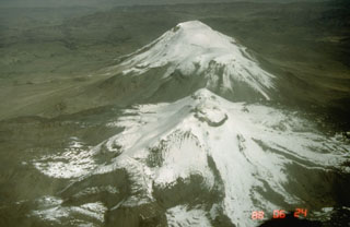
Report on Sabancaya (Peru) — May 2003
Bulletin of the Global Volcanism Network, vol. 28, no. 5 (May 2003)
Managing Editor: Edward Venzke.
Sabancaya (Peru) Inflation at Hualca Hualca detected by satellite surveys from June 1992 to April 1996
Please cite this report as:
Global Volcanism Program, 2003. Report on Sabancaya (Peru) (Venzke, E., ed.). Bulletin of the Global Volcanism Network, 28:5. Smithsonian Institution. https://doi.org/10.5479/si.GVP.BGVN200305-354006
Sabancaya
Peru
15.787°S, 71.857°W; summit elev. 5960 m
All times are local (unless otherwise noted)
A satellite-based interferometric synthetic aperture radar (InSAR) survey of the remote central Andes volcanic arc (Pritchard and Simons, 2002) revealed deformation in the Sabancaya area during June 1992-mid 1997. Inflation was detected ~2.5 km E of the Hualca Hualca cone and 7 km N of Sabancaya (figure 16), with the maximum deformation rate in the radar line-of-sight being ~2 cm/year. While not temporally well-constrained, this inflation seems to have stopped in 1997, perhaps related to the large eruption of Sabancaya in May 1997 (BGVN 22:07). No deformation was observed between mid 1997-December 2001. The inferred source depth was 11-13 km below sea level. Additional details about the study and analysis are available in Pritchard and Simons (2002).
Reference. Pritchard, M., and Simons, M., 2002, A satellite geodetic survey of large-scale deformation of volcanic centres in the Central Andes: Nature, v. 418, p. 167-170.
Geological Summary. Sabancaya, located in the saddle NE of Ampato and SE of Hualca Hualca volcanoes, is the youngest of these volcanic centers and the only one to have erupted in historical time. The oldest of the three, Nevado Hualca Hualca, is of probable late-Pliocene to early Pleistocene age. The name Sabancaya (meaning "tongue of fire" in the Quechua language) first appeared in records in 1595 CE, suggesting activity prior to that date. Holocene activity has consisted of Plinian eruptions followed by emission of voluminous andesitic and dacitic lava flows, which form an extensive apron around the volcano on all sides but the south. Records of observed eruptions date back to 1750 CE.
Information Contacts: Matthew Pritchard and Mark Simons, Division of Geological and Planetary Sciences, California Institute of Technology, Pasadena, CA 91125, USA (URL: http://www.gps.caltech.edu/).

