Report on Nightingale Island (United Kingdom) — August 2004
Bulletin of the Global Volcanism Network, vol. 29, no. 8 (August 2004)
Managing Editor: Richard Wunderman.
Nightingale Island (United Kingdom) Earthquake swarm on 29-30 July followed by floating pumice
Please cite this report as:
Global Volcanism Program, 2004. Report on Nightingale Island (United Kingdom) (Wunderman, R., ed.). Bulletin of the Global Volcanism Network, 29:8. Smithsonian Institution. https://doi.org/10.5479/si.GVP.BGVN200408-386011
Nightingale Island
United Kingdom
37.42°S, 12.48°W; summit elev. 365 m
All times are local (unless otherwise noted)
[This event was originally assigned to Tristan da Cunha, but later work located the earthquake swarm on the SE submarine flank of Nightingale Island, about 40 km S.]
The Comprehensive Nuclear Test Ban Treaty Organisation (CTBTO) in Vienna operates a recently installed (July 2002) satellite-linked real-time hydroacoustic station on the island of Tristan da Cunha, with two elements (figure 1). These are designed to record T phases and use three-component short-period seismometers sampled at 100 samples per second. Roderick Stewart, a scientist with the CTBTO, reported that seismic activity, including several felt events, occurred in the vicinity of Tristan da Cunha in July and August 2004. This is the first time that seismicity near this volcano has been instrumentally recorded.
 |
Figure 1. Map of the island of Tristan da Cunha showing the locations of the two CTBTO hydroacoustic stations. Station locations courtesy of R. Stewart, CTBTO. |
An intense swarm of seismic activity was recorded, and felt, on the night of 29-30 July. The activity lasted approximately six hours and peaked around 2100-2200 UTC on 29 July. There were a number of large earthquakes in the swarm; the largest, at approximately 2220 UTC on 29 July, had a body-wave magnitude of 4.2. The epicenter was in the vicinity of the island, but location uncertainties make it impossible to say whether the source was onshore or offshore. Seismic activity continued to be recorded, and occasionally felt, throughout August 2004, but was declining slowly (figure 2). No long-period earthquakes or tremor signals were positively identified although, according to Stewart, the temporal pattern of the swarm appeared to be volcanic. A pseudo-RSAM plot of the data from one of the stations showed that the activity grew gradually to a peak over a period of two or three hours and that the larger events occurred after this peak.
 |
Figure 2. Hourly count of earthquakes at Tristan da Cunha from 27 July to 31 August 2004. Events were counted manually on constant gain plots. The counts of earthquakes during the initial swarm were more than 100 per hour. Courtesy of R. Stewart, CTBTO. |
Stewart described the earthquakes as follows. "All the earthquake signals were impulsive with well-developed P and S phases, typical of volcano-tectonic activity. With only two stations, it is not possible to determine individual hypocentres with any confidence and the locations of the earthquakes can only be inferred from general observations made on the data. First-motion analysis of the P waves was made difficult because the arrivals were very small on the horizontal components. However, it was possible to determine that the P wave was always arriving from the SE at both stations and that the angle of incidence of the arriving P wave was very steep, within 10 degrees of vertical. S-P times were between 4 and 5 seconds at both stations, with H09N1 typically a fraction of a second longer than H09W1. Depending on the velocities assumed, these S-P times indicate that the earthquakes were between 20 and 30 km from the stations. The simplest interpretation of both the above observations is that the earthquakes occurred at depth directly below the volcano. However, an offshore location to the SE cannot be ruled out. What is certain is that these events occurred close to the volcano."
Reports from the island of rocks floating in the water in the days following the seismic activity, along with an initial offshore estimate of the location of the largest earthquake (which had large uncertainties), led to speculation of an underwater eruption. One newspaper account from the Tristan Times on 6 August described "angular and not round" rocks seen by fishermen floating "all around the Island." In a 14 September BBC World Service interview, Island Administrator Mike Hentley stated that fishermen found "huge lumps of [pumice], up to 10 or 12 kg floating on the surface to the south/west of the Island." He further described the pumice as "a very crumbly, light grey stone." Samples of this pumice collected by James Glass (figure 3) are being sent to the Global Volcanism Program.
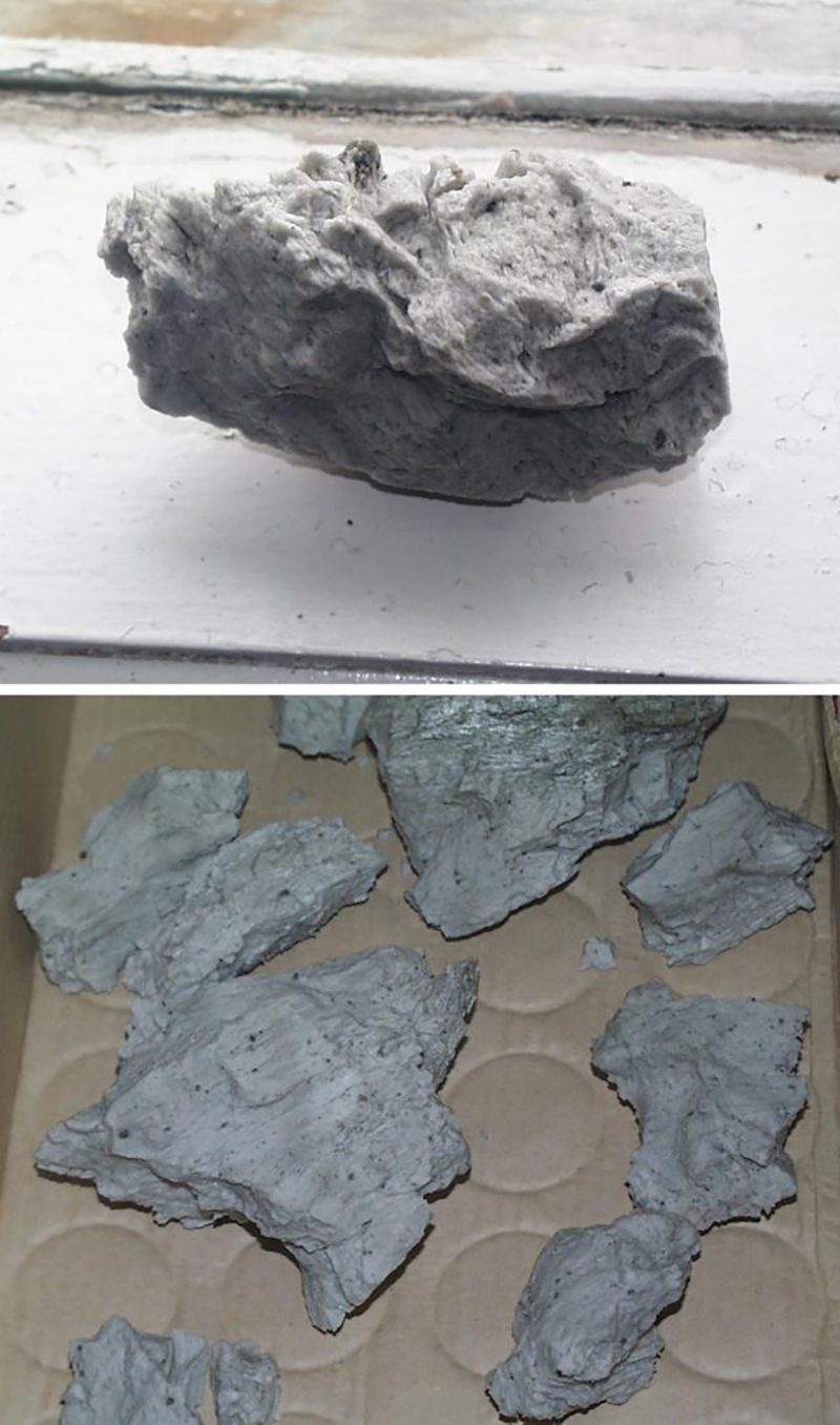 |
Figure 3. Photographs of pumice collected near Tristan da Cunha, August 2004. No scale or size description was provided with the photos, but the top photo of the single sample appears to have been taken on a window ledge and the bottom photo of multiple samples on a bench `seat cushion. Courtesy of James Glass, Tristan Times. |
The Tristan Times also reported on 30 September that volcanologist Victoria Hards from the British Geological Survey (BGS) arrived on the island on 10 September to assess the potential threat of the recent seismic activity. She reportedly determined that the 29-30 July event was caused by rising magma 25 km SE of the island. She also noted that there was no sign of activity at the 1961 eruption site, and no eruption was imminent so there was no threat to the settlement. The BGS planned to monitor the seismic data over the next four months to assess any longer-term implications.
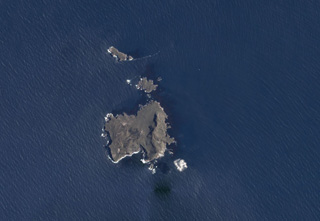
Geological Summary. Nightingale Island, along with the adjacent smaller Middle (or Alex) and Stoltenhoff Islands and associated small islets, are the southernmost of the Tristan da Cunha island group. The heavily eroded island consists of ash and agglomerate units with intervening massive trachytic intrusions and lava flows. Volcanic rocks were K-Ar dated at between 400,000 and 150,000 years, and a radiocarbon date of about 39,000 years BP was obtained from an ash layer overlain by a lava flow. An earthquake swarm lasting 6 hours beginning on 29 July 2004 was followed by observation of large blocks of floating phonolitic pumice that washed up on Tristan da Cunha. The pumice was considered to be from an eruption associated with an earthquake swarm 37-53 km SSE of Tristan da Cunha on the submarine SE flank of Nightingale Island.
Information Contacts: David Booth, British Geological Survey, Murchison House, Edinburgh EH9 3LA, UK; Roderick Stewart, Preparatory Commission for the Comprehensive Nuclear Test Ban Treaty Organisation (CTBTO), Vienna International Centre, PO Box 1200, A-1400 Vienna, Austria; Juanita Brock and James Glass, Tristan Times (URL: http://www.tristantimes.com); BBC World Service (URL: http://www.bbc.co.uk/worldservice/).