Report on Kerinci (Indonesia) — January 2005
Bulletin of the Global Volcanism Network, vol. 30, no. 1 (January 2005)
Managing Editor: Richard Wunderman.
Kerinci (Indonesia) 27 September 2004 ash plumes to 6 km altitude; thick gray plumes during October 2004
Please cite this report as:
Global Volcanism Program, 2005. Report on Kerinci (Indonesia) (Wunderman, R., ed.). Bulletin of the Global Volcanism Network, 30:1. Smithsonian Institution. https://doi.org/10.5479/si.GVP.BGVN200501-261170
Kerinci
Indonesia
1.697°S, 101.264°E; summit elev. 3800 m
All times are local (unless otherwise noted)
Events at Kerinci were previously discussed through 29 August 2004 (BGVN 29:08). The following report overlaps slightly, covering 17 July through 24 October 2004. As already reported, on 24 July 2004 a thick plume rose to 100-600 m above the crater rim, ash fell ~ 3 km from the crater forming deposits as thick as 1 cm. Seismicity is summarized in table 6.
Table 6. Volcanic seismicity registered at Kerinci during 17 July to 24 October 2004. Courtesy of DVGHM.
| Date | Volcanic A | Volcanic B | Emission |
| 17 Jul-24 Jul 2004 | 2 | 1 | 0.5-3 |
| 24 Jul-31 Jul 2004 | 5-6 | 3 | 0.5-5 |
| 02 Aug-08 Aug 2004 | 5 | 2 | continuous |
| 09 Aug-15 Aug 2004 | 1 | 1 | continuous |
| 16 Aug-22 Aug 2004 | 2 | 2 | continuous |
| 23 Aug-29 Aug 2004 | -- | 1 | continuous |
| 27 Sep-03 Oct 2004 | 5 | 1 | continuous |
| 04 Oct-10 Oct 2004 | -- | 1 | continuous |
| 11 Oct-17 Oct 2004 | -- | 2 | continuous |
| 18 Oct-24 Oct 2004 | 3 | 2 | continuous |
There were six Darwin VAAC reports on Kerinci in 2004, two on 21 June and four on 27 September. (Prior to that the VAAC reports were clustered in mid- to late-August 2002.) The 21 June cases discussed a continuous emission with ash to ~ 4 km drifting W. The 27 September cases began with and then repeated an aviator's statement (an AIREP at 0136 UTC 27 September), noting that ash was observed to ~ 6 km, drifting W. For all six cases (June and September), the VAAC staff noted that due to cloud cover, ash was not visible in satellite data.
Kerinci erupted on 6 August 2004 at 0835 hours. Gray ash rose to 50-600 m above the summit. The hazard status was raised to Alert Level II (yellow) at 1030, where it stayed for the remainder of this report period.
During 9-15 August 2004 the number of earthquakes decreased. A white thin plume again rose to 50-300 m above the summit. Volcanic activity remained relatively stable from 15 August through 24 October 2004, with thick gray plumes rising 50-300 m above the summit.
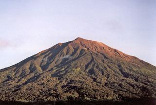
Geological Summary. Gunung Kerinci in central Sumatra forms Indonesia's highest volcano and is one of the most active in Sumatra. It is capped by an unvegetated young summit cone that was constructed NE of an older crater remnant. There is a deep 600-m-wide summit crater often partially filled by a small crater lake that lies on the NE crater floor, opposite the SW-rim summit. The massive 13 x 25 km wide volcano towers 2400-3300 m above surrounding plains and is elongated in a N-S direction. Frequently active, Kerinci has been the source of numerous moderate explosive eruptions since its first recorded eruption in 1838.
Information Contacts: Directorate of Volcanology and Geological Hazard Mitigation (DVGHM), Jalan Diponegoro 57, Bandung 40122, Indonesia (URL: http://www.vsi.esdm.go.id/).

