Report on Soputan (Indonesia) — April 2006
Bulletin of the Global Volcanism Network, vol. 31, no. 4 (April 2006)
Managing Editor: Richard Wunderman.
Soputan (Indonesia) Late 2005 phreatic and Strombolian eruptions; ash plume to ~ 5.8 km altitude
Please cite this report as:
Global Volcanism Program, 2006. Report on Soputan (Indonesia) (Wunderman, R., ed.). Bulletin of the Global Volcanism Network, 31:4. Smithsonian Institution. https://doi.org/10.5479/si.GVP.BGVN200604-266030
Soputan
Indonesia
1.112°N, 124.737°E; summit elev. 1785 m
All times are local (unless otherwise noted)
Our last report covered events through July 2005 (BGVN 30:08); this report includes activity that took place in late December 2005 and also presents a discussion of the wide discrepancy of cloud-height estimates between ground, aircraft, and satellite remote-sensing observations.
Activity during 21-27 December 2005. A phreatic eruption began at Soputan on 26 December 2005 around 1230 following heavy rain. Observers concluded that rainwater contacted lava at the volcano's summit. On 27 December at 0400, a Strombolian eruption began that lasted about 50 minutes. Incandescent material was ejected ~ 35 m, and avalanches spalling off the margins of the summit traveled as far as 750 m E. Booming noises were heard 5 km from the summit. The Darwin VAAC reported that an ash plume reached a height of ~ 5.8 km altitude and drifted SE.
As of 28 December, eruptive activity continued, producing ash plumes to a height of ~ 1 km above the volcano. Strombolian eruptions ejected incandescent material up to 200 m above the summit. Pyroclastic avalanches traveled ~ 500 m E and SW. This was Soputan's fourth event in 2005, with previous activity on 14 and 20 April, and on 12 September. The Alert Level remained at 2, since the volcano is about 11 km from the nearest settlement. Visitors were prohibited from climbing Soputan's summit and from camping around Kawah Masem.
October 2005 eruption plume height discussion. The Darwin Volcanic Ash Advisory Centre and the Cooperative Institute for Meteorological Satellite Studies (CIMSS) at the University of Wisconsin – Madison collaborated to compare various estimates for the height of the 27 December cloud (BGVN 30:08). The eruption height had been initially reported at less than 6 km altitude on the 27th by an airline pilot, and 1 km above the summit (~ 2.8 km altitude) by ground observers on the 28th. Darwin VAAC, on reviewing hourly MTSAT imagery on the 27th, estimated the plume top at 15 km altitude operationally and then 12.5 km altitude in post-analysis studies.
Michael Richards of CIMSS used an established remote-sensing technique known as "CO2 slicing" (Menzel et al., 1983, Richards et al., 2006), to obtain heights of the cloudscape around Soputan after the eruption. The technique takes advantage of the fact that the emissive infrared CO2 bands available on the MODIS satellite become more transmissive with decreasing wavelength, as the bands move away from the peak wavelength of CO2 absorption at 15 µm. There were two good MODIS images obtained over the eruption on the 27th, with the first, at 0210 UTC or 1010 local time. These images were taken at close to the time of the peak cloud height observed on MTSAT imagery, and the CO2 slicing technique appears to validate the post-analyzed VAAC height of ~ 12.5 km altitude.
The different results for the height of the eruption cloud illustrate the difficulty that observers would have had viewing the cloud from any angle. Weather clouds in the tropics typically extend up to 16 km or more altitude. Cirrus cloud from a storm complex can obscure the view of a satellite for hours. On the other hand, middle-level clouds, such as altostratus, will typically lie between aircraft cruising altitudes and the ground, meaning that pilots at cruising altitude may not associate any eruption cloud with a volcano on the ground, unless the cloud is obviously volcanic. Ground observers are completely unable to view the full height of the cloud if it is penetrating through the middle-level clouds.
The appearance of the cloud on true-color, near-infrared and infrared imagery is consistent with an ice-rich (glaciated) volcanic cloud, in-line with the CVGHM account of water interactions at the ground, and also with a high water loading in the atmosphere. The extensive areas of cloud in the area hindered satellite detection of the eruption until after the pilot report of the eruption had been received.
References. Menzel, W. P., Smith, W. L., and Stewart, T. R., 1983, Improved cloud motion wind vector and altitude assignment using VAS: Journal of Applied Meteorology, v. 22, p. 377-384.
Richards, M. S., Ackerman, S. A., Pavolonis, M. J., Feltz, W. F., and Tupper, A.C., 2006, Volcanic ash cloud heights using the MODIS CO2-slicing algorithm: AMS 12th, conference on aerospace and range meteorology, Atlanta, Georgia, USA (http://ams.confex.com/ams/pdfpapers/104055.pdf).
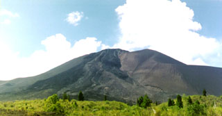
Geological Summary. The Soputan stratovolcano on the southern rim of the Quaternary Tondano caldera on the northern arm of Sulawesi Island is one of Sulawesi's most active volcanoes. The youthful, largely unvegetated volcano is the only active cone in the Sempu-Soputan volcanic complex, which includes the Soputan caldera, Rindengan, and Manimporok (3.5 km ESE). Kawah Masem maar was formed in the W part of the caldera and contains a crater lake; sulfur has been extracted from fumarolic areas in the maar since 1938. Recent eruptions have originated at both the summit crater and Aeseput, a prominent NE-flank vent that formed in 1906 and was the source of intermittent major lava flows until 1924.
Information Contacts: Center of Volcanology and Geological Hazard Mitigation, Jalan Diponegoro 57, Bandung 40122, Indonesia (URL: http://www.vsi.esdm.go.id/); Andrew Tupper and Rebecca Patrick, Darwin Volcanic Ash Advisory Centre (VAAC), Australian Bureau of Meteorology (URL: http://www.bom.gov.au/info/vaac/soputan.shtml); Michael Richards and Wayne Feltz, Cooperative Institute for Meteorological Satellite Studies (CIMSS), University of Wisconsin, 1225 West Dayton Street, Madison, WI 53706, USA.

