Report on Egon (Indonesia) — August 2008
Bulletin of the Global Volcanism Network, vol. 33, no. 8 (August 2008)
Managing Editor: Richard Wunderman.
Egon (Indonesia) Phreatic eruption on 15 April 2008 prompted evacuations
Please cite this report as:
Global Volcanism Program, 2008. Report on Egon (Indonesia) (Wunderman, R., ed.). Bulletin of the Global Volcanism Network, 33:8. Smithsonian Institution. https://doi.org/10.5479/si.GVP.BGVN200808-264160
Egon
Indonesia
8.676°S, 122.455°E; summit elev. 1661 m
All times are local (unless otherwise noted)
The Center of Volcanology and Geological Hazard Mitigation (CVGHM) indicated that after the 28 January 2004 eruption of Egon, phreatic eruptions often occurred without preceding increases in seismicity. Eruptions reported during July, August, and September 2004, and during February 2005 occasionally resulted in evacuations.
During 4-14 April 2008 visual observations showed daily white plumes rising to an altitude of 1.8 km. This activity was considered to be normal. A peak in seismicity was reached during 6-7 April but then declined significantly through 15 April. On 15 April a phreatic explosion produced an ash plume that rose to an altitude of 5.7 km and drifted ~ 25 km W, reaching Maumere City, the capital of Flores. The emissions were accompanied by thunderous noise. A team of emergency personnel in the closest village to the explosion reported that about 600 people evacuated from three villages. No fatalities were reported.
During 15 April to 10 May, earthquakes declined in number. The altitudes of "eruption plumes" became smaller during the later half of April: on 20, 24, and 28 April, plumes rose to altitudes of 3.7 km, 2.6 km, and 1.8 km, respectively, although the character of the plumes was not described. During 27 April-13 May instruments measuring deformation indicated a return to background rates. Diffuse white plumes rose above the summit on 12 May. Communities on the W flank within 1 km of the peak remained on high alert due to the presence of gasses and the possibility of future phreatic eruptions.
A search of the MODVOLC website found there were no thermal alerts for Egon during this report's time frame.
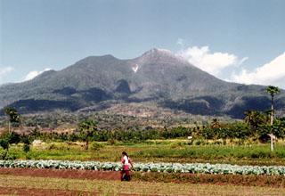
Geological Summary. Gunung Egon, also known as Namang, sits within the narrow section of eastern Flores Island. The barren, sparsely vegetated summit region has a 350-m-wide, 200-m-deep crater that sometimes contains a lake. Other small crater lakes occur on the flanks. A lava dome forms the southern summit. Solfataric activity occurs on the crater wall and rim and on the upper S flank. Reports of eruptive activity prior to explosive eruptions beginning in 2004 are unconfirmed. Emissions were often observed above the summit during 1888-1892. Strong emissions in 1907 reported by Sapper (1917) was considered by the Catalog of Active Volcanoes of the World (Neumann van Padang, 1951) to be an historical eruption, but Kemmerling (1929) noted that this was likely confused with an eruption on the same date and time from Lewotobi Lakilaki.
Information Contacts: Center of Volcanology and Geological Hazard Mitigation, Saut Simatupang, 57, Bandung 40122, Indonesia (URL: http://vsi.esdm.go.id/); Hawai'i Institute of Geophysics and Planetology (HIGP) Thermal Alerts System, School of Ocean and Earth Science and Technology (SOEST), University of Hawai'i, 2525 Correa Road, Honolulu, HI 96822, USA (URL: http://modis.higp.hawaii.edu/).