Report on Reventador (Ecuador) — August 2008

Bulletin of the Global Volcanism Network, vol. 33, no. 8 (August 2008)
Managing Editor: Richard Wunderman.
Reventador (Ecuador) Eruptions, seismicity, and hot spots in late July and early August 2008
Please cite this report as:
Global Volcanism Program, 2008. Report on Reventador (Ecuador) (Wunderman, R., ed.). Bulletin of the Global Volcanism Network, 33:8. Smithsonian Institution. https://doi.org/10.5479/si.GVP.BGVN200808-352010
Reventador
Ecuador
0.077°S, 77.656°W; summit elev. 3562 m
All times are local (unless otherwise noted)
Eruptions from Reventador (figure 28) occurred between March and May 2007, and an ash plume was reported in October 2007. The eruptions were characterized by steam-and-ash plumes that rose to altitudes as high as 7.6 km, thermal anomalies on satellite imagery, roaring noises, and a small lava flow (BGVN 33:03 and 33:04).
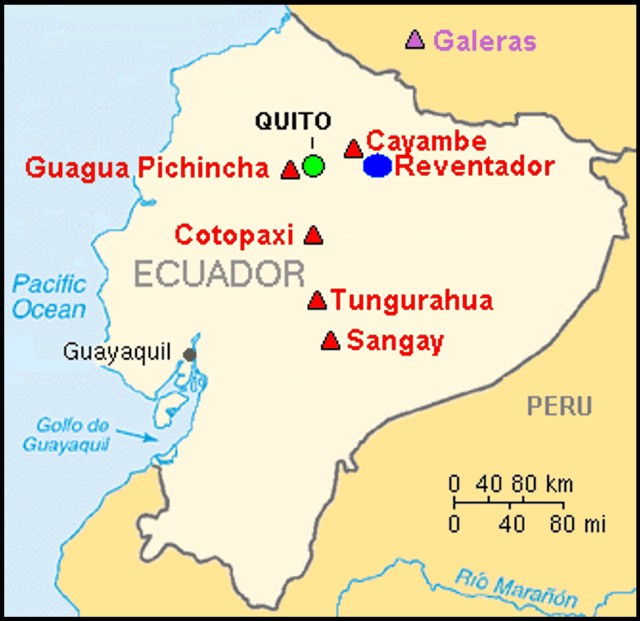 |
Figure 28. Map of Ecuador showing Reventador and selected other volcanoes. Courtesy of USGS. |
MODVOLC thermal alerts were issued on 28 and 31 July 2008 (local dates). Mapping of the MODIS anomaly locations indicated that thermally radiant material was within the crater (no anomalies outside the crater).
According to the Instituto Geofísico-Escuela Politécnica Nacional (IG), seismic activity showed a progressive and constant increase from the beginning of July. The number of earthquakes per day were the greatest on 24 and 25 July. On 27 July continuous seismic tremor was followed by incandescence around the crater. Thermal anomalies were also identified on satellite imagery. In the evening, explosions produced ash plumes and ejected incandescent material that rolled down the flanks. On 28 July ash plumes rose to altitudes of 4-6 km and drifted NW and W; ashfall was reported in Olmedo, ~ 50 km NW. On 29 July, ash-free steam plumes rose from the crater and drifted NW, and a sulfur smell was noted near the volcano. A lava flow directed S from the caldera halted but the location of the flow front was ambiguous in the reporting.
According to the IG, seismicity from Reventador decreased during 30-31 July, and remained low thereafter. A lava flow within the caldera was observed. On 31 July, steam-and-gas plumes with a low ash content were detected on satellite imagery and drifted W and SW. On 1 August, steam-and-gas plumes were emitted and a lava flow in the caldera was noted. Diffuse ash emissions were noted on 2 August. On 3 August, IG scientists observed the lava flow in the caldera and estimated that it advanced at a rate of 100 m per day. They also heard sporadic roaring noises.
On 2 August, the Washington Volcanic Ash Advisory Center (VAAC) began to advise that light ash and gas was being emitted. An occasional hotspot was observed on 3 August. By 4 August, the VAAC reported that emissions had ceased and seismicity was decreasing.
According to the IG, during 5-8 August, gas-and-steam plumes were noted. By 7 August the lava flow had ceased. On 8 August, incandescence from the crater was observed at night. There were no further reports through 1 October.
During July-August 2008 the government did not believe the risk to human health was sufficient to increase the alert status or evacuate the residents. However, officials activated some emergency responses in nearby towns.
Geological Summary. Volcán El Reventador is the most frequently active of a chain of Ecuadorian volcanoes in the Cordillera Real, well east of the principal volcanic axis. The forested, dominantly andesitic stratovolcano has 4-km-wide avalanche scarp open to the E formed by edifice collapse. A young, unvegetated, cone rises from the amphitheater floor to a height comparable to the rim. It has been the source of numerous lava flows as well as explosive eruptions visible from Quito, about 90 km ESE. Frequent lahars in this region of heavy rainfall have left extensive deposits on the scarp slope. The largest recorded eruption took place in 2002, producing a 17-km-high eruption column, pyroclastic flows that traveled up to 8 km, and lava flows from summit and flank vents.
Information Contacts: P. Ramón, Escuela Politécnica Nacional, Casilla 17-01-2759, Quito, Ecuador (URL: http://www.igepn.edu.ec/); Washington Volcanic Ash Advisory Center, Satellite Analysis Branch (SAB), NOAA/NESDIS E/SP23, NOAA Science Center Room 401, 5200 Auth Road, Camp Springs, MD 20746, USA (URL: http://www.ssd.noaa.gov/).