Report on Kaba (Indonesia) — September 2009
Bulletin of the Global Volcanism Network, vol. 34, no. 9 (September 2009)
Managing Editor: Richard Wunderman.
Kaba (Indonesia) Increased seismicity and whitish vapor emissions
Please cite this report as:
Global Volcanism Program, 2009. Report on Kaba (Indonesia) (Wunderman, R., ed.). Bulletin of the Global Volcanism Network, 34:9. Smithsonian Institution. https://doi.org/10.5479/si.GVP.BGVN200909-261220
Kaba
Indonesia
3.522°S, 102.615°E; summit elev. 1940 m
All times are local (unless otherwise noted)
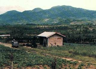
Deep volcanic earthquakes, seismic tremor, and five small explosions with corresponding ash emission were reported from Kaba in August 2000 (BGVN 25:11). Since then, Kaba has been quiet, but even in its normal state it almost always emits whitish plumes 25-100 m high.
On 20 October 2009, the Center of Volcanology and Geological Hazard Mitigation (CVGHM) reported that seismic activity from Kaba increased in August and remained elevated into September and October. Inflation was also detected. When weather permitted, diffuse white plumes were seen rising ~ 25-50 m above the summit crater complex and drifting E. Based on the deformation and increased seismicity, CVGHM raised the Alert Level to 2 (on a scale of 1-4).
From January through August 2009, the frequency of deep volcanic earthquakes averaged 85 events per month, but in August the number of events rose to 257 per month. During August-September, whitish plumes remained similar to September-October. In September seismicity fluctuated but tended to increase. Earthquakes and total tremors recorded at Kaba's monitoring post are shown in table 2.
Table 2. Summary of Kaba seismic data recorded during 12 September-20 October 2009. Courtesy of CVGHM.
| Dates (2009) | Deep volcanic earthquakes (Count, Characteristics) | Shallow volcanic earthquakes (Count, Characteristics) | Notes |
| Beginning on 12 September | 343 | 55 | -- |
| 1-17 October | 253. Max. amplitudes of 1-18 mm; S-wave minus P-wave arrival times ("S-P") of 0.2-3.5 s with signals lasting 4-35 s. | 271. Max. amplitudes 0.5-15 mm, durations of 2.5-11 s. | -- |
| 18 October | 68. Max. amplitude of 1-19 mm; S-P times of 0.2-3 s, and a duration of 3.5-47 s. | 67. Max. amplitudes 0.8-16 mm, durations of 2.5-13 s. | -- |
| 19 October | 50. Max. amplitudes of 0.5-18 mm; S-P 0.5-2 s, and a duration of 2-15 s. | 127. Max. amplitudes 0.5-15 mm, durations of 2.5-10 s. | Volcanic tremor registered during 0640-0900 local time; max. amplitudes 0.5-2 mm. |
| 20 October | 29. Max. amplitudes of 0.5-18 mm; S-P 0.5-2 seconds and a duration of 2-15 s. | 21. Max. amplitudes 0.5-15 mm, durations of 2.5-10 s. | Continuous tremor with amplitudes of 1-7 mm; the most prevalent amplitudes 1-3 mm. During clear weather, whitish plumes rose ~ 25 m. |
Deformation measurements taken using an EDM (electronic distance measurement) method were as follows: Biring station, shorter by 10 cm; Voelsang station, longer by 0.4 cm; and Kaba station, shorter by 2 cm.
Measurements of the crater water temperature on 15 October showed a reading of 72°C, with a pH of 3.24. The sulfurous and associated solfatara areas recorded a temperature of around 106-107°C. There was no other activity in the area of the crater.
Geological Summary. Kaba, a twin volcano with Mount Hitam, has an elongated summit crater complex dominated by three large historically active craters trending ENE from the summit to the upper NE flank. The SW-most crater of Gunung Kaba, named Hidup (or Lama), is the largest. Most historical eruptions have affected only the summit area. They mostly originated from the central summit craters, although the upper-NE flank crater Kawah Vogelsang also produced explosions during the 19th and 20th centuries.
Information Contacts: Center of Volcanology and Geological Hazard Mitigation (CVGHM), Jalan Diponegoro 57, Bandung 40122, Indonesia (URL: http://vsi.esdm.go.id/).