Report on Pinatubo (Philippines) — November 2011

Bulletin of the Global Volcanism Network, vol. 36, no. 11 (November 2011)
Managing Editor: Richard Wunderman.
Pinatubo (Philippines) Hardships and economic impact of the 1991 eruption
Please cite this report as:
Global Volcanism Program, 2011. Report on Pinatubo (Philippines) (Wunderman, R., ed.). Bulletin of the Global Volcanism Network, 36:11. Smithsonian Institution. https://doi.org/10.5479/si.GVP.BGVN201111-273083
Pinatubo
Philippines
15.13°N, 120.35°E; summit elev. 1486 m
All times are local (unless otherwise noted)
This report summarizes a news article by Lourdes Solidum-Montevirgen of the Philippines' Department of Science and Technology (Solidum-Montevirgen, 2011). The article noted that 20 years after one of the last century's biggest volcanic eruption (April-September 1991, BGVN 16:03-16:10), hunger and lahars continue to threaten Aeta communities around Pinatubo's foothills. The Aetas (an indigenous people who live in scattered, isolated mountainous parts of Luzon, Philippines) resided, in part, before the eruption in the towns of San Marcelino and Botolan, settlements almost destroyed by the 1991 eruption. The rainy season has resulted in lahar flows that continue to threaten these and nearby towns, displacing thousands of people. Agriculture continues to suffer badly, as hundreds of square kilometers of formerly arable land remain unproductive. Pinatubo is located NW of the capital of Manila (figure 39).
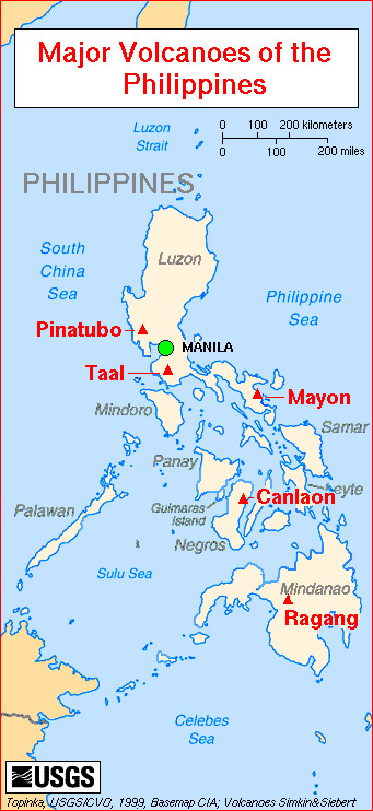 |
Figure 39. A map of major Philippine volcanoes, including Pinatubo. Courtesy of Lyn Topinka, US Geologic Survey. |
Aetas were hardest hit because they were both uprooted from their homes and their way of life. Many remain in government resettlement areas, huddled in makeshift homes, tents, and evacuation dwellings. Many of them are recent refugees after part of a protective dike along the Bucao River collapsed during Typhoon Kiko in August 2009, flooding Botolan and ten villages, resulting in death and hunger. Typhoons that followed two months later (October 2009) broke down an additional 1-km portion of the dike, causing lahars and floodwaters to rise more than 1.5 m, displacing over 20,000 people in nine villages. Over 9,000 of these recent refugees remained in evacuation centers as they awaited dike repair. They have joined thousands of evacuees still huddled in the ten evacuation centers inside three resettlement sites that were created following Pinatubo's eruption.
There is still widespread devastation in Botolan and nearby towns where several square kilometers of lakes and farm lands were "desertified". It is doubtful whether a new bridge and the dike, when repaired, will hold lahar floods because the Bucao river is heavily silted. Botolan (population 51,675), the largest town in Zambales and closest to Pinatubo, also has the largest Aeta population in the province. In 2010, 160 km2 (16,000 hectares) of the area nearest Pinatubo was declared as Aeta ancestral domain by the National Commission on Indigenous Peoples.
Farming has not yet resumed in many rice paddies and vegetable farms damaged by flash floods and lahars. Farm lands were covered with thick ash and reworked tephra, irrigation equipment ruined, roads and bridges destroyed, properties lost, trade and business centers collapsed. Overall, 364 communities and 2.1 million people were affected by the eruption, and more than 80,000 houses were lost. Roads and communications were damaged by pyroclastic flows and lahars. Some 800 km2 of rice lands and almost 800,000 farm animals were lost. The cost to agriculture was estimated at P1.5 billion (~ $25 million US) and the cost of repairs to damaged infrastructure was P3.8 billion (~ $62 million US).
Reference. Solidum-Montevirgen, L., 2011, Hunger, lahar haunt homeless Aetas 20 years after Pinatubo, Malay Business Insight, 29 July.
Geological Summary. Prior to 1991 Pinatubo volcano was a relatively unknown, heavily forested lava dome complex located 100 km NW of Manila with no records of historical eruptions. The 1991 eruption, one of the world's largest of the 20th century, ejected massive amounts of tephra and produced voluminous pyroclastic flows, forming a small, 2.5-km-wide summit caldera whose floor is now covered by a lake. Caldera formation lowered the height of the summit by more than 300 m. Although the eruption caused hundreds of fatalities and major damage with severe social and economic impact, successful monitoring efforts greatly reduced the number of fatalities. Widespread lahars that redistributed products of the 1991 eruption have continued to cause severe disruption. Previous major eruptive periods, interrupted by lengthy quiescent periods, have produced pyroclastic flows and lahars that were even more extensive than in 1991.
Information Contacts: Lourdes Solidum-Montevirgen, Industrial Technology Development Institute-Food Processing Division, Department of Science and Technology, Phillippines; Malaya Business Insight (URL: http://www.malaya.com.ph).