Report on Masaya (Nicaragua) — November 2011

Bulletin of the Global Volcanism Network, vol. 36, no. 11 (November 2011)
Managing Editor: Richard Wunderman.
Masaya (Nicaragua) Degassing through at least mid-2011; episodic crater wall collapse
Please cite this report as:
Global Volcanism Program, 2011. Report on Masaya (Nicaragua) (Wunderman, R., ed.). Bulletin of the Global Volcanism Network, 36:11. Smithsonian Institution. https://doi.org/10.5479/si.GVP.BGVN201111-344100
Masaya
Nicaragua
11.9844°N, 86.1688°W; summit elev. 594 m
All times are local (unless otherwise noted)
This report on Masaya presents a summary of activity through mid-2011. Our last report was issued in March 2009 (BGVN 34:03) and highlighted the intermittent plumes and explosions of 2006 and 2008.
From 2008-2010 activity generally consisted of degassing with sulfur dioxide (SO2) fluxes typically under 1,200 tons per day. Instability of the S andW crater walls was a concern for the National Park and monitored by the agency INETER (Instituto Nicaragüense de Estudios Territoriales). Mass wasting, frequently triggered by heavy rain, occurred within the crater with debris occasionally blocking the active vents.
Throughout this 3-year period, fumarole temperatures ranged from 58 to 84°C and regular monitoring of the El Comalito cinder cone showed that degassing continued. Tremor sources shallowed during 2008-2010, rising from a 2008 depth of 26 km to a 2010 depth of ~ 1 km.
On 12 October 2010 incandescence occurred in the intra-crater area's largest opening (figure 24). Temperature at the points of incandescence reached 207°C. Differential optical-absorption spectroscopy (DOAS) measurements from vents registered SO2 fluxes of 465 tons per day. SO2 emissions increased throughout October 2010, reaching 586 tons per day. INETER reports contain plots with more detailed SO2 data.
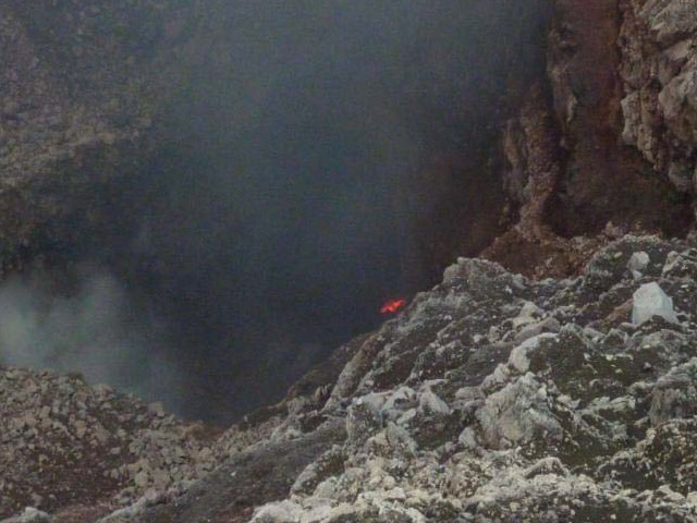 |
Figure 24. Incandescence seen in Masaya's Santiago crater on 12 October 2010. Note the crater's vertical walls and depth. Courtesy of INETER. |
SO2 fluxes in 2011. In January 2011, INETER's team measured SO2 fluxes while in transit along the easternmost route on figure 25 (between the town of Ticuantepe and the community of San Juan). Those SO2 measurements averaged 642 tons per day, an increase over 2010 that was attributed to increased gas and magma output.
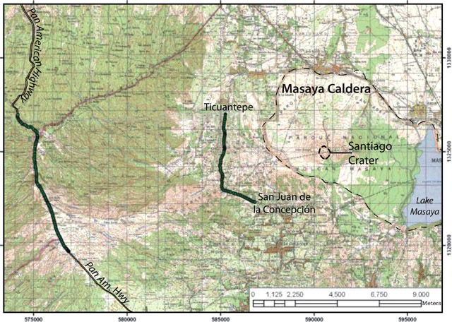 |
Figure 25. Vehicle routes (heavy lines) used while recording Masaya's SO2 fluxes. The scale at bottom shows distance in meters. The topographic margin of Masaya's main caldera sits ~2 km E of the easternmost vehicle route. Courtesy of INETER. |
During 7-30 March 2011 collaborators from the University of East Anglia, Heidelberg University, and Oxford University measured Santiago crater's SO2 and other gas emissions. A Mini-DOAS mobile was one of the many instruments used to monitor the atmosphere and SO2 fluxes (figures 26-28).
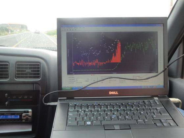 |
Figure 26. SO2 measurements underway at Masaya on 20 January 2011. The vehicle passed beneath Masaya's gas plume on the Southern Pan-American Highway. The laptop displays a well-defined red histogram representing SO2 measured along the plume transect. Courtesy of INETER. |
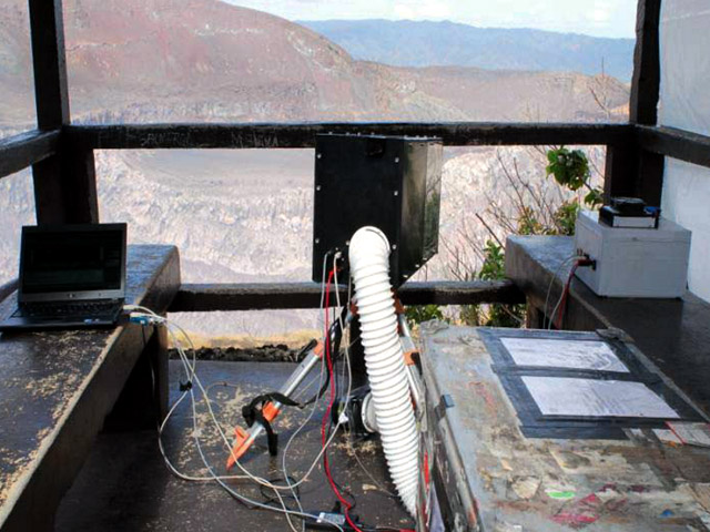 |
Figure 27. Instruments used during the 7-30 March 2011 campaign to measure SO2 on a continuous basis from a viewing platform overlooking Masaya. Courtesy of INETER. |
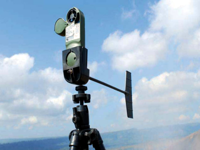 |
Figure 28. A compact, automatic meteorological station used to measure wind velocity, air humidity, and other parameters that could refine and enable comparisons with the gas measurements. Courtesy of INETER. |
In addition to mobile DOAS and fixed gas monitoring systems, a small dirigible (Zeppelin) represented a novel monitoring approach. One potential use for the dirigible was as a platform from which to measure gas concentrations inside the volcanic plume at altitude. Unfortunately, when deployed on its trial launch, heavy winds quickly blew it out of control (figure 29).
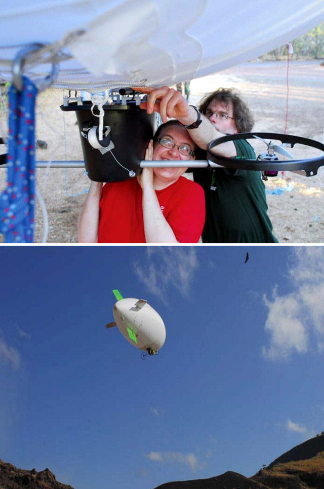 |
Figure 29. The dirigible (Zeppelin) deployed at Masaya during 7-30 March 2011. The dirigible undergoing instrumental work (top), and floating above Santiago crater moments before being blown away by heavy winds (bottom). Courtesy of INETER. |
Crater-wall collapse leads to 6 August 2011 Park closure. More than a dozen crater-wall collapses occurred at Santiago crater during June and July 2011. INETER geologist Marisol Echaverry López noted that the SW and W sides of the crater wall had severely eroded. Echaverry recommended that, should the situation worsen, nearby residents be evacuated since debris-covered vents could pressurize the system and lead to explosions. On 14 July, geologist Martha Ibarra found that debris shed from the steep walls was accumulating and the recent collapses had blocked two gas vents. The deep, steep wall of Santiago crater frequently collapsed along fracture zones.
On 6 August 2011, Masaya National Park officials alerted INETER that significant portions of the SW crater rim had collapsed and completely covered the active vent. The park closed for the day during inspections by INETER. The SW rim was the site of frequent failures and field investigators noted that gas emissions were blocked for ~ 10 minutes. No additional failures were observed and activity did not escalate.
During field investigations in September and October 2011, INETER described and measured temperatures from three new fumaroles within Santiago crater. These sites were located at the edges of debris fill within the crater, along the S and E walls and were degassing with temperatures from 48 to 74°C. SO2 measurements from Mini-DOAS indicated decreasing emissions during this time period, from 518 tons per day in September to 153 tons per day in October 2011.
Geological Summary. Masaya volcano in Nicaragua has erupted frequently since the time of the Spanish Conquistadors, when an active lava lake prompted attempts to extract the volcano's molten "gold" until it was found to be basalt rock upon cooling. It lies within the massive Pleistocene Las Sierras caldera and is itself a broad, 6 x 11 km basaltic caldera with steep-sided walls up to 300 m high. The caldera is filled on its NW end by more than a dozen vents that erupted along a circular, 4-km-diameter fracture system. The Nindirí and Masaya cones, the source of observed eruptions, were constructed at the southern end of the fracture system and contain multiple summit craters, including the currently active Santiago crater. A major basaltic Plinian tephra erupted from Masaya about 6,500 years ago. Recent lava flows cover much of the caldera floor and there is a lake at the far eastern end. A lava flow from the 1670 eruption overtopped the north caldera rim. Periods of long-term vigorous gas emission at roughly quarter-century intervals have caused health hazards and crop damage.
Information Contacts: Instituto Nicaragüense de Estudios Territoriales (INETER), Apartado Postal 2110, Managua, Nicaragua (URL: http://www.ineter.gob.ni/).