Report on Asosan (Japan) — August 2012
Bulletin of the Global Volcanism Network, vol. 37, no. 8 (August 2012)
Managing Editor: Richard Wunderman.
Asosan (Japan) Minor mud ejections resumed in 2011, the first since 2008
Please cite this report as:
Global Volcanism Program, 2012. Report on Asosan (Japan) (Wunderman, R., ed.). Bulletin of the Global Volcanism Network, 37:8. Smithsonian Institution. https://doi.org/10.5479/si.GVP.BGVN201208-282110
Asosan
Japan
32.8849°N, 131.085°E; summit elev. 1592 m
All times are local (unless otherwise noted)
This report summarizes Japan Meteorological Agency (JMA) monthly reports (available in English since October 2010) covering the interval April 2011 to September 2012, with a separate subsection largely focused on aviation reports of Aso plumes emitted at Naka-dake crater during mid-2011. During this reporting interval Naka-dake continued to degas and emit small ash plumes. Eruptions of mud resumed after a hiatus of several years (February 2008 to April 2011).
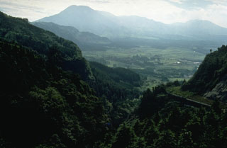
Aso (also called Aso-san) is a caldera with dimensions ~17 km E-W by ~25 km N-S encompassing an area of ~350 km2. Figure 29 indicates the location of Aso in relation to other Holocene Japanese volcanoes and landmarks in the region.
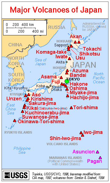 |
Figure 29. A map of the major volcanoes of Japan. Aso is shown on the left side, on the island of Kyushu. Courtesy of the U.S. Geological Survey. |
Aso's most recent series of eruptions began in April 2011, with minor phreatic (mud-bearing) eruptions from Naka-dake's crater lake. These eruptions were accompanied by minor ash plumes, rock ejections, an increase in the temperature of fumaroles (BGVN 36:09), and continuous, small-amplitude tremor.
Field observations during April 2011-June 2011. In April 2011, a small phreatic (mud-bearing) eruption 5-10-m-high was observed in Naka-dake's crater lake; the lake's temperature was 67°C. Volcanic seismicity remained at a relatively low level. A photo from 21 April 2011 shows a white steam plume (figure 30).
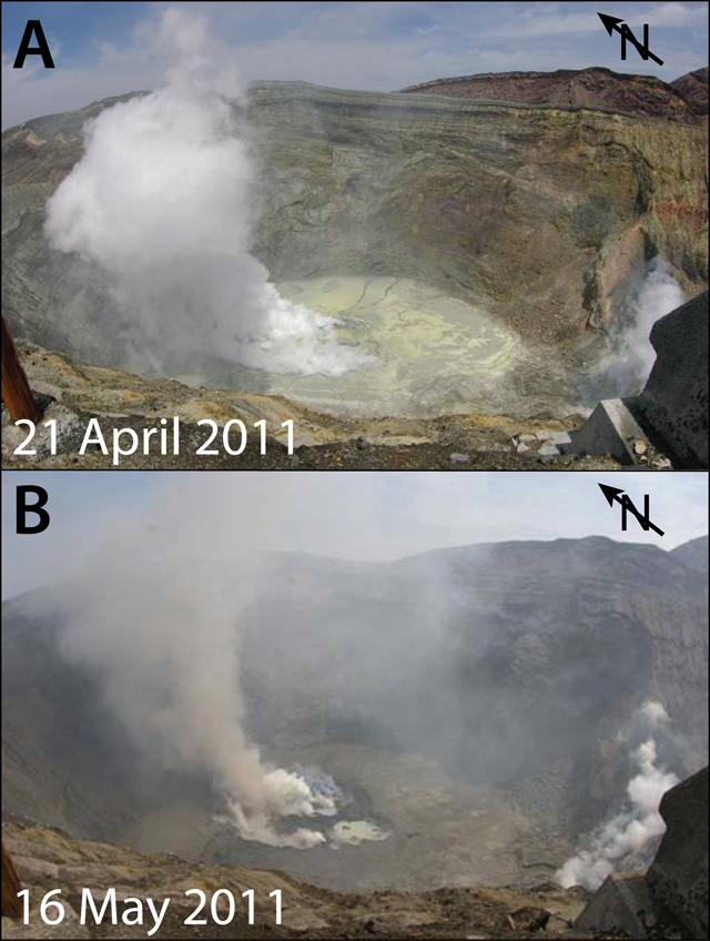 |
Figure 30. (A) A photo taken by a field survey team on 21 April 2011 shows a white steam plume rising from the crater floor. (B) A photo taken on 16 May 2011 shows a grayish plume venting from the crater floor. Courtesy of JMA. |
From 3 to 10 May, continuous small-amplitude tremor was detected. Seismicity, including isolated-pulse events, remained relatively low during this time. On 6 and 9 May, field surveyers observed a small 5-10-m-high phreatic eruption from the hot crater lake (locally called "Yudamari").
A camera installed by the Aso Volcano Museum detected a small volcanic ash emissions from within the crater beginning on 13 May. Six cameras provide live image feeds to the Aso Museum website. There are also many videos showing Aso and Naka-dake on YouTube.
On 13 May, a field survey found increased fumarole temperatures in the crater, and a video camera revealed incandescence on multiple nights. According to JMA, a small eruption occurred on 15 May followed by minor ashfall, which extended 2 km NE of the crater. A field survey on 15 May recorded a temperature of ~370°C at a fumarole in the crater.
Another eruption occurred on 16 May, producing a grayish plume that rose 500 m above the crater rim. As a result of this increased activity, the Alert Level was raised from 1 to 2 (on a scale from 1-5). A field surveyer later the same day saw a gray plume rise 800 m above the crater rim (figure 30). Small-scale eruptions occurred intermittently on the 17th. The lake water volume was low around this time, ~10-20% of its full volume.
A 9 June field survey revealed a decrease in fumarole temperatures from ~370°C on 15 May to ~160°C on 9 June. After 10 June, eruptions ceased and the lake water volume increased from 60% full on 12 June to 80% full on 17 June (figure 31). The rising lake level suggested a decrease in activity. Consequently, the Alert Level was lowered from 2 to 1 on 20 June. Seismicity, including isolated-pulse events, remained at relatively low levels.
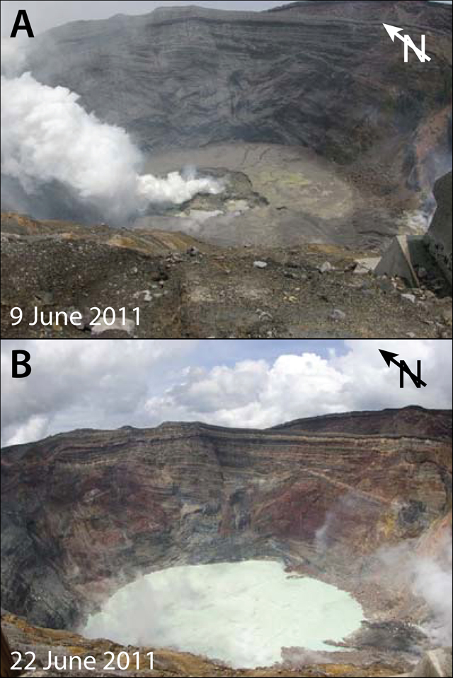 |
Figure 31. (A) Photo taken on 9 June 2011 showing the bottom of Naka-dake crater. Note the absence (or near absence) of the crater's lake. (B) Photo taken on 22 June 2011 showing the presence of the steaming crater lake just about two weeks after the photo in (A) was taken. Courtesy of JMA. |
Plume heights and drift directions during May-June 2011. We summarize reports from the Tokyo Volcanic Ash Advisory Center (VAAC) issued between 15 May and 9 June 2011 (table 10). Many plumes contained ash. Notice that the plume heights are stated as altitudes above sea level (as compared to heights above the crater rim, as in the other sections of this report).
Table 10. Summary of plumes at Aso between 15 May and 9 June 2011. Smaller plumes may not have been recorded or were omitted. In most cases, the presence of ash in the plume was noted; in other cases ash may have been present but not recorded. '-' indicates data not reported. Data provided by Tokyo VAAC and JMA.
| Date | Plume altitude | Drift | Ash? | Pilot/JMA report |
| 15 May 2011 | 2.1 km | NE | Ash | Pilot |
| 16 May 2011 | 1.8-2.1 km | -- | -- | JMA |
| 16 May 2011 | 2.4 km | N | Ash | Pilot |
| 17-18 May 2011 | 1.8 km | E, SE | Ash | JMA |
| 18 May 2011 | 3 km | -- | Ash | Pilot |
| 18-22 May 2011 | 1.5-2.1 km | N, NE, SE | Ash | JMA |
| 25, 27-28, 31 May 2011 | 1.5-1.8 km | NW, N, E, S | Ash | JMA |
| 01-07 June 2011 | 1.5-2.1 km | NW, N, NE, E, S | -- | JMA |
| 08-09 June 2011 | 1.5-1.8 km | NW, N, NE, E | -- | JMA |
Field observations during October 2011-June 2012. In October 2011, white plumes rose on average less than 200 m above the crater rim, with a maximum of 300 m. The lake water volume during September and October was at about 90% full, and the September and October lake-surface temperatures were 47-56°C and 49-58°C, respectively. Based on field surveys made on 3, 17, and 20 October, the sulfur-dioxide (SO2) flux was ~300-500 tons/day, compared to ~300 tons/day in September. Volcanic seismicity remained low. Tremor, detected 13 times during September, was absent during October. The total magnetic intensity measured at the NW rim of the Naka-dake crater had increased since December 2010, but was static during June 2011 through October 2011. No change was detected by GPS measurements.
The next JMA monthly report on Aso discussed activity during May and June 2012. Because of heavy rains after 15 May, the lake water volume had increased to ~70% full, and during the course of the month the volume was in the range 60-80% full. Then in late May, the lake level begain to drop, and continued into at least mid-June.
The lake surface temperature was 63-72°C in May and 67-73°C in June. The highest temperature of fumaroles along the southern crater wall was 246-260°C, compared to 228-267°C in May. Scientists conducting a field survey at night on 22 June noted that part of the S crater wall was incandescent.
In June 2012, white plumes rose an average of 600 m above the crater rim. There were 621 isolated cases of tremor in June, approaching a 2-fold increase over some of the previous months, but only amounting to a duration of a few minutes per month. Isolated volcanic tremor and seismicity remained low but had slightly increased overall after February 2012, with most hypocenters located at shallow depths under Naka-dake. No change was detected by GPS measurements. The total magnetic intensity began to increase again in June 2012.
Lake levels during July-September 2012. In July, heavy rains caused the lake level to rise to 80-90% full (from 30-70% full in June). The volume remained high in August and September (90-100% full). During June-July the lake surface temperature decreased slowly, from 58-66°C in July to 57-61°C in August and to 54-59°C in September. Steam emissions from the crater occurred in July and August, but stopped by September.
Crater temperatures during July-September 2012. The highest temperature of the S wall of Naka-dake-Daiichi crater decreased in July, but rose slightly in August and September (213-250°C in July, 241-249°C in August, and 250-283°C in September). A field survey on 24 September revealed that the hot areas had not changed since the previous survey on 22 June. On 23-26 September, weak glow in the crater was recorded at night by a thermal camera. Officials assumed the glow was caused by the hot crater wall.
July-September 2012 seismicity. Both isolated volcanic tremor and other seismicity returned at low levels during July-September 2012. 621 volcanic tremors occurred in June, 669 in July, 1,025 in August and 867 in September. 669 volcanic earthquakes occurred in July, 951 in August, and 978 in September. Other seismic events occurred 369 times in June, 626 in July, and were not reported in August or September. Few short-term tremors occurred (4 in June, none in July, 2 in August, and 1 in September). Most hypocenters were located at shallow depths (2-4 km) and in an area ~6 km NE of Naka-dake.
Based on field studies, sulfur dioxide levels were elevated during May-September 2012 (600-800 t/d in May, ~400 t/d on 10 July, and 500-700 t/d on 19 and 24 September). The total magnetic intensity at the NW rim of Naka-dake-Daiishi crater increased between December 2010 and September 2012, which officials suggested might signify a temperature rise underneath the crater.
Geological Summary. The 24-km-wide Asosan caldera was formed during four major explosive eruptions from 300,000 to 90,000 years ago. These produced voluminous pyroclastic flows that covered much of Kyushu. The last of these, the Aso-4 eruption, produced more than 600 km3 of airfall tephra and pyroclastic-flow deposits. A group of 17 central cones was constructed in the middle of the caldera, one of which, Nakadake, is one of Japan's most active volcanoes. It was the location of Japan's first documented historical eruption in 553 CE. The Nakadake complex has remained active throughout the Holocene. Several other cones have been active during the Holocene, including the Kometsuka scoria cone as recently as about 210 CE. Historical eruptions have largely consisted of basaltic to basaltic andesite ash emission with periodic strombolian and phreatomagmatic activity. The summit crater of Nakadake is accessible by toll road and cable car, and is one of Kyushu's most popular tourist destinations.
Information Contacts: Japan Meteorological Agency (JMA), Otemachi, 1-3-4, Chiyoda-ku Tokyo 100-8122, Japan (URL: http://www.jma.go.jp/); Tokyo Volcanic Ash Advisory Center (VAAC), Tokyo, Japan (URL: http://ds.data.jma.go.jp/svd/vaac/data/); Aso Volcano Museum (URL: http://www.asomuse.jp/); Volcano Discovery (URL: http://www.volcanodiscovery.com/); Earth Observation Research Center (Japan) (URL: http://www.eorc.jaxa.jp/en/index.php).