Report on Sinabung (Indonesia) — March 2016
Bulletin of the Global Volcanism Network, vol. 41, no. 3 (March 2016)
Managing Editor: Edward Venzke.
Research and preparation by Paul Berger.
Sinabung (Indonesia) Eruption that began in September 2013 continued during May-October 2015
Please cite this report as:
Global Volcanism Program, 2016. Report on Sinabung (Indonesia) (Venzke, E., ed.). Bulletin of the Global Volcanism Network, 41:3. Smithsonian Institution. https://doi.org/10.5479/si.GVP.BGVN201603-261080
Sinabung
Indonesia
3.17°N, 98.392°E; summit elev. 2460 m
All times are local (unless otherwise noted)
The eruption of Sinabung which began in mid-September 2013 (BGVN 38:09 continued during May-October 2015. Data were primarily drawn from reports issued by the Indonesian Center of Volcanology and Geological Hazard Mitigation (PVMBG, CVGHM) and the Badan Nacional Penanggulangan Bencana (National Disaster Management Authority, BNPB).
During the reporting period, activity remained at high levels, but fluctuated over time, with frequent explosions, intermittent pyroclastic flows, and lava flows. PVMBG reported that fog and other inclement weather often prevented visual observations.
The Alert Level remained at 3 (on a scale of 1-4) through May, but on 2 June it was raised to 4, signifying that people within 7 km in the SSE sector and 6 km in the ESE sector should evacuate. According to BNPB, this increase was a result of a sharp rise in activity during the previous several days, including an increase in the lava dome volume to more than 3 million cubic meters and greater dome instability. The higher Alert Level prompted the evacuation of 2,727 people (677 families) from the S and SE flanks. BNPB noted that by 29 June a total of 10,645 people (3,150 families) had been displaced.
White and white-gray plumes frequently rose 200-1,000 m above the crater. Ash plumes were common, some caused by explosions and others generated by pyroclastic flows. The ash plumes generally rose up to 4.3 km in altitude, but several rose to 6-7 km and one rose to 7.6 km on 30-31 October. During 9-15 September, explosions caused thick ashfall deposits in Berastagi, Kabanjahe, and surrounding areas.
Pyroclastic flows from the lava dome were common, ranging from 0 to 8 per day. The flows traveled up to 4 km down the S, SE, ESE, and SSE flanks, often generating ash plumes that rose as high as 3.5 km above the crater. Lava from the dome traveled down the S and SE flanks during late May to late June, and down the E, ESE, SSE, and SE flanks during September and October. The lava was incandescent 1.5-3 km down the flanks.
Seismicity consisted of avalanche signals, low-frequency and hybrid events, tremor, tectonic events, and volcanic earthquakes. During mid-May seismicity declined, but at the end of May, avalanche signals increased. Elevated numbers of avalanche signals were also reported during 24-30 June and 12-18 August. During 27 May-2 June, deformation data trended toward inflation. The trend continued until 16-22 September, when deflation was observed.
Thermal anomalies based on MODIS satellite instruments analyzed using the MODVOLC algorithm, were observed each month during June-October 2015. None were reported in May, while the highest number, ten, occurred in June. The number of days with anomalies during other months ranged from 3-8. In September, five alert pixels were present on the 4th, and four on the 20th.
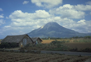
Geological Summary. Gunung Sinabung is a Pleistocene-to-Holocene stratovolcano with many lava flows on its flanks. The migration of summit vents along a N-S line gives the summit crater complex an elongated form. The youngest crater of this conical andesitic-to-dacitic edifice is at the southern end of the four overlapping summit craters. The youngest deposit is a SE-flank pyroclastic flow 14C dated by Hendrasto et al. (2012) at 740-880 CE. An unconfirmed eruption was noted in 1881, and solfataric activity was seen at the summit and upper flanks in 1912. No confirmed historical eruptions were recorded prior to explosive eruptions during August-September 2010 that produced ash plumes to 5 km above the summit.
Information Contacts: Pusat Vulkanologi dan Mitigasi Bencana Geologi (PVMBG, also known as Indonesian Center for Volcanology and Geological Hazard Mitigation, CVGHM), Jalan Diponegoro 57, Bandung 40122, Indonesia (URL: http://www.vsi.esdm.go.id/); Badan Nacional Penanggulangan Bencana (National Disaster Management Authority, BNPB)(URL: http://www.bnpb.go.id/); Hawai'i Institute of Geophysics and Planetology (HIGP) MODVOLC Thermal Alerts System, School of Ocean and Earth Science and Technology (SOEST), Univ. of Hawai'i, 2525 Correa Road, Honolulu, HI 96822, USA (URL: http://modis.higp.hawaii.edu/).

