Report on Dieng Volcanic Complex (Indonesia) — October 2017
Bulletin of the Global Volcanism Network, vol. 42, no. 10 (October 2017)
Managing Editor: Edward Venzke.
Research and preparation by Robert Andrews.
Dieng Volcanic Complex (Indonesia) Three phreatic eruptions at Sileri Crater; deaths due to helicopter crash involved in evacuations
Please cite this report as:
Global Volcanism Program, 2017. Report on Dieng Volcanic Complex (Indonesia) (Venzke, E., ed.). Bulletin of the Global Volcanism Network, 42:10. Smithsonian Institution. https://doi.org/10.5479/si.GVP.BGVN201710-263200
Dieng Volcanic Complex
Indonesia
7.2°S, 109.879°E; summit elev. 2565 m
All times are local (unless otherwise noted)
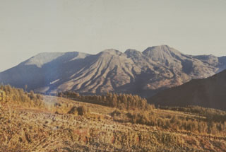
Located on an elevated plateau in central Java NW of Yogyakarta (figure 4), multiple craters within the Dieng Volcanic Complex (figure 5) have been intermittently active over the past 200 years. Brief phreatic eruptions took place at Sibanteng crater on 15 January 2009 (BGVN 34:04) and at Sileri crater on 26 September later that year (BGVN 34:08). Increased unrest during March-April 2013 (BGVN 38:08) consisted of elevated volcanic gas emissions from Timbang Crater that resulted in an increase in the Alert Level to as high as 3 on 27 March, then back to Level 2 on 8 May. There was a precautionary evacuation of local villages, but no eruption took place. Regular monitoring is done by the Pusat Vulkanologi dan Mitigasi Bencana Geologi (PVMBG, also known as Centre for Volcanology and Geological Hazard Mitigation or CVGHM).
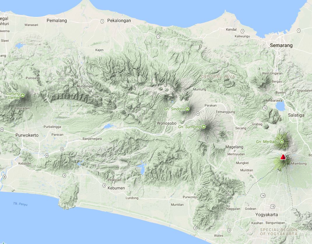 |
Figure 4. Topographic terrain map of central Java showing the Dieng Volcanic Province to the NW of Gunung Sumbing and Gunung Sindoro volcanoes. The volcano indicated by a red symbol N of Yogyakarta is Merapi. Courtesy of Peakery. |
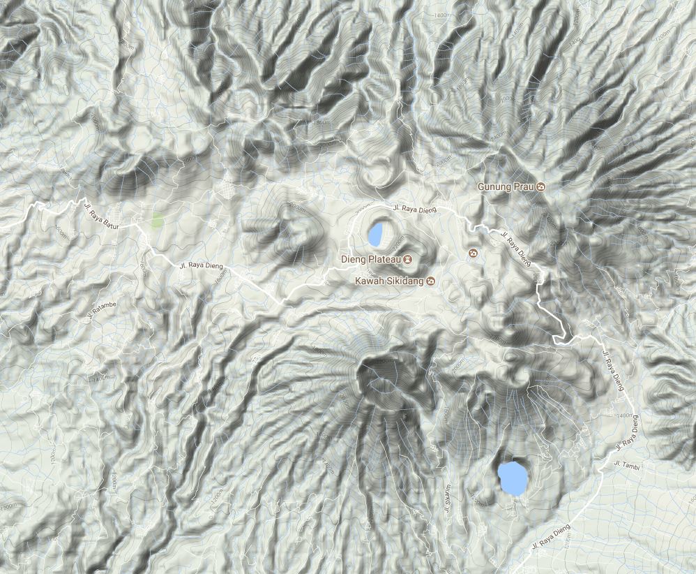 |
Figure 5. Topographic terrain map of the Dieng Volcanic Province on the Dieng plateau of central Java. The notable cone at bottom center is Bisma; the crater with a lake at center is Merdada, adjoining Kawah Sikidang to the SE. The frequently active Sileri area is immediately W of the more noticeable Pagerkandang crater N of Merdada. Courtesy of Peakery. |
The alert status remained at Level 2 for about 15 months following the hazardous gas emissions in 2013. On 11 August 2014 the PVMBG noted that, due to decreased activity and no observable flow of gas in high concentrations from the crater, the Alert Level was lowered to 1 (on a scale of 1-4). No further activity was reported until late April 2017.
A phreatic event from Sileri Crater at 1303 on 30 April 2017 ejected material 10 m high and 1 m past the crater edge, forming a 1-2 mm thick deposit. Another emission at 0941 on 24 May consisted of gas and black "smoke" that rose 20 m.
The Disaster Management Authority, Badan Nacional Penanggulangan Bencana (BNPB), reported that there had been another phreatic eruption from the Sileri Crater lake at 1154 on 2 July 2017, ejecting mud and material 150 m high, and 50 m to the N and S. The event injured 11 of 18 tourists that were near the crater. According to a news article a helicopter on the way to assist with evacuations after the event crashed, killing all eight people (four crewmen and four rescuers) on board. PVMBG scientists visited the next day and observed weak white emissions rising 60 m.
PVMBG reported that during 8 July-14 September 2017 measurements indicated an increase in water temperature at Sileri Crater lake from 90.7 to 93.5°C. Soil temperatures also increased, from 58.6 to 69.4°C. At Timbang Crater temperatures in the lake increased from 57.3 to 62.7°C, and in the soil they decreased from 18.6 to 17.2°C. The report noted that conditions at Timbang Crater were normal.
Temperature increases at Sileri, along with tremor detected during 13-14 September, prompted PVMBG to raise the Alert Level to 2 (on a scale of 1-4). PVMBG warned the public to stay at least 1 km away from the crater rim, and for residents living within that radius to evacuate. However, after 20 September tremor and water temperatures both declined. The Alert Level was lowered back to 1 on 2 October, with a warning to stay at least 100 m from the crater rim.
Geological Summary. The Dieng plateau in the highlands of central Java is renowned both for the variety of its volcanic scenery and as a sacred area housing Java's oldest Hindu temples, dating back to the 9th century CE. The Dieng Volcanic Complex consists of multiple stratovolcanoes and more than 20 small Pleistocene-to-Holocene craters and cones over a 6 x 14 km area. Prahu stratovolcano was truncated by a large Pleistocene caldera, which was subsequently filled by a series of cones, lava domes, and craters, many containing lakes. Lava flows cover much of the plateau, but observed activity has been restricted to minor phreatic eruptions. Gas emissions are a hazard at several craters and have caused fatalities. There are abundant thermal features and high heat flow across the area.
Information Contacts: Pusat Vulkanologi dan Mitigasi Bencana Geologi (PVMBG, also known as Indonesian Center for Volcanology and Geological Hazard Mitigation, CVGHM), Jalan Diponegoro 57, Bandung 40122, Indonesia (URL: http://www.vsi.esdm.go.id/); Badan Nasional Penanggulangan Bencana (BNPB), National Disaster Management Agency, Graha BNPB - Jl. Scout Kav.38, East Jakarta 13120, Indonesia (URL: http://www.bnpb.go.id/); Peakery (URL: https://peakery.com/).