Barren Island
India
12.278°N, 93.858°E; summit elev. 354 m
All times are local (unless otherwise noted)
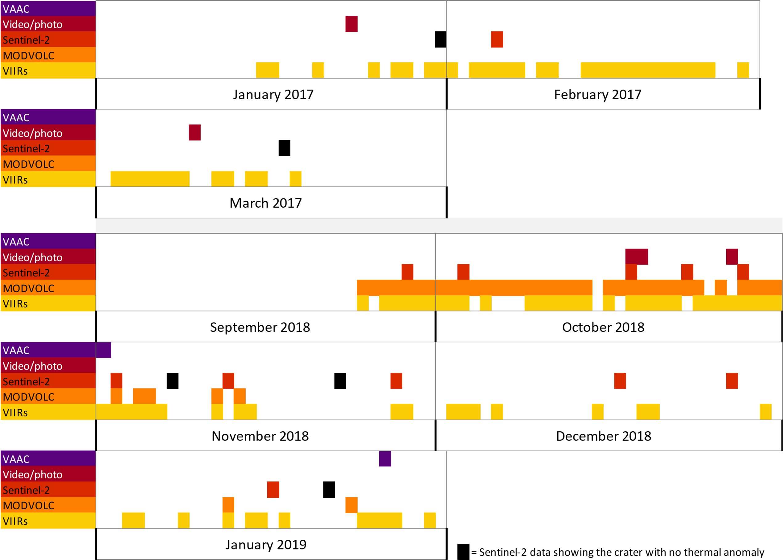
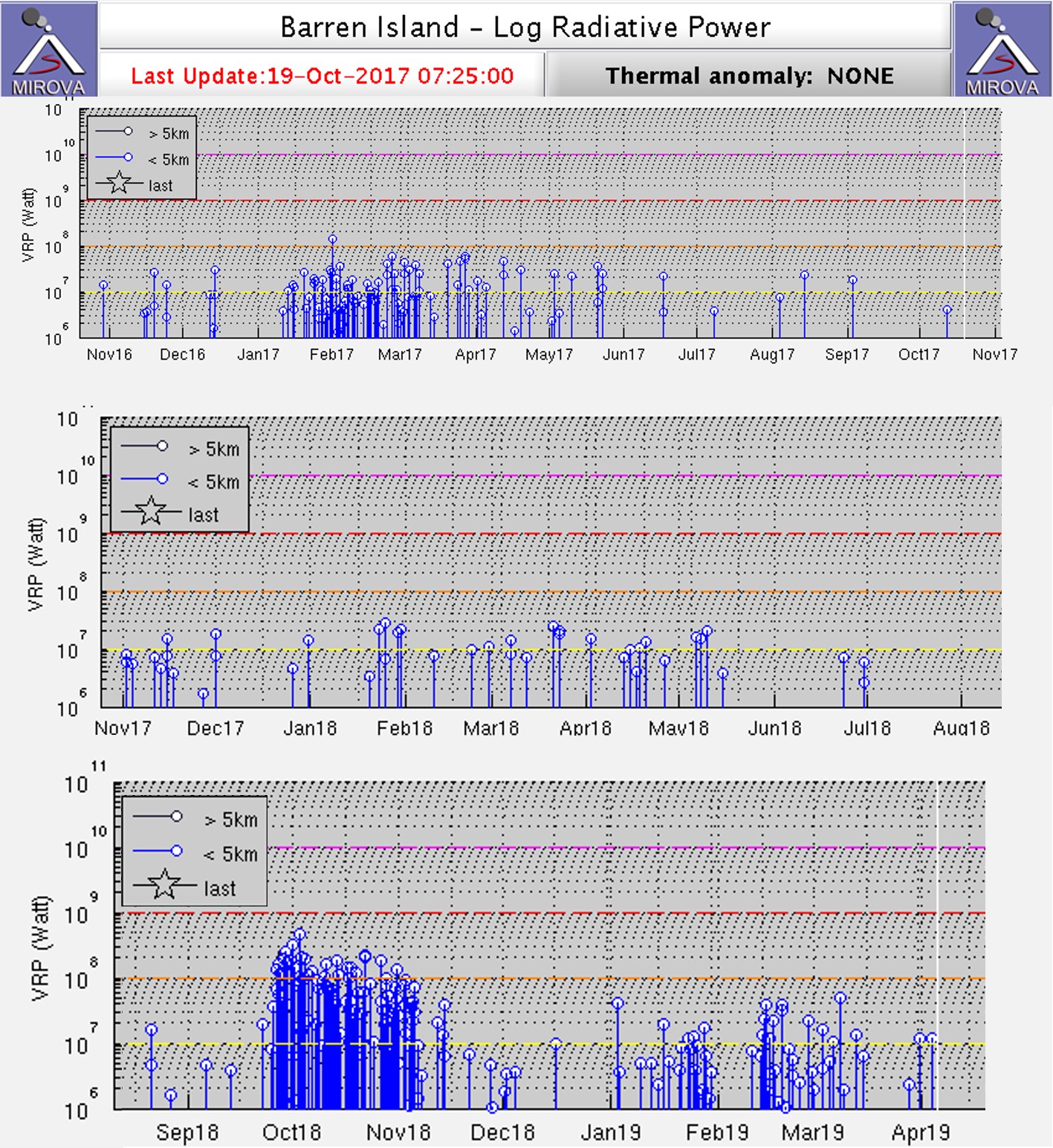
Barren Island is a remote volcano east of India in the Andaman islands. Recent intermittent eruptions observed since 1991 have consisted of explosions, ash plumes, and lava flows. This report summarizes activity from January 2017 through January 2019 and is based on satellite data and observations. Two main periods of eruptive activity are apparent (figure 29): the first in January-March 2017, and the second in September 2018-January 2019.
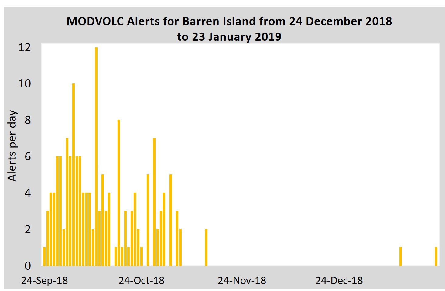
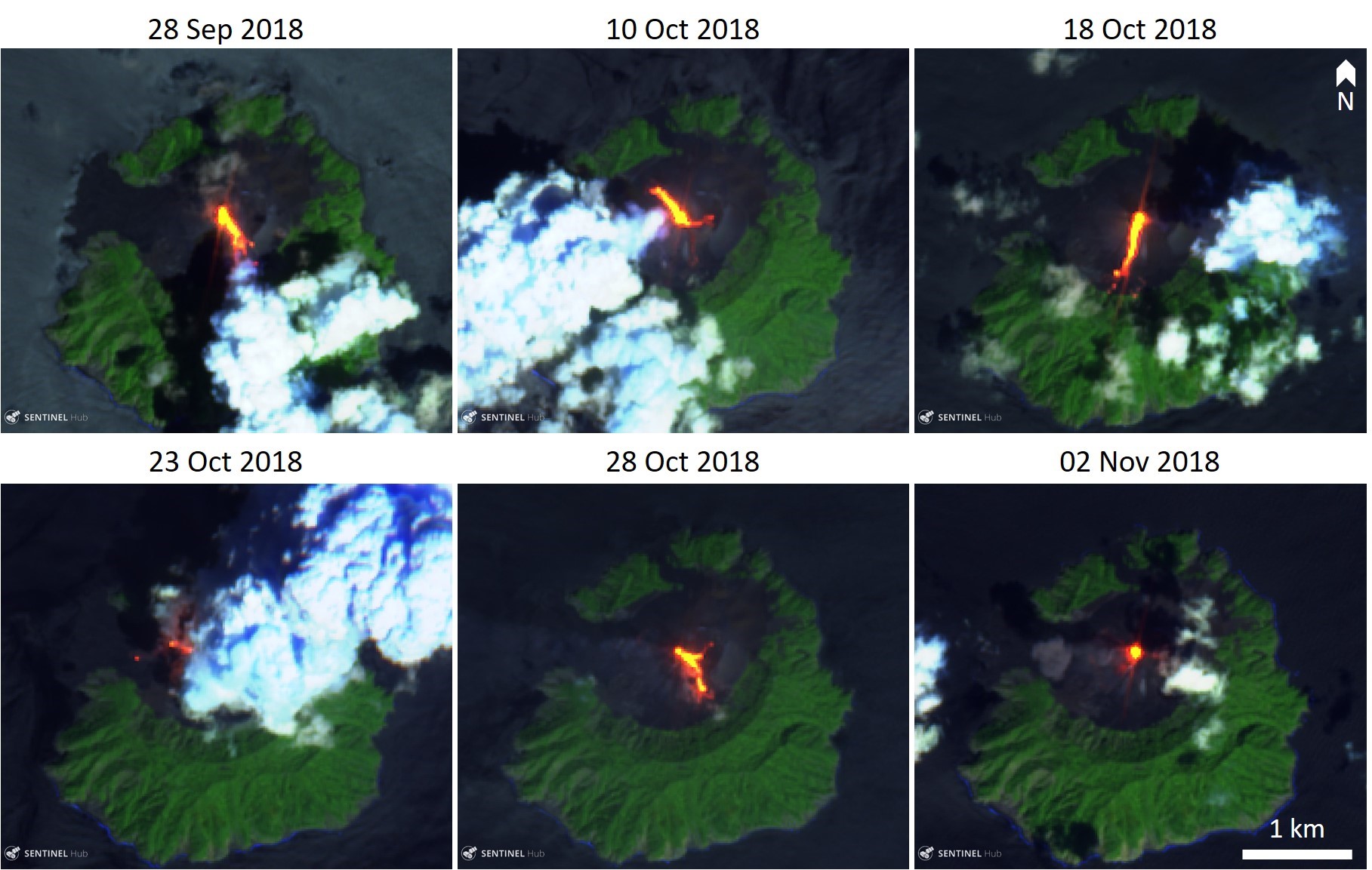
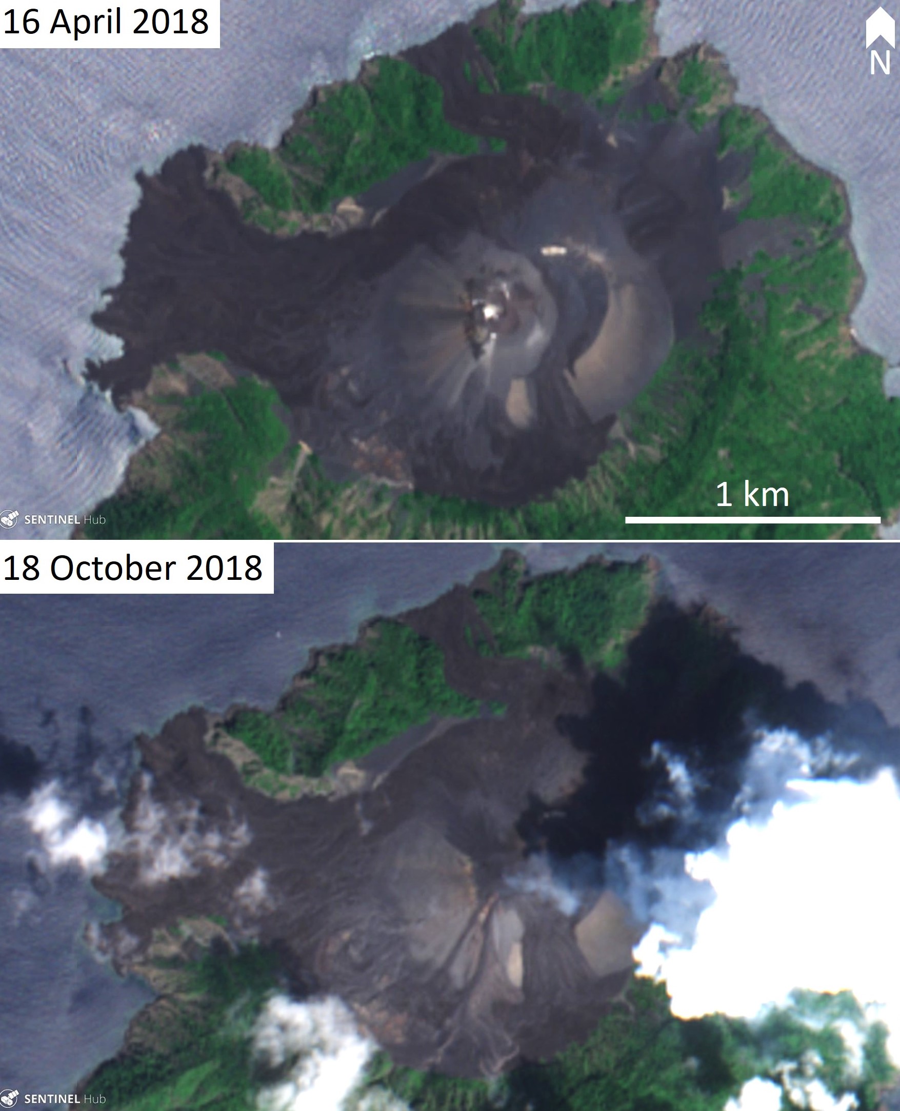
During January-March 2017 there were frequent thermal anomalies detected by the Suomi NPP/VIIRS sensor, then again during late September to mid-November 2018 (see figure 29). These times coincide with the highest frequency of thermal anomalies detected by the MIROVA algorithm (figure 30). There are intermittent low-energy anomalies detected by MIROVA between these two periods but there are no indications of thermal anomalies in other datasets. The MODVOLC algorithm for MODIS thermal anomalies registered elevated temperatures during the late September to mid-November 2018 period, then on a few isolated dates in January 2019 (figure 31). The anomalies with greater thermal energy in September-October 2018 correspond to lava flows on different flanks of the cone, as shown in Sentinel-2 thermal and visible satellite data (figures 32 and 33). From November 2018 through January 2019 there were intermittent thermal signatures and gas plumes from the crater visible in Sentinel-2 images.
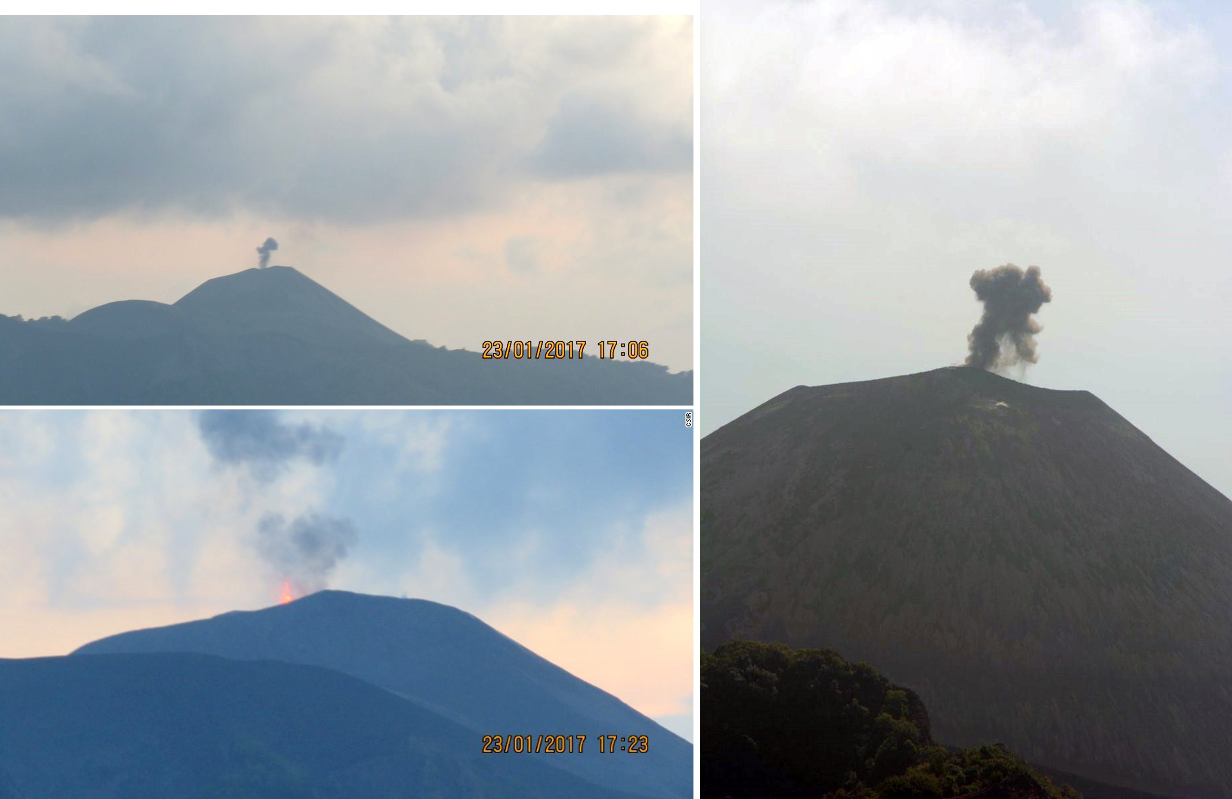
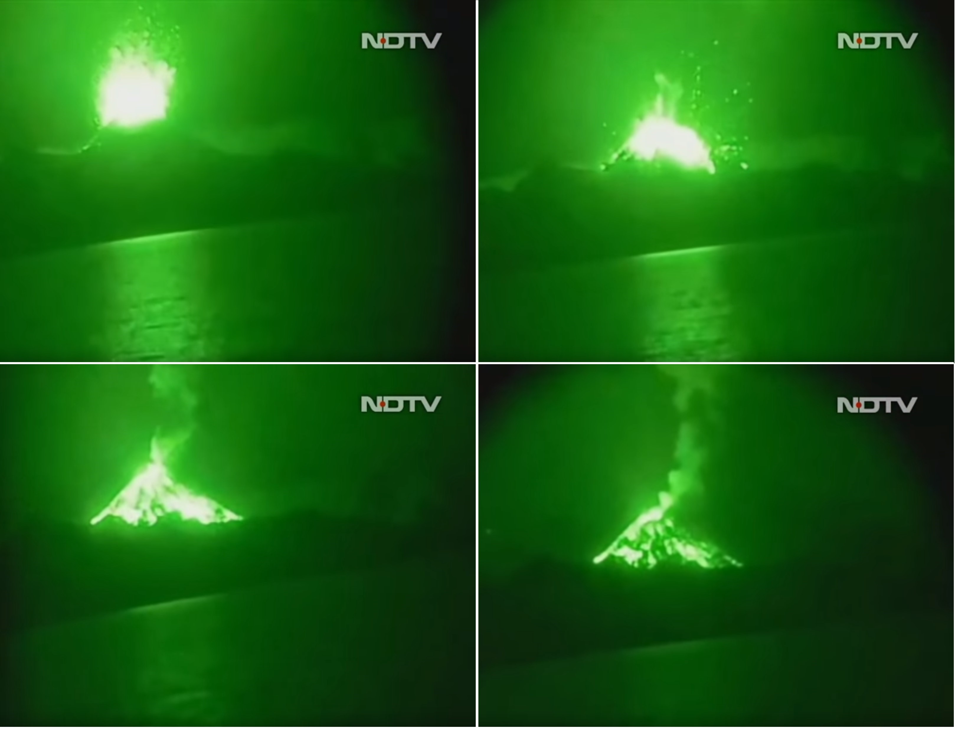
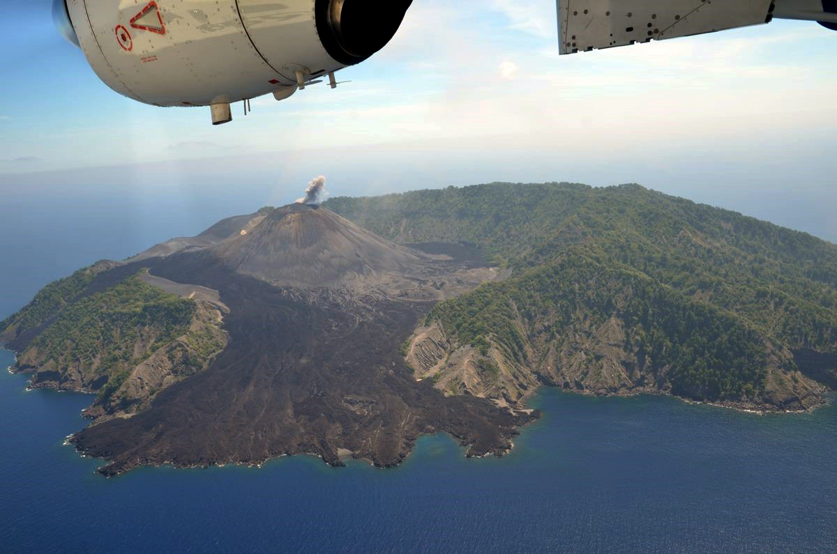
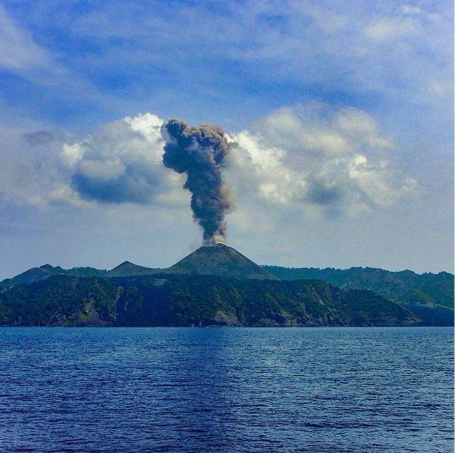
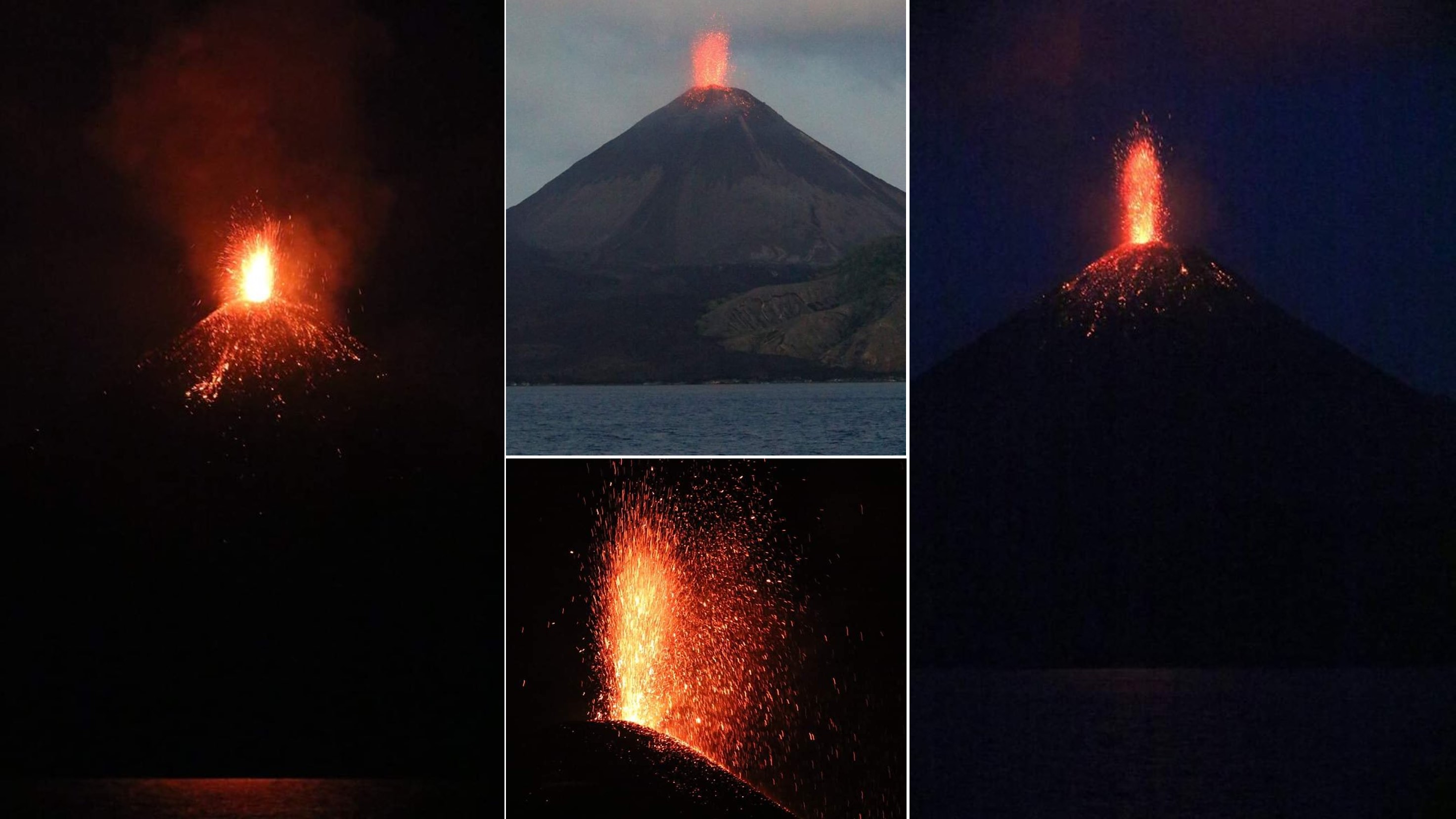
The new eruption was first observed on 23 January 2017, when a research cruise was working nearby. They witnessed explosions that produced incandescent material and small ash plumes (figure 34) with the episodes lasting five to ten minutes. The team noted ash plumes during the day and incandescent material being ejected onto the slopes at night. They observed four hours of activity before leaving the area. The Indian Coast Guard also witnessed the eruption before 25 February, capturing a night-vision video of an explosion that produced an ash plume and ejected incandescent blocks above the crater that impacted the flanks of the volcano (figure 35). An overflight on 23 February 2017 was undertaken to assess the volcanic activity after several reports of activity over the previous days. They observed intermittent explosions ejecting incandescent material and small ash plumes (figure 36).
On 9 March 2017 a group from the Physical Research Laboratory in Ahmedabad observed the eruption and published a report in Current Science (Ray et al., 2017). Activity consisted of ash plumes that rose a few hundred meters above the crater and the ejection of incandescent material every 10-15 minutes, with blocks and bombs rolling down the flanks of the cone. Later in the month, an ash plume was observed on 24 March (figure 37).
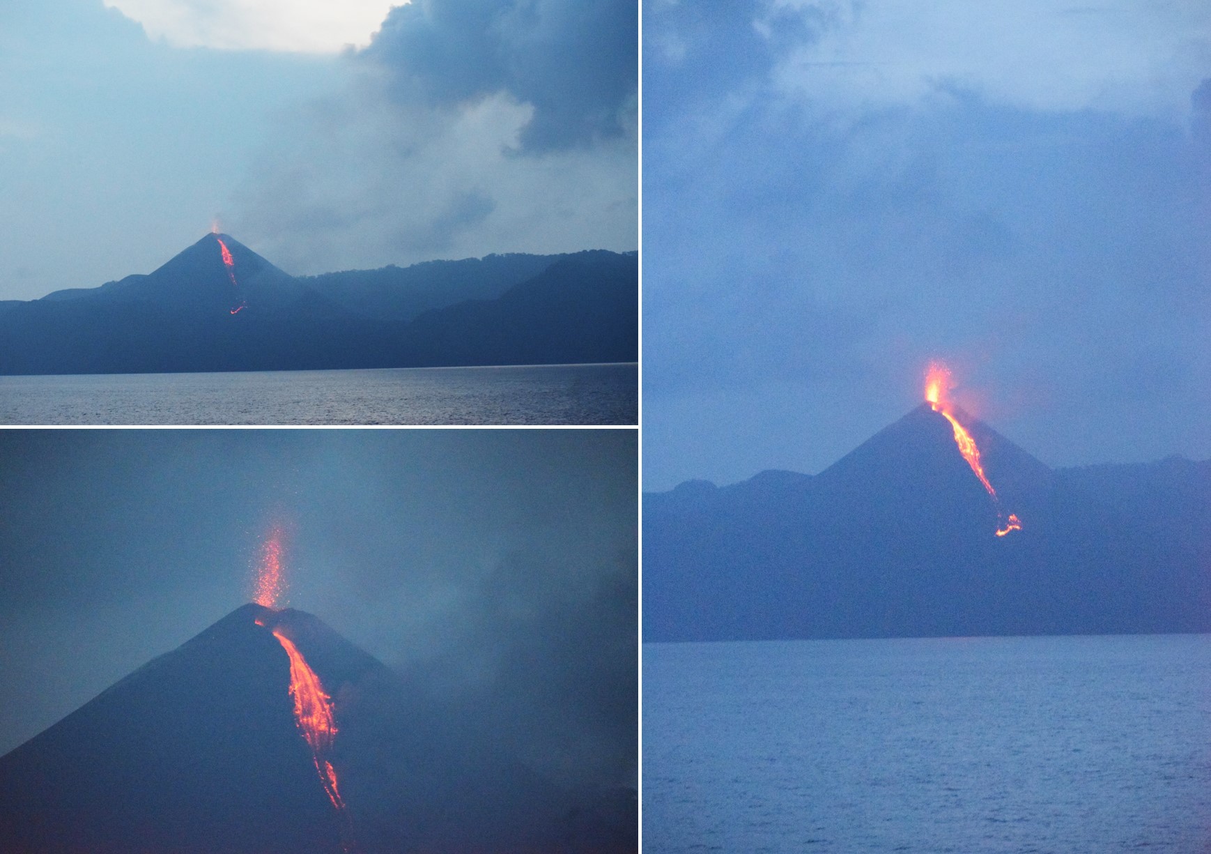
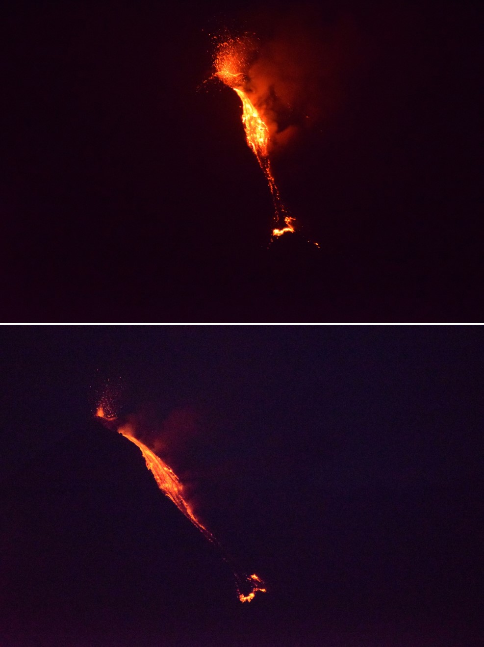
Along with the lack of activity detected in satellite data, there were no reports of activity after 24 March 2017 until September 2018. While the first indications of a new eruptive in thermal data is on 24 September, the first observations on the 18 and 19 October show lava fountaining at the summit and a lava flow on the flank (figures 38, 39, and 40). These images coincide with Sentinel-2 thermal data showing a lava flow on the SSW flank. A video taken on 27 October shows explosions ejecting incandescent material and small plumes. Darwin VAAC advisories noted ash plumes to about 0.9 km altitude on 1 November and 26 January 2019.
Reference: Ray, D., Shukla, A.D., Ray, J.S., 2017. Early 2017 activity of the Barren Island volcano: facts versus hype. Current Science, 113(9): 1657-1659.
Geological Summary. Barren Island, a possession of India in the Andaman Sea about 135 km NE of Port Blair in the Andaman Islands, is the only historically active volcano along the N-S volcanic arc extending between Sumatra and Burma (Myanmar). It is the emergent summit of a volcano that rises from a depth of about 2250 m. The small, uninhabited 3-km-wide island contains a roughly 2-km-wide caldera with walls 250-350 m high. The caldera, which is open to the sea on the west, was created during a major explosive eruption in the late Pleistocene that produced pyroclastic-flow and -surge deposits. Historical eruptions have changed the morphology of the pyroclastic cone in the center of the caldera, and lava flows that fill much of the caldera floor have reached the sea along the western coast.
Information Contacts: Darwin Volcanic Ash Advisory Centre (VAAC), Bureau of Meteorology, Northern Territory Regional Office, PO Box 40050, Casuarina, NT 0811, Australia (URL: http://www.bom.gov.au/info/vaac/); Hawai'i Institute of Geophysics and Planetology (HIGP) - MODVOLC Thermal Alerts System, School of Ocean and Earth Science and Technology (SOEST), Univ. of Hawai'i, 2525 Correa Road, Honolulu, HI 96822, USA (URL: http://modis.higp.hawaii.edu/); Sentinel Hub Playground (URL: https://www.sentinel-hub.com/explore/sentinel-playground); NASA Worldview (URL: https://worldview.earthdata.nasa.gov/); CSIR-National Institute of Oceanography, Raj Bhavan Rd, Dona Paula, Goa 403004, India (URL: https://www.nio.org/); NDTV (URL: https://www.ndtv.com/india-news/watch-indias-only-active-volcano-at-barren-island-filmed-erupting-1667796); Sugendran (TwitterURL: https://twitter.com/sugender); Atmaram Deshpande (Instagram URL: https://www.instagram.com/atmadesh/); Jagdish Mukhi, Lt. Governor, Andaman and Nicobar Islands (Facebook URL: https://www.facebook.com/jagdishmukhi/posts/1504497106227132); Samrat Kalita (Instagram URL: https://www.instagram.com/nibir_samrat/).