Ol Doinyo Lengai
Tanzania
2.764°S, 35.914°E; summit elev. 2962 m
All times are local (unless otherwise noted)
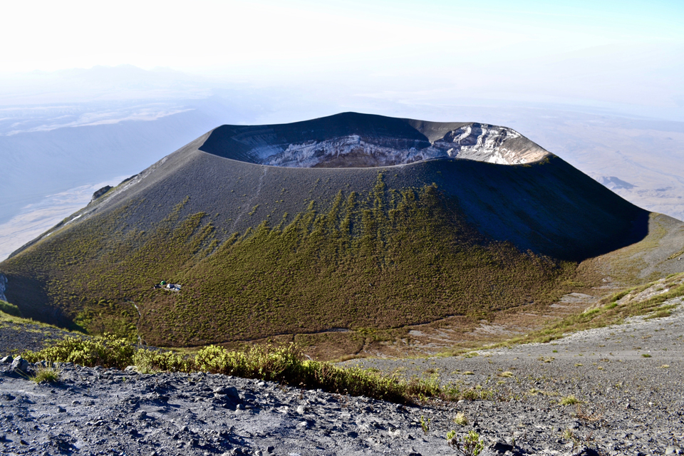
Frequent historical eruptions from Tanzania's Ol Doinyo Lengai have been recorded since the late 19th century. Located near the southern end of the East African Rift in the Gregory Rift Valley, the unique low-temperature carbonatitic lavas have been the focus of numerous volcanological studies; the volcano has also long been a cultural icon central to the Maasai people who live in the region. Following explosive eruptions in the mid-1960s and early 1980s the volcano entered a phase of effusive activity with the effusion of small, fluid, natrocarbonatitic lava flows within its active north summit crater. From 1983 to early 2007 the summit crater was the site of numerous often-changing hornitos (or spatter cones) and lava flows that slowly filled the crater. Lava began overflowing various flanks of the crater in 1993; by 2007 most flanks had been exposed to flows from the crater.
Seismic and effusive activity increased in mid-2007, and a new phase of explosive activity resumed in September of that year. The explosive activity formed a new pyroclastic cone inside the crater; repeated ash emissions reached altitudes greater than 10 km during March 2008, causing relocation of several thousand nearby villagers. Explosive activity diminished by mid-April 2008; by September new hornitos with small lava flows were again forming on the crater floor. Periodic eruptions of lava from fissures, spatter cones, and hornitos within the crater were witnessed throughout the next decade by scientists and others occasionally visiting the summit. Beginning in 2017, satellite imagery has become a valuable data source, providing information about both the thermal activity and the lava flows in the form of infrared imagery and the color contrast of black fresh lava and whiter cooled lava that is detectable in visible imagery (BGVN 43:10). The latest expeditions in 2018 and 2019 have added drone technology to the research tools. This report covers activity from September 2018 through August 2019 with data and images provided from satellite information and from researchers and visitors to the volcano.
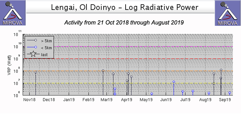
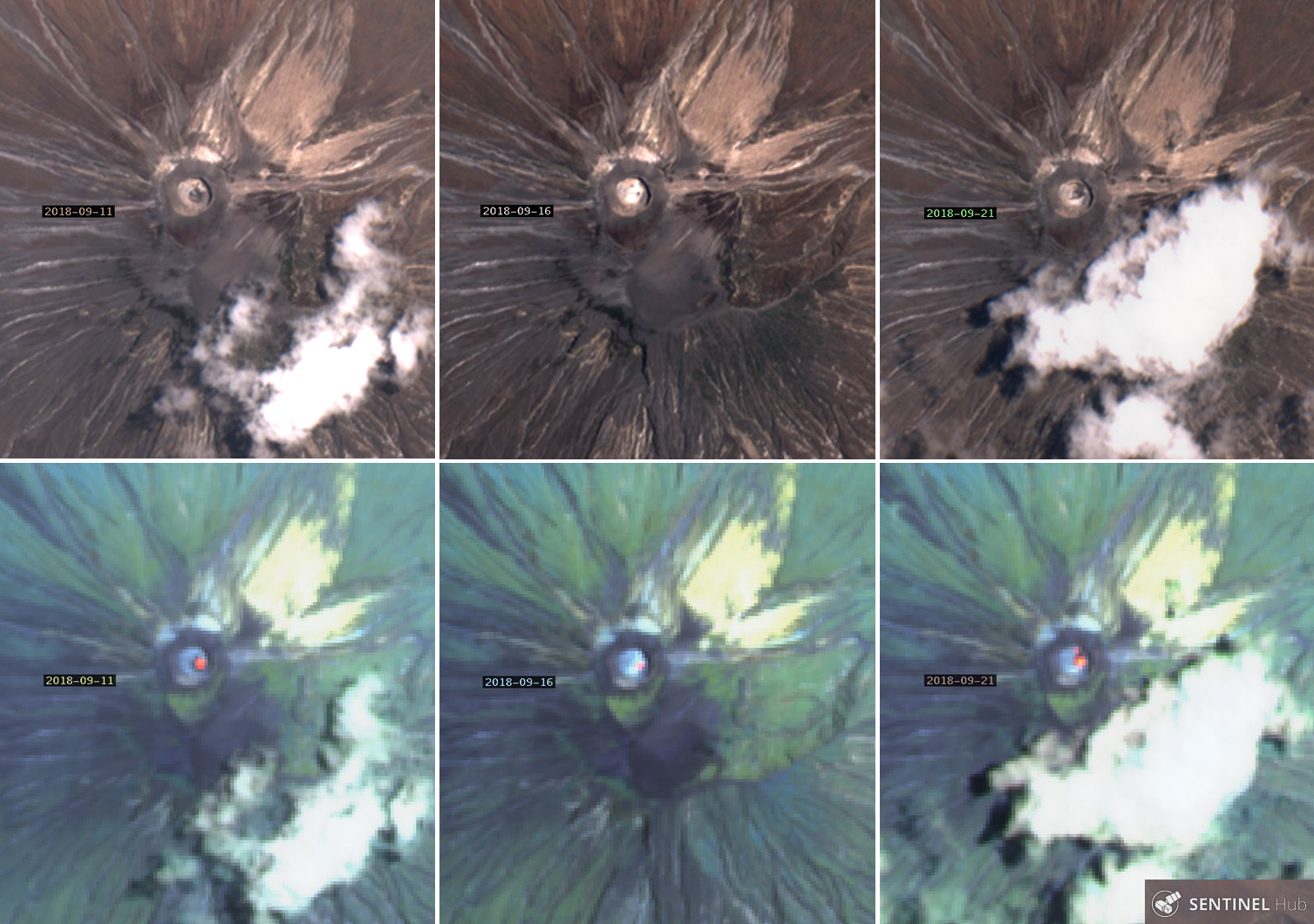
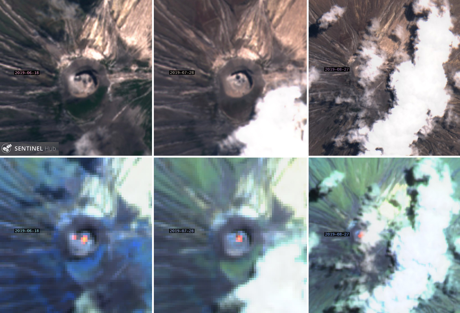
Summary and data from satellite imagery. Throughout September 2018 to August 2019, evidence for repeated small lava flows was recorded in thermal data, satellite imagery, and from a few visits to or overflights of the summit crater by researchers. Intermittent low-level pulses of thermal activity appeared in MIROVA data a few times during the period (figure 187). Most months, Sentinel-2 satellite imagery generated six images with varying numbers of days that had a clear view of the summit and showed black and white color contrasts from fresh and cooled lava and/or thermal anomalies (table 27, figures 188-191). Lava flows came from multiple source vents within the crater, produced linear flows, and covered large areas of the crater floor. Thermal anomalies were located in different areas of the crater; multiple anomalies from different source vents were visible many months.
Table 27. The number of days each month with Sentinel-2 images of Ol Doinyo Lengai, days with clear views of the summit showing detectable color contrasts between black and white lava, and days with detectable thermal anomalies within the summit crater. A clear summit means more than half the summit visible or features identifiable through diffuse cloud cover. Information courtesy of Sentinel Hub Playground.
| Month |
Sentinel-2 Images |
Clear Summit with Lava Color Contrasts |
Thermal anomalies |
| Sep 2018 |
6 |
5 |
5 |
| Oct 2018 |
7 |
4 |
3 |
| Nov 2018 |
6 |
2 |
0 |
| Dec 2018 |
5 |
1 |
1 |
| Jan 2019 |
6 |
5 |
3 |
| Feb 2019 |
6 |
5 |
6 |
| Mar 2019 |
6 |
5 |
5 |
| Apr 2019 |
6 |
1 |
0 |
| May 2019 |
6 |
3 |
2 |
| Jun 2019 |
6 |
3 |
3 |
| Jul 2019 |
6 |
5 |
5 |
| Aug 2019 |
6 |
5 |
3 |
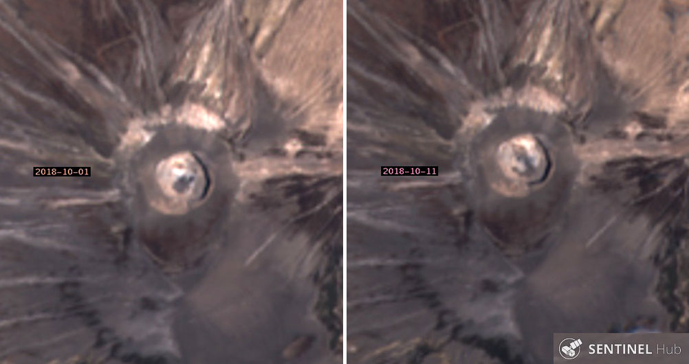
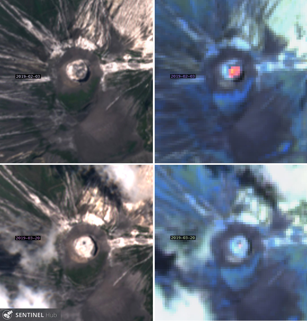
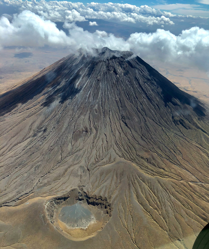
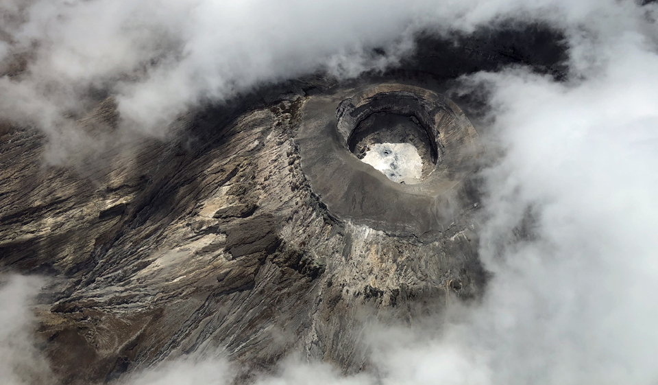
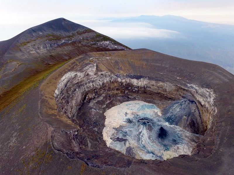
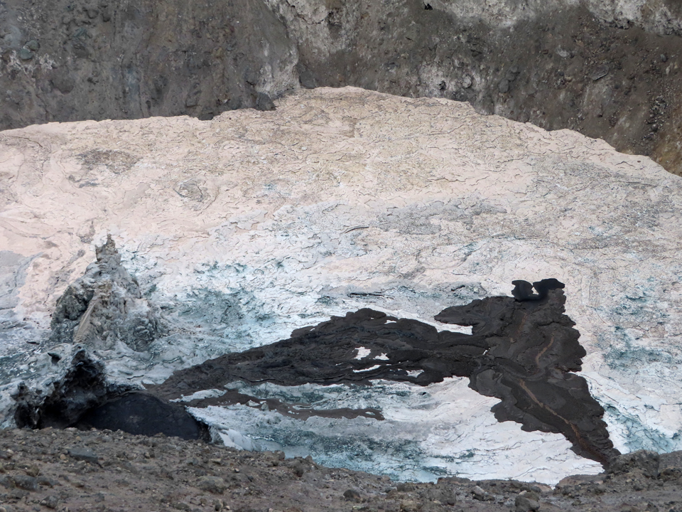
Information from site visits and overflights. Minor steam and gas emissions were visible from the summit crater during an overflight on 29 September 2018. Geologist Cin-Ty Lee captured excellent images of the W flank on 20 October 2018 (figure 192). The large circular crater at the base of the flank is the 'Oldoinyo' Maar (Graettinger, 2018a and 2018b). A view into the crater from an overflight that day (figure 193) showed clear evidence of at least five areas of dark, fresh lava. An effusive eruption was visible on the crater floor on 2 March 2019 (figure 194).
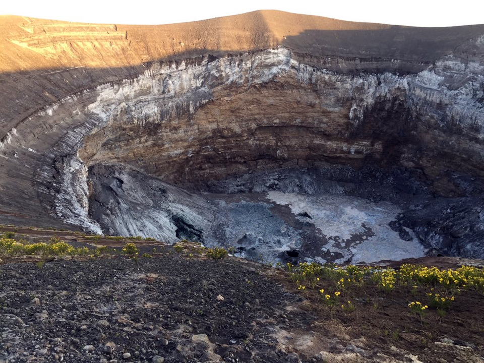
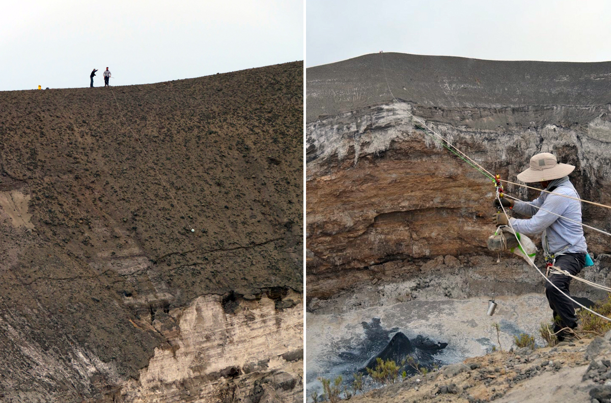
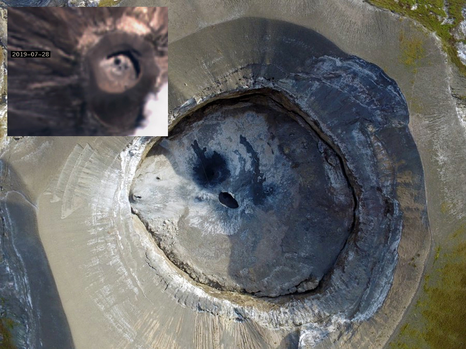
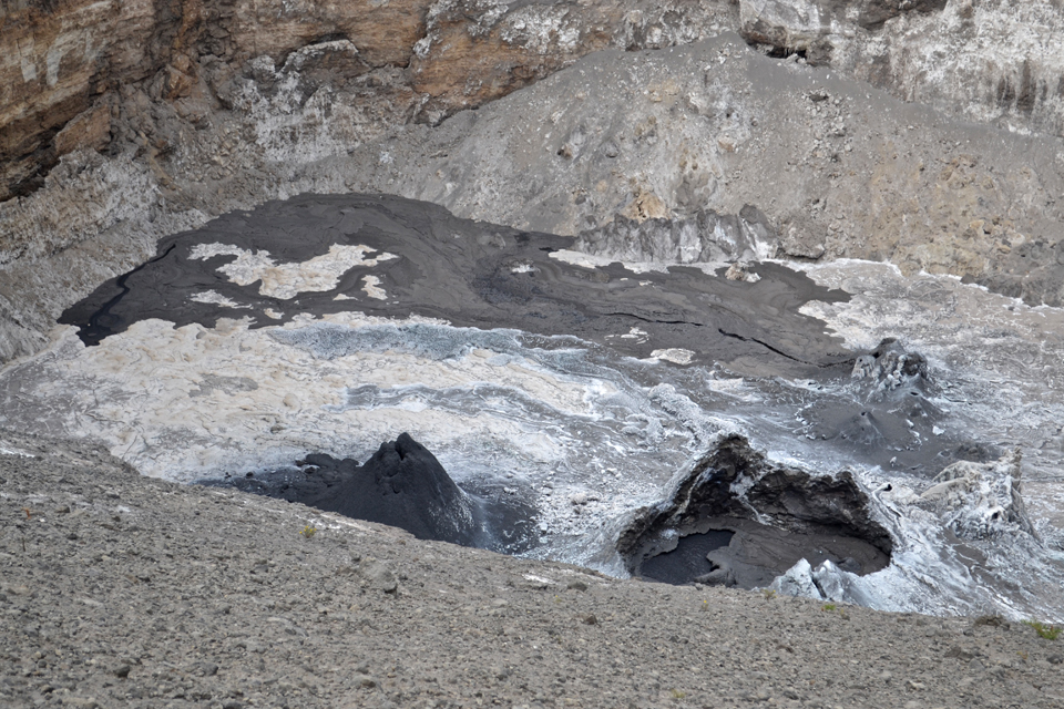
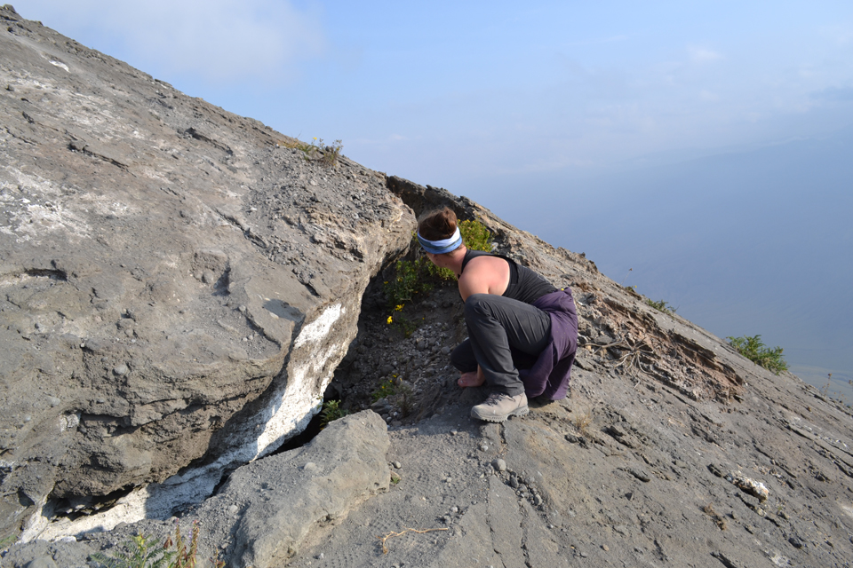
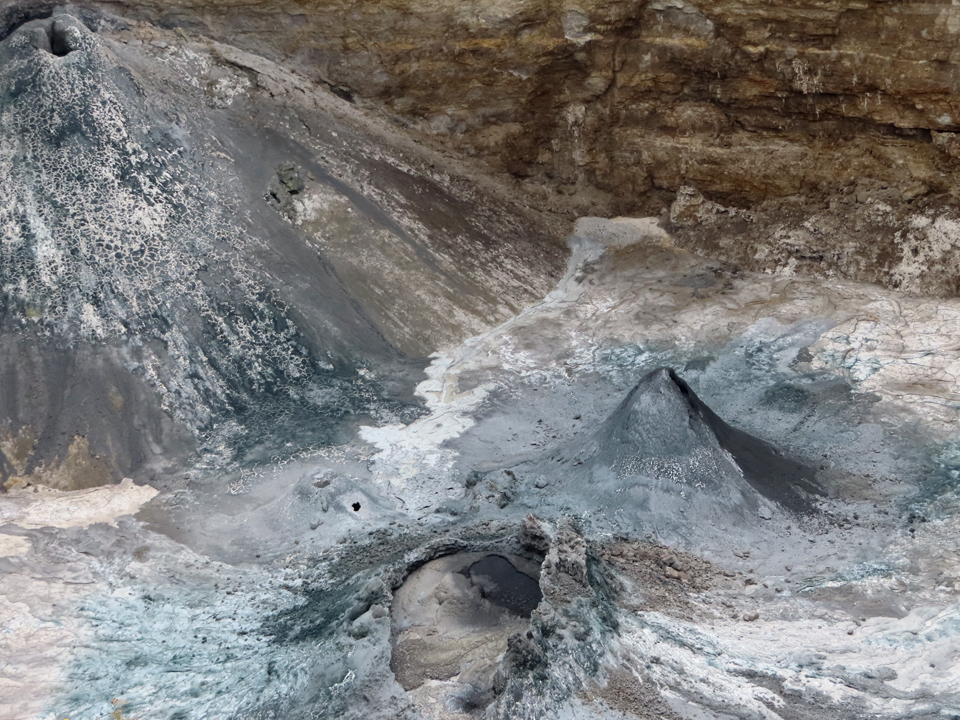
Research expedition in July-August 2019. In late July and early August 2019 an expedition, sponsored by the Deep Carbon Observatory (DCO) and led by researchers Kate Laxton and Emma Liu (University College London), made gas measurements, collected lava samples for the first time in 12 years, and deployed drones to gather data and images. The Ol Doinyo Lengai sampling team included Papkinye Lemolo, Boni Kicha, Ignas Mtui, Boni Mawe, Amedeus Mtui, Emma Liu, Arno Van Zyl, Kate Laxton, and their driver, Baraka. They collected samples by lowering devices via ropes and pulleys into the crater and photographed numerous active flows emerging from vents and hornitos on the crater floor (figure 195). By analyzing the composition of the first lava samples collected since the volcano's latest explosive activity in 2007, they hope to learn about recent changes to its underground plumbing system. A comparison of the satellite image taken on 28 July with a drone image of the summit crater taken by them the next day (figure 196) confirms the effectiveness of both the satellite imagery in identifying new flow features on the crater floor, and the drone imagery in providing outstanding details of activity.
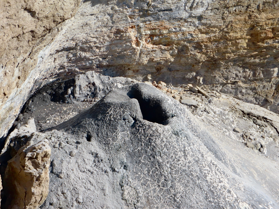
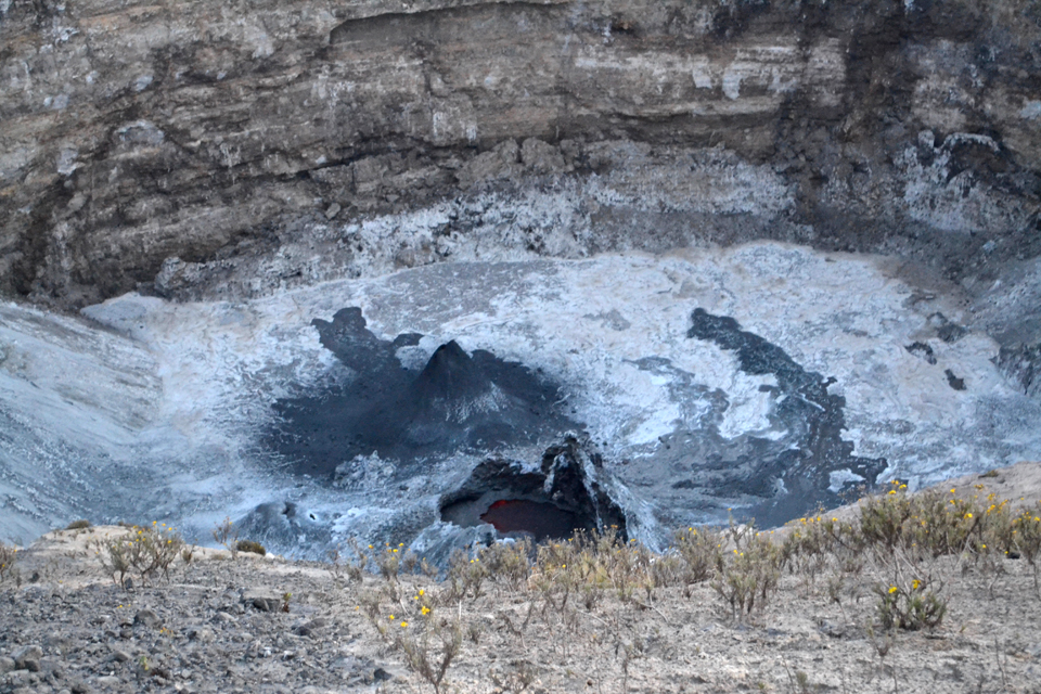
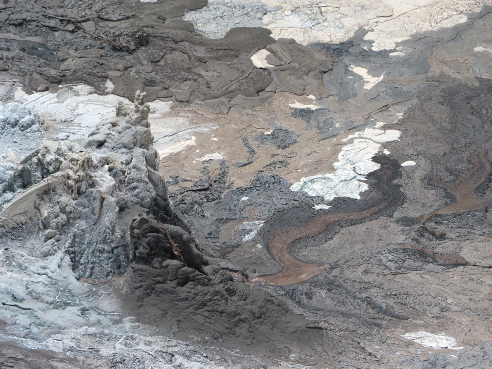
With the drone technology, they were able to make close-up observations of features on the north crater floor such as the large hornito on the inner W wall of the crater (figure 197), an active lava pond near the center of the crater (figure 198), and several flows resurfacing the floor of the crater while they were there (figure 199). A large crack that rings the base of the N cone had enlarged significantly since last measured in 2014 (figure 200).
The color of the flows on the crater floor changed from grays and browns to blues and greens after a night of rainfall on 31 July 2019 (figure 201). Much of the lava pond surface was crusted over that day, but the large hornito in the NW quadrant was still active (figure 202), and both the pond and another hornito produced flows that merged onto the crater floor (figure 203).
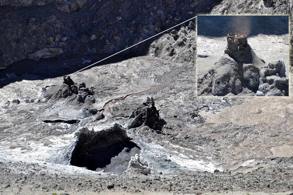
On 1 August 2019 much of the crater floor was resurfaced by a brown lava that flowed from a hornito E of the lava pond (figure 204). Images of unusual, ephemeral features such as "spatter pots," "frozen jets," and "frothy flows" (figure 205) help to characterize the unusual magmatic activity at this unique volcano (figure 206).
References: Graettinger, A. H., 2018a, MaarVLS database version 1, (URL: https://vhub.org/resources/4365).
Graettinger, A. H., 2018b, Trends in maar crater size and shape using the global Maar Volcano Location and Shape (MaarVLS) database. Journal of Volcanology and Geothermal Research, v. 357, p. 1-13. https://doi.org/10.1016/j.jvolgeores.2018.04.002.
Geological Summary. The symmetrical Ol Doinyo Lengai is the only volcano known to have erupted carbonatite tephras and lavas in historical time. The prominent stratovolcano, known to the Maasai as "The Mountain of God," rises abruptly above the broad plain south of Lake Natron in the Gregory Rift Valley. The cone-building stage ended about 15,000 years ago and was followed by periodic ejection of natrocarbonatitic and nephelinite tephra during the Holocene. Historical eruptions have consisted of smaller tephra ejections and emission of numerous natrocarbonatitic lava flows on the floor of the summit crater and occasionally down the upper flanks. The depth and morphology of the northern crater have changed dramatically during the course of historical eruptions, ranging from steep crater walls about 200 m deep in the mid-20th century to shallow platforms mostly filling the crater. Long-term lava effusion in the summit crater beginning in 1983 had by the turn of the century mostly filled the northern crater; by late 1998 lava had begun overflowing the crater rim.
Information Contacts: Cin-Ty Lee, Department of Earth, Environmental and Planetary Sciences, Rice University, 6100 Main St., Houston, TX 77005-1827, USA (URL: https://twitter.com/CinTyLee1, images at https://twitter.com/CinTyLee1/status/1054337204577812480, https://earthscience.rice.edu/directory/user/106/); Emma Liu, University College London, UCL Hazards Centre (Volcanology), Gower Street, London, WC1E 6BT, United Kingdom (URL: https://twitter.com/EmmaLiu31, https://www.ucl.ac.uk/earth-sciences/people/academic/dr-emma-liu); Kate Laxton, University College London, UCL Earth Sciences, Gower Street, London, WC1E 6BT, United Kingdom (URL: https://twitter.com/KateLaxton, https://www.ucl.ac.uk/earth-sciences/people/research-students/kate-laxton); Deep Carbon Observatory, Carnegie Institution for Science, 5251 Broad Branch Road NW, Washington, DC 20015-1305, USA (URL: https://deepcarbon.net/field-report-ol-doinyo-lengai-volcano-tanzania); Sentinel Hub Playground (URL: https://www.sentinel-hub.com/explore/sentinel-playground); MIROVA (Middle InfraRed Observation of Volcanic Activity), a collaborative project between the Universities of Turin and Florence (Italy) supported by the Centre for Volcanic Risk of the Italian Civil Protection Department (URL: http://www.mirovaweb.it/); Aman Laizer, Volcanologist, Arusha, Tanzania (URL: https://twitter.com/amanlaizerr, image at https://twitter.com/amanlaizerr/status/1102483717384216576).