Report on Soufriere Guadeloupe (France) — August 1976
Natural Science Event Bulletin, vol. 1, no. 11 (August 1976)
Managing Editor: David Squires.
Soufriere Guadeloupe (France) Summary of activity during 2-15 September 1976
Please cite this report as:
Global Volcanism Program, 1976. Report on Soufriere Guadeloupe (France) (Squires, D., ed.). Natural Science Event Bulletin, 1:11. Smithsonian Institution. https://doi.org/10.5479/si.GVP.NSEB197608-360060
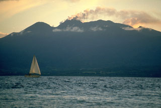
Soufriere Guadeloupe
France
16.044°N, 61.664°W; summit elev. 1467 m
All times are local (unless otherwise noted)
2 September: Heavy steam emission from all vents continued after the 30 August eruption. Ash emission was slight. Several loud, booming reports were heard in rapid succession at 1600.
3-7 September: Surface activity diminished. No significant ash eruption occurred. Tilt measurements showed a very slight movement downwards to the NW through 5 September; a 2-3 µrad deflation was noted between 6 and 7 September. Mean earthquake focal depth increased to ~3 km.
7-9 September: Eruptive activity was limited to mild steaming. Gas analysis yielded low values for acid gases (SO2, F2, and fluorides). The magnetic anomaly increased slightly. Mean focal depths were 2.5 km (based on 4 events) on 8 September, increasing to 3.4 km (based on three events) on 9 September.
10-13 September: Mild steaming continued; only small amounts of gases other than H2O were present. At 0418 on 13 September a M 3 earthquake occurred, centered under St. Claude (SW of the summit).
14 September: A summit eruption, lasting between 5 and 9 minutes, began at 1922, 15.4 days after the last significant eruption. Juergen Kienle (University of Alaska) had predicted an eruption between 14 and 18 September, a period centered around the lunar last quarter on 16 September. Immediately prior to the eruption, tilt at the summit went off scale. Loud noise was heard, but cloud cover at the summit prevented visual observation. Harmonic tremor accompanied the eruption, saturating seismographs for the first 4 minutes. Inspection of the summit area revealed airfall ash as far away as St. Claude (4.5 km SW of the summit) and Vieux Habitants (11 km W of the summit). Tom McGetchin reported that a small directed blast, originating from a fissure just S of the main vent, defoliated vegetation up to 500 m away.
15 September: Eruptive activity was confined to steaming and minor ash emission.
Local seismic energy release from mid-July to mid-September was calculated at the University of the West Indies (table 1).
Table 1. Total local earthquake energy for each of six 10-day periods and one 8-day period, 8 July-13 September 1976. Calculated using the formula log E = 9.4 + 2.14 M + 0.054 m2 by the Seismic Research Unit, University of the West Indies.
| Dates | Total Local Earthquake Energy (Ergs) | Comment |
| 08 Jul-17 Jul 1976 | 3.0 x 10¹⁷ | Initial steam explosion 8 July. |
| 18 Jul-27 Jul 1976 | 6.3 x 10¹⁷ | -- |
| 28 Jul-06 Aug 1976 | 1.6 x 10¹⁸ | -- |
| 07 Aug-16 Aug 1976 | 2.27 x 10¹⁹ | Evacuation began 12 August. |
| 27 Aug-05 Sep 1976 | 1.72 x 10¹⁹ | -- |
| 06 Sep-13 Sep 1976 | 4.63 x 10¹⁶ | 8-day period. |
Dry tilt stations were installed 28 August by the USGS and are being relevelled daily by George Jezouin, government engineer (table 2).
Table 2. Data from three USGS dry-tilt stations (with azimuth and distance to summit) on the SW flank of Soufrière, August-September 1976. All values are expressed in µrad vectored towards or away from the summit. Positive values represent inflation.
| Date | Bonne Terre (N47°E, 5 km) | Parnasse (N66°E, 3 km) | Savane à Mulets (N10°E, 1 km) |
| 29 Aug 1976 | 10 µrad inflation; no station data | ||
| 31 Aug 1976 | -4.1 | -7.0 | +32.0 |
| 02 Sep 1976 | 0.0 | +5.0 | -9.0 |
| 03 Sep 1976 | +3.0 | -4.0 | -6.0 |
| 04 Sep 1976 | -3.0 | -6.0 | -4.5 |
| 06 Sep 1976 | +5.0 | -4.0 | +2.5 |
| 07 Sep 1976 | 0.0 | -7.0 | -- |
| 08 Sep 1976 | -3.5 | -5.0 | 0.0 |
| 09 Sep 1976 | +2.3 | +3.8 | -- |
| 10 Sep 1976 | Deflation; no figures | ||
| 12 Sep 1976 | Inflation; no figures | ||
| 13 Sep 1976 | Inflation; no figures | ||
| 14 Sep 1976 | +5.0 | 0.0 | 0.0 |
Raw data from the LANL borehole tiltmeter array appear to be generally compatible with the dry tilt figures. 5-10 µrad tilt events occurring over about 10-minute time spans have been recorded simultaneously at more than one tilt station.
Seismic velocity profiles (18 shot points on land, 2-3 in the ocean) were being run 16 and 17 September by a French team. Velocities previously used to calculate focal depths were estimates which may have been too high. The French scientific team is responsible for gas sampling, magnetic readings and seismic recording as well as overseeing all scientific work on the volcano. The LANL is operating a camera station at Fort St. Charles and plans to establish another at Pointe-à-Pitre. Juergen Kienle is running a daily gravity survey. Michael Sheridan (Arizona State Univ.) is studying pyroclastic flow deposits from past eruptions.
Geological Summary. La Soufrière de la Guadeloupe volcano occupies the southern end of Basse-Terre, the western half of the island of Guadeloupe. Construction of the Grand Découverte volcano about 200,000 years ago was followed a Plinian eruption and caldera formation about 100,000 years later, and then by construction of the Carmichaël volcano within the caldera. Two episodes of edifice collapse and associated large debris avalanches formed the Carmichaël and Amic craters about 11,500 and 3,100 years ago, respectively. The present volcano subsequently grew within the Amic crater. The summit consists of a flat-topped lava dome, and several other domes occur on the southern flanks. Six phreatic explosive eruptions since 1690 opened radial fractures across the summit lava dome. The phreatic eruptions in 1976-77 caused severe economic disruption when Basse-Terre, the island's capital city immediately below the volcano, was evacuated.
Information Contacts: J. Tomblin and W. Aspinall, UWI; T. McGetchin, LANL.