Report on Soufriere Guadeloupe (France) — October 1976
Natural Science Event Bulletin, vol. 1, no. 13 (October 1976)
Managing Editor: David Squires.
Soufriere Guadeloupe (France) Eruption on 2 October deposits ash 7 km away; continued steam emission
Please cite this report as:
Global Volcanism Program, 1976. Report on Soufriere Guadeloupe (France) (Squires, D., ed.). Natural Science Event Bulletin, 1:13. Smithsonian Institution. https://doi.org/10.5479/si.GVP.NSEB197610-360060
Soufriere Guadeloupe
France
16.044°N, 61.664°W; summit elev. 1467 m
All times are local (unless otherwise noted)
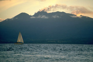
2 October: At about 1630, a steam and ash eruption began, producing a cloud that reached a maximum of 1000-1500 m height. The cloud deposited a fine veneer of ash on vegetation as far as 7 km downwind. Maximum ejecta diameter on the summit dome was 1-2 cm. Mudflows accompanied the eruption. Harmonic tremor events of 10 and 13 minutes respectively saturated seismographs at 1615 and 1654.
3 October: Normal activity resumed (200-300-m sulfurous steam plumes).
4 October: Steam clouds, fluctuating in volume and ash content, were emitted from the dome fracture system. Activity was greatest near the S flank. Ash slurries, 4-5 m wide, flowed downslope from the dome fractures. Two ash samples and one mudflow sample were taken by LANL the next day.
5 October: Summit fumarolic activity was visible in the early morning and late afternoon. Little or no ash was present in the steam plumes.
6-7 October: Clouds and heavy rain precluded observations of the summit area.
8 October: Moderate steam plumes, sometimes containing small amounts of ash, were emitted during the morning. A significant increase in activity began at 1237, about 2.5 hours after unusual heavy rains on the summit area. The steam plumes reached 50 m height.
9 October: Continued moderate steam emission, with varying but minor amounts of ash in the plumes.
10 October: At 1111, a 13-minute period of harmonic tremor began, coincident with a pronounced increase in ash emission from the summit, which lasted for 20-30 minutes. Four mm of ash were deposited at the summit parking lot and at Marigot (5.5 km W of the summit), considerably more than was deposited from the larger ash clouds of 2 and 4 October.
11 October: A pronounced increase in seismic activity began at about 0500 and continued through about 1100. No simultaneous increase in eruptive activity was noted.
12 October: Eruptive activity was limited to weak steaming. Plumes rose only 10-12 m above the summit.
13-14 October: Steam emission returned to the "moderate" level of 8-9 October.
15 October: LANL scientists returned to Los Alamos leaving borehole tiltmeters in concrete building foundations for continued use by the French team.
21 October: 65 earthquakes were recorded.
22 October: Earthquake activity increased sharply. Between 1330 and 1610, 182 earthquakes larger than M 2.2 were recorded. Eruptive activity increased during the afternoon and evening.
23 October: A harmonic tremor event occurred at about 0530, saturating instruments for 1 minute. Steam and "smoke" emission had declined since the previous evening.
Continuing dry tilt measurements by French technicians have indicated no coherent pattern of deformation 1-16 October. It is probable that the small tilts observed can be attributed to the near-surface effects of variation in rainfall, sunlight, and evaporation at each of the 4 stations.
Analysis of unsieved material by LANL from the 30 September and 15 October eruptions detected mainly hydrothermally altered lithic and mineral fragments. No fresh glass was found (table 3).
Table 3. Modal analyses by LANL of unsieved 30 September and 15 October 1976 ejecta from Soufrière.
| Components (%) | 30 Sep 1976 | 15 Oct 1976 |
| Altered and unaltered plagioclase, ortho- and clinopyroxe | 18 | 16 |
| Altered and unaltered lithic fragments (mostly porphyritic, glassy dacite) | 18 | 20 |
| Altered colorless glass | 4 | 1 |
| Matrix; less than 2 µm altered glass and mineral phases, clay, and celadonite (?) | 55 | 60 |
Sulfur contents of tephra samples increased over the period mid-August to early September, according to LANL analyses (table 4).
Table 4. Sulfur content of several ash samples from August 1976 eruptions of Soufrière. Analyzed by D. Curtis, LANL, using the thermal neutron-prompt gamma activation method.
| Date | Wt.% sulfur of tephra samples |
| 12 Aug 1976 | 1.7 |
| 22 Aug 1976 | 2.3 (1.1, 3.4; two locations) |
| 26 Aug 1976 | 2.7 |
| 27 Aug 1976 | 3.6 (3.0, 4.1; two locations) |
| 30 Aug 1976 | 4.3 |
Geological Summary. La Soufrière de la Guadeloupe volcano occupies the southern end of Basse-Terre, the western half of the island of Guadeloupe. Construction of the Grand Découverte volcano about 200,000 years ago was followed a Plinian eruption and caldera formation about 100,000 years later, and then by construction of the Carmichaël volcano within the caldera. Two episodes of edifice collapse and associated large debris avalanches formed the Carmichaël and Amic craters about 11,500 and 3,100 years ago, respectively. The present volcano subsequently grew within the Amic crater. The summit consists of a flat-topped lava dome, and several other domes occur on the southern flanks. Six phreatic explosive eruptions since 1690 opened radial fractures across the summit lava dome. The phreatic eruptions in 1976-77 caused severe economic disruption when Basse-Terre, the island's capital city immediately below the volcano, was evacuated.
Information Contacts: LANL; J. Gautheyrou, ORSTOM; AFP.