Report on Ardoukoba (Djibouti) — December 1978
Scientific Event Alert Network Bulletin, vol. 3, no. 12 (December 1978)
Managing Editor: David Squires.
Ardoukoba (Djibouti) New data on November eruption
Please cite this report as:
Global Volcanism Program, 1978. Report on Ardoukoba (Djibouti) (Squires, D., ed.). Scientific Event Alert Network Bulletin, 3:12. Smithsonian Institution. https://doi.org/10.5479/si.GVP.SEAN197812-221126
Ardoukoba
Djibouti
11.58°N, 42.47°E; summit elev. 298 m
All times are local (unless otherwise noted)
The eruption of Ardoukoba began on 7 November. During the preceding 24 hours, about 800 earthquakes M < 3.3 had been recorded. These events occurred at the end of the Ghoubbat al Kharab (figure 2), just S of the rift and ~6 km SE of the eruption site.
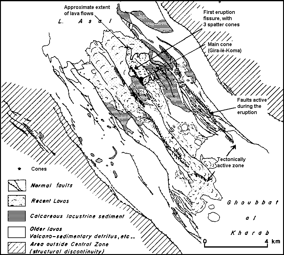 |
Figure 2. Rock types, faults, and old volcanic cones in the Ardoukoba Rift, after Needham and others (1976). An overprint, from M. Krafft, shows the active vents and lava flows from the 7-14 November 1978 eruption and the zone of active faulting accompanying the eruption. |
After a brief period of gas emission, lava fountaining began from a 500-m-long, newly opened fissure. Three spatter cones formed on this fissure, but the primary activity soon shifted about 1/2 km to the SE. For the first 2-4 hours as much as 0.5 x 10⁶ m3 of lava was extruded per hour, but the extrusion rate declined rapidly and by the 5th or 6th day had decreased by an order of magnitude.
By 9 November, only the main vent was still active. A cone (named Gira-le-Koma) about 30 m high, 200 m long, and 25 m wide, with a 60° external slope, had formed around this vent, which contained a small lava lake. On 13 November the level of the lava lake dropped rapidly, then the lake disappeared. Scoria and bombs were ejected briefly before the eruption ended on 14 November.
The total volume of lava emitted was estimated to be at least 12 x 106 m3. Lava covered an area of slightly more than 3 km2. Flow thicknesses reached 25 m but usually ranged from 1 to 2 m. About 25 fissures, parallel to the NW-SE trend of the rift, opened during the activity. Most fissures were from 1-2 mm to about 1 m wide, but there was one short segment of 3 m width. Many of the fissures also showed a component of normal movement, with scarps up to 1/2 m high.
Reference. Needham and others, 1976, The accreting plate boundary: Ardoukoba Rift (northeast Africa) and the oceanic rift system: Earth and Planetary Science Letters, v. 28, p 439-453.
Further References. Abdallah, A., and others, 1979, Relevance of Afar seismicity and volcanism to the mechanics of accreting plate boundaries: Nature, v. 282, p. 17-23.
Demange, J., and Tazieff, H., 1978, The "tectonic" eruption of the Ardoukoba (Djibouti): C.R. Acad. Sci. Paris, Ser. D, v. 287, p. 1269-1272.
Hernandez, J., and Ruegg, J.C., eds., 1980, Colloque Rift d'Asal: Réunion extraordinaire de la Société Géologique de France: Bulletin de la Societé Géologique de France, serie 7, t. XXII, no. 6, p. 797-1013.
Tarantola, A., Ruegg, J.C., and Lepine, J.C., 1979, Geodetic evidence for rifting in Afar: A brittle-elastic model for the behavior of the lithosphere: Earth and Planetary Science Letters, v. 45, p. 435-444.
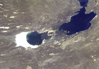
Geological Summary. The Ardoukôba (Asal) Rift in Djibouti, trending NW from the Red Sea, contains a broad area of youthful fissure vents between Lake Asal and the Ghoubbat al Kharab gulf. It is subaerially exposed over 12 km between these two bodies of water and contains numerous basaltic cinder and spatter cones. The silicic centers of Eger Alayta and Asa Aleyta, on the N and S sides, are remnants of a Pleistocene silicic center that has been disrupted and spread apart. Magma-water interaction has produced tuff cones, some of which form islands or are breached by the sea. The most recent lava flows are younger than lake sediments deposited 5,300 years ago. These lavas were thought to have been erupted during the past 3,000 years (Delibrias et al., 1975). The fissure erupted in 1978, producing a small cinder cone and lava flows that covered part of the rift floor near the Red Sea.
Information Contacts: M. Krafft, Cernay.