Report on Llaima (Chile) — October 1979
Scientific Event Alert Network Bulletin, vol. 4, no. 10 (October 1979)
Managing Editor: David Squires.
Llaima (Chile) Tephra and lava flows from summit crater
Please cite this report as:
Global Volcanism Program, 1979. Report on Llaima (Chile) (Squires, D., ed.). Scientific Event Alert Network Bulletin, 4:10. Smithsonian Institution. https://doi.org/10.5479/si.GVP.SEAN197910-357110
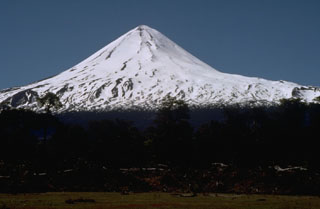
Llaima
Chile
38.692°S, 71.729°W; summit elev. 3125 m
All times are local (unless otherwise noted)
After a series of subterranean noises and local earthquakes, an eruption from Llaima's central crater began at about 0200 on 15 October, with intermittent explosions ejecting gas and ash. A group of school teachers and students 7 km to the W saw explosions beginning at about 0800 that projected an ash column to about 1 km above the central crater. Police reports state that the eruption was briefly visible from San Patricio, 35 km to the W, at 0857. After 0900, steam and ash emission rapidly declined to fumarolic activity. Ash could be seen on the snow-covered slopes of the volcano. Tourists and residents of the area immediately around the volcano were evacuated.
[Hugo Moreno notes that reports of lava extrusion following the explosive activity were incorrect. Three lava debris flows/pyroclastic flows were generated by column collapse during the main explosion.]
A brief period of lava extrusion from the central crater followed the explosive activity. The lava melted some of the ice near the summit, generating small lahars that moved N and E. Chilean Air Force personnel saw two lobes of lava on Llaima's W slopes during an overflight at 1200.
Hugo Moreno flew over the volcano the next day, observing three [black] flows, and . . . deposits of ash and lapilli to the NE (figure 1). Fine ash covered the slopes of Sierra Nevada volcano (20 km NE) and nearly reached Lonquimay village (45 km NE). Dense white vapor emerged from the central crater.
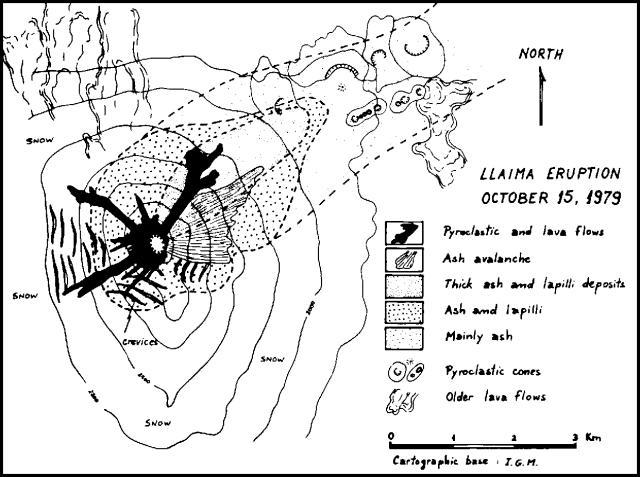 |
Figure 1. Sketch map of Llaima showing the deposits from the 15 October 1979 eruption. Courtesy of Hugo Moreno. |
Geological Summary. Llaima, one of Chile's largest and most active volcanoes, contains two main historically active craters, one at the summit and the other, Pichillaima, to the SE. The massive, dominantly basaltic-to-andesitic, stratovolcano has a volume of 400 km3. A Holocene edifice built primarily of accumulated lava flows was constructed over an 8-km-wide caldera that formed about 13,200 years ago, following the eruption of the 24 km3 Curacautín Ignimbrite. More than 40 scoria cones dot the volcano's flanks. Following the end of an explosive stage about 7200 years ago, construction of the present edifice began, characterized by Strombolian, Hawaiian, and infrequent subplinian eruptions. Frequent moderate explosive eruptions with occasional lava flows have been recorded since the 17th century.
Information Contacts: H. Moreno R. and O. González-Ferrán, Univ. de Chile, Santiago.