Report on Acatenango (Guatemala) — March 1981
Scientific Event Alert Network Bulletin, vol. 6, no. 3 (March 1981)
Managing Editor: Lindsay McClelland.
Acatenango (Guatemala) No visible fumarolic activity; strong sulfur odor near sumit craters
Please cite this report as:
Global Volcanism Program, 1981. Report on Acatenango (Guatemala) (McClelland, L., ed.). Scientific Event Alert Network Bulletin, 6:3. Smithsonian Institution. https://doi.org/10.5479/si.GVP.SEAN198103-342080
Acatenango
Guatemala
14.501°N, 90.876°W; summit elev. 3976 m
All times are local (unless otherwise noted)
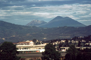
Geologists visited the summit 16, 17, and 18 February. There was no visible fumarolic activity around the summit, or in the explosion craters from the volcano's last eruption in 1972. The geologists smelled a strong sulfur odor in the immediate vicinity of the summit craters.
Geological Summary. Acatenango is ~15 km SW of the city of Antigua, Guatemala, and 3 km N of Fuego volcano. Both edifices were constructed during three eruptive periods post-dating the roughly 85,000-year-old Los Chocoyos tephra from Atitlán caldera. An older Acatenango edifice collapsed to the south sometime prior to 43,000 years ago, forming La Democracia debris-avalanche deposit, which covers a wide area of the Pacific coastal plain. Construction of the Yepocapa cone, ~900 m N of the main crater, was completed about 20,000 years ago, after which growth of the larger southern cone, Pico Central (also known as Pico Mayor), began. The first well-documented eruptions took place from 1924 to 1927 CE. Francisco Vasquez, writing in 1690 CE, noted that in 1661 a volcano that lay aside of Fuego "opened a smoking mouth and still gives off smoke from another three, but without noise."
Information Contacts: T. Bornhorst and C. Chesner, Michigan Tech. Univ.