Report on Gareloi (United States) — February 1982
Scientific Event Alert Network Bulletin, vol. 7, no. 2 (February 1982)
Managing Editor: Lindsay McClelland.
Gareloi (United States) Large plume seen on satellite imagery
Please cite this report as:
Global Volcanism Program, 1982. Report on Gareloi (United States) (McClelland, L., ed.). Scientific Event Alert Network Bulletin, 7:2. Smithsonian Institution. https://doi.org/10.5479/si.GVP.SEAN198202-311070
Gareloi
United States
51.79°N, 178.794°W; summit elev. 1573 m
All times are local (unless otherwise noted)
Infrared imagery from the NOAA 7 polar orbiting satellite 15 January at 1402 showed an apparent eruption cloud blowing E from the vicinity of Gareloi (figure 1). Analysis of this image yielded a cloud top temperature of -36°C, indicating an altitude of 7-9 km. No eruption clouds were present on images the two previous days and the following day, nor was any activity evident on imagery 24 January, or 3 and 11 February. No ashfall was reported on Adak Island (130 km to the E) or Shemya Island (500 km to the WNW). Navy pilots plan to photograph Gareloi in the near future, for comparison with photos taken during and after its August-September 1980 eruption.
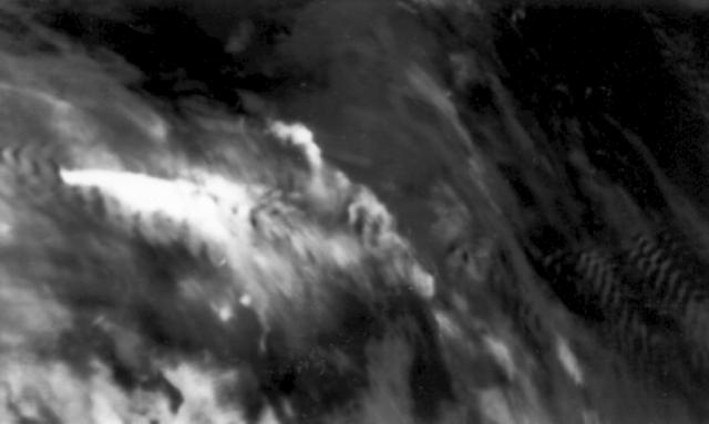 |
Figure 1. Infrared image returned 15 January 1982 at 1402 by the NOAA 7 polar orbiting satellite. A bright white plume, at left-center, drifts ESE. Dark ripples near the plume and at right-center indicate the position of islands in the Aleutian chain. |
The seismic network on Adak Island recorded an mb 3.2-3.3 earthquake on 15 January at 0521. No unique hypocenter can be determined for this event, but one of the two possible solutions places it directly under Gareloi. This shock was substantially larger than the mb 2.6 event that accompanied the February 1974 eruption of Great Sitkin, which produced a 3-km plume. Additional events were recorded the following week that may also be centered in the vicinity of Gareloi. An infrasound array at College, Alaska (about 2,200 km NE of Gareloi) recorded no acoustic wave associated with the eruption.
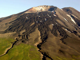
Geological Summary. The 8 x 10 km Gareloi Island, the northernmost volcano of the Delarof Group at the western end of the Andreanof Islands, consists of a stratovolcano with two summits and a prominent SE-trending fissure. The fissure was formed during an eruption in 1929 and extends from the southern summit to the sea. Steep sea cliffs that are cut into rocks of an older, eroded center are found on the SW coast, and submarine deposits of three debris avalanches produced by edifice collapse are found offshore. Young lava flows cover the older volcano from the summit to the coast along three broad axes trending NW, ENE, and S. The 1929 eruption originated from 13 craters along a 4-km-long fissure. Phreatic explosions were followed by the ejection of glassy pumice, lapilli, scoria, and older blocks, as well as by the emission of four short, steep lava flows, one of which reached the SE coast.
Information Contacts: J. Kienle, Univ. of Alaska; S. Billington, NOAA/CIRES, Univ. of Colorado; P. Mutschlecner, LANL.