Report on Pavlof (United States) — November 1983
Scientific Event Alert Network Bulletin, vol. 8, no. 11 (November 1983)
Managing Editor: Lindsay McClelland.
Pavlof (United States) Ash emission; vapor plume; volcanic tremor
Please cite this report as:
Global Volcanism Program, 1983. Report on Pavlof (United States) (McClelland, L., ed.). Scientific Event Alert Network Bulletin, 8:11. Smithsonian Institution. https://doi.org/10.5479/si.GVP.SEAN198311-312030
Pavlof
United States
55.417°N, 161.894°W; summit elev. 2493 m
All times are local (unless otherwise noted)
On 19 November a small vapor cloud rose approximately 100 m above the vent. Bad weather prevented observations until 26 November when Pavlof was visible until mid-afternoon from Cold Bay. During the morning, a vapor plume containing a little ash rose to 4.5 km altitude. At intervals of approximately 30 minutes, puffs of dark ash were emitted. The intervals became shorter, and by 1500 ash emission was nearly continuous.
Through October and early November, a Lamont-Doherty seismic monitoring station near the volcano recorded background levels of 0-40 (usually 0-30) small low-frequency events per day. A 30-minute burst of volcanic tremor began at 2000 on 4 November, and a 6-minute burst at 1757 on 9 November. Between 1430 on 11 November and 1100 on 13 November, 15 explosions were recorded. Several 1-2 minute bursts of tremor occurred between 1700 and 1900, when continuous tremor started. Its amplitude gradually increased, and tremor began to saturate the seismograph at 1100 on 14 November. Tremor was strongest between midnight and 1200 on 15 November, and continued to saturate the seismograph until 2100 on 15 November when its amplitude began to decrease. Tremor remained continuous but at low amplitude between 1300 on 16 November and 1200 on 18 November. Intermittent low-amplitude tremor and numerous low-frequency (B-type) events recorded after 1200 on 18 November were continuing on 21 November.
An increase in seismic activity had also been recorded in mid-July. Seismicity remained at background levels until 11 July. During the 24-hours beginning at 1500 on the 11th, 6 explosions were recorded at a Lamont-Doherty seismic monitoring station near the volcano. The number of recorded events increased to 55 for the same period on 12-13 July, and to 150 on 13-14 and 14-15 July, then decreased to 120 on the 15-16th, 38 on the 16-17th, and 19 on the 17-18th, returning to back-ground after 1500 on 18 July. During the period of increased seismicity, approximately half of the recorded events were explosions and half low-frequency events.
At 1549 on 15 July, a thermal infrared image from the NOAA 7 polar orbiting satellite showed a bright spot over Pavlof and an elongate plume extending approximately 150 km to the E. This plume was distinctly colder (at higher altitude) than the layer of low clouds that covered the area. No activity was visible on other NOAA 7 images returned approximately every 12 hours 11-18 July.
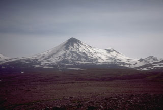
Geological Summary. The most active volcano of the Aleutian arc, Pavlof is a Holocene stratovolcano that was constructed along a line of vents extending NE from the Emmons Lake caldera. Pavlof and Pavlof Sister to the NE form a dramatic pair of symmetrical, glacier-covered stratovolcanoes that overlook Pavlof and Volcano bays. Little Pavlof is a smaller cone on the SW flank of Pavlof volcano, near the rim of Emmons Lake caldera. Unlike Pavlof Sister, eruptions have frequently been reported from Pavlof, typically Strombolian to Vulcanian explosive eruptions from the summit vents and occasional lava flows. The active vents lie near the summit on the north and east sides. The largest recorded eruption took place in 1911, at the end of a 5-year-long eruptive episode, when a fissure opened on the N flank, ejecting large blocks and issuing lava flows.
Information Contacts: S. McNutt, LDGO; T. Miller and M. E. Yount, USGS, Anchorage; M. Matson, NOAA/NESDIS.

