Report on Concepcion (Nicaragua) — November 1985
Scientific Event Alert Network Bulletin, vol. 10, no. 11 (November 1985)
Managing Editor: Lindsay McClelland.
Concepcion (Nicaragua) Ash eruption
Please cite this report as:
Global Volcanism Program, 1985. Report on Concepcion (Nicaragua) (McClelland, L., ed.). Scientific Event Alert Network Bulletin, 10:11. Smithsonian Institution. https://doi.org/10.5479/si.GVP.SEAN198511-344120
Concepcion
Nicaragua
11.538°N, 85.622°W; summit elev. 1700 m
All times are local (unless otherwise noted)
A violent tephra eruption occurred on 2 January 1985, accompanied by strong rumbling. Ashfall damaged tobacco and sesame crops, and fell on the towns of Esquipulas, Los Angeles, and to a lesser extent, Moyogalpa (at the W foot of the volcano). As the eruption began, Esquipulas was celebrating the festival of its patron saint, but heavy ashfall forced the festival's suspension. Blocks fell on the volcano's flanks. The eruption was comparable to that of 1977 (2:4).
During Space Shuttle mission 61B (27 November-3 December 1985), astronauts photographed Concepción three times. The first two photographs (nos. 61B-121-101 and 61B-36-086), taken on 28 November at 1300 and 30 November at 1230, showed no plume or other signs of volcanic activity. A photograph (no. 61B-39-066) taken later in the mission, however, exhibited a buff-brown plume over the volcano, which could be traced clearly for 6.6 km to the SW with possible wispy material for an additional 10 km.
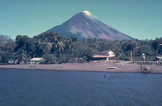
Geological Summary. Volcán Concepción is one of Nicaragua's highest and most active volcanoes. The symmetrical basaltic-to-dacitic stratovolcano forms the NW half of the dumbbell-shaped island of Ometepe in Lake Nicaragua and is connected to neighboring Madera volcano by a narrow isthmus. A steep-walled summit crater is 250 m deep and has a higher western rim. N-S-trending fractures on the flanks have produced chains of spatter cones, cinder cones, lava domes, and maars located on the NW, NE, SE, and southern sides extending in some cases down to Lake Nicaragua. Concepción was constructed above a basement of lake sediments, and the modern cone grew above a largely buried caldera, a small remnant of which forms a break in slope about halfway up the N flank. Frequent explosive eruptions during the past half century have increased the height of the summit significantly above that shown on current topographic maps and have kept the upper part of the volcano unvegetated.
Information Contacts: D. Fajardo B., INETER; C. Wood, M. Helfert, NASA, Houston.