Report on Ranakah (Indonesia) — December 1987
Scientific Event Alert Network Bulletin, vol. 12, no. 12 (December 1987)
Managing Editor: Lindsay McClelland.
Ranakah (Indonesia) Explosions, then lava plug forms in crater within area of no known historic activity
Please cite this report as:
Global Volcanism Program, 1987. Report on Ranakah (Indonesia) (McClelland, L., ed.). Scientific Event Alert Network Bulletin, 12:12. Smithsonian Institution. https://doi.org/10.5479/si.GVP.SEAN198712-264071
Ranakah
Indonesia
8.637°S, 120.5302°E; summit elev. 2288 m
All times are local (unless otherwise noted)
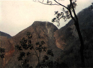
Explosions began at 2200 on 28 December from a pre-existing crater [(Anak Ranakah)] in an area without known historical eruptive activity (figure 1).
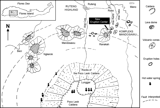 |
Figure 1. Geological sketch map (after Katili, 1988) showing the position of Anak Ranakah (labeled "new eruption center") in relation to other young domes and vents on the flanks of the Poco Leok caldera. |
From 28 December to 2 January numerous explosions sent columns 500-2,000 m above the vent. By 1 January, the vent diameter was ~ 100 m and ~ 40 cm of ashfall had accumulated near the rim. The ash was hot, but did not burn vegetation. Ballistic fragments of light-colored porphyritic dacite, up to 15 cm in diameter, were found in the ash deposits within several hundred meters of the crater rim. The rock fragments and ash were older hydrothermally altered volcanic rocks. Through 1 January there was no evidence for new magmatic material in the deposits. Larger explosions on 3 January (at 1611 and 1646) sent dark ash plumes to 4 and 6 km above the summit, dropping 1 mm of ash in Ruteng (8 km NW) and ~ 3 mm in Robo village (~ 4.5 km NNW). At 0322 on 4 January, a third large explosion occurred. As of 6 January, 20,000 people had been evacuated from an area within a 5 km radius of the vent.
A VSI observer arrived in Ruteng on 30 December and was joined by two additional observers with a seismometer and radio on 1 January. Preliminary seismic data showed roughly 2-4 tectonic earthquakes and ~ 50 volcanic earthquakes/day. An observatory post has been established at Robo village, equipped with a short-period seismometer and a radio for direct communications with VSI headquarters. A second two-person team of VSI observers with an additional seismometer arrived 5 January.
Local officials reported "fire" at the crater associated with the first explosion on 28 December, but no incandescence or lightning had accompanied subsequent larger explosions. A glow from the vent was first observed during the evening of 8 January. When VSI observers visited the crater on 11 January, they confirmed that a new plug of lava had risen 50-75 m within the crater. . . .
Previous seismic activity includes a M 5.6 earthquake that struck the Ruteng area on 7 August 1982 at 0440, damaging the microwave station near the presently active crater and other buildings.
Reference. Katili, J.A., 1988, Anak Ranaka: the birth of a volcano in Flores: Voice of Nature, n. 57, p. 6-11, 50-51.
Geological Summary. The Anak Ranakah (Child of Ranakah) lava dome was formed in 1987 in an area without previous recorded eruptions at the base of the large older lava dome of Gunung Ranakah. An arcuate group of lava domes extending about 12 km west from Gunung Ranakah to Poco Mandosawa occurs on the outer N flanks of the poorly known Poco Leok caldera on western Flores Island.
Information Contacts: VSI.