Report on Don Joao de Castro Bank (Portugal) — March 1989
Scientific Event Alert Network Bulletin, vol. 14, no. 3 (March 1989)
Managing Editor: Lindsay McClelland.
Don Joao de Castro Bank (Portugal) Seismicity since May 1988 summarized
Please cite this report as:
Global Volcanism Program, 1989. Report on Don Joao de Castro Bank (Portugal) (McClelland, L., ed.). Scientific Event Alert Network Bulletin, 14:3. Smithsonian Institution. https://doi.org/10.5479/si.GVP.SEAN198903-382070
Don Joao de Castro Bank
Portugal
38.23°N, 26.63°W; summit elev. -13 m
All times are local (unless otherwise noted)
[Don João de Castro Bank information only; extracted from a summary of significant seismic activity in the E Azores since May 1988.]
"A small swarm of earthquakes occurred within the volcano Don João de Castro Bank (figure 1, zone 4) 3-5 October. Sixty-two earthquakes were recorded; no harmonic tremor was detected. A felt earthquake occurred in the same area 23 October; it had intensities of MM IV-V on Terceira and MM III-IV on the N coast of Sao Miguel."
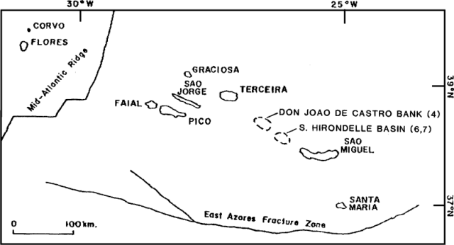 |
Figure 1. Sketch map showing islands in the eastern Azores. Approximate epicenters of the 3-5 October 1988 swarm at the submarine volcano Don Joao de Castro Bank (4) and the 21 November 1988 and 21 January 1989 earthquakes in the Hirondelle Basin (6 and 7) are shown. Courtesy of R. Moore. |
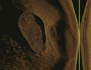
Geological Summary. Don Joao de Castro Bank is a large submarine volcano that rises to within 13 m of the ocean surface roughly halfway between Terceira and San Miguel Islands. Pillow lavas form the base of the volcano, which is capped by basaltic hyaloclastites. A submarine eruption during December 1720 produced an ephemeral island that attained a length of 1.5 km and a height of about 250 m before it was eroded beneath the surface two years later. The volcano (also spelled Dom Joao de Castro) was named after the Portuguese hydrographic survey vessel that surveyed the bank in 1941. Two youthful craters, one tephra covered and the other sediment free, are located on the NW flank. The submarine volcano has a shallow fumarole field and remains seismically active.
Information Contacts: A. Rodrigues da Silva, Consorcio Geotermico de S. Miguel; R. Moore, USGS; National Institute of Meteorology and Geophysics, Portugal.