Report on Deception Island (Antarctica) — March 1989
Scientific Event Alert Network Bulletin, vol. 14, no. 3 (March 1989)
Managing Editor: Lindsay McClelland.
Deception Island (Antarctica) Frequent seismicity; minor changes to fumaroles
Please cite this report as:
Global Volcanism Program, 1989. Report on Deception Island (Antarctica) (McClelland, L., ed.). Scientific Event Alert Network Bulletin, 14:3. Smithsonian Institution. https://doi.org/10.5479/si.GVP.SEAN198903-390030
Deception Island
Antarctica
62.9567°S, 60.6367°W; summit elev. 602 m
All times are local (unless otherwise noted)
Spanish and Argentine scientists visited Deception Island in December 1988 and January-February 1989. Local and regional seismicity, thermal activity, gas emission, magnetic field, geodetic, and geological studies were carried out, and the Spanish oceanographic vessel Las Palmas operated in the area. Previous work at Deception by the Vulcantar project was during the austral summers of 1986-87 and 1987-88.
During the 1988-89 field season, an array of six seismic stations was installed on Deception Island, plus a single instrument at Spain's Juan Carlos I facility on Livingston Island (figure 1). More than 2,000 events were monitored, with more than 1,000 digitally recorded. The distribution of events showed a good correlation with tectonic features on and near the island. Seismic swarms and episodes of volcanic tremor with well-defined frequencies and durations of 5-360 minutes were also recorded. Small changes were observed in the distribution of fumarolic activity and thermal fields, with some impact on the local fauna.
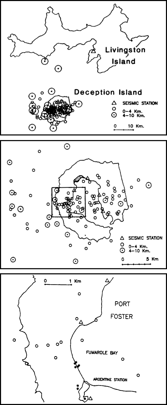 |
Figure 1. Distribution of seismic events in the vicinity of Deception Island, austral summer 1988-89 (top). Best-located seismic events near Deception Island during the same period (middle); new land built by the 1970 eruption is shaded. The inset box indicates the area shown in the map below. Detail of the Fumarole Bay area (bottom) showing seismic events 1-31 January 1989 (circles), sites of fumarolic activity (asterisks), and seismic stations (triangles). Courtesy of Ramón Ortiz. |
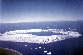
Geological Summary. Ring-shaped Deception Island, at the SW end of the South Shetland Islands, NE of Graham Land Peninsula, was constructed along the axis of the Bransfield Rift spreading center. A narrow passageway named Neptunes Bellows provides an entrance to a natural harbor within the 8.5 x 10 km caldera that was utilized as an Antarctic whaling station. Numerous vents along ring fractures circling the low 14-km-wide island have been reported active for more than 200 years. Maars line the shores of 190-m-deep Port Foster caldera bay. Among the largest of these maars is 1-km-wide Whalers Bay, at the entrance to the harbor. Eruptions during the past 8,700 years have been dated from ash layers in lake sediments on the Antarctic Peninsula and neighboring islands.
Information Contacts: R. Ortiz, Museo Nacional de Ciencias Naturales, Spain; J. Sastre, Real Instituto y Observatorio de la Armada, Spain; C. Parica, Ciudad Universitaria, Buenos Aires, Argentina; J. Viramonte, Univ Nacional de Salta, Argentina.