Report on Masaya (Nicaragua) — April 1989
Scientific Event Alert Network Bulletin, vol. 14, no. 4 (April 1989)
Managing Editor: Lindsay McClelland.
Masaya (Nicaragua) Lava lake drains; rockslides; gas emission
Please cite this report as:
Global Volcanism Program, 1989. Report on Masaya (Nicaragua) (McClelland, L., ed.). Scientific Event Alert Network Bulletin, 14:4. Smithsonian Institution. https://doi.org/10.5479/si.GVP.SEAN198904-344100
Masaya
Nicaragua
11.9844°N, 86.1688°W; summit elev. 594 m
All times are local (unless otherwise noted)
A local newspaper (the Barricada, citing Alain Creusot) reported that on 7 March, the level of the active lava lake in Santiago's crater had dropped considerably (since late February). Spatter was occasionally ejected outside the vent. The lake apparently drained on 9 March. Geologists visited the crater on 14 March and measured a temperature of 76.6°C on the surface of the frozen lake (all reported temperatures were measured by an 8-14 micrometer bandpass infrared thermometer from a distance of about 300 m unless otherwise stated). The two incandescent vents that first appeared on 23 February (14:02) were still present in the lake's N corner. The temperature of the hottest glowing vent was 667°C. On 16 and 18 March, fumes collected in the crater and limited observations. By 28 March, debris from rockslides on the SW inner wall of the crater had covered the site of the former lake, at least 175 m below the floor of Santiago Crater. Gas emission was strong. The two incandescent vents (maximum surface temperature 607°C) remained visible at night. On 12 April, the frequency of rockslides (audible about every 5 minutes) had increased significantly. Most occurred on the SW inner wall of the crater and many lasted for minutes. When geologists drove past Masaya on 18 April the amount of fuming appeared to have dramatically decreased.
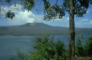
Geological Summary. Masaya volcano in Nicaragua has erupted frequently since the time of the Spanish Conquistadors, when an active lava lake prompted attempts to extract the volcano's molten "gold" until it was found to be basalt rock upon cooling. It lies within the massive Pleistocene Las Sierras caldera and is itself a broad, 6 x 11 km basaltic caldera with steep-sided walls up to 300 m high. The caldera is filled on its NW end by more than a dozen vents that erupted along a circular, 4-km-diameter fracture system. The Nindirí and Masaya cones, the source of observed eruptions, were constructed at the southern end of the fracture system and contain multiple summit craters, including the currently active Santiago crater. A major basaltic Plinian tephra erupted from Masaya about 6,500 years ago. Recent lava flows cover much of the caldera floor and there is a lake at the far eastern end. A lava flow from the 1670 eruption overtopped the north caldera rim. Periods of long-term vigorous gas emission at roughly quarter-century intervals have caused health hazards and crop damage.
Information Contacts: C. Oppenheimer, Open Univ.

